- Australia ▾
- Topographic
▾
- Australia AUSTopo 250k (2025)
- Australia 50k Geoscience maps
- Australia 100k Geoscience maps
- Australia 250k Geoscience maps
- Australia 1:1m Geoscience maps
- New Zealand 50k maps
- New Zealand 250k maps
- New South Wales 25k maps
- New South Wales 50k maps
- New South Wales 100k maps
- Queensland 10k maps
- Queensland 25k maps
- Queensland 50k maps
- Queensland 100k maps
- Western Australia 25k maps
- Western Australia 50k maps
- Western Australia 100k maps
- Compasses
- Software
- GPS Systems
- International ▾
- Wall Maps
▾
- World
- Australia & New Zealand
- Countries, Continents & Regions
- Historical
- Vintage National Geographic
- Australian Capital Territory
- New South Wales
- Northern Territory
- Queensland
- South Australia
- Tasmania
- Victoria
- Western Australia
- Celestial
- Children's
- Mining & Resources
- Wine Maps
- Healthcare
- Postcode Maps
- Electoral Maps
- Nautical ▾
- Flags
▾
- Australian Flag Sets & Banners
- Flag Bunting
- Handwavers
- Australian National Flags
- Aboriginal Flags
- Torres Strait Islander Flags
- International Flags
- Flagpoles & Accessories
- Australian Capital Territory Flags
- New South Wales Flags
- Northern Territory Flags
- Queensland Flags
- South Australia Flags
- Tasmania Flags
- Victoria Flags
- Western Australia Flags
- Gifts ▾
- Globes ▾
Dear valued customer. Please note that our checkout is not supported by old browsers. Please use a recent browser to access all checkout capabilities


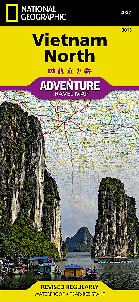
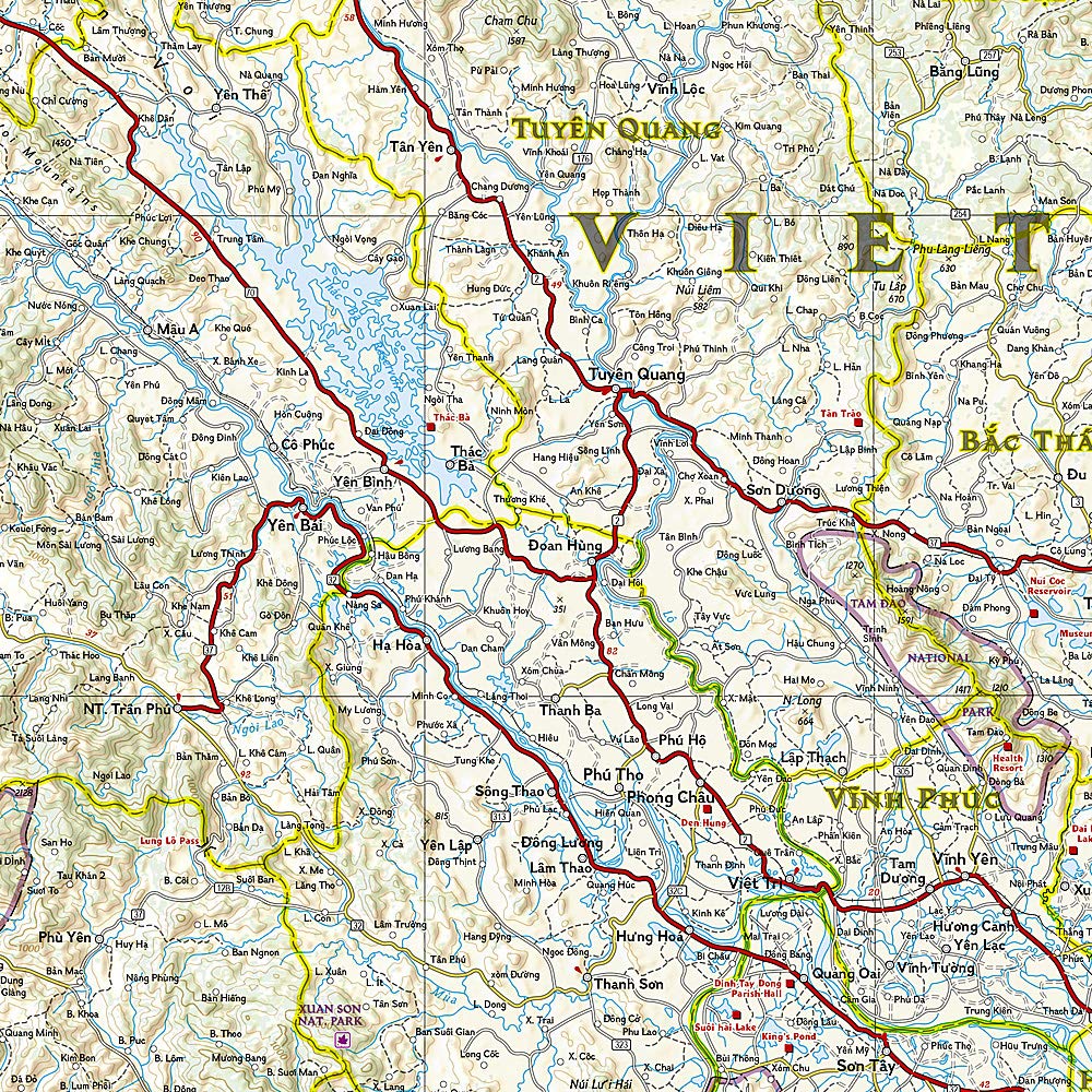
Vietnam North National Geographic Folded Map
$27.95
Afterpay is only available for orders between $50.00 and $1000.00 More info
Folded Travel Map | Waterproof & Tear-Resistant | Scale 1:650,000
Detailed Road Map with Tourist Highlights & Regional Transport Routes
Sheet Size: 648 mm x 959 mm
🇻🇳 Discover Northern Vietnam with Confidence
Explore the breathtaking mountains, terraced rice fields, historic cities, and cultural heartlands of northern Vietnam with National Geographic’s Vietnam North Adventure Map—a durable and detailed guide ideal for backpackers, cyclists, overlanders, and cultural explorers.
Expertly designed to balance detail with perspective, this folded travel map showcases both major transit routes and hidden gems—from the colonial streets of Hanoi to the dramatic karst formations of Ha Long Bay and the border highlands of Lào Cai.
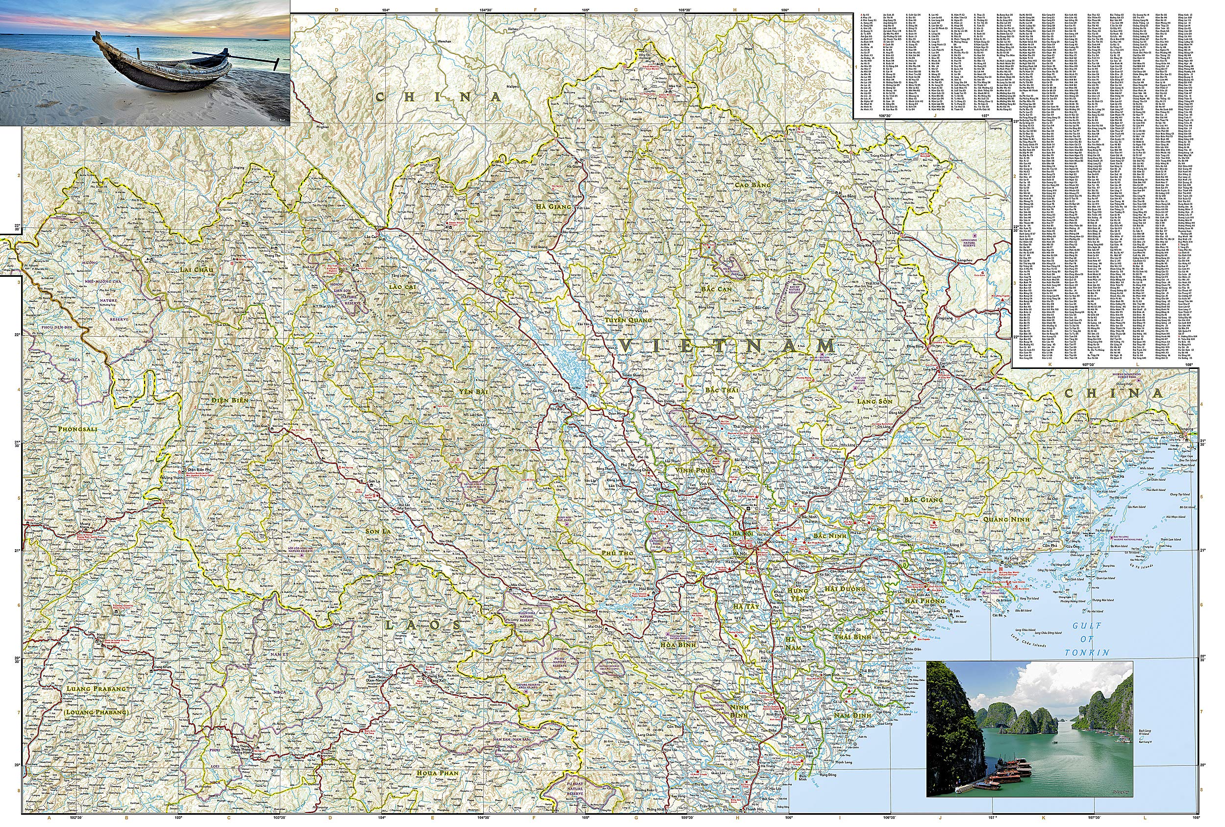
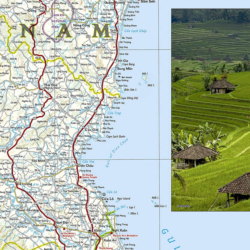
🗺️ Map Coverage
Front Side
-
Covers the north-central region of Vietnam
-
From the Laos border in the west to the Gulf of Tonkin in the east
-
Includes key locations like Vinh, Thanh Hóa, Ninh Bình, and portions of Hanoi
Reverse Side
-
Focuses on northernmost Vietnam, including the borders with China and Laos
-
Features destinations such as Sa Pa, Cao Bằng, Hà Giang, and the northern coastline
🌟 Key Features
✅ Road & Transport Network
-
Clearly marked highways, secondary roads, and tracks
-
Distances in kilometers included for route planning
-
✈️ Airports, 🚢 harbors, ⛴️ ferry routes, and 🚆 railways all shown
✅ Tourist & Cultural Points of Interest
-
Highlights UNESCO World Heritage Sites, ancient temples, hill-tribe regions, beaches, and more
-
Features waterfalls, caves, monuments, museums, and scenic vistas
-
Helpful for discovering off-the-beaten-path destinations
✅ User-Friendly Design
-
Includes a comprehensive place name index
-
Clear cartographic style by National Geographic, known for accuracy and beauty
-
Perfect for pairing with travel guides or mobile navigation apps
✅ Adventure-Ready Durability
-
Printed on synthetic waterproof paper
-
Tear-resistant, foldable, and built for the wear and tear of international travel
-
Ideal for motorbiking, trekking, or navigating Vietnam’s backroads
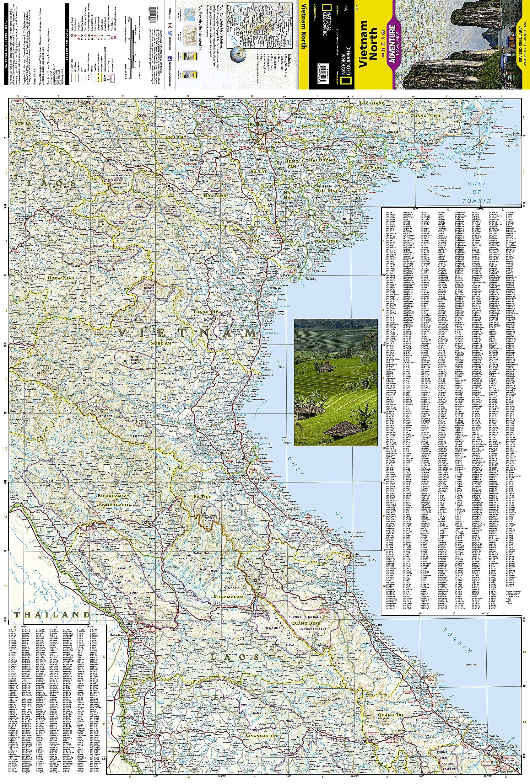
📐 Map Specifications
| Feature | Details |
|---|---|
| Publisher | National Geographic |
| Map Type | Folded, two-sided adventure map |
| Scale | 1:650,000 |
| Sheet Size | 648 mm x 959 mm |
| Material | Synthetic waterproof paper |
| Regions Covered | North and North-Central Vietnam |
| Language | English (with local names clearly shown) |
| Printed In | USA |
👥 Ideal For:
-
🧳 Independent travellers exploring northern Vietnam by road, rail, or bike
-
🏞️ Hikers and nature lovers venturing into mountainous or rural areas
-
📚 Cultural enthusiasts discovering temples, pagodas, and heritage towns
-
📷 Photographers and explorers looking for scenic vistas and local encounters
-
🗺️ Map collectors and National Geographic fans
🛒 Add the Vietnam North Adventure Map to Your Travel Gear Today
Whether you're cruising through Ha Long Bay, trekking the rice terraces of Sapa, or tracing the Ho Chi Minh Trail, this map ensures you won't miss a single landmark, path, or hidden valley in northern Vietnam.
Frequently Asked Questions
What area does the Vietnam North National Geographic Folded Map cover?
The Vietnam North National Geographic Folded Map provides road coverage of the region named in the product title. The map covers major cities, highways, towns, and regional roads, with inset city maps for key urban centres where applicable.
Is the Vietnam North National Geographic Folded Map up to date?
Yes, this is the current edition. Mapworld stocks the most current editions from all major publishers, updated to reflect new roads and infrastructure.
What size is this map when unfolded?
Folded maps from Mapworld's range are compact and portable. Most standard folded road or travel maps open to between A1 (594 × 841mm) and A0 (841 × 1189mm) when fully unfolded, and fold down to approximately A4 or smaller for easy storage in a glove box, bag, or backpack.
Is the Vietnam North National Geographic Folded Map in stock at Mapworld?
Mapworld maintains extensive stock across its map range and aims for fast dispatch. Orders placed before 2pm AEST on business days are typically dispatched the same day, with standard and express Australia-wide delivery options available.
Does Mapworld ship the Vietnam North National Geographic Folded Map across Australia?
Yes, Mapworld ships Australia-wide. Standard shipping is a flat $7 rate, with free standard shipping on orders over $75. Express options are available at checkout. Most orders placed before 2pm AEST on weekdays are dispatched same day.
Related Items


© 2026 Mapworld. Website designed by Genie Media
X