- Australia ▾
- Topographic
▾
- Australia AUSTopo 250k (2024)
- Australia 50k Geoscience maps
- Australia 100k Geoscience maps
- Australia 250k Geoscience maps
- Australia 1.1m Geoscience maps
- New Zealand 50k maps
- New Zealand 250k maps
- New South Wales 25k maps
- New South Wales 50k maps
- New South Wales 100k maps
- Queensland 10k maps
- Queensland 25k maps
- Queensland 50k maps
- Queensland 100k maps
- Compasses
- Software
- GPS Systems
- Orienteering
- International ▾
- Wall Maps
▾
- World
- Australia & New Zealand
- Countries, Continents & Regions
- Historical
- Vintage National Geographic
- Australian Capital Territory
- New South Wales
- Northern Territory
- Queensland
- South Australia
- Tasmania
- Victoria
- Western Australia
- Celestial
- Children's
- Mining & Resources
- Wine Maps
- Healthcare
- Postcode Maps
- Electoral Maps
- Nautical ▾
- Flags
▾
- Australian Flag Sets & Banners
- Flag Bunting
- Handwavers
- Australian National Flags
- Aboriginal Flags
- Torres Strait Islander Flags
- International Flags
- Flagpoles & Accessories
- Australian Capital Territory Flags
- New South Wales Flags
- Northern Territory Flags
- Queensland Flags
- South Australia Flags
- Tasmania Flags
- Victoria Flags
- Western Australia Flags
- Gifts ▾
- Globes ▾
Dear valued customer. Please note that our checkout is not supported by old browsers. Please use a recent browser to access all checkout capabilities
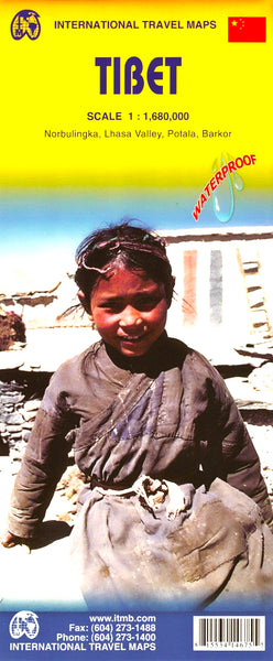
Tibet ITMB Map
$24.95
Afterpay is only available for orders between $50.00 and $1000.00 More info
A Rare Window into the “Roof of the World” – Meticulously Researched and Exceptionally Detailed
This Tibet map by ITMB (International Travel Maps) is the result of years of dedicated fieldwork, undertaken to ensure precision and cultural accuracy in one of the world’s most remote and politically sensitive regions. Unlike many maps created from afar, ITMB delayed publication for over six months to send an on-the-ground cartographer into the region—tasked with charting the exact route of the new railway to Lhasa and correcting the placement and spelling of dozens of monasteries, mountains, and rural villages. This is not just a map—it’s a cartographic labour of love.
🧭 Map Coverage & Detail
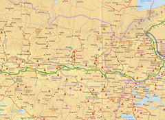
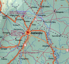
Covering the vast and mountainous expanse of Tibet, this map clearly shows:
-
✅ International borders, including disputed boundaries
-
🛣️ Major motorways, connecting roads, minor routes, and unsealed tracks
-
🚉 The Lhasa railway, painstakingly mapped through in-country research
-
🏙️ Cities, towns, villages, and remote settlements
-
🏔️ Shaded relief and colour elevation gradients to indicate the dramatic topography of the Tibetan Plateau
-
📍 Spot heights of notable mountain peaks
🔎 Inset Maps for Greater Insight
To complement the large regional overview, the map also includes detailed insets of important cultural and historical areas:
-
🏯 Norbulingka Palace – The summer residence of the Dalai Lamas
-
🧘 Lhasa Valley – The spiritual and administrative heart of Tibet
-
🏰 Potala Palace – A UNESCO World Heritage Site
-
🛍️ Barkor – Lhasa’s iconic pilgrimage circuit and bustling marketplace
These inset maps provide essential orientation for travellers and scholars alike.
Laminated for Practical Use
This map has been professionally flattened and laminated using durable 80-micron gloss laminate, making it ideal for active use:
-
Use whiteboard markers to plan routes or annotate points of interest
-
Apply acid-free map dots to mark visited locations
-
Simply wipe clean for ongoing use—perfect for classrooms, travel planning, or wall display
⚠️ Please note: as this is a folded map that has been laminated, minor fold lines will remain visible.
📏 Product Specifications
| Feature | Description |
|---|---|
| Publisher | International Travel Maps (ITMB) |
| Publication Date | 2012 |
| Scale | 1:1,680,000 |
| Map Dimensions | 690 mm (W) x 1000 mm (H) |
| Format | Laminated (from folded) |
| Language | English |
| Index | Fully Indexed |
🧳 Ideal For:
-
Explorers, trekkers, and adventure travellers
-
Educators and students of Asian geography, politics, or culture
-
Offices, embassies, and consulates with regional interest
-
Cultural enthusiasts and armchair travellers intrigued by Tibet's mystique
Bring the mystical landscapes of Tibet into your home or workspace with this beautifully rendered and field-researched map from one of the most respected names in global cartography.


