- Australia ▾
- Topographic
▾
- Australia AUSTopo 250k (2025)
- Australia 50k Geoscience maps
- Australia 100k Geoscience maps
- Australia 250k Geoscience maps
- Australia 1:1m Geoscience maps
- New Zealand 50k maps
- New Zealand 250k maps
- New South Wales 25k maps
- New South Wales 50k maps
- New South Wales 100k maps
- Queensland 10k maps
- Queensland 25k maps
- Queensland 50k maps
- Queensland 100k maps
- Compasses
- Software
- GPS Systems
- Orienteering
- International ▾
- Wall Maps
▾
- World
- Australia & New Zealand
- Countries, Continents & Regions
- Historical
- Vintage National Geographic
- Australian Capital Territory
- New South Wales
- Northern Territory
- Queensland
- South Australia
- Tasmania
- Victoria
- Western Australia
- Celestial
- Children's
- Mining & Resources
- Wine Maps
- Healthcare
- Postcode Maps
- Electoral Maps
- Nautical ▾
- Flags
▾
- Australian Flag Sets & Banners
- Flag Bunting
- Handwavers
- Australian National Flags
- Aboriginal Flags
- Torres Strait Islander Flags
- International Flags
- Flagpoles & Accessories
- Australian Capital Territory Flags
- New South Wales Flags
- Northern Territory Flags
- Queensland Flags
- South Australia Flags
- Tasmania Flags
- Victoria Flags
- Western Australia Flags
- Gifts ▾
- Globes ▾
Dear valued customer. Please note that our checkout is not supported by old browsers. Please use a recent browser to access all checkout capabilities


Rwanda Burundi ITMB Map
$24.95
Afterpay is only available for orders between $50.00 and $1000.00 More info
Double-Sided Map Featuring Two Countries | Optional Lamination Available
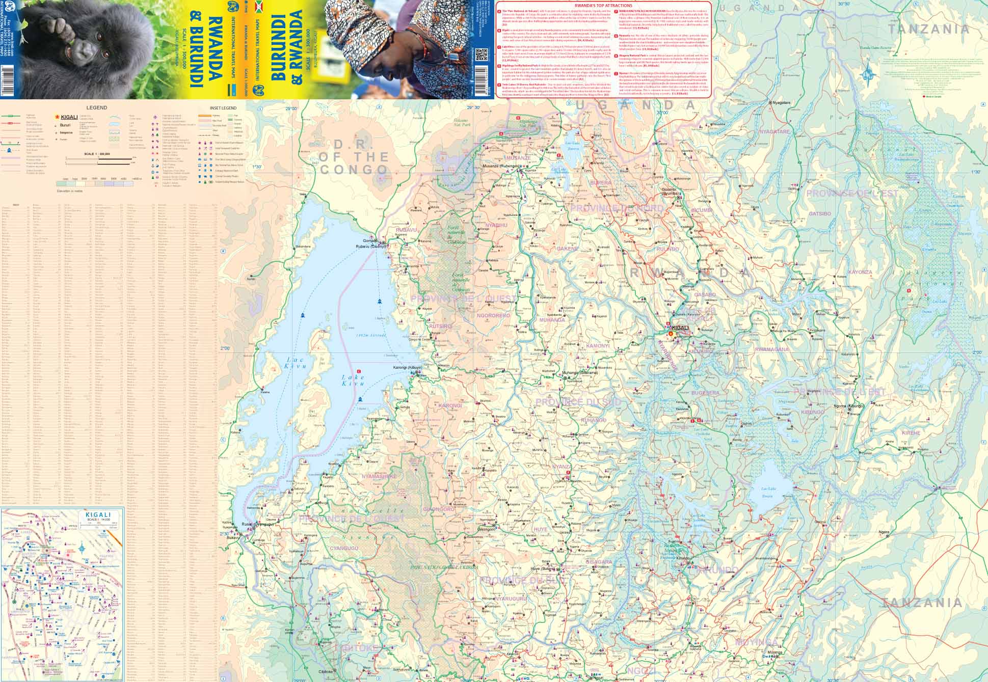
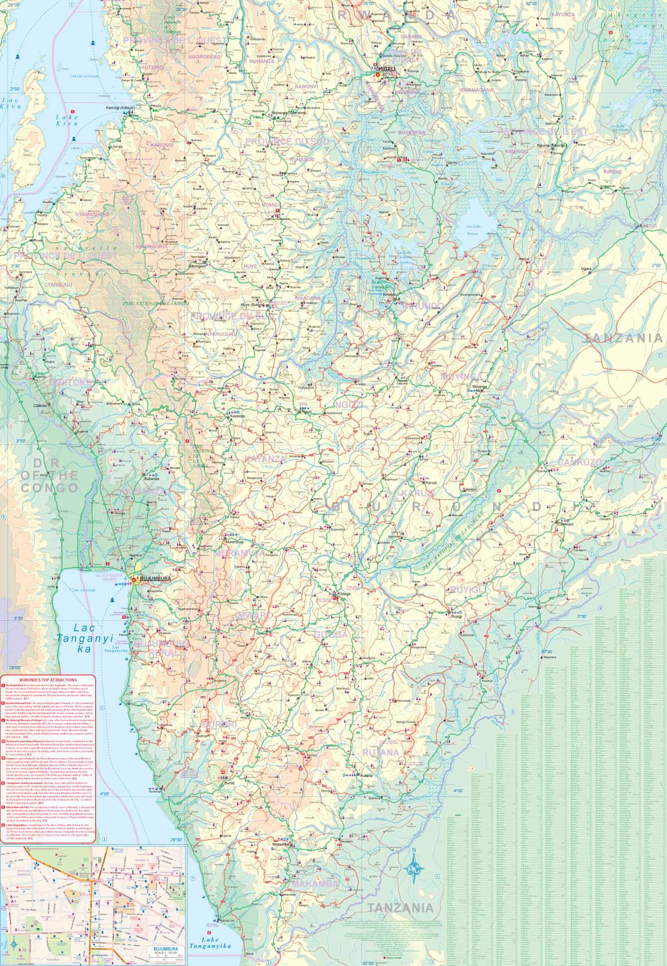
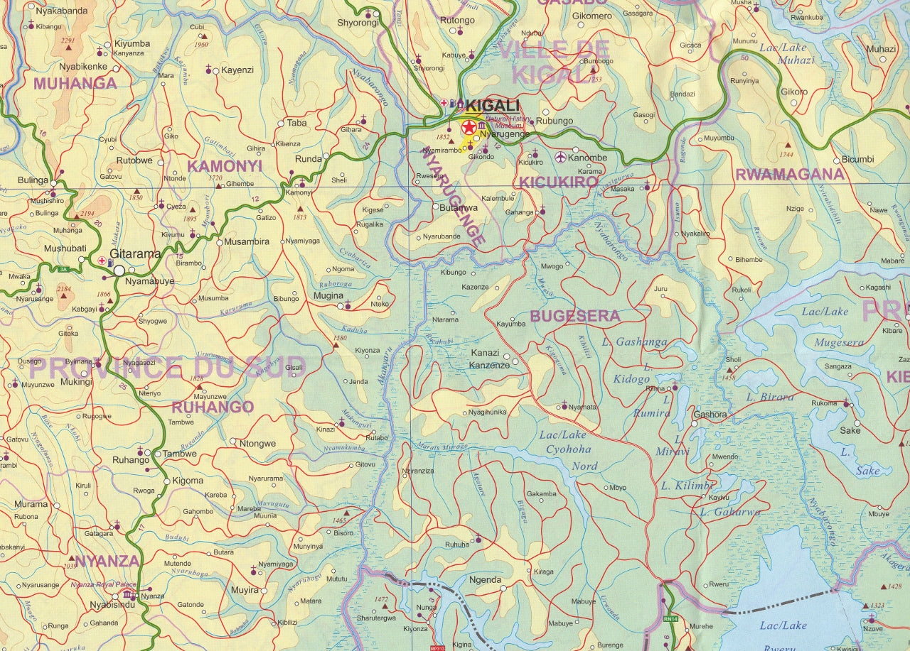
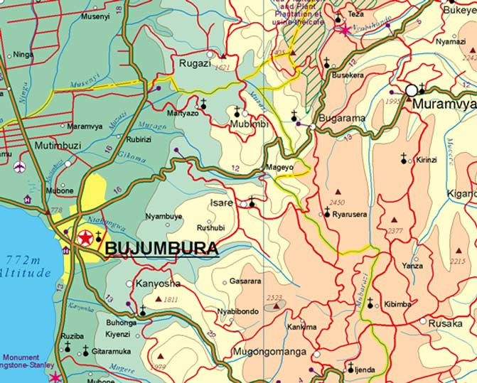
Explore two of Africa’s most fascinating and scenic countries with this detailed double-sided map by ITMB (International Travel Maps). This updated edition presents Rwanda on one side and Burundi on the reverse, each rendered in rich cartographic detail at a practical scale of 1:300,000.
Whether you're a traveller, humanitarian, student, or simply curious about Central Africa, this map is a reliable companion for understanding the geography, road networks, and key locations of two nations that are stepping into the future with resilience and grace.
📌 Map Features
| Details | Specifications |
|---|---|
| Title | Rwanda & Burundi |
| Publisher | ITMB – International Travel Maps |
| Edition | Latest edition |
| Map Type | Folded (optional lamination available) |
| Scale | 1:300,000 (both countries) |
| Size (Flat) | 680 mm × 990 mm |
| Sides | Rwanda on one side, Burundi on the other |
| Indexing | Includes cities, towns, roads, lakes, borders |
🌍 A Window Into Central Africa
These two countries are small in size but rich in cultural, ecological, and historical importance:
-
Rwanda, known as the Land of a Thousand Hills, offers lush landscapes, volcanic mountains, and gorilla trekking in the Virunga Mountains. Kigali, Lake Kivu, and the Volcanoes National Park are major highlights.
-
Burundi is less travelled but equally charming, with emerald hills, lakeside communities along Lake Tanganyika, and a deep cultural heritage waiting to be explored. Its capital, Gitega, and former capital Bujumbura are both featured.
This map is especially valuable for aid workers, NGO personnel, educational institutions, and adventurous travellers. The countries’ national parks, roadways, border crossings, and elevation details are all clearly marked.
🛡️ Laminated Version Available
Prefer a version for repeated use or wall display? We offer optional lamination, which:
-
Lets you draw on the map with whiteboard markers
-
Accepts map dots to highlight locations
-
Resists tears, stains, and water damage
For laminated maps, we flatten the folded version and encapsulate it in 80-micron gloss laminate. Please note that slight fold lines may still be visible due to the original creasing.
Whether you’re planning a trek through Nyungwe Forest, researching Lake Tanganyika, or simply fascinated by Africa’s heartland, the Rwanda & Burundi ITMB Map is a practical and inspiring tool for your journey.
Discover two countries that are small in size—but vast in experience.
Frequently Asked Questions
Where can I buy the Rwanda Burundi ITMB Map?
The Rwanda Burundi ITMB Map is available to buy online from Mapworld, Australia's largest map and geographic product retailer, with fast shipping Australia-wide.
Is the Rwanda Burundi ITMB Map in stock at Mapworld?
Mapworld maintains extensive stock across its map range and aims for fast dispatch. Orders placed before 2pm AEST on business days are typically dispatched the same day, with standard and express Australia-wide delivery options available.
What is Mapworld's returns policy?
Mapworld accepts returns on undamaged items in original condition. Contact Mapworld within 90 days of purchase to arrange a return or exchange.
Does Mapworld ship the Rwanda Burundi ITMB Map across Australia?
Yes, Mapworld ships Australia-wide. Standard shipping is a flat $7 rate, with free standard shipping on orders over $75. Express options are available at checkout. Most orders placed before 2pm AEST on weekdays are dispatched same day.
Related Items


© 2026 Mapworld. Website designed by Genie Media
X