- Australia ▾
- Topographic
▾
- Australia AUSTopo 250k (2025)
- Australia 50k Geoscience maps
- Australia 100k Geoscience maps
- Australia 250k Geoscience maps
- Australia 1:1m Geoscience maps
- New Zealand 50k maps
- New Zealand 250k maps
- New South Wales 25k maps
- New South Wales 50k maps
- New South Wales 100k maps
- Queensland 10k maps
- Queensland 25k maps
- Queensland 50k maps
- Queensland 100k maps
- Western Australia 25k maps
- Western Australia 50k maps
- Western Australia 100k maps
- Compasses
- Software
- GPS Systems
- International ▾
- Wall Maps
▾
- World
- Australia & New Zealand
- Countries, Continents & Regions
- Historical
- Vintage National Geographic
- Australian Capital Territory
- New South Wales
- Northern Territory
- Queensland
- South Australia
- Tasmania
- Victoria
- Western Australia
- Celestial
- Children's
- Mining & Resources
- Wine Maps
- Healthcare
- Postcode Maps
- Electoral Maps
- Nautical ▾
- Flags
▾
- Australian Flag Sets & Banners
- Flag Bunting
- Handwavers
- Australian National Flags
- Aboriginal Flags
- Torres Strait Islander Flags
- International Flags
- Flagpoles & Accessories
- Australian Capital Territory Flags
- New South Wales Flags
- Northern Territory Flags
- Queensland Flags
- South Australia Flags
- Tasmania Flags
- Victoria Flags
- Western Australia Flags
- Gifts ▾
- Globes ▾
Dear valued customer. Please note that our checkout is not supported by old browsers. Please use a recent browser to access all checkout capabilities


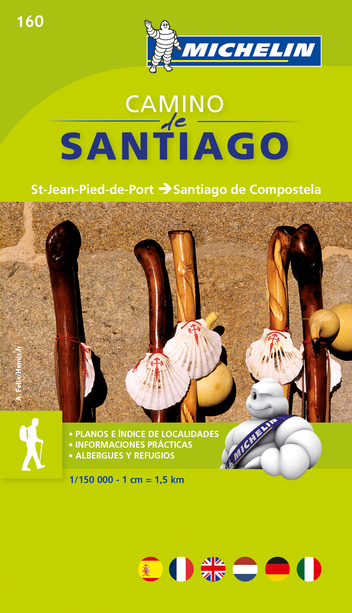
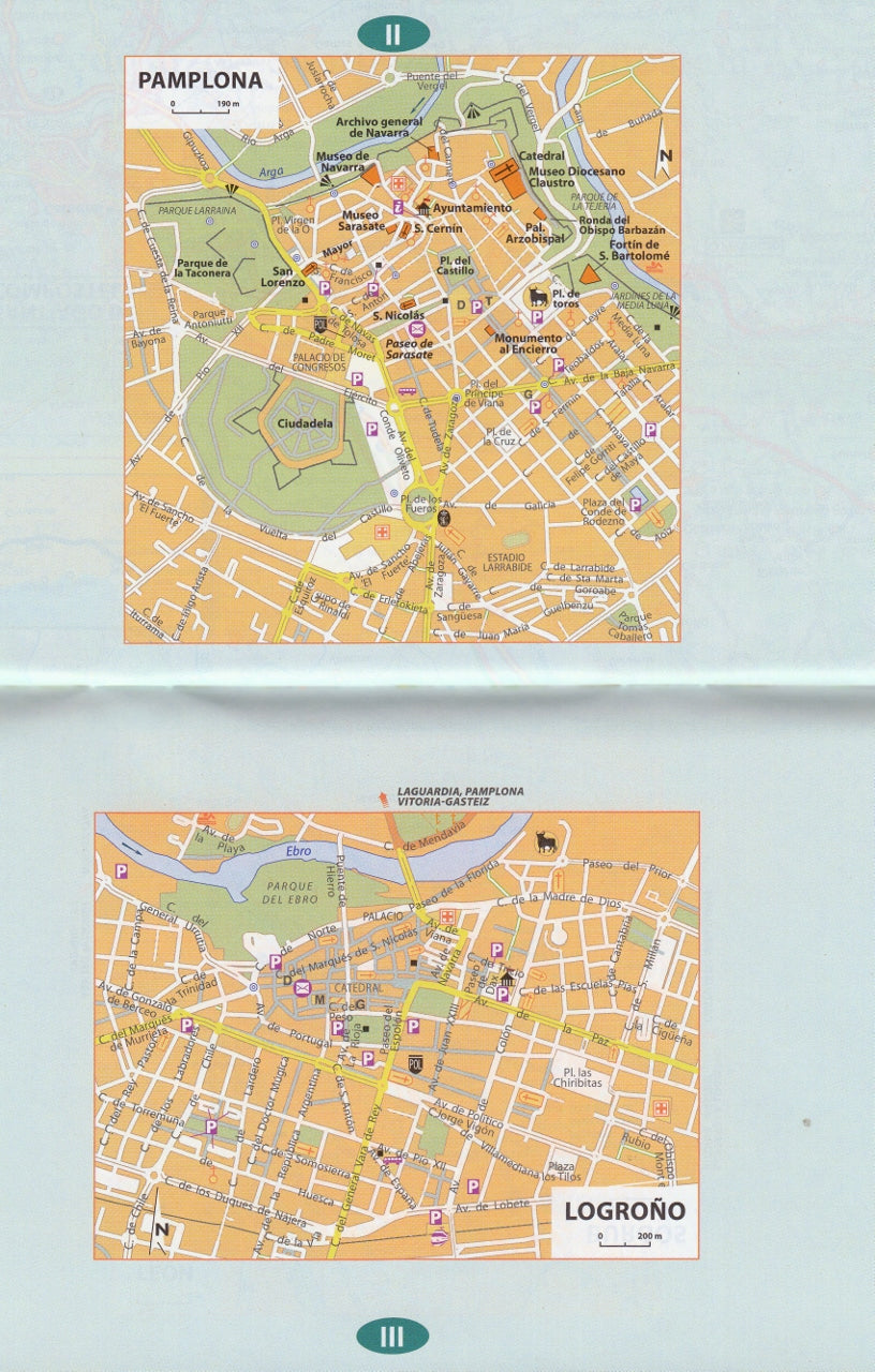
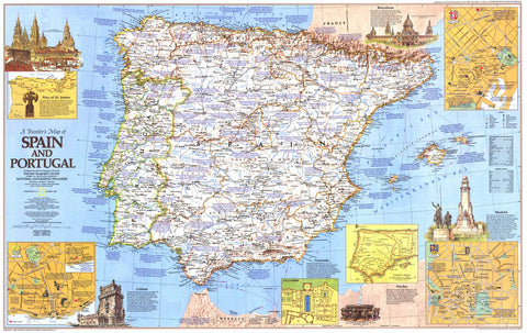
Way of St James Spain - Camino de Santiago Map Book Michelin 160
$21.95
Afterpay is only available for orders between $50.00 and $1000.00 More info
Way of St James – Camino de Santiago Map Book (Spain) – Michelin Map 160
Your trusted companion for walking the Camino – from Saint-Jean-Pied-de-Port to Santiago de Compostela
Topographic Map Book | 1:150,000 Scale | Lightweight & Pack-Friendly
Overview
Whether you're walking for pilgrimage, personal growth, or the sheer beauty of the journey, the Way of St James (Camino de Santiago) Map Book by Michelin is a must-have tool for planning and navigating the world-famous route across Spain.
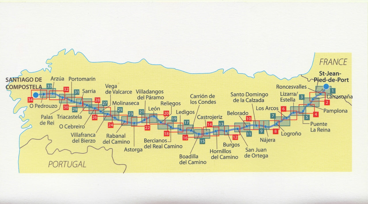
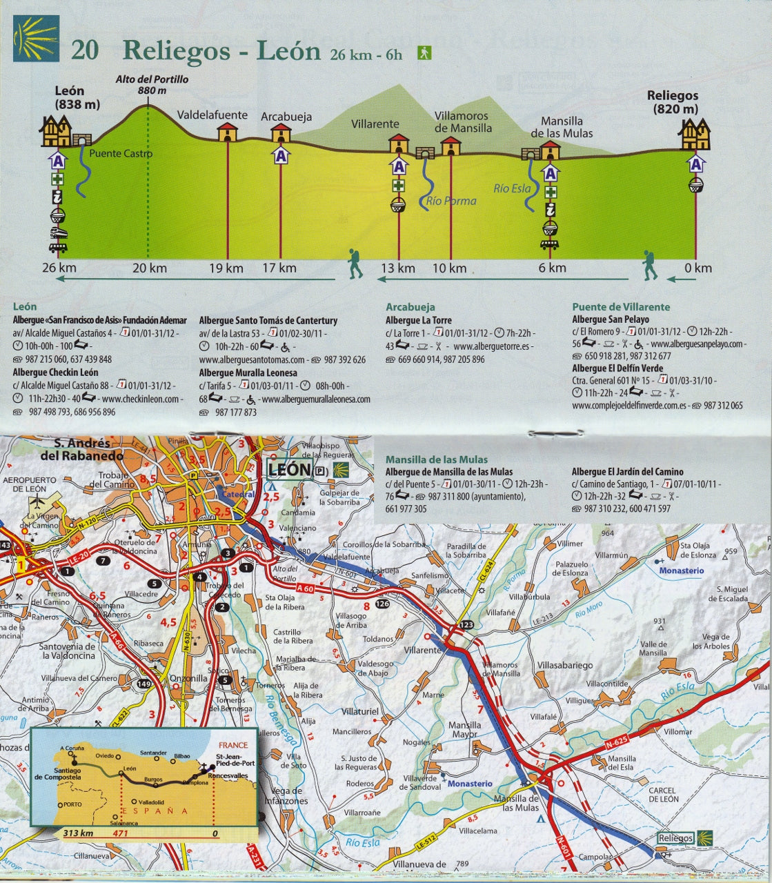
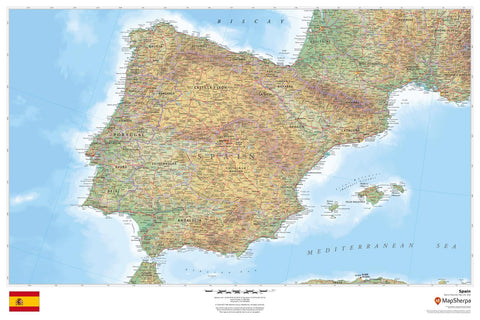
This is the second volume in Michelin’s acclaimed two-book set and focuses on the most iconic stretch—from Saint-Jean-Pied-de-Port in the French Pyrenees to Santiago de Compostela in Galicia, Spain. Covering the full Spanish section of the Camino Francés, this compact, lightweight atlas offers 1:150,000 scale topographic mapping, altitude profiles, and town-to-town guidance that’s easy to follow even when you're on a muddy trail or a foggy mountain pass.
Tested by walkers on the path itself, this map book fits comfortably into a daypack (20 x 11 cm) and is rugged enough to accompany you across hundreds of kilometres—rain, shine, or blisters.
📖 What's Included
| Feature | Description |
|---|---|
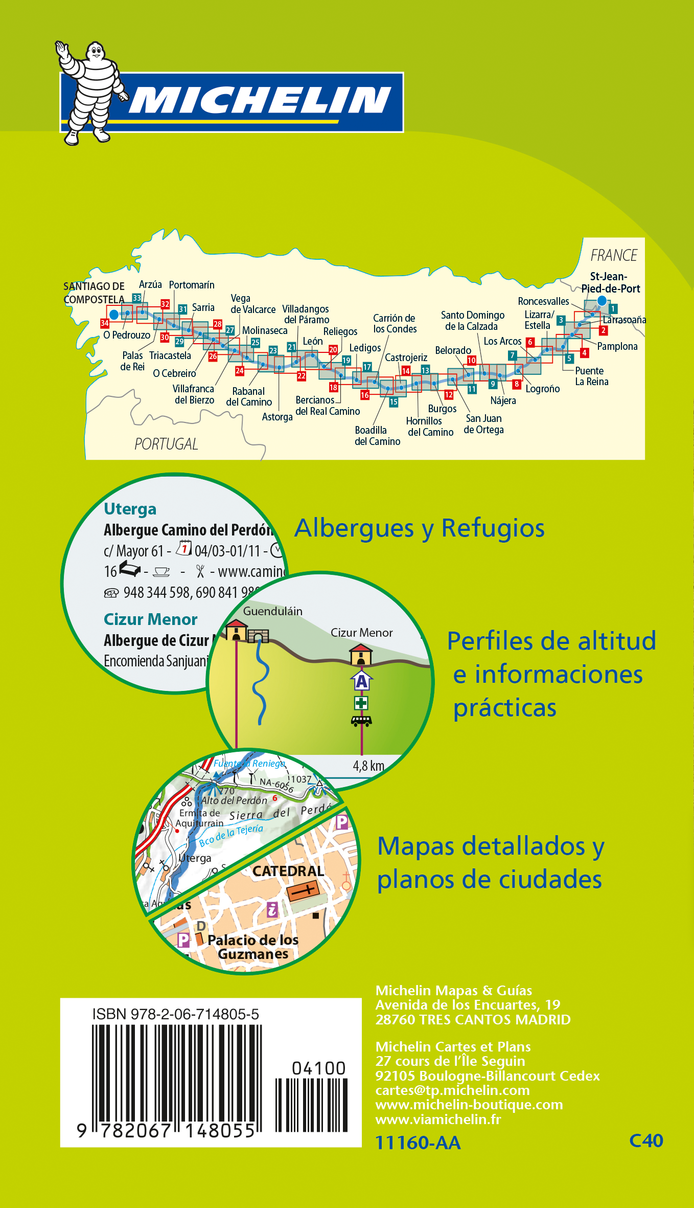
| Topographic Maps | Clear, easy-to-read cartography at 1:150,000 scale (1 cm = 1.5 km) |
| Altitude Profiles | Elevation data for each stage to help pace your walk and plan your rest stops |
| Place Name Index | Quickly locate towns, villages, albergues, and landmarks along the route |
| Key Town Maps | Zoomed-in detail maps of larger settlements to help you navigate accommodations, food, and supplies |
| Multilingual | Minimal text makes it accessible to international walkers |
| Compact Size | Lightweight (approx. 200g) and portable – ideal for daily use on the trail |
👣 Two-Book Series for the Full Journey
This guide is Volume 2 of Michelin’s full Camino set:
-
Volume 1: Chemins de Compostelle (France)
Covers the French section from Le Puy-en-Velay to Saint-Jean-Pied-de-Port. -
Volume 2: Camino de Santiago (Spain)
Covers the Spanish section from Saint-Jean-Pied-de-Port to Santiago de Compostela. ← This listing
Why Choose Michelin’s Camino Map Book?
✅ Trail-Tested by Pilgrims
As someone who has personally walked 200 km of the Chemin de Saint-Jacques, I can vouch for the practical value of this book. It’s incredibly useful for both planning and daily navigation—especially when you're off the grid or your phone is flat.
✅ Lightweight & Durable
At just 20 cm x 11 cm, this book tucks neatly into any side pocket or pack compartment. The maps are printed on high-quality paper designed to resist tears and creases—ideal for handling in all weather.
✅ Clear Visual Guidance
Unlike many apps and GPS tools, these maps provide a bird’s-eye view of your progress, helping you connect more deeply with the landscape—and with centuries of pilgrimage tradition.
✅ Perfect for the Pilgrim’s Mindset
There’s something deeply satisfying about walking with a physical map in hand—no pings, no distractions, just you, the road, and a quiet awareness of where you’ve been and where you’re going.
📐 Specifications
| Detail | Specification |
|---|---|
| Title | Way of St James – Camino de Santiago (Spain) |
| Publisher | Michelin |
| Series | Map 160 |
| Format | Softcover Map Book |
| Scale | 1:150,000 (1 cm = 1.5 km) |
| Dimensions | 200 mm x 110 mm |
| Weight | Approx. 200 g |
| Edition | Latest Available |
| Language | Visual/international with minimal text |
| Coverage | Saint-Jean-Pied-de-Port to Santiago de Compostela |
🎒 A Worthy Companion for a Life-Changing Journey
Whether you’re preparing for your first Camino or returning for a second pilgrimage, the Michelin Way of St James Map Book is a practical, lightweight, and beautifully detailed tool that honours the spirit of the walk.
🛒 Add to cart now and take the first step toward one of the world’s most legendary journeys.
📦 In stock and ready to ship.
Frequently Asked Questions
Where can I buy the Way of St James Spain - Camino de Santiago Map Book Michelin 160?
The Way of St James Spain - Camino de Santiago Map Book Michelin 160 is available to buy online from Mapworld, Australia's largest map and geographic product retailer, with fast shipping Australia-wide.
Is the Way of St James Spain - Camino de Santiago Map Book Michelin 160 in stock at Mapworld?
Mapworld maintains extensive stock across its map range and aims for fast dispatch. Orders placed before 2pm AEST on business days are typically dispatched the same day, with standard and express Australia-wide delivery options available.
What is Mapworld's returns policy?
Mapworld accepts returns on undamaged items in original condition. Contact Mapworld within 90 days of purchase to arrange a return or exchange.
Does Mapworld ship the Way of St James Spain - Camino de Santiago Map Book Michelin 160 across Australia?
Yes, Mapworld ships Australia-wide. Standard shipping is a flat $7 rate, with free standard shipping on orders over $75. Express options are available at checkout. Most orders placed before 2pm AEST on weekdays are dispatched same day.
Related Items
© 2026 Mapworld. Website designed by Genie Media
X