- Australia ▾
- Topographic
▾
- Australia AUSTopo 250k (2025)
- Australia 50k Geoscience maps
- Australia 100k Geoscience maps
- Australia 250k Geoscience maps
- Australia 1:1m Geoscience maps
- New Zealand 50k maps
- New Zealand 250k maps
- New South Wales 25k maps
- New South Wales 50k maps
- New South Wales 100k maps
- Queensland 10k maps
- Queensland 25k maps
- Queensland 50k maps
- Queensland 100k maps
- Compasses
- Software
- GPS Systems
- Orienteering
- International ▾
- Wall Maps
▾
- World
- Australia & New Zealand
- Countries, Continents & Regions
- Historical
- Vintage National Geographic
- Australian Capital Territory
- New South Wales
- Northern Territory
- Queensland
- South Australia
- Tasmania
- Victoria
- Western Australia
- Celestial
- Children's
- Mining & Resources
- Wine Maps
- Healthcare
- Postcode Maps
- Electoral Maps
- Nautical ▾
- Flags
▾
- Australian Flag Sets & Banners
- Flag Bunting
- Handwavers
- Australian National Flags
- Aboriginal Flags
- Torres Strait Islander Flags
- International Flags
- Flagpoles & Accessories
- Australian Capital Territory Flags
- New South Wales Flags
- Northern Territory Flags
- Queensland Flags
- South Australia Flags
- Tasmania Flags
- Victoria Flags
- Western Australia Flags
- Gifts ▾
- Globes ▾
Dear valued customer. Please note that our checkout is not supported by old browsers. Please use a recent browser to access all checkout capabilities
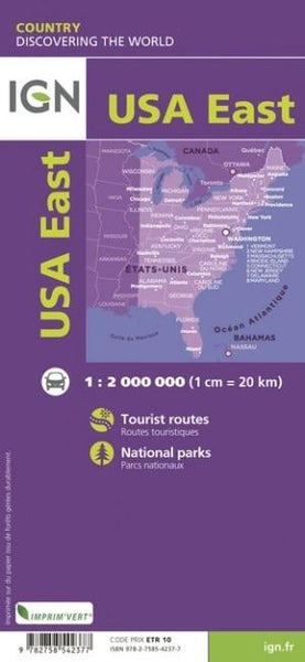
USA East IGN Folded Map
Sold Out
Afterpay is only available for orders between $50.00 and $1000.00 More info
Your Essential Road Map for Exploring the Eastern United States – From the Gulf Coast to the Canadian Border
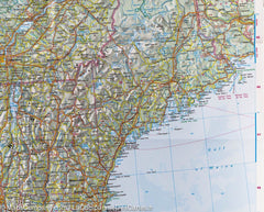
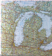
Navigate the full sweep of the Eastern United States with the USA East Folded Map by IGN (Institut Géographique National, France). With clear and detailed cartography at a scale of 1:2,000,000, this map offers extensive coverage—from the southern tip of Florida all the way north to the Canadian border. Ideal for road trips, long-haul journey planning, or as a dependable backup to digital navigation.
Whether you're following the scenic Blue Ridge Parkway, visiting New York, Washington D.C., or Boston, or road-tripping through the Appalachians, this map provides a clean, high-level view of the region’s road networks, state boundaries, major cities, and key natural features.
🗺️ Map Features
-
Covers the entire Eastern half of the United States, from the Gulf of Mexico to Maine and the Great Lakes
-
Includes all major interstate highways, state routes, and primary regional roads
-
Displays state boundaries, urban centres, rivers, mountain ranges, and national parks
-
Designed and published by IGN (Institut Géographique National) – France’s leading mapping authority
-
Ideal for holidaymakers, road trippers, educators, and logistics planners
📐 Specifications
| Attribute | Detail |
|---|---|
| Map Title | USA East Folded Road Map |
| Publisher | IGN – Institut Géographique National |
| Scale | 1:2,000,000 |
| Size (open) | 1000 mm x 1200 mm |
| Size (folded) | Approx. 250 mm x 130 mm |
| Format | Folded paper map |
| Language | Multilingual legend (including English & French) |
🚗 Perfect For:
-
East Coast U.S. road trips – from Florida to New England
-
Multi-state touring – navigate key destinations like Philadelphia, Savannah, Nashville, and Cincinnati
-
RV and campervan travel
-
Educators & geography students
-
Backup navigation tool for long-distance drivers and international travellers
✅ Why Choose This Map?
| Feature | Benefit |
|---|---|
| Extensive regional coverage | From Southern states to Northern borders – all in one map |
| Ideal scale for overview travel | 1:2,000,000 allows clear route planning while covering large areas |
| Produced by IGN France | Trusted European mapmaker with international acclaim |
| Folded for convenience | Compact enough to fit into bags, folders, or gloveboxes |
| Useful for planning or navigation | Easy-to-read layout with clearly marked cities and roadways |
From the historic towns of Virginia to the lively streets of Chicago, and the sun-soaked shores of Georgia to the wilderness of Vermont, the USA East Folded Map by IGN is the perfect companion for discovering every mile of America’s dynamic East.


