The European Union Wall Map (2020 Edition)
820 x 780mm | Detailed Overview | Premium Finishes Available
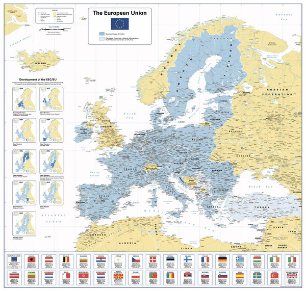
National Geographic's European Union Wall Map offers a comprehensive and insightful look at the EU and its member countries, with an in-depth timeline charting the EEC/EU's development from 1958 to the UK’s departure in January 2020. Ideal for educational, office, or classroom settings, this map provides a visually engaging and informative overview of Europe and the countries that make up the European Union, alongside those applying for membership.
The accompanying flag table highlights key facts about each country in the EU, as well as the United Kingdom, offering additional educational value.
🗺️ Features & Highlights
🌍 Complete Political and Geographical Coverage
-
European Union Member States: Clear demarcation of the EU countries and those seeking membership.
-
Timeline of the EEC/EU: A historical timeline outlining significant events in the European Union's development since 1958.
-
UK Exit: Visual representation of the United Kingdom’s departure from the EU in January 2020.
-
Flags and Key Facts: A detailed table featuring flags and important information about each EU country and the UK.
🏙️ Detailed Country Breakdown
-
Member States and Applicants: Displayed in clear and bright colours for easy identification, making the map a perfect tool for understanding Europe’s political landscape.
-
European Capitals & Major Cities: Major cities and capitals are clearly labelled, highlighting economic, political, and cultural hubs.
-
Border and Regional Features: Key political boundaries are outlined to show how Europe’s political landscape has evolved over time.
🖼️ Finishing Options to Suit Your Space
Choose from several high-quality finishes for this informative map, tailored to fit your home, office, or classroom:
| Format | Description |
|---|---|
| 📜 Paper (160 gsm) | Printed on high-quality matte-coated paper—perfect for framing under glass. |
| 🧼 Laminated (Encapsulated) | 80-micron gloss laminate offers durability and easy cleaning for high-traffic areas. |
| 🪵 Laminated with Wooden Hang Rails | Laminated version mounted with natural timber rails—ready to hang and display. |
| 🖼️ Canvas (395 gsm) | HP Professional Matte Canvas, printed with pigment-based inks. This option provides an artistic, archival-quality finish. |
| 🪵 Canvas with Wooden Hang Rails | Canvas mounted with lacquered timber rails—no framing required for a refined look. |
🔨 Note: Please allow 10 working days for delivery of hang-railed maps, as each one is professionally mounted by our framer.
📐 Specifications
| Feature | Detail |
|---|---|
| Title | The European Union Wall Map (2020 Edition) |
| Map Type | Political / Historical |
| Scale | 1:10,000,000 |
| Dimensions | 820 mm (W) x 780 mm (H) |
| Material Options | Paper, Laminated, Canvas, With or Without Timber Rails |
| Printed & Mounted In | Australia |
🎁 Perfect For...
-
🌍 Educational Institutions: A must-have for students and teachers studying European geography or political science.
-
🌍 Corporate & Office Settings: A great addition to office walls, providing employees with a visual guide to the European political landscape.
-
🌍 History Buffs & Politicians: Perfect for those interested in the history of the European Union and the UK’s exit.
-
🌍 Interior Designers: This map serves as a functional yet decorative addition to modern homes and study spaces.
🚚 Delivery & Framing Notes
-
Paper, Laminated, and Canvas (rolled) maps: Ships within 1–2 business days.
-
Hang-railed maps: Made to order—please allow up to 10 working days for production.
-
Secure Packaging: All maps are carefully packaged in protective materials to ensure they arrive in perfect condition.
🌍 Understand the Evolution of Europe
This European Union Wall Map provides a comprehensive visual of the political landscape of Europe, offering valuable insight into the EU’s growth, member states, and the significance of the UK’s departure in 2020.
👉 Order yours today to enhance your understanding of the European Union and its dynamic political history.


