- Australia ▾
- Topographic
▾
- Australia AUSTopo 250k (2025)
- Australia 50k Geoscience maps
- Australia 100k Geoscience maps
- Australia 250k Geoscience maps
- Australia 1:1m Geoscience maps
- New Zealand 50k maps
- New Zealand 250k maps
- New South Wales 25k maps
- New South Wales 50k maps
- New South Wales 100k maps
- Queensland 10k maps
- Queensland 25k maps
- Queensland 50k maps
- Queensland 100k maps
- Western Australia 25k maps
- Western Australia 50k maps
- Western Australia 100k maps
- Compasses
- Software
- GPS Systems
- International ▾
- Wall Maps
▾
- World
- Australia & New Zealand
- Countries, Continents & Regions
- Historical
- Vintage National Geographic
- Australian Capital Territory
- New South Wales
- Northern Territory
- Queensland
- South Australia
- Tasmania
- Victoria
- Western Australia
- Celestial
- Children's
- Mining & Resources
- Wine Maps
- Healthcare
- Postcode Maps
- Electoral Maps
- Nautical ▾
- Flags
▾
- Australian Flag Sets & Banners
- Flag Bunting
- Handwavers
- Australian National Flags
- Aboriginal Flags
- Torres Strait Islander Flags
- International Flags
- Flagpoles & Accessories
- Australian Capital Territory Flags
- New South Wales Flags
- Northern Territory Flags
- Queensland Flags
- South Australia Flags
- Tasmania Flags
- Victoria Flags
- Western Australia Flags
- Gifts ▾
- Globes ▾
Dear valued customer. Please note that our checkout is not supported by old browsers. Please use a recent browser to access all checkout capabilities


Tahiti & Polynesia Pacific Cruising ITMB Map
$24.95
Afterpay is only available for orders between $50.00 and $1000.00 More info
Double-Sided Map | Covers Tahiti + South Pacific Cruising Region
Map Size: 685 mm x 990 mm | Durable Folded Format
🌺 Discover Island Paradise by Land and Sea
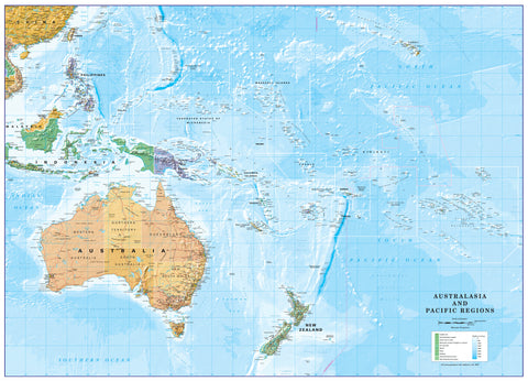
Embark on a journey through the heart of the South Pacific with ITMB’s Tahiti & Polynesia Pacific Cruising Map—a beautifully designed, double-sided map tailored to two distinct travel experiences: on-island exploration and open-ocean cruising. Whether you're navigating the roads of Tahiti or planning a cruise through Polynesian waters, this map delivers clarity, coverage, and adventure-ready detail.
Perfect for travellers, cruisers, and tropical island enthusiasts alike, this title is part of ITMB’s expanding Cruising Series, combining practical travel data with reliable, easy-to-read cartography.
🧭 Dual-Sided Coverage
🗺️ Side 1 – Island Map of Tahiti (1st Focus)
-
Detailed map of Tahiti, the largest island in French Polynesia
-
Includes key roadways, topography, towns, beaches, and travel infrastructure
-
Ideal for self-guided driving, resort-based planning, and local touring
🗺️ Side 2 – Eastern South Pacific Cruising Map (2nd Focus)
-
Broad coverage of the eastern South Pacific Ocean
-
Ranges from the Marshall Islands, Nauru, and Solomon Islands in the west
to Tahiti, Hawaii, and all the way south to New Zealand -
Shows cruising routes and island positions for trip planning and oceanic navigation
🧳 Key Features
✅ Cruise-Ready Oceanic Overview
-
Designed for long-distance cruise planning
-
Highlights the location of major Pacific island groups and key cruise destinations
-
Ideal for visualising trans-Pacific itineraries and island-to-island routes
✅ Detailed Local Island Map
-
Explore Tahiti with clearly marked roads, elevation, bays, and points of interest
-
Towns, beaches, harbours, and main transport links are easy to locate
-
Useful for car rentals, resort planning, and cultural day trips
✅ Intuitive Cartography
-
Easy-to-read fonts, clear color contrasts, and detailed coastlines
-
Ideal for both educational and navigational use
✅ Compact and Foldable
-
Lightweight and travel-friendly
-
Folds neatly for backpacks, glove compartments, or cruise luggage
📌 Specifications at a Glance
| Feature | Details |
|---|---|
| Map Type | Double-sided folded travel & cruising map |
| Publisher | ITMB (International Travel Maps) |
| Coverage | Side 1: Tahiti; Side 2: Eastern South Pacific region |
| Map Size | 685 mm x 990 mm (approx. 27" x 39") |
| Format | Folded map |
| Language | English (legend and place names) |
👥 Who Is This Map For?
-
🚢 Cruise passengers navigating the South Pacific’s island chains
-
🏝️ Independent travellers and backpackers visiting Tahiti and French Polynesia
-
🧭 Island hoppers and yachters exploring the Pacific by sea
-
📚 Students and educators studying Pacific geography and maritime routes
-
🗺️ Map collectors and cartography enthusiasts looking for unique Pacific coverage
🛒 Add the Tahiti & Polynesia Pacific Cruising Map to Your Cart Today
Whether you’re sailing across the Pacific or relaxing under a palm tree in Tahiti, this dual-purpose map brings the beauty and complexity of Polynesia into perfect focus.
Frequently Asked Questions
Where can I buy the Tahiti & Polynesia Pacific Cruising ITMB Map?
The Tahiti & Polynesia Pacific Cruising ITMB Map is available to buy online from Mapworld, Australia's largest map and geographic product retailer, with fast shipping Australia-wide.
Is the Tahiti & Polynesia Pacific Cruising ITMB Map in stock at Mapworld?
Mapworld maintains extensive stock across its map range and aims for fast dispatch. Orders placed before 2pm AEST on business days are typically dispatched the same day, with standard and express Australia-wide delivery options available.
What is Mapworld's returns policy?
Mapworld accepts returns on undamaged items in original condition. Contact Mapworld within 90 days of purchase to arrange a return or exchange.
Does Mapworld ship the Tahiti & Polynesia Pacific Cruising ITMB Map across Australia?
Yes, Mapworld ships Australia-wide. Standard shipping is a flat $7 rate, with free standard shipping on orders over $75. Express options are available at checkout. Most orders placed before 2pm AEST on weekdays are dispatched same day.
Related Items


© 2026 Mapworld. Website designed by Genie Media
X