- Australia ▾
- Topographic
▾
- Australia AUSTopo 250k (2024)
- Australia 50k Geoscience maps
- Australia 100k Geoscience maps
- Australia 250k Geoscience maps
- Australia 1.1m Geoscience maps
- New Zealand 50k maps
- New Zealand 250k maps
- New South Wales 25k maps
- New South Wales 50k maps
- New South Wales 100k maps
- Queensland 10k maps
- Queensland 25k maps
- Queensland 50k maps
- Queensland 100k maps
- Compasses
- Software
- GPS Systems
- Orienteering
- International ▾
- Wall Maps
▾
- World
- Australia & New Zealand
- Countries, Continents & Regions
- Historical
- Vintage National Geographic
- Australian Capital Territory
- New South Wales
- Northern Territory
- Queensland
- South Australia
- Tasmania
- Victoria
- Western Australia
- Celestial
- Children's
- Mining & Resources
- Wine Maps
- Healthcare
- Postcode Maps
- Electoral Maps
- Nautical ▾
- Flags
▾
- Australian Flag Sets & Banners
- Flag Bunting
- Handwavers
- Australian National Flags
- Aboriginal Flags
- Torres Strait Islander Flags
- International Flags
- Flagpoles & Accessories
- Australian Capital Territory Flags
- New South Wales Flags
- Northern Territory Flags
- Queensland Flags
- South Australia Flags
- Tasmania Flags
- Victoria Flags
- Western Australia Flags
- Gifts ▾
- Globes ▾
Dear valued customer. Please note that our checkout is not supported by old browsers. Please use a recent browser to access all checkout capabilities


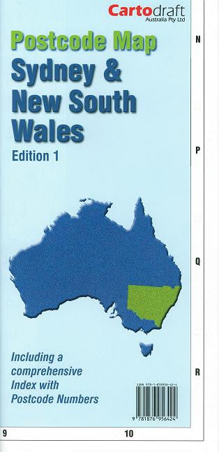
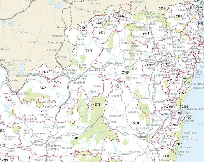
Sydney & New South Wales Folded Postcode Map
$29.95
Afterpay is only available for orders between $50.00 and $1000.00 More info
A practical, accurate, and easy-to-use reference for navigating postcode boundaries across Sydney and greater New South Wales.
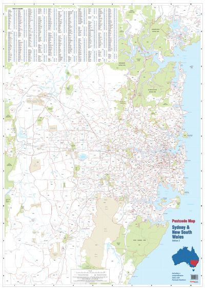
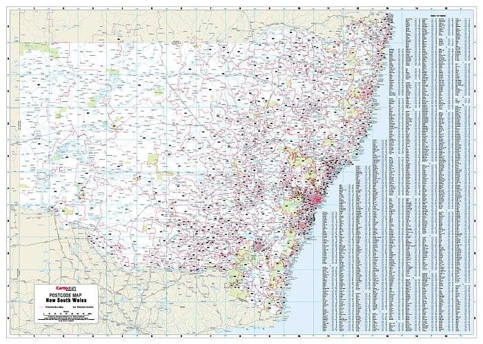
Whether you're managing deliveries, planning sales territories, or coordinating marketing campaigns, the Cartodraft Sydney & New South Wales Postcode Map is an essential business tool. This double-sided folded map clearly displays postcode boundaries and postcode numbers, covering both metropolitan Sydney and regional NSW in fine detail.
🔍 Key Features
-
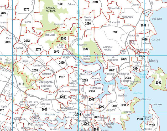
📌 Clearly Defined Postcode Boundaries
Easily identify the divisions between postcode areas across Sydney and New South Wales. Ideal for logistics, mail planning, and service areas. -
🧭 Comprehensive Coverage
Includes the full state of New South Wales, with detailed mapping of the Sydney metropolitan area and key regional hubs. -
🗂️ Fully Indexed for Quick Reference
Features an alphabetical index of town and suburb names matched with their corresponding postcodes — making it easy to locate any area at a glance. -
🔁 Double-Sided Format
One side focuses on Greater Sydney, while the reverse side details the entire state of New South Wales, offering both localised detail and state-wide overview. -
🏢 Perfect for Business Use
Essential for:-
Real estate agents
-
Courier and freight companies
-
Marketing professionals
-
Regional planners
-
Franchise and territory managers
-
📐 Map Specifications
| Feature | Details |
|---|---|
| Publisher | Cartodraft |
| Format | Folded, double-sided |
| Coverage | Greater Sydney & all of New South Wales |
| Size (Unfolded) | 1110 mm (W) × 788 mm (H) |
| Index | Complete postcode index with towns & suburbs |
| Use Case | Business planning, delivery logistics, postcode lookup |
🧳 Ideal For:
-
🚚 Logistics and transport coordinators
-
🏢 Businesses assigning sales or service zones
-
🏘️ Real estate offices working across multiple districts
-
📬 Postal operations and bulk mailing planners
-
🗺️ Map users who need postcode-specific data in an easy-to-read layout
📌 Stay Organised. Plan Smarter. Deliver with Confidence.
The Sydney & New South Wales Folded Postcode Map by Cartodraft is more than just a map — it’s a powerful planning tool designed to support efficiency and accuracy in your business operations.
Order now and make postcode navigation simple and reliable — every time.


