


Explore Western Canada’s Most Iconic Landscapes – Now on One Map
This beautifully detailed double-sided map from International Travel Maps (ITMB) showcases the most scenic and visited parts of Canada’s western provinces—from the towering peaks of the Rockies to the serene vineyards of the Okanagan, and across to the dramatic prairies of Alberta.
Designed and published in Vancouver, BC, this map reflects the publisher’s deep local knowledge and is perfect for travellers, overlanders, tour operators, and anyone planning to discover the untamed beauty of southern British Columbia and Alberta.
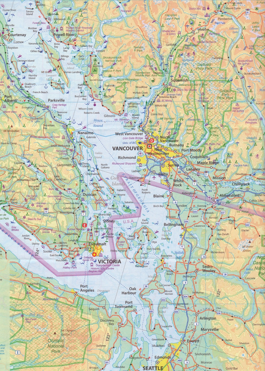
🏔️ Side One: Southern British Columbia
Covers the region from Prince George in the north to the US border in the south, with convenient carry-overs into Seattle, Calgary, and portions of Washington, Idaho, and Montana for border-crossing context.
Key features:
-
Includes Vancouver, Victoria, Vancouver Island, the Okanagan Valley, and Kootenay regions
-
Highlights Banff and Jasper National Parks
-
Nearly 1,000 wilderness campsites
-
Marked ski areas, fishing spots, and remote gas stations
-
Ideal for road-tripping, camping, and alpine touring
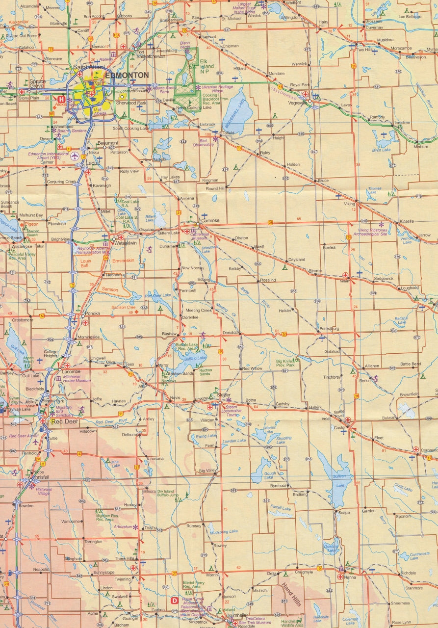
🌾 Side Two: Southern Alberta
Covers from north of Edmonton to the US border, and from the Rocky Mountains eastward into the Canadian Prairies—an area rich in both natural beauty and cultural heritage.
Highlights include:
-
The Columbia Icefield – One of the few in the world accessible on foot
-
Drumheller’s Royal Tyrrell Museum – Arguably the world’s best dinosaur museum
-
Head-Smashed-In Buffalo Jump – A UNESCO World Heritage site
-
Detailed depiction of Alberta’s evolving terrain from alpine ranges to open plains
-
Clear representation of roads, railways, parks, and provincial boundaries
Why This Map Stands Out
-
✅ Fully updated cartography with accurate topography, border crossings, and national/provincial parks
-
✅ Covers all key roadways and backcountry access routes
-
✅ Designed for practical travel use, not just reference
-
✅ Includes a Top Attractions guide for both provinces
📏 Specifications
| Feature | Details |
|---|---|
| Scale | 1:1,000,000 (approx.) |
| Size | 690 mm (w) x 1000 mm (h) |
| Printed | Double-sided, colour |
| Finish | Folded paper (laminated available upon request) |
Whether you’re planning a trans-Canada road trip, navigating remote campsites in the Rockies, or seeking iconic attractions like Banff or Drumheller, this map is an essential tool for making the most of your Western Canadian journey.

