- Australia ▾
- Topographic
▾
- Australia AUSTopo 250k (2024)
- Australia 50k Geoscience maps
- Australia 100k Geoscience maps
- Australia 250k Geoscience maps
- Australia 1.1m Geoscience maps
- New Zealand 50k maps
- New Zealand 250k maps
- New South Wales 25k maps
- New South Wales 50k maps
- New South Wales 100k maps
- Queensland 10k maps
- Queensland 25k maps
- Queensland 50k maps
- Queensland 100k maps
- Compasses
- Software
- GPS Systems
- Orienteering
- International ▾
- Wall Maps
▾
- World
- Australia & New Zealand
- Countries, Continents & Regions
- Historical
- Vintage National Geographic
- Australian Capital Territory
- New South Wales
- Northern Territory
- Queensland
- South Australia
- Tasmania
- Victoria
- Western Australia
- Celestial
- Children's
- Mining & Resources
- Wine Maps
- Healthcare
- Postcode Maps
- Electoral Maps
- Nautical ▾
- Flags
▾
- Australian Flag Sets & Banners
- Flag Bunting
- Handwavers
- Australian National Flags
- Aboriginal Flags
- Torres Strait Islander Flags
- International Flags
- Flagpoles & Accessories
- Australian Capital Territory Flags
- New South Wales Flags
- Northern Territory Flags
- Queensland Flags
- South Australia Flags
- Tasmania Flags
- Victoria Flags
- Western Australia Flags
- Gifts ▾
- Globes ▾
Dear valued customer. Please note that our checkout is not supported by old browsers. Please use a recent browser to access all checkout capabilities


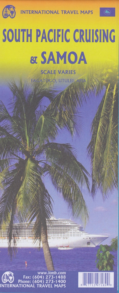

South Pacific Cruising & Samoa ITMB Map
$24.95
Afterpay is only available for orders between $50.00 and $1000.00 More info
Double-Sided Travel & Oceanic Map | Scale: Varies | Size: 685 mm x 990 mm
Optional Lamination Available
🚢 Explore the South Pacific by Sea with This Unique Cruise-Centric Map
The South Pacific Cruising & Samoa Map by ITMB is a first-of-its-kind cartographic resource, specially designed to meet the needs of modern cruise travellers. With the cruise industry seeing unprecedented global growth—now over 25 million passengers annually—this map addresses a clear gap in travel mapping: the vast and majestic waters of the South Pacific.
Whether you're planning an ocean voyage or simply dreaming of island-hopping adventures, this map provides a richly illustrated guide to one of the world’s fastest-growing cruising regions.
🏝️ Two Maps in One
🧭 Side A – South Pacific Ocean & Cruise Routes
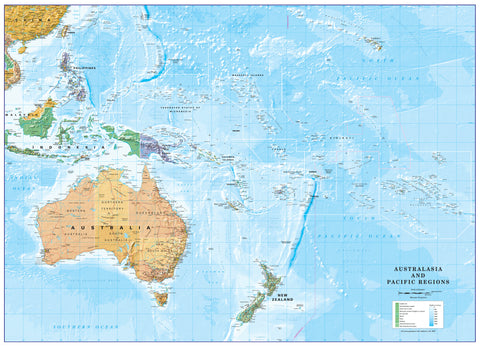
Covers the entire South Pacific Ocean from Hawai‘i to New Zealand, and from Papua New Guinea and eastern Australia to the Pitcairn Islands. This side offers:
-
📍 Cruise Routes indicated with red dashed lines (note: cruise line names not specified due to route overlaps)
-
🌊 Oceanic Relief with subtle hill shading that reveals deep Pacific trenches and undersea contours
-
🌐 Key island groups such as Fiji, Tonga, Tahiti, Kiribati, the Cook Islands, and New Caledonia
-
🚢 Perfect for visualising long-range cruising patterns and port stopovers
💡 Note: Due to the vast oceanic scale (approx. 1:12,000,000), island detail is generalized for regional overview purposes.
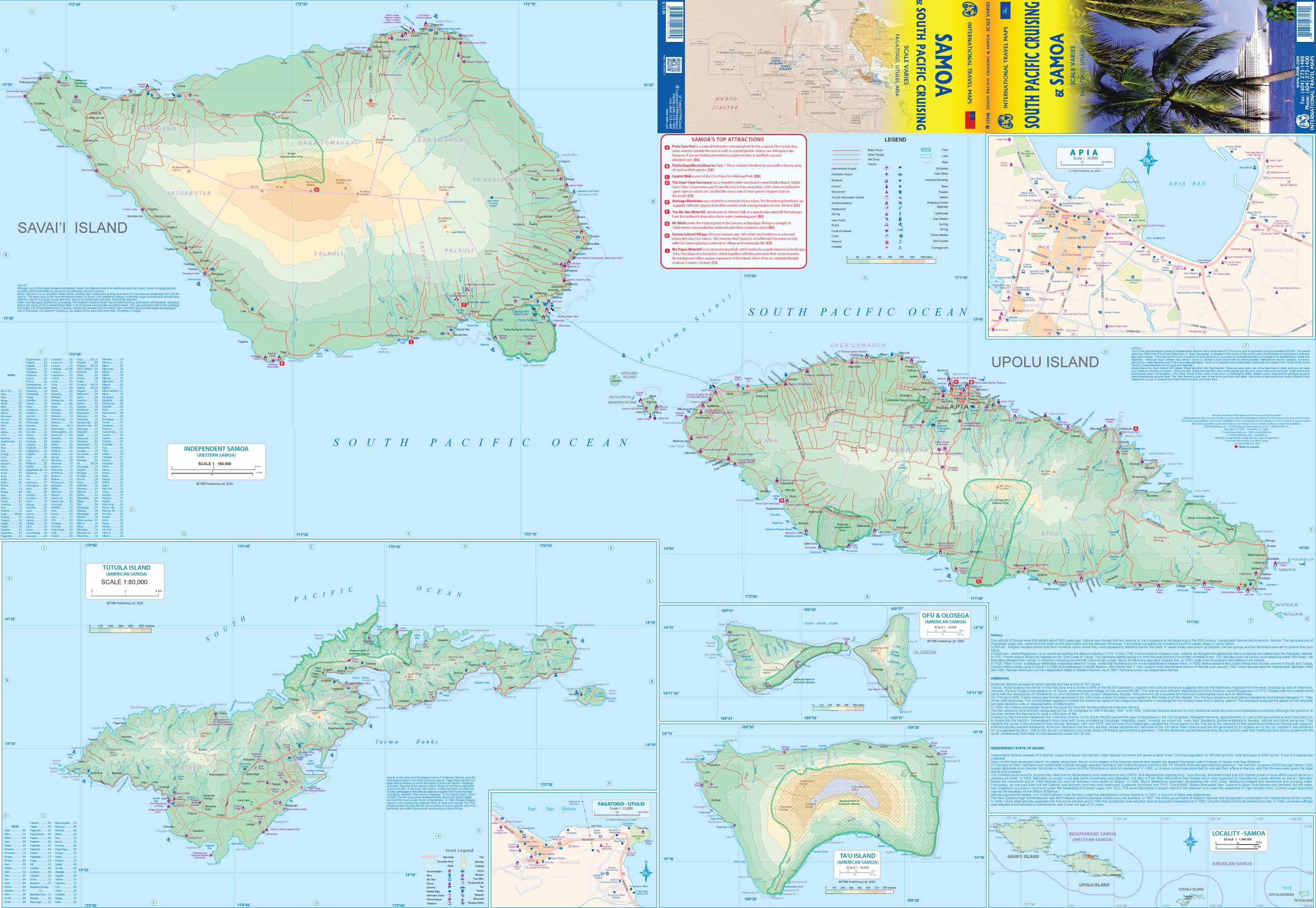
🗺 Side B – Samoa & American Samoa
Focused, detailed cartography of both Samoa and American Samoa:
-
🏝️ Main islands of Upolu, Savai‘i, and Tutuila shown at 1:160,000 scale
-
🏙️ Inset map of Apia, Samoa’s capital
-
⚓ Highlighted cruise port of Pago Pago and main urban centre Fagatogo
-
🛫 Key infrastructure including Tutuila’s airport, roads, and townships
-
🇺🇸 Includes historical and political context of American Samoa, a U.S. overseas territory
📌 Map Features at a Glance
| Feature | Description |
|---|---|
| Coverage Area | South Pacific Ocean, Samoa, and American Samoa |
| Cruise Routes | Red dashed lines (multi-operator generalisation) |
| Map Type | Double-sided folded map |
| Relief Shading | Underwater hill shading reveals ocean trench depth |
| Inset Maps | Apia (capital of Samoa) |
| Topography & Transport | Ports, airstrips, roads, urban areas |
| Languages | English (legend, place names, and notes) |
| Scale | Varies (South Pacific: ~1:12M; Samoa: 1:160,000) |
| Flat Size | 685 mm x 990 mm (approx. 27" x 39") |
| Publisher | ITMB (International Travel Maps & Books) |
🧳 Who Is This Map For?
-
🚢 Cruise passengers voyaging through the South Pacific or exploring future itineraries
-
🌏 Travel enthusiasts and overlanders interested in Pacific island geography
-
🧭 Collectors of nautical or oceanic-themed maps
-
📚 Educators and students studying political geography or American overseas territories
-
🏖️ Holidaymakers planning visits to Samoa, Tahiti, or other Pacific islands
🔒 Optional Upgrade: Laminated Edition
Want your map to last longer and serve as a reusable planning tool? Choose the laminated option for added durability and interactivity:
-
✅ Draw routes with whiteboard markers
-
✅ Add removable map dots or sticky notes
-
✅ Protect your map from moisture, creases, and wear
📌 Please note: laminated maps are made by flattening and encapsulating the folded map in high-grade 80-micron gloss laminate. Fold lines may remain faintly visible.
📦 Shipping & Format Options
-
Ships folded as standard
-
Laminated maps are custom-prepared in house
-
Worldwide delivery available
🌊 Navigate the Blue Continent with Confidence
From coral-ringed atolls to volcanic high islands, from open ocean crossings to historic harbours—this map provides a panoramic and practical guide to the South Pacific like no other. Whether you're planning your next cruise or studying the geography of this enchanting part of the world, the ITMB South Pacific Cruising & Samoa Map is your essential companion.
🛒 Add to Cart Today
Your journey through the Pacific starts with a map.