- Australia ▾
- Topographic
▾
- Australia AUSTopo 250k (2025)
- Australia 50k Geoscience maps
- Australia 100k Geoscience maps
- Australia 250k Geoscience maps
- Australia 1:1m Geoscience maps
- New Zealand 50k maps
- New Zealand 250k maps
- New South Wales 25k maps
- New South Wales 50k maps
- New South Wales 100k maps
- Queensland 10k maps
- Queensland 25k maps
- Queensland 50k maps
- Queensland 100k maps
- Western Australia 25k maps
- Western Australia 50k maps
- Western Australia 100k maps
- Compasses
- Software
- GPS Systems
- International ▾
- Wall Maps
▾
- World
- Australia & New Zealand
- Countries, Continents & Regions
- Historical
- Vintage National Geographic
- Australian Capital Territory
- New South Wales
- Northern Territory
- Queensland
- South Australia
- Tasmania
- Victoria
- Western Australia
- Celestial
- Children's
- Mining & Resources
- Wine Maps
- Healthcare
- Postcode Maps
- Electoral Maps
- Nautical ▾
- Flags
▾
- Australian Flag Sets & Banners
- Flag Bunting
- Handwavers
- Australian National Flags
- Aboriginal Flags
- Torres Strait Islander Flags
- International Flags
- Flagpoles & Accessories
- Australian Capital Territory Flags
- New South Wales Flags
- Northern Territory Flags
- Queensland Flags
- South Australia Flags
- Tasmania Flags
- Victoria Flags
- Western Australia Flags
- Gifts ▾
- Globes ▾
Dear valued customer. Please note that our checkout is not supported by old browsers. Please use a recent browser to access all checkout capabilities


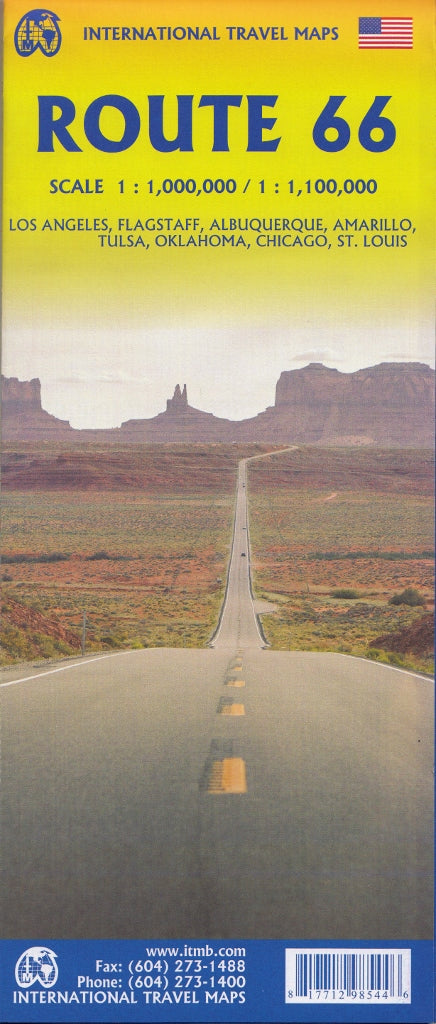
Route 66 Map ITMB
$29.95
Afterpay is only available for orders between $50.00 and $1000.00 More info
Trace the Path of America’s Most Iconic Highway – From Chicago to Santa Monica
Double-Sided Map | Includes City Inset Maps | Historic Route Coverage
Nicknamed “The Mother Road”, Route 66 is far more than just a stretch of highway—it’s a journey through America’s cultural heartland. The Route 66 Map by ITMB is a detailed and thoughtfully designed guide to this legendary route, covering the full historic path from Chicago, Illinois, to Santa Monica, California.
Whether you’re travelling east to west or west to east, this map is your perfect companion for exploring the towns, landscapes, and roadside attractions that made Route 66 a symbol of American freedom, adventure, and reinvention.
A Historic Highway, A Modern Road Trip
Originally completed in the 1920s and later fully paved to link the Midwest with the Pacific Coast, Route 66 became a symbol of opportunity during the Great Depression, a vital military supply route in World War II, and a post-war passage to prosperity in the booming era of American car culture.
Even though it no longer exists as an official U.S. highway, Route 66 lives on as a National Scenic Byway and historic route, with countless original sections, attractions, diners, motels, and neon-lit landmarks still welcoming travellers from around the world.
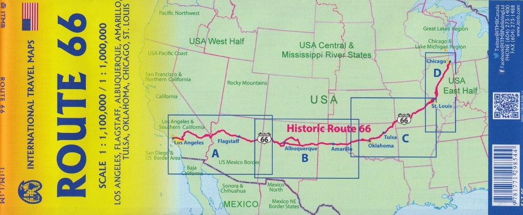
Map Coverage & Layout
This double-sided map provides detailed road guidance, geographic context, and a nostalgic nod to one of the world’s most iconic road trips:
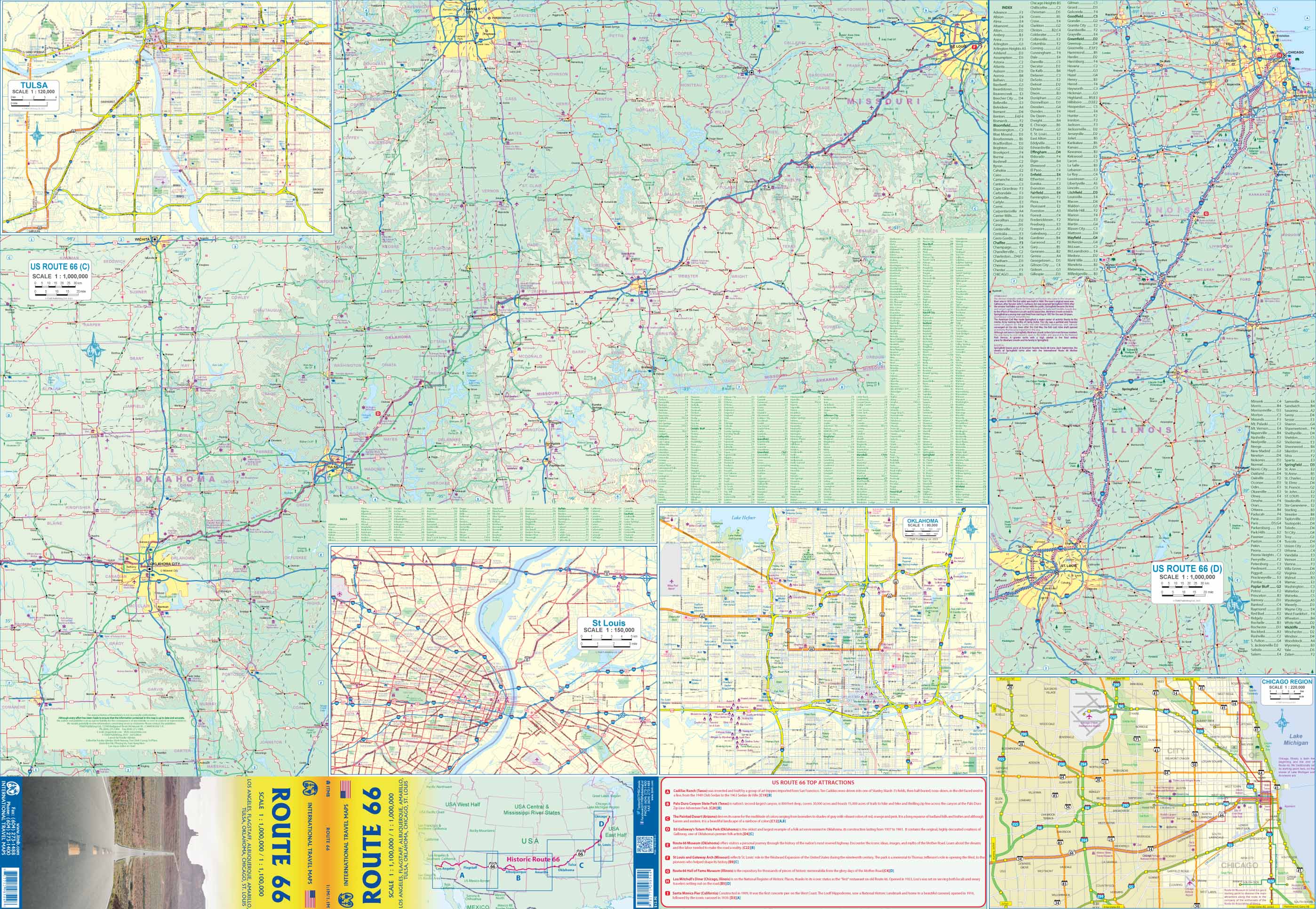
Side 1: Eastern Route
-
Starts with an inset map of Chicago, marking the original route
-
Tracks the highway through Illinois, Missouri, and into Oklahoma
-
Major cities include: Chicago, Springfield, St. Louis, Tulsa, Oklahoma City
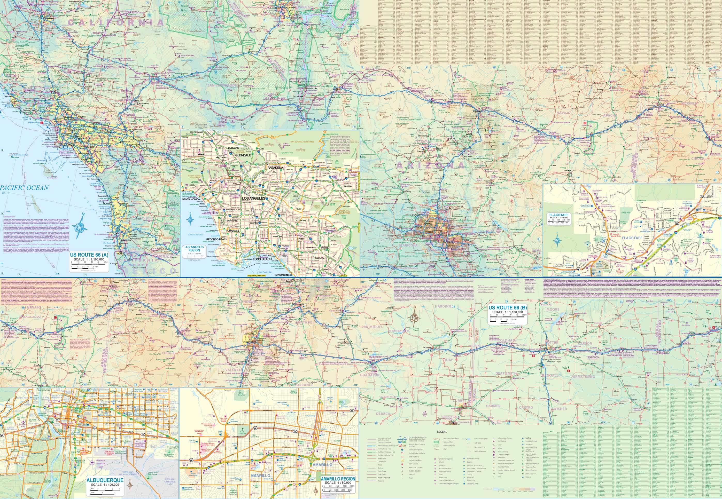
Side 2: Western Route
-
Continues westward through Texas, New Mexico, Arizona, and California
-
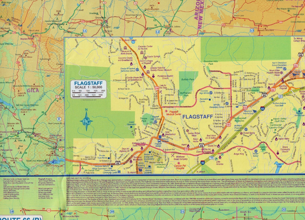
Highlights include: Albuquerque, Flagstaff, the Mojave Desert, and Los Angeles
-
Ends at the historic terminus on the beach at Santa Monica Pier
Although Route 66 has been decommissioned as a federal highway, this map faithfully follows the original alignments, using Highway 36 and other parallel roads to recreate the classic journey.
🧭 Key Features:
-
🛣️ Historic Route 66 path clearly highlighted
-
🗺️ City inset maps for Chicago and key urban areas along the route
-
🧱 Points of interest, roadside landmarks, and attractions noted
-
🚙 Designed for road trippers, tour planners, and history enthusiasts
-
🧭 Equally suitable for east-to-west or west-to-east travel
-
🏞️ Covers interstate alternatives and nearby detours to enrich your route
📐 Specifications
| Feature | Detail |
|---|---|
| Map Title | Route 66 Travel Map – ITMB |
| Publisher | International Travel Maps (Canada) |
| Coverage | Full Route 66 (Chicago to Santa Monica) |
| Format | Double-sided folded paper map |
| Insets | Includes Chicago and other urban areas |
| Language | English |
| Printed In | Canada |
Perfect For:
-
🚗 Road trippers planning the ultimate cross-country adventure
-
🗺️ Map collectors and Route 66 enthusiasts
-
📚 Teachers or tour guides teaching U.S. history, geography, or culture
-
🎁 Travel gift for vintage Americana lovers and highway historians
-
🏍️ Motorcyclists and RV travellers tracing the classic route
The Route 66 Map by ITMB is more than just a navigation tool—it’s a nostalgic tribute to America’s golden age of road travel. Whether you're chasing neon motels, sampling classic diners, or photographing abandoned gas stations, this map will help guide you through one of the most unforgettable journeys on Earth.
Drive the dream. Relive the legend. Follow the Mother Road.
Frequently Asked Questions
Where can I buy the Route 66 Map ITMB?
The Route 66 Map ITMB is available to buy online from Mapworld, Australia's largest map and geographic product retailer, with fast shipping Australia-wide.
Is the Route 66 Map ITMB in stock at Mapworld?
Mapworld maintains extensive stock across its map range and aims for fast dispatch. Orders placed before 2pm AEST on business days are typically dispatched the same day, with standard and express Australia-wide delivery options available.
What is Mapworld's returns policy?
Mapworld accepts returns on undamaged items in original condition. Contact Mapworld within 90 days of purchase to arrange a return or exchange.
Does Mapworld ship the Route 66 Map ITMB across Australia?
Yes, Mapworld ships Australia-wide. Standard shipping is a flat $7 rate, with free standard shipping on orders over $75. Express options are available at checkout. Most orders placed before 2pm AEST on weekdays are dispatched same day.
Related Items


© 2026 Mapworld. Website designed by Genie Media
X