Queensland — Local Government Areas Map
Laminated Wall Map with Timber Hang Rails • 1000 × 1314 mm • Ready to Hang
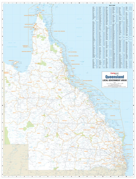
A professional, large-format reference to Queensland’s current Local Government Area (LGA) boundaries. This wall map distinctly colours and labels every council, adds main roads, townships, and key land features, and includes an easy-to-read town index—perfect for planning, analysis, and display.
🗝️ Key Features
-
Up-to-date LGA boundaries — Every council clearly differentiated and labelled for fast orientation.
-
Town index & clear labels — Rapid lookups for regional and remote communities.
-
Transport & terrain context — Main roads, townships, and notable land features provide real-world usability.
-
Large-format clarity — Designed to be read across meeting rooms, service counters, and classrooms.
🗺️ What’s Shown (At a Glance)
-
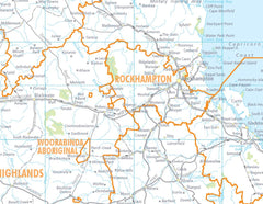
Colour-coded LGA polygons with boundary lines and names
-
State & regional road network (primary/secondary)
-
Townships & settlements (hierarchy emphasised for readability)
-
Key land features to aid wayfinding and discussion
-
Legend & scale bar for quick interpretation
🎨 Materials & Finish
💧 Lamination (True Encapsulation)
-
Fully sealed in 2 × 80-micron gloss laminate, edge-to-edge for maximum durability
-
Waterproof • Tear-resistant • Wipe-clean
-
Write on with whiteboard markers and use Map Dots; erase cleanly without ghosting
🪵 Timber Hang Rails (Ready to Hang)
-
Natural lacquered timber rails fitted top & bottom
-
Strong top hanging cord for quick, tidy wall mounting (single hook friendly)
-
Warm, professional presentation suited to offices, foyers, and public spaces
⚠️ Lead time: Hang rails are custom-fitted by our framer — please allow up to 10 working days for delivery.
📐 Size & Orientation
-
1000 mm (W) × 1314 mm (H)
-
Orientation: Portrait
🧼 Care & Use
-
Use non-permanent whiteboard markers; wipe with a soft, dry cloth
-
For stickers/labels, use Map Dots to avoid residue
-
Avoid ammonia/alcohol cleaners; a damp microfiber cloth handles stubborn marks
📊 Specifications
| Attribute | Details |
|---|---|
| Title | Queensland — Local Government Areas Map |
| Coverage | Entire state of Queensland (current LGAs) |
| Layers | LGAs, main roads, townships, key land features, town index |
| Format | Laminated Wall Map + Timber Hang Rails |
| Laminate | 2 × 80-micron gloss (true encapsulation) |
| Hang Rails | Natural timber, lacquered; top hanging cord |
| Size | 1000 × 1314 mm |
🎯 Ideal For
-
🏛️ Government & councils — boundary reference, service planning, community engagement
-
💼 Businesses & utilities — franchise/territory design, stakeholder planning
-
🎓 Schools & libraries — civics, geography, and regional studies
-
🏥 Healthcare & NGOs — coverage planning and outreach coordination
-
🧭 Visitor centres & public counters — clear, authoritative Queensland council overview
Why This Map Works
-
Immediate comprehension — Colour-coded LGAs make boundary discussions fast and clear
-
Room-scale readability — Typeface, contrast, and line weights tuned for distance viewing
-
Operational durability — Lamination stands up to daily handling and annotations
🛒 Order your Queensland LGA Map (Laminated with Hang Rails) today — durable, wipe-clean, and display-ready for everyday decision-making.


