- Australia ▾
- Topographic
▾
- Australia AUSTopo 250k (2025)
- Australia 50k Geoscience maps
- Australia 100k Geoscience maps
- Australia 250k Geoscience maps
- Australia 1:1m Geoscience maps
- New Zealand 50k maps
- New Zealand 250k maps
- New South Wales 25k maps
- New South Wales 50k maps
- New South Wales 100k maps
- Queensland 10k maps
- Queensland 25k maps
- Queensland 50k maps
- Queensland 100k maps
- Compasses
- Software
- GPS Systems
- Orienteering
- International ▾
- Wall Maps
▾
- World
- Australia & New Zealand
- Countries, Continents & Regions
- Historical
- Vintage National Geographic
- Australian Capital Territory
- New South Wales
- Northern Territory
- Queensland
- South Australia
- Tasmania
- Victoria
- Western Australia
- Celestial
- Children's
- Mining & Resources
- Wine Maps
- Healthcare
- Postcode Maps
- Electoral Maps
- Nautical ▾
- Flags
▾
- Australian Flag Sets & Banners
- Flag Bunting
- Handwavers
- Australian National Flags
- Aboriginal Flags
- Torres Strait Islander Flags
- International Flags
- Flagpoles & Accessories
- Australian Capital Territory Flags
- New South Wales Flags
- Northern Territory Flags
- Queensland Flags
- South Australia Flags
- Tasmania Flags
- Victoria Flags
- Western Australia Flags
- Gifts ▾
- Globes ▾
Dear valued customer. Please note that our checkout is not supported by old browsers. Please use a recent browser to access all checkout capabilities


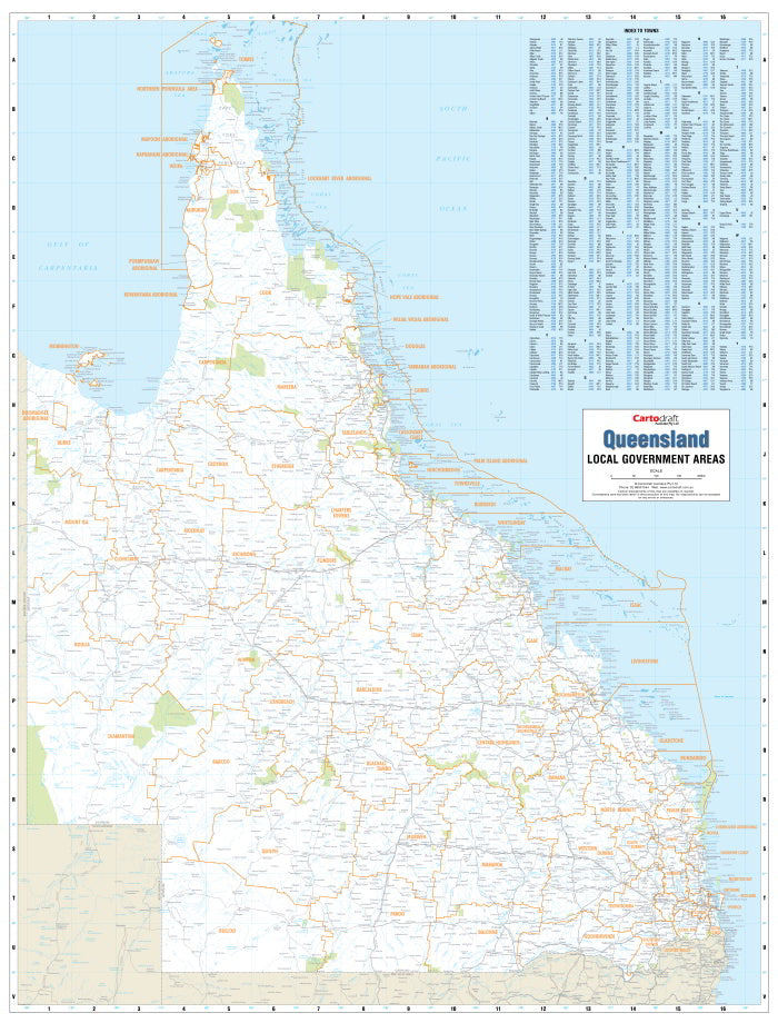
Queensland Local Government Areas Map Laminated Wall Map
$169.95
or make 4 interest-free payments of
$42.49 AUD
fortnightly with
![]() More info
More info
Clearly defined boundaries. Durable, practical, and perfect for planning.
Stay informed and organised with the most current administrative map of Queensland. This Local Government Areas (LGA) Map is an essential resource for government offices, planning departments, schools, real estate professionals, logistics companies, and any business operating within Queensland’s regional framework.
Covering the entire state, this map displays all current local government boundaries, providing a clear and accurate overview of how Queensland is divided by council areas.
Key Features
✓ Up-to-Date Local Government Boundaries
This map reflects the most recent updates to council jurisdictions, offering a reliable reference for strategic planning, electoral mapping, resource allocation, and regional development projects.
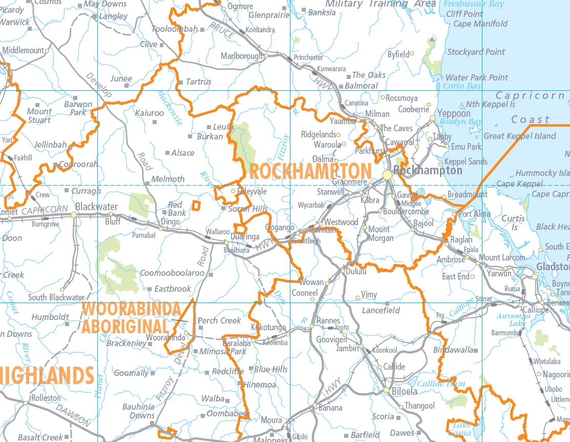
✓ Clear Colour-Coding by LGA
Each local government area is clearly differentiated with coloured boundaries for easy visual reference. Council names are prominently labelled, making it easy to distinguish neighbouring LGAs at a glance.
✓ Easy-to-Read Town Index
The map includes a fully indexed list of towns, helping you quickly locate any settlement or locality within the state. Whether you're searching for a remote outback township or a coastal centre, this index streamlines navigation and planning.
✓ Additional Map Details
Beyond administrative boundaries, the map includes:
-
Major highways and main roads
-
Townships and regional centres
-
Key land features such as rivers and mountain ranges
-
Locality markers to assist with navigation
Durable Laminated Finish
The map is encapsulated in high-quality 80-micron gloss laminate, making it not just long-lasting, but also interactive:
-
Write-on/wipe-off surface – use whiteboard markers for planning or notes
-
Apply map dots or sticky tabs – mark key service areas, territories, or offices
-
Resistant to tears, stains, and moisture – perfect for busy workplaces or classrooms
📐 Specifications
| Attribute | Detail |
|---|---|
| Map Title | Queensland Local Government Areas |
| Finish | Laminated (80-micron gloss) |
| Size | 1000 mm (W) × 1314 mm (H) |
| Format | Flat, rolled wall map |
| Index | Yes – includes town index |
| Projection | Topographic with administrative overlay |
| Publisher | Cartodraft / Local Government Map Specialist |
🏢 Perfect For:
-
Council offices and state government departments
-
Business logistics and distribution planning
-
Franchise and service area mapping
-
Educational settings, from high schools to universities
-
Real estate and property development professionals
-
Tourism and travel organisations
🚚 Shipping & Production
Please note: This is a print-on-demand map, made to order in Australia.
👉 Please allow up to 10 working days for dispatch and delivery.
Practical, authoritative, and easy to use, this Queensland LGA map is a must-have tool for anyone working across the Sunshine State.
