- Australia ▾
- Topographic
▾
- Australia AUSTopo 250k (2025)
- Australia 50k Geoscience maps
- Australia 100k Geoscience maps
- Australia 250k Geoscience maps
- Australia 1:1m Geoscience maps
- New Zealand 50k maps
- New Zealand 250k maps
- New South Wales 25k maps
- New South Wales 50k maps
- New South Wales 100k maps
- Queensland 10k maps
- Queensland 25k maps
- Queensland 50k maps
- Queensland 100k maps
- Western Australia 25k maps
- Western Australia 50k maps
- Western Australia 100k maps
- Compasses
- Software
- GPS Systems
- International ▾
- Wall Maps
▾
- World
- Australia & New Zealand
- Countries, Continents & Regions
- Historical
- Vintage National Geographic
- Australian Capital Territory
- New South Wales
- Northern Territory
- Queensland
- South Australia
- Tasmania
- Victoria
- Western Australia
- Celestial
- Children's
- Mining & Resources
- Wine Maps
- Healthcare
- Postcode Maps
- Electoral Maps
- Nautical ▾
- Flags
▾
- Australian Flag Sets & Banners
- Flag Bunting
- Handwavers
- Australian National Flags
- Aboriginal Flags
- Torres Strait Islander Flags
- International Flags
- Flagpoles & Accessories
- Australian Capital Territory Flags
- New South Wales Flags
- Northern Territory Flags
- Queensland Flags
- South Australia Flags
- Tasmania Flags
- Victoria Flags
- Western Australia Flags
- Gifts ▾
- Globes ▾
Dear valued customer. Please note that our checkout is not supported by old browsers. Please use a recent browser to access all checkout capabilities


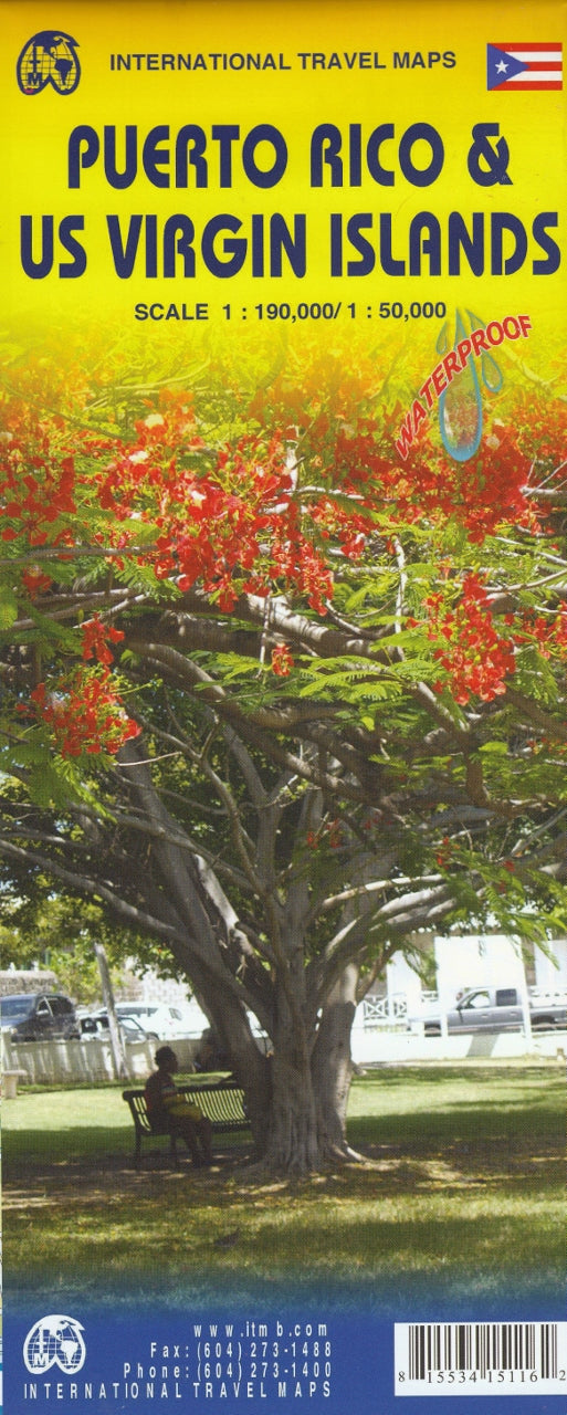
Puerto Rico & US Virgin Islands ITMB Map
$24.95
Afterpay is only available for orders between $50.00 and $1000.00 More info
🇵🇷 Puerto Rico & U.S. Virgin Islands – ITMB Travel Map
1st Edition – Fully Updated with Inset Maps of Key Cities
Map Size: 990 mm x 680 mm
Double-Sided, Folded Travel Map
Explore the vibrant Caribbean landscapes, colonial cities, and tropical coastlines of Puerto Rico and the U.S. Virgin Islands with this beautifully updated travel map from ITMB (International Travel Maps). Featuring up-to-date cartography and detailed inset city maps, this dual-country map is the perfect companion for road trips, cultural exploration, or planning a relaxed island getaway.
This new edition benefits from on-the-ground research and satellite-assisted geo-referencing, making it one of the most accurate and user-friendly maps available for the region.
🗺️ What’s Inside?
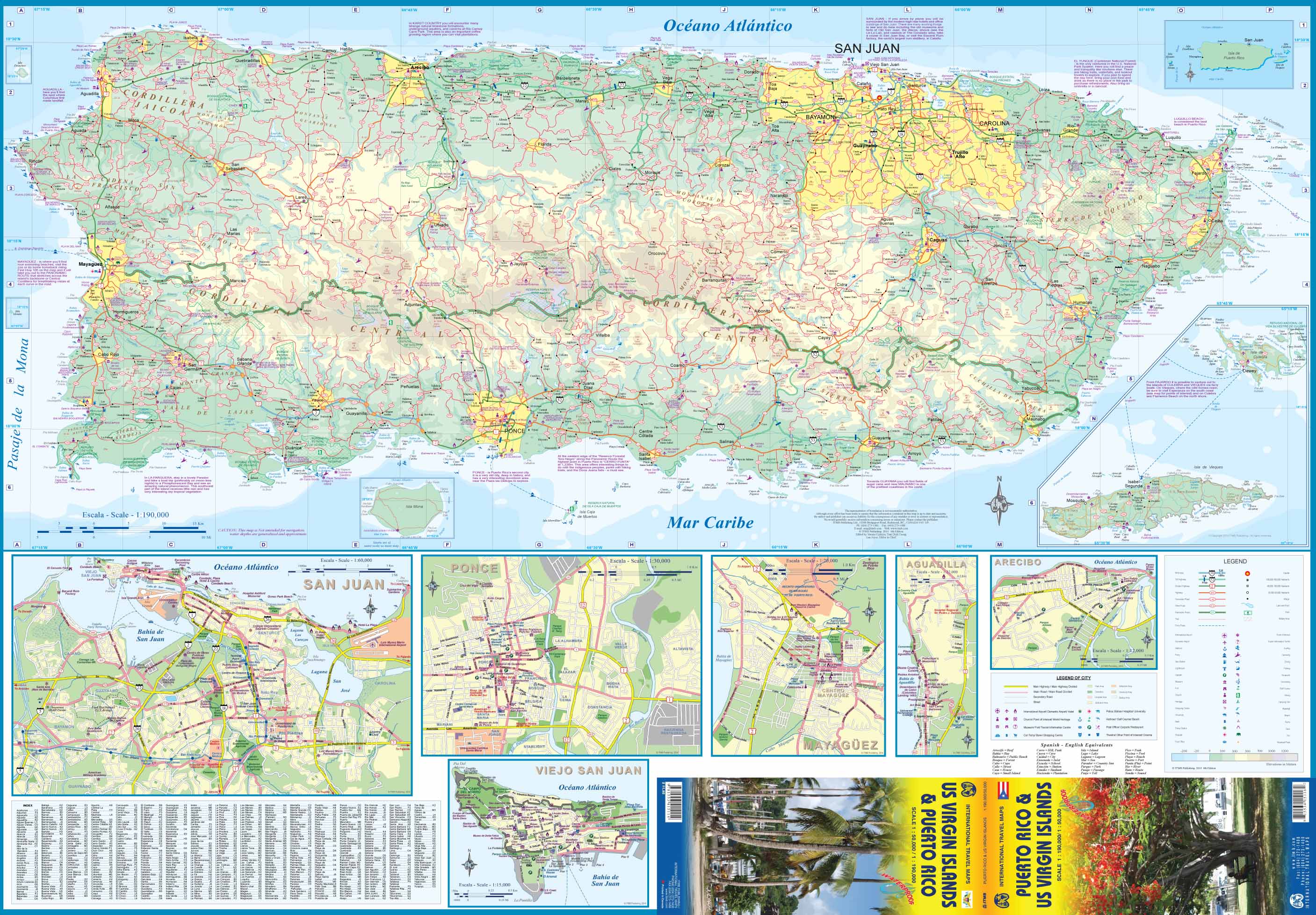
🟦 Side One: Puerto Rico
-
Full road network coverage, from major highways to secondary and rural roads
-
Accurate topographical features, towns, rivers, and parks
-
Tourist highlights, beaches, ferry terminals, and scenic routes
-
Inset maps of San Juan, Ponce, Mayagüez, Arecibo, and Aguadilla
-
Useful for both visitors and locals navigating across the island
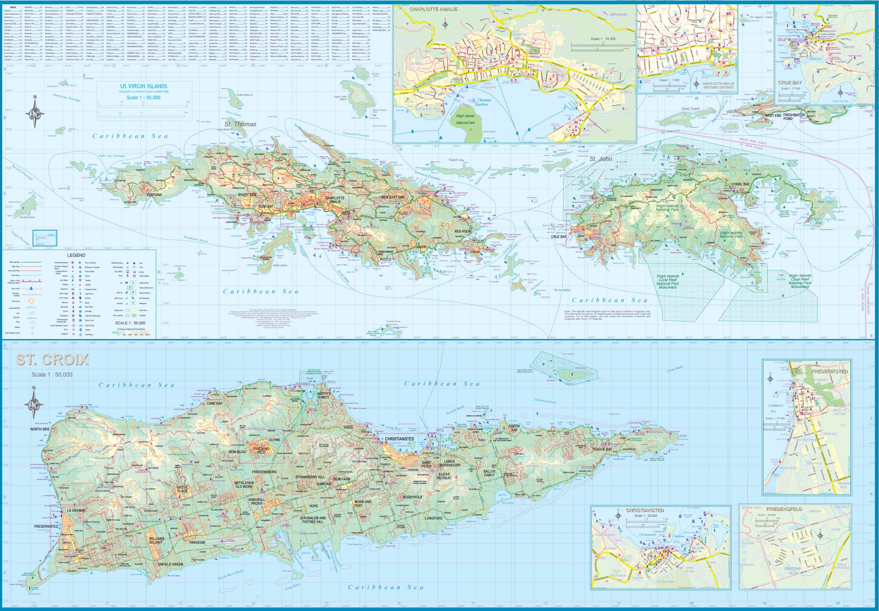
🟨 Side Two: U.S. Virgin Islands
-
Detailed mapping of St. Thomas, St. John, and St. Croix
-
Insets of key urban centres: Charlotte Amalie, Cruz Bay, Christiansted, and Frederiksted
-
Road networks, heritage landmarks, ports, and major resorts highlighted
-
A wonderful blend of U.S. infrastructure and Danish colonial charm
📌 Key Features
-
✅ Full-colour, double-sided map covering both territories
-
✅ Inset city maps for key urban centres and port towns
-
✅ Tourist information including points of interest, national parks, and beaches
-
✅ Detailed road networks including kilometre distances and ferry routes
-
✅ Accurate and up-to-date with ground-truthed research and satellite data
-
✅ Perfect for car travel, touring, or cruise ship stops
📏 Map Specifications
| Feature | Description |
|---|---|
| Publisher | ITMB (International Travel Maps) |
| Regions Covered | Puerto Rico, U.S. Virgin Islands |
| Inset Maps | San Juan, Ponce, Mayagüez, Arecibo, Aguadilla, Charlotte Amalie, Christiansted, Frederiksted, Cruz Bay |
| Map Format | Folded, double-sided |
| Map Size | 990 mm x 680 mm |
| Paper Type | Standard paper (lamination optional) |
| Scale | Approx. 1:190,000 (Puerto Rico) / Varies (Islands) |
🌴 Who Is This Map For?
-
🧳 Travellers touring Puerto Rico by car or bus
-
🛳️ Cruise passengers stopping at St. Thomas, St. John, or San Juan
-
🗺️ Cultural explorers seeking historic sites, heritage towns, and scenic routes
-
🏝️ Beach lovers chasing hidden coves and Caribbean vibes
-
🏡 Expats or retirees navigating life between islands
Whether you're hiking El Yunque Rainforest, exploring colonial forts in Old San Juan, or sailing between turquoise bays in the Virgin Islands, this ITMB travel map will help you get the most out of your Caribbean experience.
Frequently Asked Questions
Where can I buy the Puerto Rico & US Virgin Islands ITMB Map?
The Puerto Rico & US Virgin Islands ITMB Map is available to buy online from Mapworld, Australia's largest map and geographic product retailer, with fast shipping Australia-wide.
Is the Puerto Rico & US Virgin Islands ITMB Map in stock at Mapworld?
Mapworld maintains extensive stock across its map range and aims for fast dispatch. Orders placed before 2pm AEST on business days are typically dispatched the same day, with standard and express Australia-wide delivery options available.
What is Mapworld's returns policy?
Mapworld accepts returns on undamaged items in original condition. Contact Mapworld within 90 days of purchase to arrange a return or exchange.
Does Mapworld ship the Puerto Rico & US Virgin Islands ITMB Map across Australia?
Yes, Mapworld ships Australia-wide. Standard shipping is a flat $7 rate, with free standard shipping on orders over $75. Express options are available at checkout. Most orders placed before 2pm AEST on weekdays are dispatched same day.
Related Items


© 2026 Mapworld. Website designed by Genie Media
X