- Australia ▾
- Topographic
▾
- Australia AUSTopo 250k (2024)
- Australia 50k Geoscience maps
- Australia 100k Geoscience maps
- Australia 250k Geoscience maps
- Australia 1.1m Geoscience maps
- New Zealand 50k maps
- New Zealand 250k maps
- New South Wales 25k maps
- New South Wales 50k maps
- New South Wales 100k maps
- Queensland 10k maps
- Queensland 25k maps
- Queensland 50k maps
- Queensland 100k maps
- Compasses
- Software
- GPS Systems
- Orienteering
- International ▾
- Wall Maps
▾
- World
- Australia & New Zealand
- Countries, Continents & Regions
- Historical
- Vintage National Geographic
- Australian Capital Territory
- New South Wales
- Northern Territory
- Queensland
- South Australia
- Tasmania
- Victoria
- Western Australia
- Celestial
- Children's
- Mining & Resources
- Wine Maps
- Healthcare
- Postcode Maps
- Electoral Maps
- Nautical ▾
- Flags
▾
- Australian Flag Sets & Banners
- Flag Bunting
- Handwavers
- Australian National Flags
- Aboriginal Flags
- Torres Strait Islander Flags
- International Flags
- Flagpoles & Accessories
- Australian Capital Territory Flags
- New South Wales Flags
- Northern Territory Flags
- Queensland Flags
- South Australia Flags
- Tasmania Flags
- Victoria Flags
- Western Australia Flags
- Gifts ▾
- Globes ▾
Dear valued customer. Please note that our checkout is not supported by old browsers. Please use a recent browser to access all checkout capabilities
Political World Wall Map with Flags in French & English 1016 x 711mm
$89.95
or make 4 interest-free payments of
$22.49 AUD
fortnightly with
![]() More info
More info
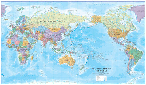
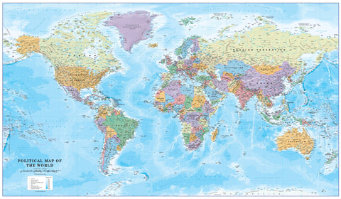
🌎 Political World Wall Map with Flags – French & English
A Bilingual Global View with Educational & Decorative Appeal
In an increasingly connected world, the ability to communicate across cultures is more important than ever. This Political World Map with Flags – French & English celebrates that connection, presenting a detailed view of the globe with all place names clearly labelled in both official languages of Canada.
Designed with precision cartography, it pairs updated political boundaries with a vibrant border of every national flag—making it a functional learning tool and an elegant wall feature. Its clean design and bilingual format make it equally suited to classrooms, corporate boardrooms, libraries, and public display.
Why You’ll Love This Map
-
Bilingual Clarity for Canada: All countries, capitals, and major cities named in both French and English, making it ideal for bilingual and language-learning environments.
-
Every Flag of the World: Encircling the map is a complete set of national flags, offering a quick reference to the symbols and colours of each country.
-
Educational & Decorative in Equal Measure: Designed for learning, yet stylish enough to enhance any wall in a professional or public setting.
-
Accurate & Up to Date: Incorporates the latest political boundaries and place names for reliable reference.
-
Perfect for All Ages: Suitable for school students, office workers, and lifelong learners alike.
Format & Material Options
| Format | Material & Finish | Best For |
|---|---|---|
| Paper | Heavyweight 160 gsm art paper | Elegant framing under glass for a refined look in homes, offices, or libraries |
| Laminated | Fully encapsulated in two sheets of 80 micron gloss laminate | Classrooms, training rooms, and busy spaces where maps are handled frequently |
| Laminated with Hang Rails | Laminated map with natural timber rails & hanging cord | Quick and attractive wall display in educational, public, or professional settings |
| Canvas | 395 gsm HP Professional Matte Canvas, pigment-based inks | Premium textured wall art with long-lasting colour stability |
| Canvas with Hang Rails | Canvas with natural timber rails & hanging cord | Warm, heritage-style presentation for prominent wall display |
Specifications
| Feature | Detail |
|---|---|
| Scale | 1:41,500,000 |
| Size | 1016 mm (W) × 711 mm (H) |
| Origin | Made in Australia |
| Printing | High-clarity pigment-based inks for vivid colour, crisp detail, and excellent readability |
| Mounting | Optional natural timber hang rails in a clear lacquer finish for ready-to-hang presentation |
Ready-to-Hang Elegance
For canvas and laminated with hang rails versions, we hand-fit lacquered natural timber rails at the top and bottom, with a strong hanging cord. This clean, timeless presentation ensures your map looks impressive the moment it’s unpacked—no framing required.
Production & Delivery
-
Paper, Laminated & Canvas Maps: Dispatched promptly for fast delivery.
-
Hang-Railed Maps: Please allow up to 10 working days as each is professionally mounted by our framer.
Perfect For
✔ Canadian classrooms and bilingual teaching spaces
✔ Corporate offices, boardrooms, and reception areas
✔ Libraries, cultural centres, and public institutions
✔ Homes with a love for geography and global awareness
✔ Businesses working in multicultural or international settings
More Than a Map – A Tool for Connection
This Political World Map with Flags – French & English does more than display borders—it helps bridge them. Its bilingual design encourages inclusivity, its flags inspire curiosity, and its detailed cartography invites exploration. Whether displayed in a school to inspire young minds, in an office to reflect international reach, or in a library to promote learning, it is a statement of global understanding.


