- Australia ▾
- Topographic
▾
- Australia AUSTopo 250k (2024)
- Australia 50k Geoscience maps
- Australia 100k Geoscience maps
- Australia 250k Geoscience maps
- Australia 1.1m Geoscience maps
- New Zealand 50k maps
- New Zealand 250k maps
- New South Wales 25k maps
- New South Wales 50k maps
- New South Wales 100k maps
- Queensland 10k maps
- Queensland 25k maps
- Queensland 50k maps
- Queensland 100k maps
- Compasses
- Software
- GPS Systems
- Orienteering
- International ▾
- Wall Maps
▾
- World
- Australia & New Zealand
- Countries, Continents & Regions
- Historical
- Vintage National Geographic
- Australian Capital Territory
- New South Wales
- Northern Territory
- Queensland
- South Australia
- Tasmania
- Victoria
- Western Australia
- Celestial
- Children's
- Mining & Resources
- Wine Maps
- Healthcare
- Postcode Maps
- Electoral Maps
- Nautical ▾
- Flags
▾
- Australian Flag Sets & Banners
- Flag Bunting
- Handwavers
- Australian National Flags
- Aboriginal Flags
- Torres Strait Islander Flags
- International Flags
- Flagpoles & Accessories
- Australian Capital Territory Flags
- New South Wales Flags
- Northern Territory Flags
- Queensland Flags
- South Australia Flags
- Tasmania Flags
- Victoria Flags
- Western Australia Flags
- Gifts ▾
- Globes ▾
Dear valued customer. Please note that our checkout is not supported by old browsers. Please use a recent browser to access all checkout capabilities
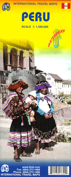
Peru ITMB Map
$24.95
Afterpay is only available for orders between $50.00 and $1000.00 More info
Scale: 1:1,500,000 | Size: 690 mm x 1000 mm | Printed on Durable Waterproof Plastic Paper
Explore the heart of the Andes and the Amazon with the Peru Travel Map by ITMB (International Travel Maps)—an essential tool for anyone navigating this breathtakingly diverse and historically rich country. Whether you're heading to Machu Picchu, trekking the Cordillera Blanca, or venturing deep into the Amazon Basin, this map offers clarity, reliability, and resilience.
✅ Key Features
Comprehensive Coverage
-
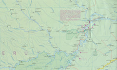
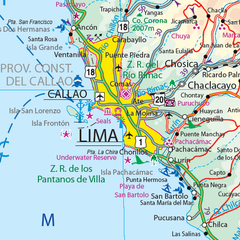
Detailed cartography of Peru’s road network, including major highways, secondary roads, and remote routes
-
Clearly marked cities, towns, villages, and archaeological sites
-
Shows airports, airfields, petrol stations, railways, rivers, lakes, and mines
Topographic Detail
-
Mountain ranges with spot elevations
-
Highlights Peru’s complex geography—from high-altitude peaks to lush rainforests
Tourist & Practical Points of Interest
-
Includes major ruins, national parks, World Heritage sites, and eco-lodges
-
A practical tool for planning backpacking trips, overland routes, or guided tours
Waterproof & Tear-Resistant Material
-
Printed on ITMB plastic paper, this map is designed to withstand the rigours of travel
-
Ideal for use in humid, wet, or rugged conditions—won’t tear or degrade from frequent folding
Optional Laminated Version
-
Write-on/wipe-off surface for planning or route marking
-
Allows you to use whiteboard markers or map dots without leaving permanent marks
-
Laminated using high-quality 80-micron gloss laminate, fully encapsulated
-
Note: Slight fold lines may be visible from flattening the folded version for lamination
📐 Product Specifications
| Feature | Description |
|---|---|
| Publisher | ITMB – International Travel Maps |
| Title | Peru Travel Map |
| Scale | 1:1,500,000 |
| Size (Unfolded) | 690 mm x 1000 mm |
| Material | Waterproof synthetic paper (laminated option available) |
| Map Type | Single-sided, topographic and political travel map |
Perfect For:
✔️ Travellers planning extended visits to Peru
✔️ Adventure seekers tackling the Inca Trail or Andes trekking routes
✔️ Students and educators teaching Latin American geography or archaeology
✔️ Travel agencies, tour planners, and cultural enthusiasts
✔️ Eco-tourists and wildlife photographers heading to the Amazon
Why Choose This Map?
Peru is a land of contrast and wonder—from ancient ruins and soaring peaks to tropical jungles and vibrant cities. This ITMB map of Peru brings together all the geographical and cultural details you need in a format that’s built for travel, weather, and wear.
Whether you’re exploring Lima, Cusco, or beyond, this map helps you do it with clarity and confidence.
🛒 Add to Cart Today and take the ultimate map of Peru with you—wherever the trail leads.


