- Australia ▾
- Topographic
▾
- Australia AUSTopo 250k (2024)
- Australia 50k Geoscience maps
- Australia 100k Geoscience maps
- Australia 250k Geoscience maps
- Australia 1.1m Geoscience maps
- New Zealand 50k maps
- New Zealand 250k maps
- New South Wales 25k maps
- New South Wales 50k maps
- New South Wales 100k maps
- Queensland 10k maps
- Queensland 25k maps
- Queensland 50k maps
- Queensland 100k maps
- Compasses
- Software
- GPS Systems
- Orienteering
- International ▾
- Wall Maps
▾
- World
- Australia & New Zealand
- Countries, Continents & Regions
- Historical
- Vintage National Geographic
- Australian Capital Territory
- New South Wales
- Northern Territory
- Queensland
- South Australia
- Tasmania
- Victoria
- Western Australia
- Celestial
- Children's
- Mining & Resources
- Wine Maps
- Healthcare
- Postcode Maps
- Electoral Maps
- Nautical ▾
- Flags
▾
- Australian Flag Sets & Banners
- Flag Bunting
- Handwavers
- Australian National Flags
- Aboriginal Flags
- Torres Strait Islander Flags
- International Flags
- Flagpoles & Accessories
- Australian Capital Territory Flags
- New South Wales Flags
- Northern Territory Flags
- Queensland Flags
- South Australia Flags
- Tasmania Flags
- Victoria Flags
- Western Australia Flags
- Gifts ▾
- Globes ▾
Dear valued customer. Please note that our checkout is not supported by old browsers. Please use a recent browser to access all checkout capabilities


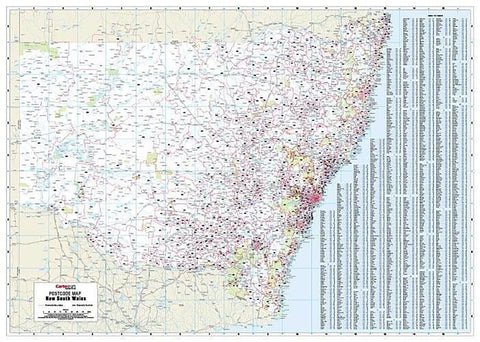
Western Australia Postcode Laminated Wall Map 788 x 1120mm
$109.95
or make 4 interest-free payments of
$27.49 AUD
fortnightly with
![]() More info
More info
Western Australia Postcode Laminated Wall Map · 788 × 1120 mm
The definitive postcode planning map for WA—covering the entire state in one clear, durable, wall-sized view. Cartodraft’s Western Australia Postcode Map presents postcode boundaries and numbers across metro Perth and the vast regional areas, supported by a comprehensive suburb and town index. Finished in a robust write-on/wipe-off laminate, this map is a practical, professional tool for any organisation operating across Australia’s largest state.
✅ Why this map is indispensable
-
Complete statewide coverage — the only map that brings every Western Australia postcode and boundary together on one sheet
-
Comprehensive suburb & town index — instantly locate communities and match them with their postcode
-
True write & wipe surface — update territories, service areas, or routes using whiteboard markers; erase cleanly without smudges
-
Dot mapping ready — use Mark-It-Dots to highlight depots, customer clusters, or project sites without harming the surface
-
Built for business — essential for logistics planning, franchise and sales management, regional service allocation, and government reference
🪵 Premium materials (built to last)
This is not a fragile poster—it’s a professional-grade planning tool designed for years of daily use:
-
Heavy base stock — sturdy, bright paper for sharp detail and vibrant colour reproduction
-
True encapsulation lamination — sealed in 2 × 80-micron gloss film, edge-to-edge, for waterproof and tear-resistant strength
-
Write-on/wipe-off finish — works flawlessly with whiteboard markers for annotations that erase cleanly
-
Edge-sealed protection — prevents peeling, fraying, and moisture ingress
-
Colour-managed printing — high-contrast tones ensure legibility from wall distance, even in large rooms
✨ Optional upgrade: Laminated + Timber Hang Rails — natural lacquered timber rails fitted top & bottom with a hanging cord for a professional, ready-to-hang display.
⏱️ Please allow up to 10 working days for hang-railed maps.
🧾 What’s on the map
-
Postcode boundaries & numbers for all of Western Australia—Perth metro, regional centres, mining towns, and remote communities
-
Comprehensive suburb & town index with postcodes for instant cross-reference
-
Major highways, roads, and key regional features (as supplied by Cartodraft)
📐 Size & display
-
788 × 1120 mm (portrait) — large enough to display WA’s vast geography while still compact for office walls
-
Mount directly with 3M picture strips or screws, or upgrade to timber rails for a professional display solution
📦 Practical uses in business & government
-
Sales & franchise territory design — define and manage catchments across one of the world’s largest jurisdictions
-
Logistics & freight planning — map distribution routes from Perth to the Pilbara, Kimberley, and Goldfields
-
Mining & resources operations — allocate postcode regions to projects, camps, and infrastructure
-
Government & administration — reference tool for service delivery, electoral boundaries, and planning
-
Education & training — visual reference for geography, planning courses, and regional studies
-
Professional display — a functional centrepiece for offices, boardrooms, and operations hubs
🧽 Care & maintenance
-
Wipe clean with a soft dry or slightly damp cloth
-
Use only whiteboard markers (avoid permanent or ethanol-based inks)
-
Remove adhesive dots carefully to maintain the laminate edge seal
📊 Specifications
| Field | Detail |
|---|---|
| Title | Western Australia Postcode Laminated Wall Map |
| Publisher | Cartodraft |
| Coverage | Statewide Western Australia — postcode boundaries & numbers |
| Index | Suburb & town index with postcodes |
| Colour-managed, high-contrast cartography | |
| Lamination | 2 × 80-micron gloss film, fully encapsulated, edge-sealed |
| Surface | Write-on/wipe-off (whiteboard-marker compatible) |
| Orientation & Size | Portrait — 788 × 1120 mm |
| Optional Display | Laminated + Timber Hang Rails (natural lacquered; allow up to 10 working days) |
| Best for | Sales, logistics, government, franchise planning, service coverage |
🇦🇺 Our commitment
-
Made & printed in Australia — proudly supporting local production and quality
-
Colour-managed workflow — every map is checked for sharpness, tone, and readability
-
Hand-finished lamination — edges sealed smooth for durability and long service life
-
Packed with care — shipped in protective tubes or flat-packed for safe delivery
-
Family-run expertise — decades of mapping knowledge and customer support
Plan WA with confidence. Select your finish, add accessories, and bring clarity to your wall with the complete statewide postcode view.