- Australia ▾
- Topographic
▾
- Australia AUSTopo 250k (2024)
- Australia 50k Geoscience maps
- Australia 100k Geoscience maps
- Australia 250k Geoscience maps
- Australia 1.1m Geoscience maps
- New Zealand 50k maps
- New Zealand 250k maps
- New South Wales 25k maps
- New South Wales 50k maps
- New South Wales 100k maps
- Queensland 10k maps
- Queensland 25k maps
- Queensland 50k maps
- Queensland 100k maps
- Compasses
- Software
- GPS Systems
- Orienteering
- International ▾
- Wall Maps
▾
- World
- Australia & New Zealand
- Countries, Continents & Regions
- Historical
- Vintage National Geographic
- Australian Capital Territory
- New South Wales
- Northern Territory
- Queensland
- South Australia
- Tasmania
- Victoria
- Western Australia
- Celestial
- Children's
- Mining & Resources
- Wine Maps
- Healthcare
- Postcode Maps
- Electoral Maps
- Nautical ▾
- Flags
▾
- Australian Flag Sets & Banners
- Flag Bunting
- Handwavers
- Australian National Flags
- Aboriginal Flags
- Torres Strait Islander Flags
- International Flags
- Flagpoles & Accessories
- Australian Capital Territory Flags
- New South Wales Flags
- Northern Territory Flags
- Queensland Flags
- South Australia Flags
- Tasmania Flags
- Victoria Flags
- Western Australia Flags
- Gifts ▾
- Globes ▾
Dear valued customer. Please note that our checkout is not supported by old browsers. Please use a recent browser to access all checkout capabilities


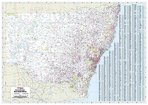
Perth Postcode Map Laminated Wall Map 788 x 1120mm
$109.95
or make 4 interest-free payments of
$27.49 AUD
fortnightly with
![]() More info
More info
A Clear, Durable & Professional Planning Tool for Businesses, Offices & Warehouses
Designed and published by Cartodraft, this detailed postcode map of Perth is an essential reference for anyone managing logistics, sales territories, delivery routes, or regional operations across Western Australia's capital. With crisp boundary delineations and clear numbering, this map provides a clean, precise overview of Perth’s postcode zones, making it a practical addition to any commercial workspace.
Key Features:
-
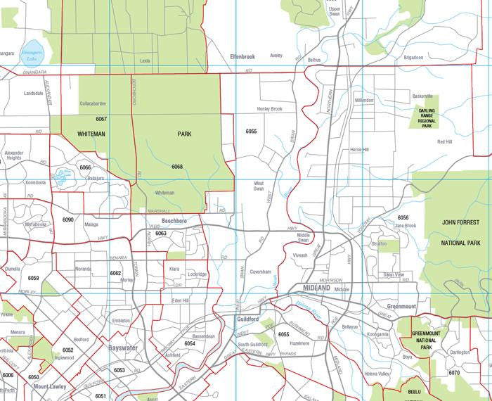
✅ Postcode Boundaries and Numbers Clearly Marked
Each postcode area is distinctly outlined and labelled, allowing for fast and easy reference when planning or locating suburbs. -
✅ Comprehensive Suburb Index
An easy-to-read index lists all suburbs and their corresponding postcodes, helping users quickly cross-reference information without additional lookup tools. -
✅ Laminated with Write-On, Wipe-Off Surface
The map is encapsulated in high-quality gloss laminate, making it durable, stain-resistant, and reusable. Ideal for use with whiteboard markers or Mark-It-Dots, allowing you to mark, track, and update areas of interest again and again. -
✅ Perfect for Office & Commercial Use
Whether you're allocating delivery zones, managing sales territories, or setting up service areas, this map offers a practical and visually clear tool for operational planning.
Specifications:
| Feature | Detail |
|---|---|
| Publisher | Cartodraft |
| Map Type | Laminated Wall Map |
| Finish | Gloss-laminated (write and wipe) |
| Size (Unfolded) | 788 mm (W) x 1120 mm (H) |
| Scale | Varies for readability |
| Index Included | Suburb names with postcode numbers |
| Customisation | Suitable for pins, dots, markers |
| Ideal Use | Business planning, logistics, wall display |
Please Note:
Print-on-Demand Item
This map is custom printed and laminated to order. Please allow up to 10 working days for production and delivery.
Why Choose This Map?
-
Designed by a leading Australian cartographic publisher
-
Suited for professionals working in real estate, logistics, sales, urban planning, and retail
-
Makes complex territory management simple and visual
-
Neatly sized for office walls—large enough to see detail, compact enough for smaller spaces
Whether you’re plotting distribution routes in Osborne Park, managing a service team in Joondalup, or planning sales territories across the southern suburbs—this Perth Postcode Map is your indispensable visual guide to the metropolitan area.