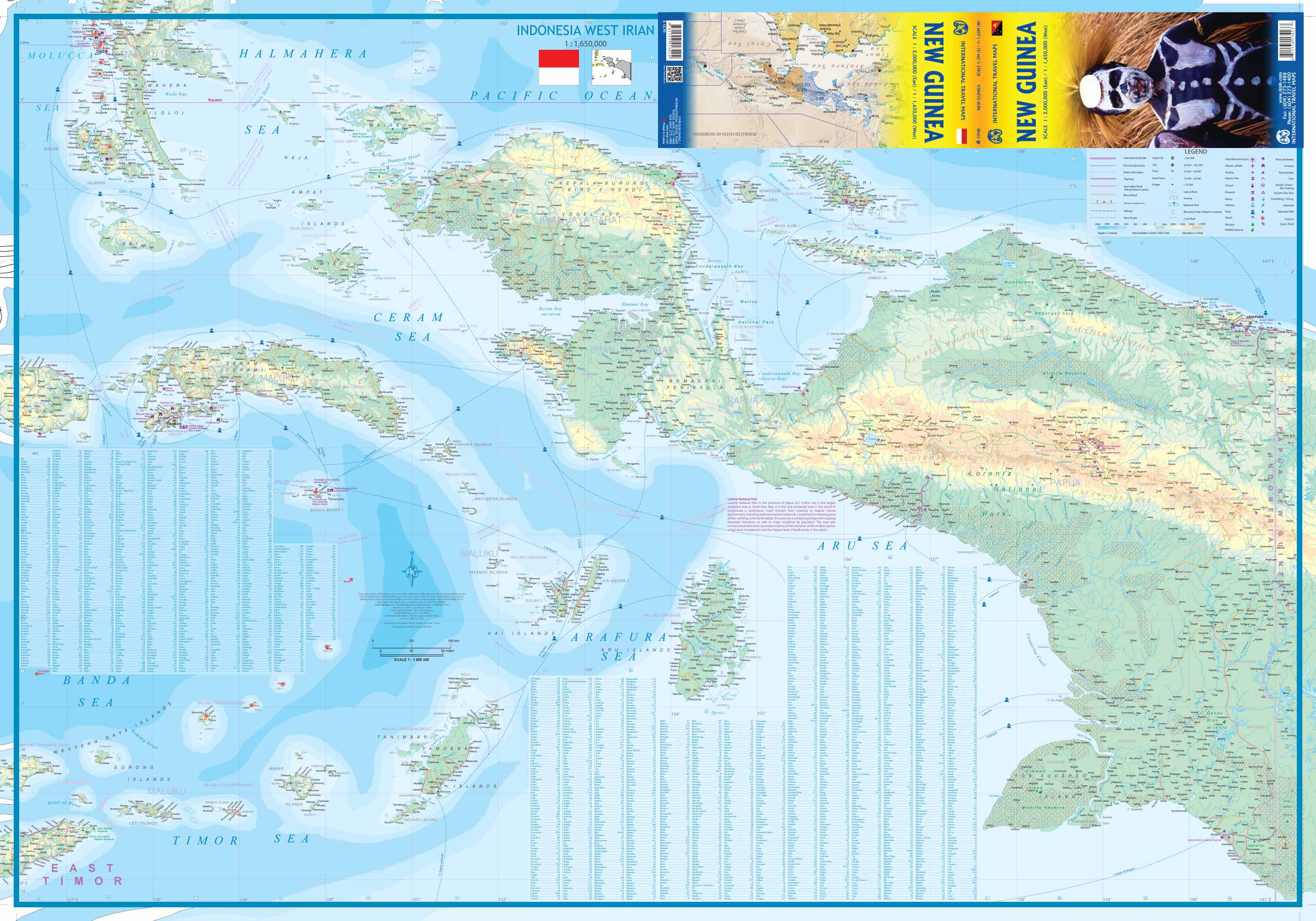
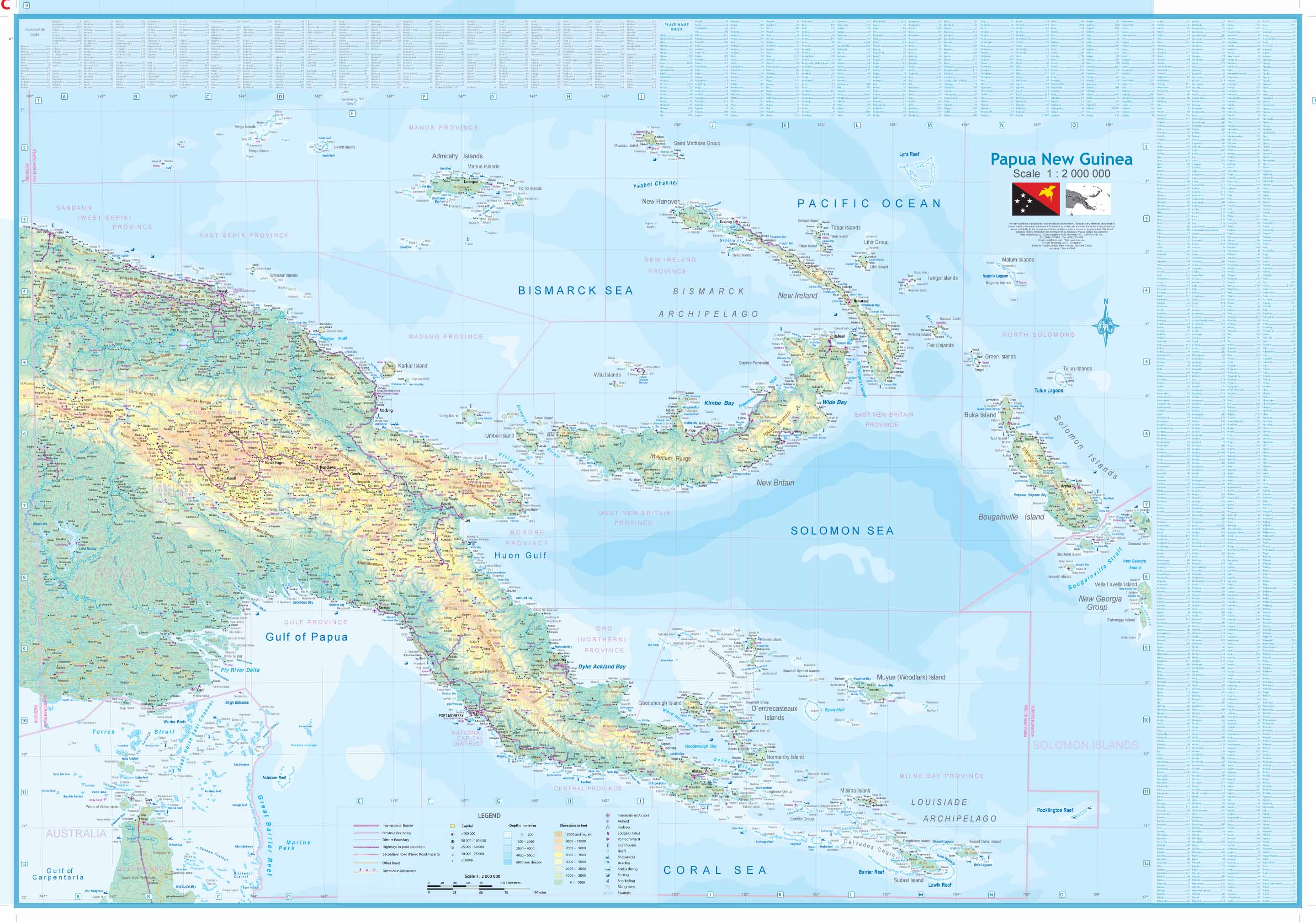
Scale: 1:2,000,000 (East) / 1:1,650,000 (West) | Size: 685 mm x 990 mm
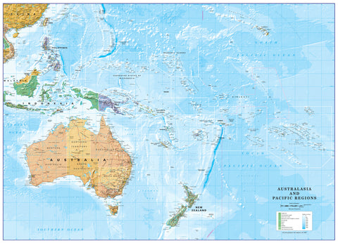
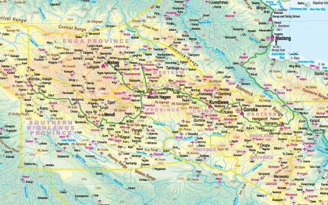
Explore one of the world’s largest and least-charted islands in exquisite detail with this double-sided folded map of New Guinea and the Maluku Islands from ITMB (International Travel Maps). For the first time, both Papua New Guinea and West Irian (Papua Indonesia) are presented together in a comprehensive, island-wide format, offering full geographic coverage of this vast and diverse region.
✅ Key Features
Complete Coverage of New Guinea
-
East Side: Fully updated map of Papua New Guinea, with clear cartographic improvements
-
West Side: First detailed map in years of West Irian (Papua Indonesia)—a valuable addition for researchers, travellers, and adventurers
Expanded Regional Scope
-
Includes neighbouring islands from the Ceram Sea region, such as Ambon, Hatta, and Aru
-
Also features the location of East Timor (Timor-Leste) for contextual understanding
Double-Sided Printing
-
Maximises space without sacrificing clarity
-
Ideal for educational use, planning overland expeditions, or simply understanding one of Earth’s final frontiers
First-Ever Full Island Mapping
-
A unique milestone in cartography: this is the first time New Guinea has been mapped as a whole in a single publication
-
Combines ITMB’s signature attention to detail with rugged travel functionality
Laminated Option Available
Prefer a durable, reusable finish? We offer professional lamination using 80-micron gloss film, perfect for:
-
Drawing on with whiteboard markers
-
Applying map dots to mark journeys, projects, or locations of interest
-
Protection against tears, spills, and wear over time
🔧 Please note: For laminated versions, we carefully flatten the original folded map before encapsulation. Minor fold lines may remain visible.
📏 Specifications
| Feature | Detail |
|---|---|
| Region | New Guinea & Maluku Islands |
| Coverage | Papua New Guinea, West Irian, Ceram Sea islands, East Timor (overview) |
| Format | Double-sided folded map |
| Finish | Paper (standard) / Laminated (optional) |
| Scale | 1:2,000,000 (East) / 1:1,650,000 (West) |
| Map Size | 685 mm (W) x 990 mm (H) |
| Publisher | ITMB (International Travel Maps) |
Perfect For:
✔️ Adventure travellers heading to Papua or Indonesian outposts
✔️ Educators teaching geography or geopolitics of the Asia-Pacific
✔️ Expats, missionaries, or NGOs operating in the region
✔️ Collectors of rare or frontier-region cartography
🛒 Ready to Chart New Territory?
This map is more than just a travel aid—it’s a first-of-its-kind geographic reference, revealing one of the last great wild frontiers in extraordinary detail. Choose your finish and add to cart today.