- Australia ▾
- Topographic
▾
- Australia AUSTopo 250k (2024)
- Australia 50k Geoscience maps
- Australia 100k Geoscience maps
- Australia 250k Geoscience maps
- Australia 1.1m Geoscience maps
- New Zealand 50k maps
- New Zealand 250k maps
- New South Wales 25k maps
- New South Wales 50k maps
- New South Wales 100k maps
- Queensland 10k maps
- Queensland 25k maps
- Queensland 50k maps
- Queensland 100k maps
- Compasses
- Software
- GPS Systems
- Orienteering
- International ▾
- Wall Maps
▾
- World
- Australia & New Zealand
- Countries, Continents & Regions
- Historical
- Vintage National Geographic
- Australian Capital Territory
- New South Wales
- Northern Territory
- Queensland
- South Australia
- Tasmania
- Victoria
- Western Australia
- Celestial
- Children's
- Mining & Resources
- Wine Maps
- Healthcare
- Postcode Maps
- Electoral Maps
- Nautical ▾
- Flags
▾
- Australian Flag Sets & Banners
- Flag Bunting
- Handwavers
- Australian National Flags
- Aboriginal Flags
- Torres Strait Islander Flags
- International Flags
- Flagpoles & Accessories
- Australian Capital Territory Flags
- New South Wales Flags
- Northern Territory Flags
- Queensland Flags
- South Australia Flags
- Tasmania Flags
- Victoria Flags
- Western Australia Flags
- Gifts ▾
- Globes ▾
Dear valued customer. Please note that our checkout is not supported by old browsers. Please use a recent browser to access all checkout capabilities


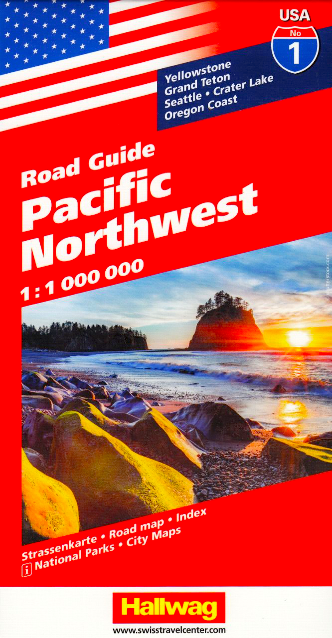

Pacific Northwest USA Hallwag Map
$24.95
Afterpay is only available for orders between $50.00 and $1000.00 More info
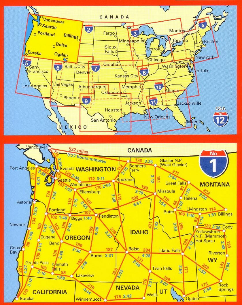
Includes Washington, Oregon, Idaho, Montana & Wyoming
Scale: 1:1,000,000 | Folded Map with Travel Booklet
Whether you're driving the misty coastlines of Oregon, venturing into Yellowstone’s geothermal heart, or navigating through Seattle’s urban jungle, the Pacific Northwest USA Hallwag Map is your essential, all-in-one travel companion. Produced by one of Europe’s most trusted cartographic publishers, this beautifully designed and intuitively organised map is tailored for explorers who crave the freedom of the open road with the reassurance of reliable detail in hand.
🌲 The Region at a Glance
The Pacific Northwest is more than just a collection of states—it's a traveller’s dream, where every highway bend brings a fresh wonder. This map covers the key areas of:
-
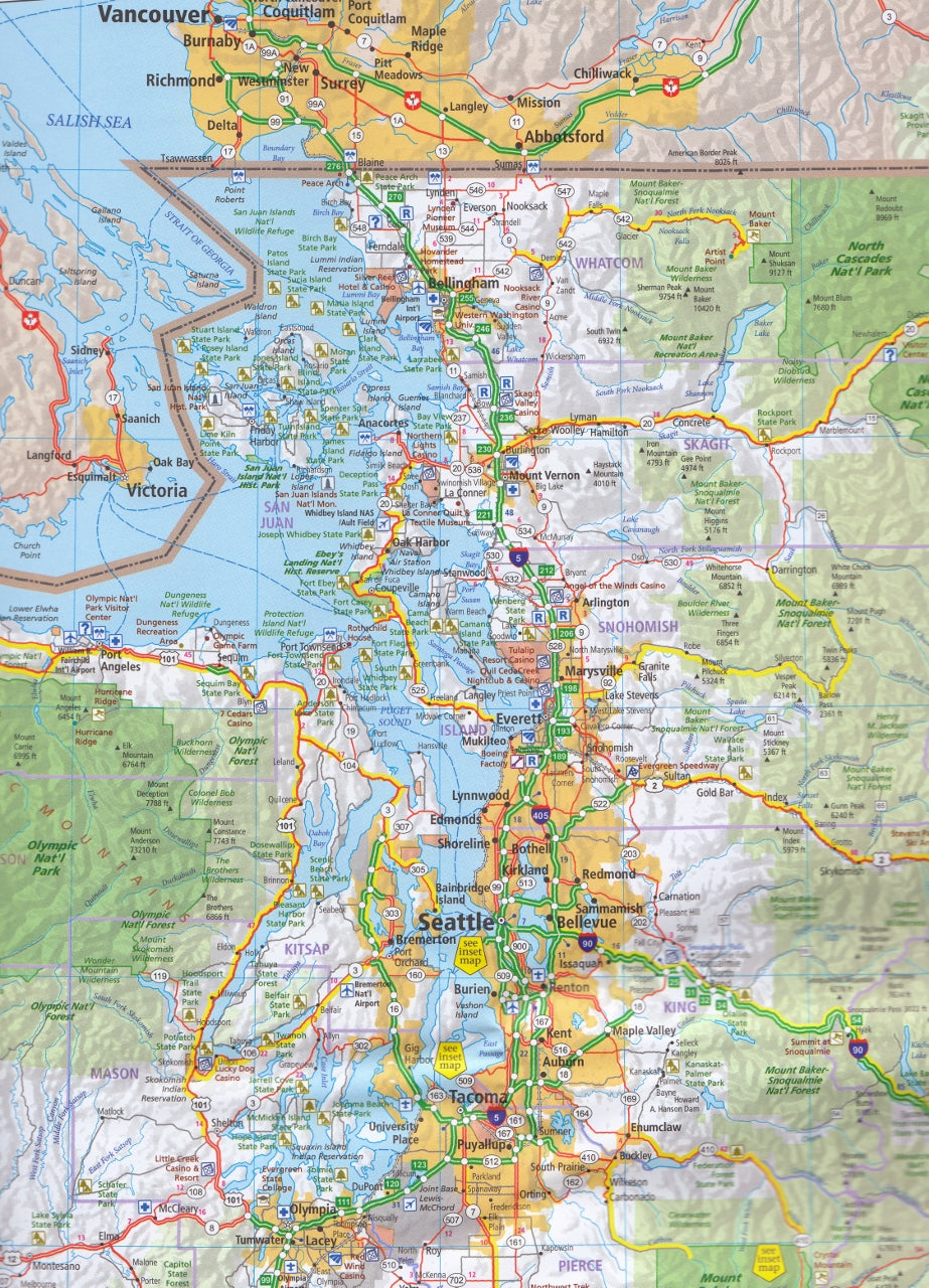
Washington – from the wild Olympic Peninsula to the tech metropolis of Seattle
-
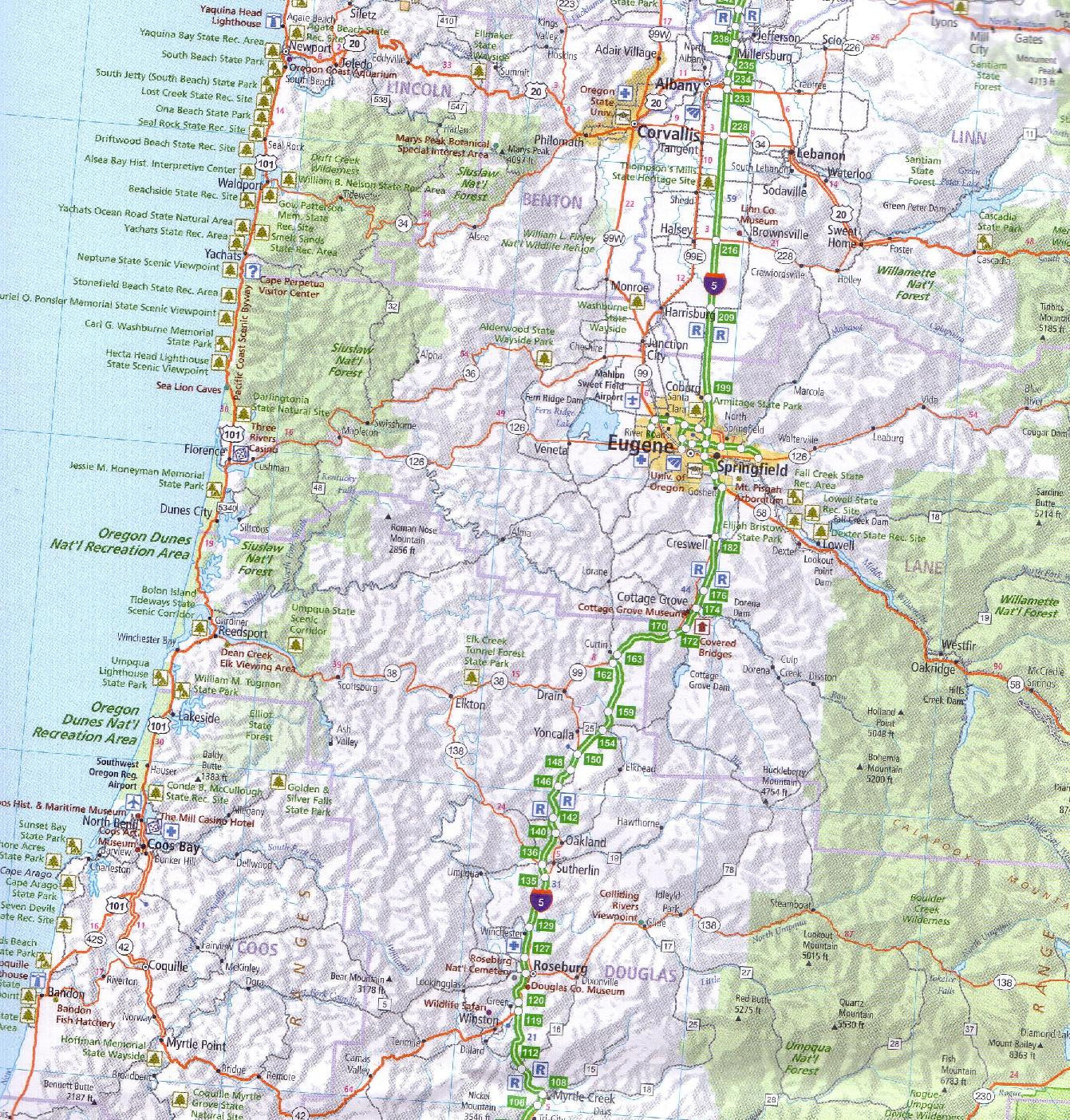
Oregon – home of Crater Lake, dense forests, and rugged Pacific beaches
-
Idaho – dotted with lakes, mountain passes, and unexpected natural beauty
-
Montana – the Big Sky State with wide open spaces and part of Yellowstone National Park
-
Wyoming – home to Grand Teton and the majority of Yellowstone’s legendary wilderness
The Hallwag map ensures nothing is missed, whether you're sticking to interstates or carving your path through back roads and scenic byways.
📘 What’s Inside the Fold-Out Booklet
Alongside the large-format, full-colour map is a lift-out travel booklet that adds a wealth of practical and planning information to your journey:
🏙️ City Street Maps
Navigate urban areas with ease using detailed street-level maps of:
-
Seattle – ferry terminals, downtown, and key cultural sites
-
Portland – bridges, breweries, and public transport access
-
Tacoma – city layout and access routes
🏞️ National Park Guides
Enjoy quick-reference maps and visitor tips for five of the region’s most iconic parks:
-
Mount Rainier National Park – a snow-capped icon just a drive from Seattle
-
Crater Lake National Park – North America’s deepest lake, born of volcanic fire
-
Grand Teton National Park – dramatic peaks and alpine lakes
-
Yellowstone National Park – America’s first national park, teeming with wildlife
-
Redwood National and State Parks – forest cathedrals of ancient trees
🧳 Travel Information
Ideal for international visitors and first-time travellers, the booklet includes:
-
Contacts for State Tourism Boards and Departments of Transportation
-
Information on hotel and motel bookings
-
Roadside help and emergency numbers
-
Major car rental companies with regional availability
-
Airline routes and nearby regional airports
-
Metric conversion tables (miles/kilometres, °C/°F, lbs/kg)
-
Traffic signs explained, including differences across states
-
Local highlights and city facts to guide your time off the road
🛣️ Map Features at a Glance
-
Clear road hierarchies, showing major highways, scenic routes, and secondary roads
-
Fully indexed cities, towns, and landmarks
-
Distances marked in both miles and kilometres
-
National park boundaries, public lands, and recreational areas
-
Topographic shading to indicate elevation changes and mountain ranges
-
Easily folded, durable, and made to withstand the rigours of road travel
📏 Map Specifications
| Feature | Details |
|---|---|
| Scale | 1:1,000,000 (1 cm = 10 km) |
| Size | Large-format folded map + booklet |
| Languages | Multilingual legend (English, German, French) |
| Publisher | Hallwag Kümmerly+Frey |
| Map Type | Folded, single-sided with companion booklet |
🌎 Who This Map Is For
-
🚗 Road Trippers – Ideal for planning long scenic drives through mountains, forests, and deserts
-
🧭 Independent Travellers – Great for those who prefer physical navigation tools over digital reliance
-
🏕️ Campers & RV Users – Perfect for mapping campground access, national park entry points, and off-grid locations
-
✈️ International Visitors – Especially helpful with conversion charts and local signage explanations
-
📚 Map Enthusiasts & Collectors – A classic addition to any map collection, beautifully printed and thoughtfully designed
🛒 Plan with Confidence
From the depths of Crater Lake to the towering redwoods of California’s north, the Hallwag Pacific Northwest Map gives you both the overview and the on-the-ground details to explore the region with confidence. Add it to your travel pack and hit the road—prepared, informed, and inspired.
Order now and unlock the full potential of your Pacific Northwest adventure.