- Australia ▾
- Topographic
▾
- Australia AUSTopo 250k (2025)
- Australia 50k Geoscience maps
- Australia 100k Geoscience maps
- Australia 250k Geoscience maps
- Australia 1:1m Geoscience maps
- New Zealand 50k maps
- New Zealand 250k maps
- New South Wales 25k maps
- New South Wales 50k maps
- New South Wales 100k maps
- Queensland 10k maps
- Queensland 25k maps
- Queensland 50k maps
- Queensland 100k maps
- Compasses
- Software
- GPS Systems
- Orienteering
- International ▾
- Wall Maps
▾
- World
- Australia & New Zealand
- Countries, Continents & Regions
- Historical
- Vintage National Geographic
- Australian Capital Territory
- New South Wales
- Northern Territory
- Queensland
- South Australia
- Tasmania
- Victoria
- Western Australia
- Celestial
- Children's
- Mining & Resources
- Wine Maps
- Healthcare
- Postcode Maps
- Electoral Maps
- Nautical ▾
- Flags
▾
- Australian Flag Sets & Banners
- Flag Bunting
- Handwavers
- Australian National Flags
- Aboriginal Flags
- Torres Strait Islander Flags
- International Flags
- Flagpoles & Accessories
- Australian Capital Territory Flags
- New South Wales Flags
- Northern Territory Flags
- Queensland Flags
- South Australia Flags
- Tasmania Flags
- Victoria Flags
- Western Australia Flags
- Gifts ▾
- Globes ▾
Dear valued customer. Please note that our checkout is not supported by old browsers. Please use a recent browser to access all checkout capabilities


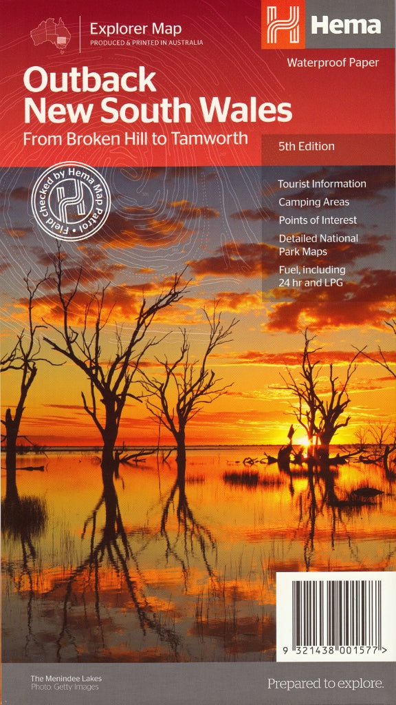
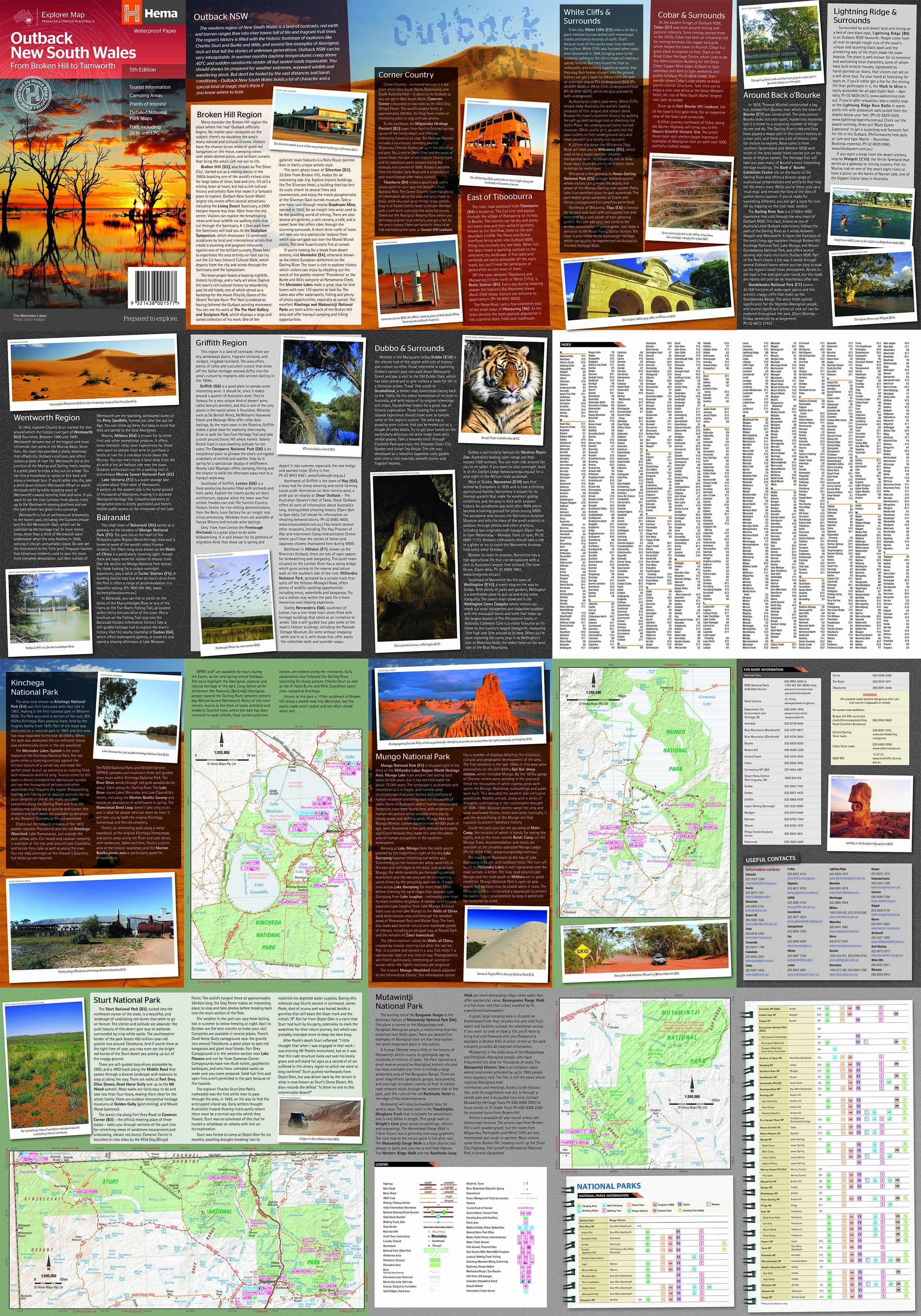
Outback New South Wales Hema Map
$14.95 $15.95
Afterpay is only available for orders between $50.00 and $1000.00 More info
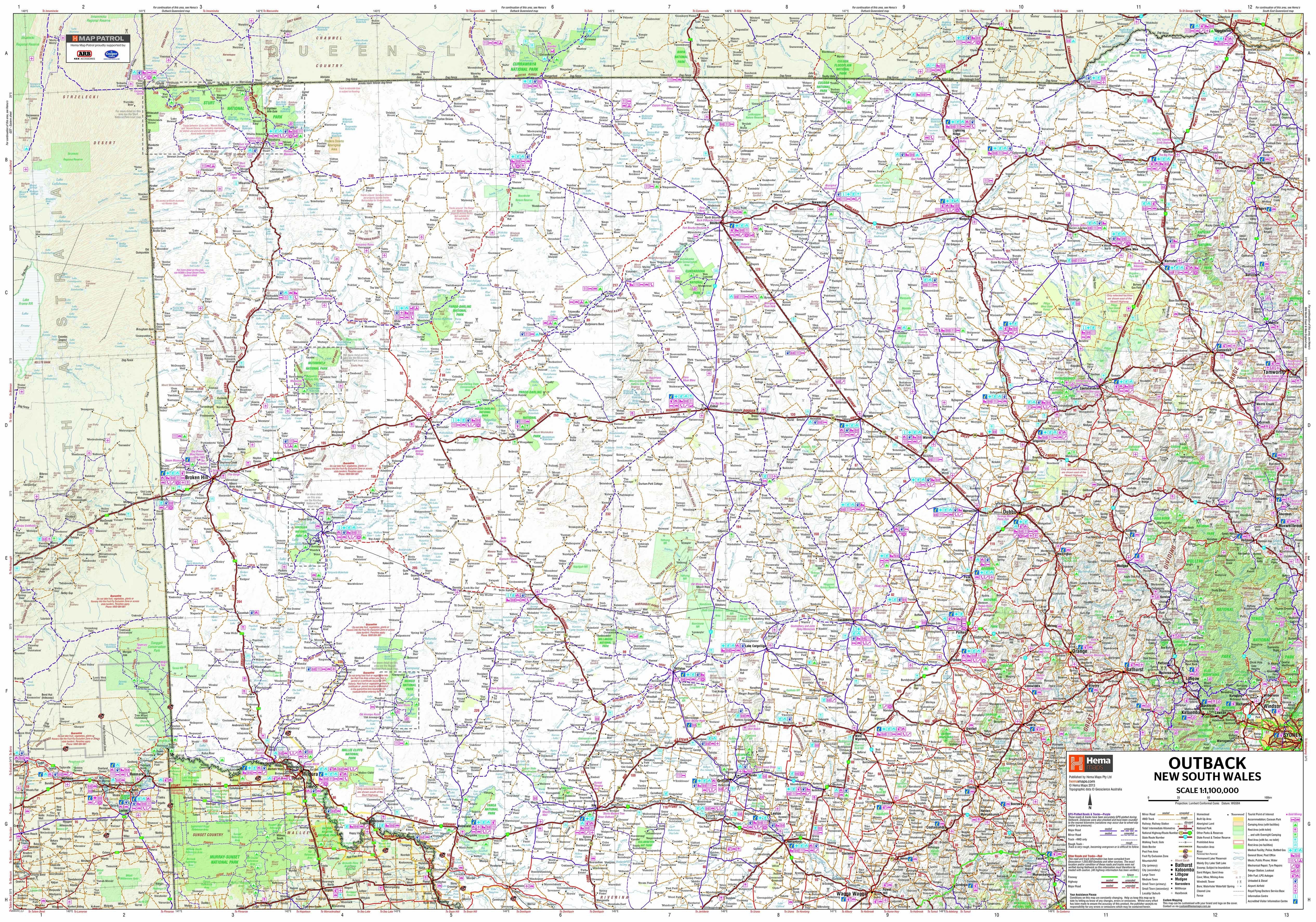
An essential touring map for discovering the raw, remote, and richly historic landscapes of western New South Wales
The Outback New South Wales Map by Hema (5th Edition) is designed for the explorer at heart. Whether you're travelling through arid red plains, remote opal towns, vast sheep stations, or ancient riverbeds, this map will guide you through one of Australia’s most expansive and underexplored regions with clarity and confidence.
Covering a vast sweep from Tamworth in the east to Broken Hill in the west, and from Wagga Wagga in the south to beyond the Queensland border, this map combines topographic accuracy, 4WD track detail, and tourist insight to help you make the most of your journey through Outback NSW.
🗺️ Map Specifications:
-
Scale: 1:1,100,000 (1 cm = 11 km)
-
Flat Size: 1000 mm (H) x 700 mm (W)
-
Folded Size: 250 mm x 140 mm
-
Weight: Approximately 90 grams
-
Edition: 5th
-
Publication Date: 1 December 2012
-
Material: Printed on tear-resistant, waterproof synthetic paper, built for durability in tough outback conditions
🌄 Coverage Area:
This map spans a broad sweep of inland NSW, including:
-
Broken Hill, White Cliffs, and Corner Country
-
Lightning Ridge and Bourke
-
Cobar, Menindee, and Wilcannia
-
Dubbo, Griffith, and Balranald
-
Wentworth and the confluence of the Darling and Murray Rivers
Whether you're heading out on the Darling River Run, touring through Mungo National Park, or venturing to Tibooburra and the Sturt Desert, this map delivers essential information for your route.
🧭 Key Features:
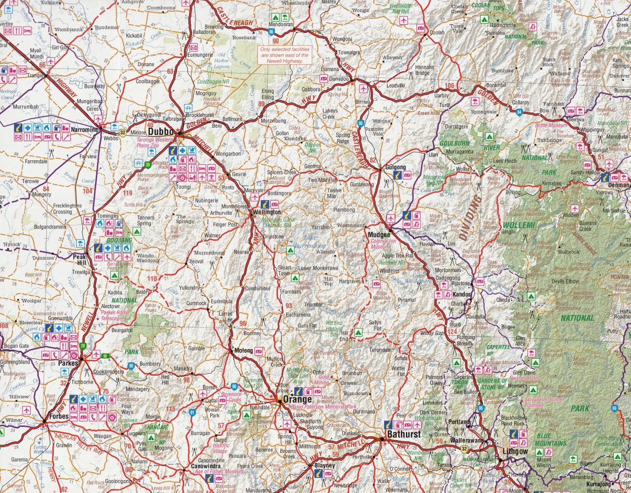
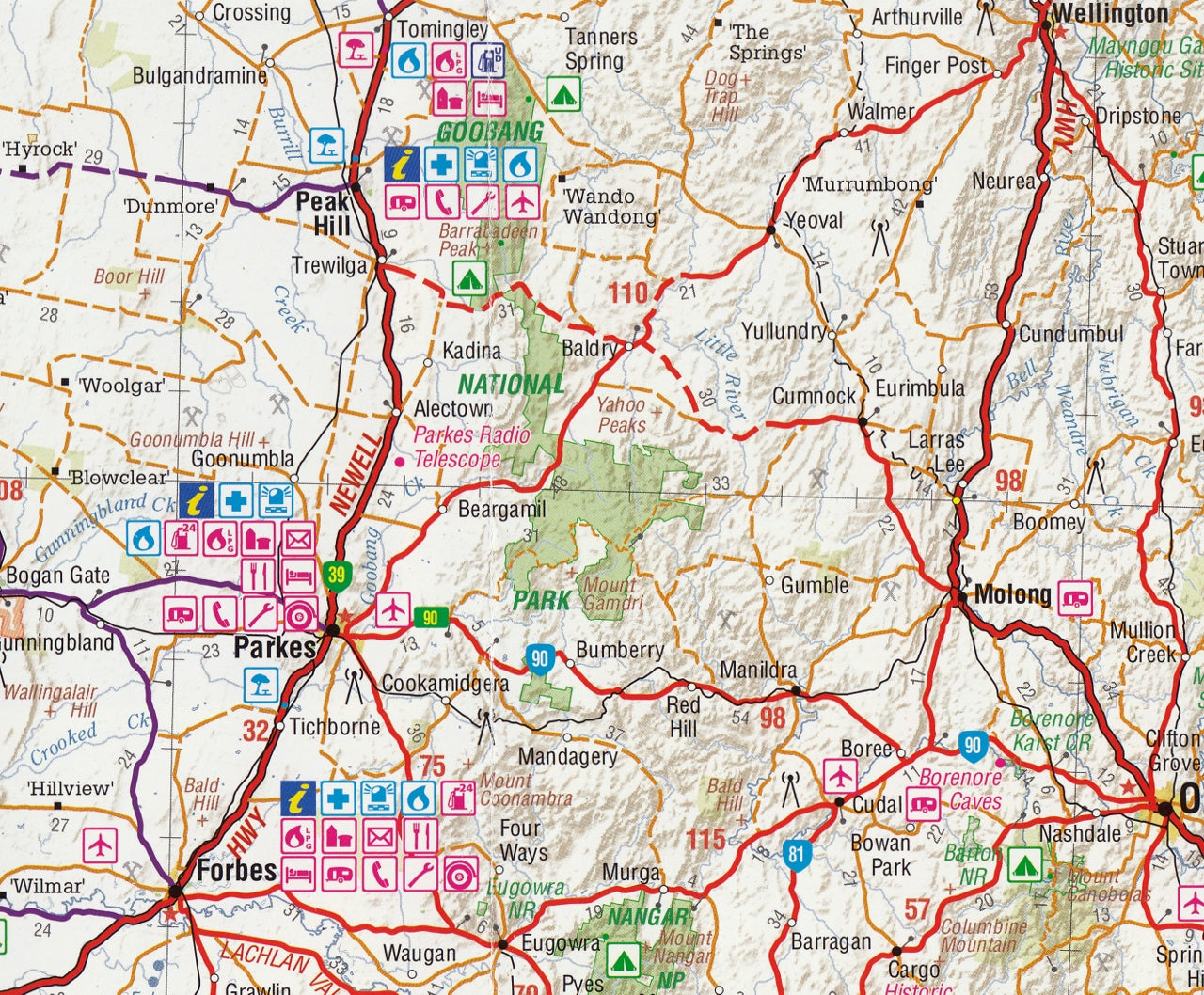
🛣️ Road and Track Coverage:
-
All major roads, minor roads, and outback tracks GPS-surveyed and verified by Hema
-
4WD-only tracks clearly marked, including difficulty level and surface type
-
Distance indicators between key points for route planning
-
Updated details on sealed vs unsealed routes and seasonal access roads
🏞️ National Park Insets:
-
Detailed inset maps of:
-
Kinchega National Park
-
Sturt National Park
-
Mutawintji National Park
-
Mungo National Park
-
-
Walking tracks, camping areas, historic ruins, rivers, and visitor facilities
🛠️ Touring & Travel Essentials:
-
Camping sites and bush camps noted throughout the region
-
Fuel stops and 24-hour service stations, including LPG availability
-
Symbols for picnic areas, toilets, info centres, accommodation, and roadhouses
-
Points of interest including historic towns, heritage sites, and scenic lookouts
🗺️ Cultural and Historical Highlights:
-
Annotated regions such as:
-
Broken Hill – mining heritage and outback art
-
White Cliffs – underground opal mining
-
Lightning Ridge – black opal country
-
Back O’ Bourke – historic gateway to the outback
-
Corner Country – where NSW meets SA and QLD
-
-
Overview of Indigenous heritage and European settlement history
🧭 Who Is This Map For?:
-
4WD adventurers exploring the red centre of NSW
-
Grey nomads touring the Darling River and beyond
-
Campers and nature lovers visiting remote parks and reserves
-
Historians and cultural travellers exploring ancient trade routes and pioneering trails
-
Educational institutions and tour guides teaching or interpreting outback Australia
-
Logistics operators and remote workers navigating pastoral and mining areas
✅ Why Choose Hema’s Outback NSW Map?
-
Australia’s most trusted 4WD mapping brand
-
Created by Hema’s field teams, not just digital estimations
-
Built to last — waterproof, tearproof, and foldable
-
Combines navigation, local knowledge, and trip planning in one map
From the saltbush plains of Cobar to the ghost towns of Silverton, the Hema Outback New South Wales Map is your key to unlocking the red-dirt roads, star-filled skies, and rich stories of Australia’s western wilderness.
Drive west. Discover deeper. Travel with Hema.
This map is also available as a laminated map encapsulated in high-quality plastic.
Frequently Asked Questions
What does the Outback New South Wales Hema Map cover?
The Outback New South Wales Hema Map covers 4WD tracks, camping areas, and travel routes for the region described in the product title. Most 4WD and camping guides in Mapworld's range include GPS coordinates, distance information, difficulty ratings, and notes on fuel stops and emergency contact points.
Is the Outback New South Wales Hema Map up to date?
Yes, this is the current edition. Mapworld stocks current editions from publishers including Hema Maps, Westprint, and others.
Is this product suitable for remote area travel?
Yes, 4WD maps and guides are designed for remote area navigation and trip planning. They include track conditions, fuel availability, camping spots, and safety information.
Does Mapworld ship the Outback New South Wales Hema Map across Australia?
Yes, Mapworld ships Australia-wide. Standard shipping is a flat $7 rate, with free standard shipping on orders over $75. Express options are available at checkout. Most orders placed before 2pm AEST on weekdays are dispatched same day.
Related Items


© 2026 Mapworld. Website designed by Genie Media
X