- Australia ▾
- Topographic
▾
- Australia AUSTopo 250k (2024)
- Australia 50k Geoscience maps
- Australia 100k Geoscience maps
- Australia 250k Geoscience maps
- Australia 1.1m Geoscience maps
- New Zealand 50k maps
- New Zealand 250k maps
- New South Wales 25k maps
- New South Wales 50k maps
- New South Wales 100k maps
- Queensland 10k maps
- Queensland 25k maps
- Queensland 50k maps
- Queensland 100k maps
- Compasses
- Software
- GPS Systems
- Orienteering
- International ▾
- Wall Maps
▾
- World
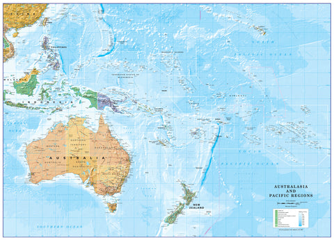
- Australia & New Zealand
- Countries, Continents & Regions
- Historical
- Vintage National Geographic
- Australian Capital Territory
- New South Wales
- Northern Territory
- Queensland
- South Australia
- Tasmania
- Victoria
- Western Australia
- Celestial
- Children's
- Mining & Resources
- Wine Maps
- Healthcare
- Postcode Maps
- Electoral Maps
- Nautical ▾
- Flags
▾
- Australian Flag Sets & Banners
- Flag Bunting
- Handwavers
- Australian National Flags
- Aboriginal Flags
- Torres Strait Islander Flags
- International Flags
- Flagpoles & Accessories
- Australian Capital Territory Flags
- New South Wales Flags
- Northern Territory Flags
- Queensland Flags
- South Australia Flags
- Tasmania Flags
- Victoria Flags
- Western Australia Flags
- Gifts ▾
- Globes ▾
Dear valued customer. Please note that our checkout is not supported by old browsers. Please use a recent browser to access all checkout capabilities
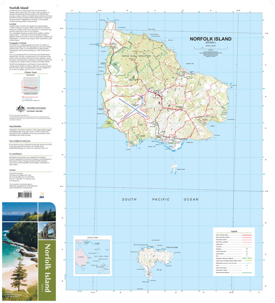
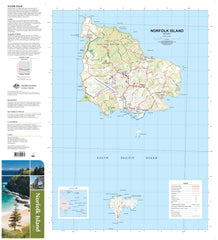
Norfolk Island Geoscience Map
$19.95
Afterpay is only available for orders between $50.00 and $1000.00 More info
Scale 1:25,000 • Geological & Topographic Detail • Multiple Premium Format Options
🌊 Discover One of Australia’s Most Remote and Fascinating Territories
Located 1,676 km northeast of Sydney at 167°57'E, 29°02'S, Norfolk Island is a captivating blend of rugged volcanic terrain, rare wildlife, and unique cultural heritage. This official Geoscience Australia map covers Norfolk, Phillip, and Nepean Islands in exceptional detail, offering a precise 1:25,000 scale depiction for explorers, researchers, and collectors alike.
Covering just over 37 km², Norfolk Island is formed from horizontal sheets of basalt, remnants of an ancient shield volcano. The highest point, Mount Bates, reaches 319 metres above sea level. Surrounding the islands is a continental shelf stretching 95 km north–south and 35 km east–west, teeming with marine biodiversity.
🌿 A Glimpse into Norfolk’s Natural Story
-
1788 – Captain James Cook lands; within 26 years, 40% of native forest cleared.
-
Today, only 5% of the original forest remains untouched, with regeneration underway.
-
Norfolk pines tower over 60 m high, sometimes with trunks over 11 m in girth.
-
Phillip Island suffered ecological collapse after rabbit introduction; since the last rabbit’s removal in 1986, rapid native regrowth has transformed the island.
🗺 Map Features
-
Full topographic detail – contours, spot heights, vegetation zones, reefs, and coastal features.
-
Geological accuracy – detailed basalt formations and volcanic history.
-
Complete island coverage – Norfolk, Phillip, and Nepean Islands in full resolution.
-
Marine shelf representation – invaluable for ecological and marine studies.
🛡 Premium Format Options
1️⃣ Standard Paper Edition
-
Printed on 120 gsm matte-coated paper for a smooth, non-reflective finish.
-
Produced with fade-resistant Hewlett-Packard pigment-based inks for long-lasting colour accuracy.
-
Ideal for framing under glass in a home, office, or classroom setting.
2️⃣ Tyvek® Waterproof/Tearproof Edition
-
Made from pure polyethylene fibres – as tough as plastic yet foldable like paper.
-
Resistant to moisture, mud, and tearing.
-
Perfect for outdoor fieldwork and expeditions.
3️⃣ Laminated Edition
-
Fully encapsulated in 80-micron gloss laminate for maximum durability.
-
Write-on/wipe-off surface for plotting with whiteboard markers.
-
Protects against water, dirt, and damage.
-
Works perfectly with our Map Dots for temporary location marking.
📐 Specifications
| Feature | Detail |
|---|---|
| Publisher | Geoscience Australia |
| Coverage | Norfolk, Phillip & Nepean Islands |
| Scale | 1:25,000 |
| Flat Size | 700 mm (W) x 1000 mm (H) |
| Material | 120 gsm matte-coated paper, Tyvek®, or laminated |
| Inks | Hewlett-Packard pigment-based (fade-resistant) |
| Projection | Topographic with geological overlay |
| Made in | Australia |
🎯 Who This Map is For
-
Researchers & Conservationists – monitor forest regeneration and marine ecosystems.
-
Hikers & Outdoor Enthusiasts – plan treks and explore the coastline.
-
Educators – teach geography, geology, and environmental science.
-
Navigators & Sailors – understand the marine shelf and surrounding waters.
-
Collectors – own a detailed, government-issued map of a unique Australian territory.
✨ Why This Map is Special
This isn’t just a map—it’s a scientifically accurate portrait of Norfolk Island’s geography and geology. Whether you choose the premium paper edition for display, the rugged Tyvek® for fieldwork, or the laminated version for interactive use, you’re getting a tool built to last and made in Australia to the highest cartographic standards.


