- Australia ▾
- Topographic
▾
- Australia AUSTopo 250k (2024)
- Australia 50k Geoscience maps
- Australia 100k Geoscience maps
- Australia 250k Geoscience maps
- Australia 1.1m Geoscience maps
- New Zealand 50k maps
- New Zealand 250k maps
- New South Wales 25k maps
- New South Wales 50k maps
- New South Wales 100k maps
- Queensland 10k maps
- Queensland 25k maps
- Queensland 50k maps
- Queensland 100k maps
- Compasses
- Software
- GPS Systems
- Orienteering
- International ▾
- Wall Maps
▾
- World
- Australia & New Zealand
- Countries, Continents & Regions
- Historical
- Vintage National Geographic
- Australian Capital Territory
- New South Wales
- Northern Territory
- Queensland
- South Australia
- Tasmania
- Victoria
- Western Australia
- Celestial
- Children's
- Mining & Resources
- Wine Maps
- Healthcare
- Postcode Maps
- Electoral Maps
- Nautical ▾
- Flags
▾
- Australian Flag Sets & Banners
- Flag Bunting
- Handwavers
- Australian National Flags
- Aboriginal Flags
- Torres Strait Islander Flags
- International Flags
- Flagpoles & Accessories
- Australian Capital Territory Flags
- New South Wales Flags
- Northern Territory Flags
- Queensland Flags
- South Australia Flags
- Tasmania Flags
- Victoria Flags
- Western Australia Flags
- Gifts ▾
- Globes ▾
Dear valued customer. Please note that our checkout is not supported by old browsers. Please use a recent browser to access all checkout capabilities


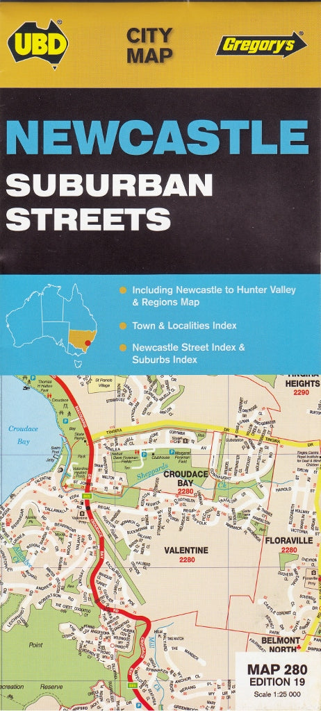
Newcastle UBD Map 280
$13.95
Afterpay is only available for orders between $50.00 and $1000.00 More info
Explore the dynamic heart of the Hunter with this essential planning and reference tool.
Newcastle is more than just a city—it’s a thriving fusion of heritage charm and modern energy, positioned at the mouth of the Hunter River and surrounded by iconic beaches, rich industrial history, and a flourishing cultural scene. As the second-largest metropolitan area in New South Wales, it stands proudly as a centre of commerce, education, and lifestyle.
Whether you're a local, a business operator, a visitor, or simply someone who appreciates good cartography, this map is a must-have for your wall.
🌟 What This Map Covers
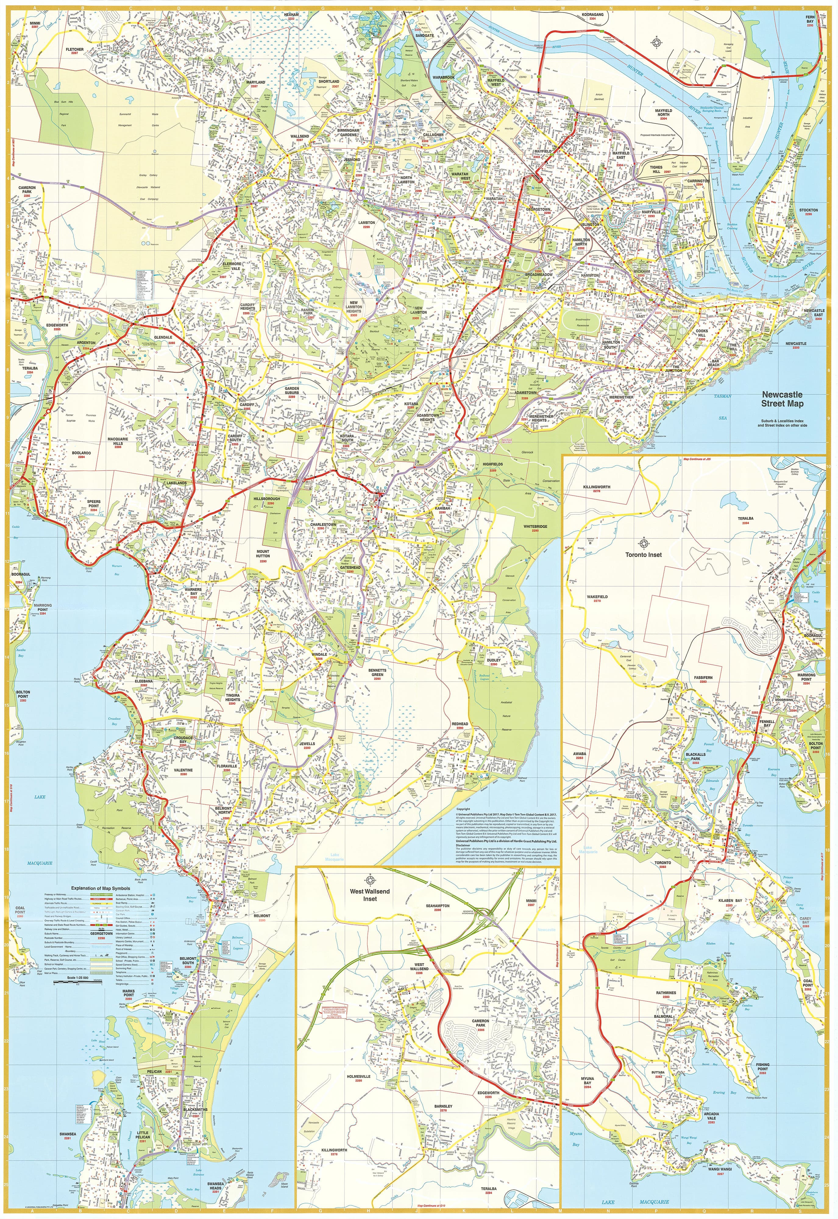
This comprehensive double-sided map offers a detailed, user-friendly view of the greater Newcastle area, including:
-
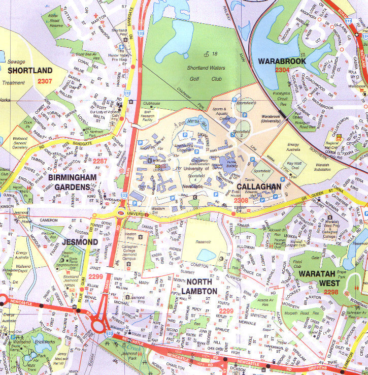
Full street-level detail of the city and key surrounding suburbs
-
Expanded coverage into the Lake Macquarie region including:
-
West Wallsend
-
Toronto
-
Rathmines
-
And adjacent urban areas
-
-
Suburb listing with postcode references, allowing for fast look-up and accurate address identification
-
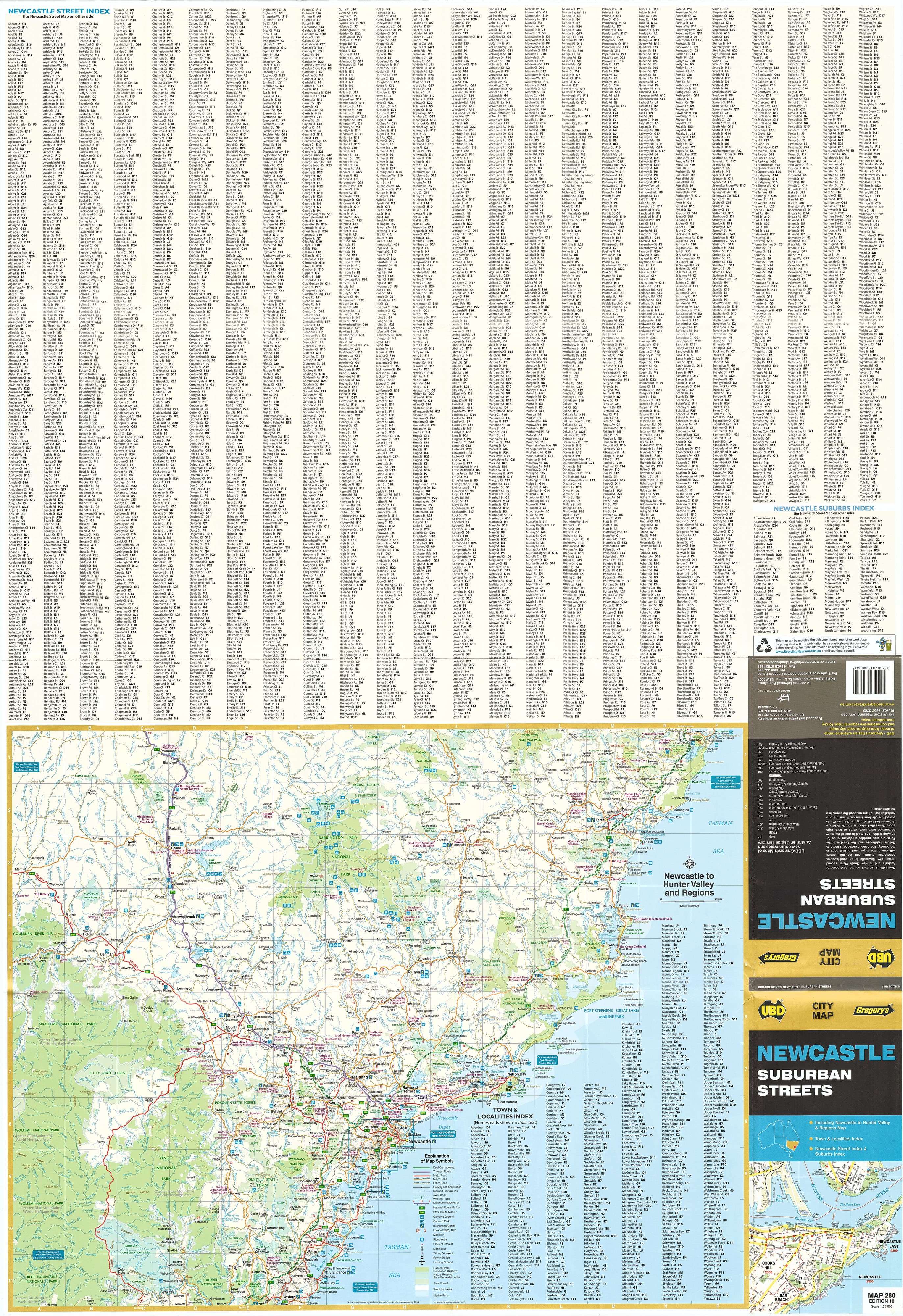
Complete street index for ease of navigation and location referencing
-
Inset town index covering the broader Hunter Valley region, providing an extended planning view
🛠️ High-Quality Lamination – Built to Last
Option to come laminated in premium 80-micron gloss laminate using a process called true encapsulation, which seals the map between two sheets of film, not just coated on one side. This means:
-
You can write on it with a whiteboard marker and wipe it clean
-
It’s suitable for Map Dot markers, great for highlighting areas of interest, project zones, or delivery regions
-
It's resistant to tearing, stains, and moisture, making it perfect for high-traffic environments
Note: This laminated version is made from a previously folded paper map. While we carefully flatten it before lamination, subtle fold lines may still be visible—a small trade-off for a more affordable price option.
📏 Technical Details
-
Scale: 1:25,000 – highly detailed for urban and suburban navigation
-
Dimensions: 700 mm (width) × 1000 mm (height)
-
Finish: Laminated (encapsulated gloss)
-
Publication: Latest edition for the most current layout and data
✅ Perfect For:
-
Real estate professionals mapping out sales zones or development sites
-
Urban planners and engineers needing a reliable visual reference
-
Emergency services and logistics teams coordinating movement and response
-
Tourism operators planning day tours or local experiences
-
Residents or visitors who want a large-format, easy-to-read layout of the city
🧭 A Smart Investment in Navigation
From the boutique cafés of Darby Street to the leafy trails of the Fernleigh Track, Newcastle is a city of discovery—and this map puts it all in your hands. Practical, attractive, and informative, it’s a valuable resource for work or leisure.
Add it to your wall, your planning room, or your business today—and bring the Hunter region into sharp focus.


