- Australia ▾
- Topographic
▾
- Australia AUSTopo 250k (2024)
- Australia 50k Geoscience maps
- Australia 100k Geoscience maps
- Australia 250k Geoscience maps
- Australia 1.1m Geoscience maps
- New Zealand 50k maps
- New Zealand 250k maps
- New South Wales 25k maps
- New South Wales 50k maps
- New South Wales 100k maps
- Queensland 10k maps
- Queensland 25k maps
- Queensland 50k maps
- Queensland 100k maps
- Compasses
- Software
- GPS Systems
- Orienteering
- International ▾
- Wall Maps
▾
- World
- Australia & New Zealand
- Countries, Continents & Regions
- Historical
- Vintage National Geographic
- Australian Capital Territory
- New South Wales
- Northern Territory
- Queensland
- South Australia
- Tasmania
- Victoria
- Western Australia
- Celestial
- Children's
- Mining & Resources
- Wine Maps
- Healthcare
- Postcode Maps
- Electoral Maps
- Nautical ▾
- Flags
▾
- Australian Flag Sets & Banners
- Flag Bunting
- Handwavers
- Australian National Flags
- Aboriginal Flags
- Torres Strait Islander Flags
- International Flags
- Flagpoles & Accessories
- Australian Capital Territory Flags
- New South Wales Flags
- Northern Territory Flags
- Queensland Flags
- South Australia Flags
- Tasmania Flags
- Victoria Flags
- Western Australia Flags
- Gifts ▾
- Globes ▾
Dear valued customer. Please note that our checkout is not supported by old browsers. Please use a recent browser to access all checkout capabilities


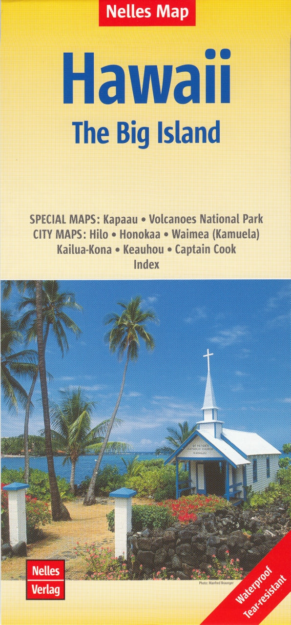
Hawaii – The Big Island by Nelles Verlag
Sold Out
Afterpay is only available for orders between $50.00 and $1000.00 More info
Detailed Folded Map • Volcanoes National Park • Coastal Towns • Waterproof & Easy to Use
Explore the awe-inspiring landscapes, lush valleys, lava fields, and coastal towns of Hawai‘i Island — commonly known as The Big Island — with this beautifully detailed Nelles Map, designed for both casual travelers and serious adventurers.
Covering the largest and youngest of the Hawaiian Islands, this map provides clear road networks, key attractions, and local town maps, making it an ideal companion for planning your journey or navigating on the go.
🌋 Features & Coverage
-
Main Map Scale: 1:330,000 – striking the perfect balance between detail and usability
-
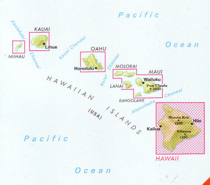
Island Coverage: Entire Big Island, including:
-
Kona Coast & Kailua-Kona
-
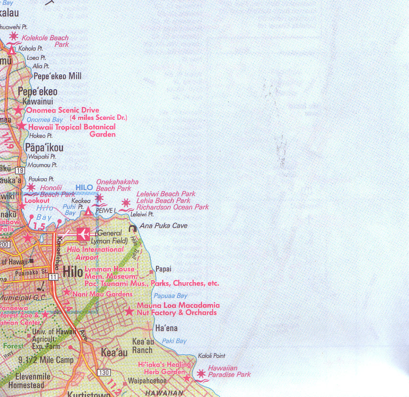
Hilo & Hamakua Coast
-
South Point (Ka Lae) & Puna Region
-
Mauna Kea & Mauna Loa
-
Volcanoes National Park
-
🏙️ Included City & Town Maps
Detailed insets help you explore popular towns and key regions with confidence:
| City / Area | Notable For |
|---|---|
| Hilo | Lively east coast town with waterfalls and markets |
| Honoka‘a | Historic plantation town on the Hamakua Coast |
| Waimea (Kamuela) | Ranching hub with green pastures and cool air |
| Kailua-Kona | Coffee farms, snorkeling beaches, and shopping |
| Keauhou | Historic district and resort area south of Kona |
| Captain Cook | Gateway to the Kona Coffee Belt and Kealakekua Bay |
Also includes inset maps of:
-
Kapa‘au – near the birthplace of King Kamehameha
-
Hawai‘i Volcanoes National Park – showcasing trails, craters, and volcanic features
📌 Travel-Friendly Design
| Feature | Details |
|---|---|
| Map Type | Folded map |
| Primary Scale | 1:330,000 |
| Inset Map Scales | Varies by region (city-level detail) |
| Printed On | Durable, lightweight travel paper |
| Size (unfolded) | Ideal for use in vehicles or on foot |
✅ Why Choose This Map?
-
🌴 Navigate easily from lush rainforests to lava deserts
-
📍 Discover small towns, hidden beaches, and scenic drives
-
🌋 Perfect for visitors to Volcanoes National Park
-
🧳 Compact and convenient for backpacks or glove compartments
-
🗺️ More detailed than standard tourist maps, yet simple to read
🌺 Ideal For:
-
🚗 Self-drive tourists exploring the island independently
-
🥾 Hikers and volcano enthusiasts heading to Mauna Kea or Kīlauea
-
🌅 Adventure seekers hunting for beaches, waterfalls, or secret valleys
-
🧭 Travel planners and geography lovers
From Hilo’s lush coast to Kona’s sunny beaches, and from historic Captain Cook to the raw power of Volcanoes National Park, the Hawaii Big Island Nelles Map is your reliable guide to every corner of this incredible island.


