- Australia ▾
- Topographic
▾
- Australia AUSTopo 250k (2024)
- Australia 50k Geoscience maps
- Australia 100k Geoscience maps
- Australia 250k Geoscience maps
- Australia 1.1m Geoscience maps
- New Zealand 50k maps
- New Zealand 250k maps
- New South Wales 25k maps
- New South Wales 50k maps
- New South Wales 100k maps
- Queensland 10k maps
- Queensland 25k maps
- Queensland 50k maps
- Queensland 100k maps
- Compasses
- Software
- GPS Systems
- Orienteering
- International ▾
- Wall Maps
▾
- World
- Australia & New Zealand
- Countries, Continents & Regions
- Historical
- Vintage National Geographic
- Australian Capital Territory
- New South Wales
- Northern Territory
- Queensland
- South Australia
- Tasmania
- Victoria
- Western Australia
- Celestial
- Children's
- Mining & Resources
- Wine Maps
- Healthcare
- Postcode Maps
- Electoral Maps
- Nautical ▾
- Flags
▾
- Australian Flag Sets & Banners
- Flag Bunting
- Handwavers
- Australian National Flags
- Aboriginal Flags
- Torres Strait Islander Flags
- International Flags
- Flagpoles & Accessories
- Australian Capital Territory Flags
- New South Wales Flags
- Northern Territory Flags
- Queensland Flags
- South Australia Flags
- Tasmania Flags
- Victoria Flags
- Western Australia Flags
- Gifts ▾
- Globes ▾
Dear valued customer. Please note that our checkout is not supported by old browsers. Please use a recent browser to access all checkout capabilities


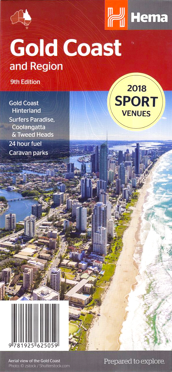
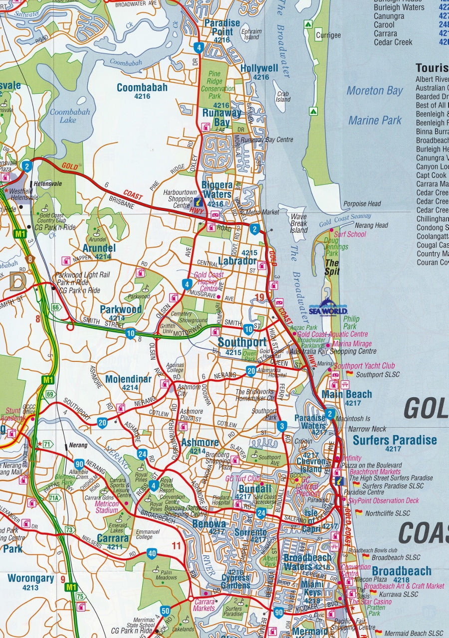
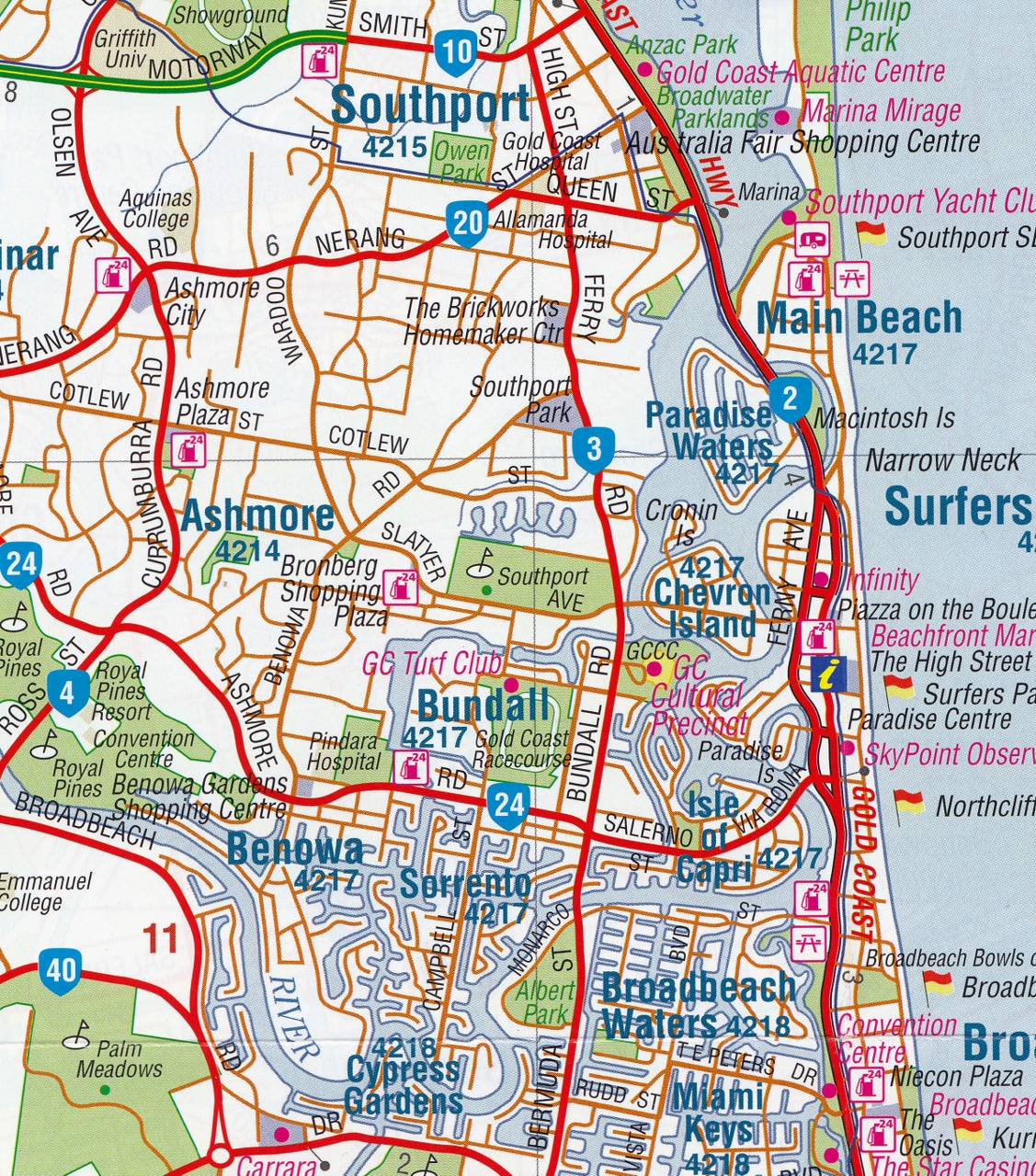
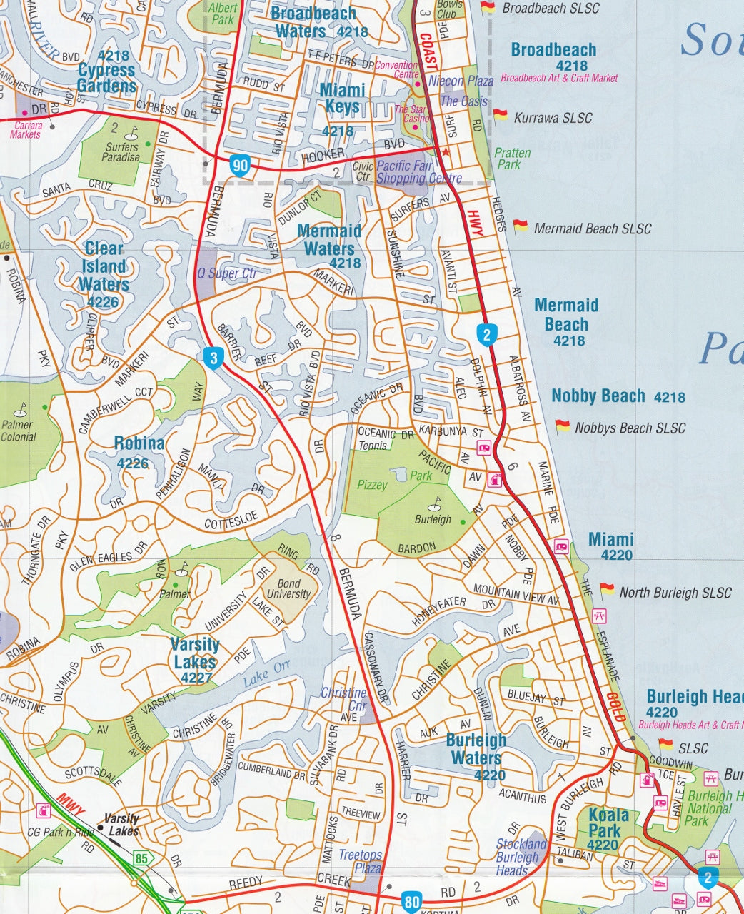
Gold Coast and Region - Hema Maps
$11.95
Afterpay is only available for orders between $50.00 and $1000.00 More info
Your essential guide to one of Australia’s most iconic coastal destinations – beautifully detailed, easy to navigate, and ideal for both locals and visitors.
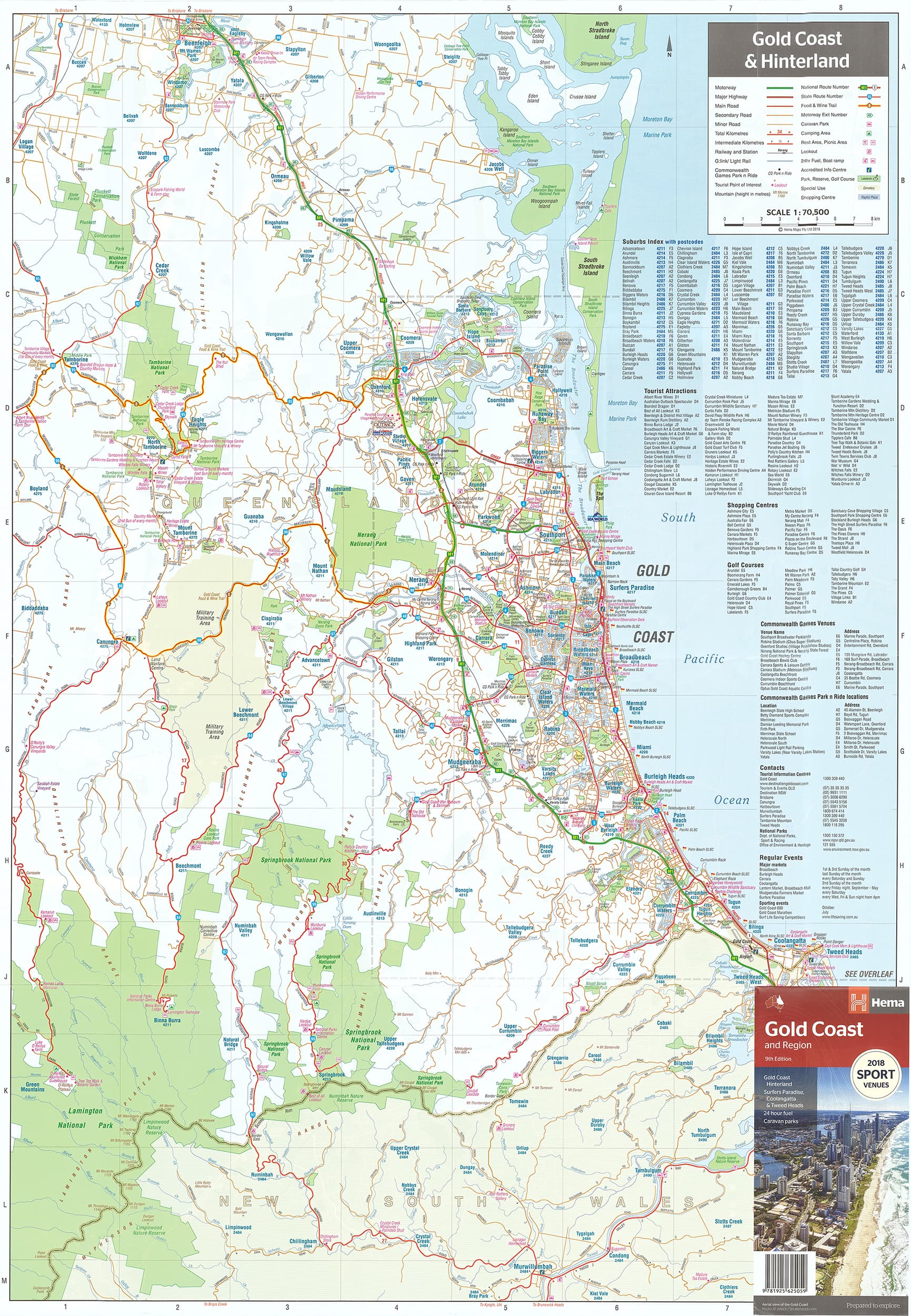
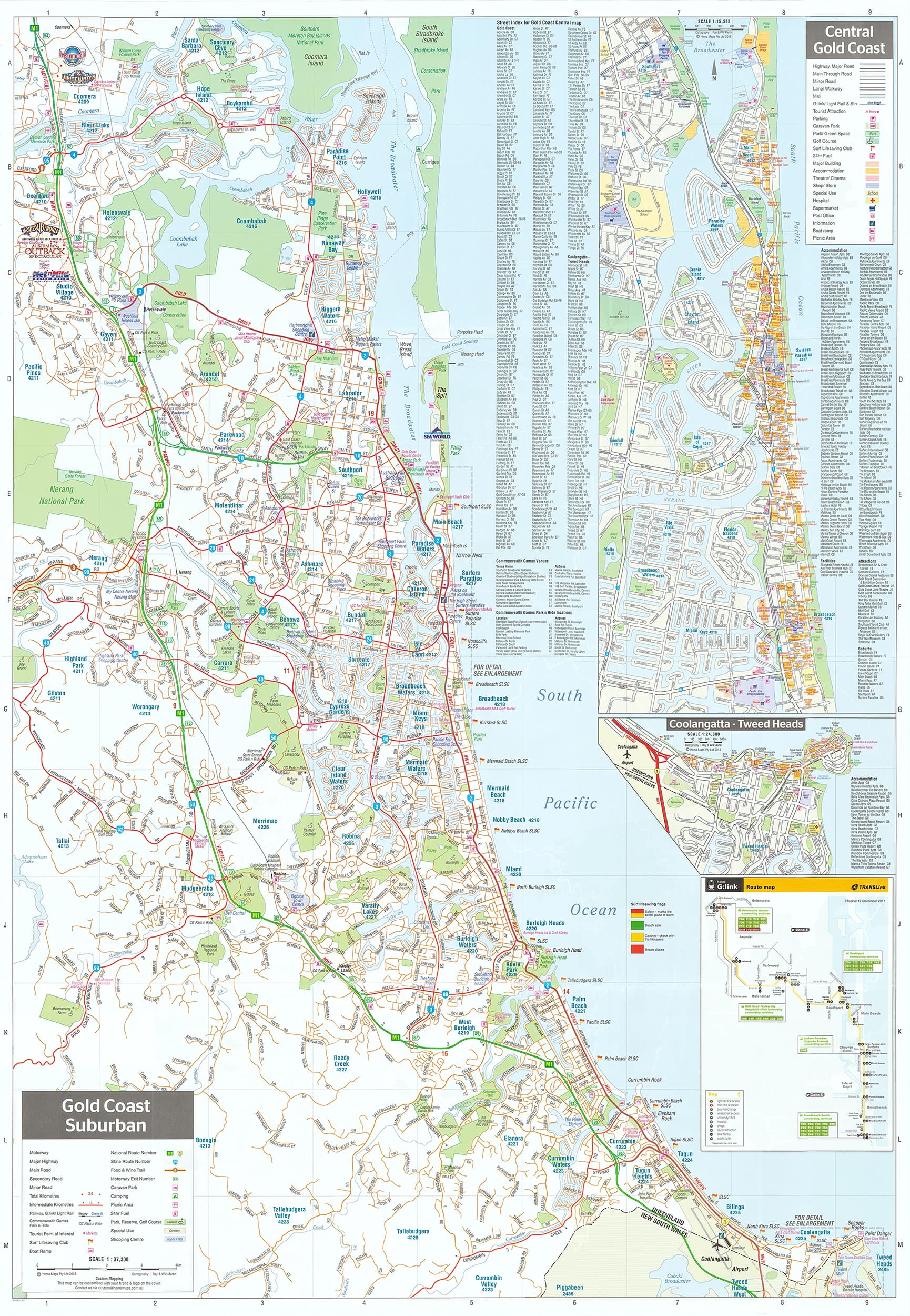
The Gold Coast & Region Map by Hema Maps is a meticulously designed, double-sided map offering comprehensive coverage of the Gold Coast metropolitan area, its sprawling suburbs, and the lush Gold Coast Hinterland. Whether you're navigating the vibrant beach precincts of Surfers Paradise, exploring the rainforest trails of Springbrook, or planning a trip between theme parks, this map brings the entire region to your fingertips with Hema’s trusted accuracy and cartographic clarity.
🗺️ Area Coverage
Covering the region from Coomera in the north to Tweed Heads in the south, and west to Nerang and the hinterland, this map provides an unmatched view of the urban, coastal, and rural landscapes that make up Queensland’s most popular tourist corridor.
Included areas:
-
Main Gold Coast Strip: Surfers Paradise, Broadbeach, Southport, Mermaid Beach, Burleigh Heads
-
Northern Suburbs: Helensvale, Oxenford, Coomera
-
Southern Areas: Coolangatta, Currumbin, Tugun, Tweed Heads
-
Western Expansion: Nerang, Mudgeeraba, Robina, and the edge of the Lamington and Springbrook National Parks
🧭 Multiple Map Scales (Double-Sided)
-
Gold Coast Regional Overview – 1:100,000
-
Suburban Gold Coast – 1:50,000
-
Central Gold Coast (Surfers Paradise focus) – 1:15,000
-
Coolangatta – Tweed Heads Detail – ~1:17,000
These varied scales allow you to switch between planning long drives across the coast, navigating detailed city streets, and exploring off-the-beaten-path tracks in the hinterland.
🌟 Key Features
-
Tourist attractions clearly marked:
-
Sea World, Dreamworld, Wet’n’Wild, Warner Bros. Movie World
-
Currumbin Wildlife Sanctuary, SkyPoint Observation Deck
-
Major shopping centres (Pacific Fair, Robina Town Centre)
-
-
National parks & reserves:
-
Springbrook National Park
-
Lamington National Park
-
Burleigh Head National Park
-
Nicely shaded relief and topography
-
-
Beach access points
-
24-hour fuel stations and Park & Ride locations
-
Walking and cycling tracks, golf courses, surf clubs
-
Public transport options, including G:link tram stations
-
Local road and street indexing for suburban navigation
-
Emergency services, hospitals, caravan parks, and picnic areas
📐 Map Specifications
-
Edition: 9th (Published March 2018)
-
Folded size: 116 mm × 250 mm × 3 mm
-
Unfolded size: 500 mm × 817 mm
-
Weight: Approx. 70 grams
-
ISBN: 9781925625059
-
Paper stock: High-quality cartographic paper with laminated or unlaminated finish available
-
Durability: Folded for convenience; flat-laminated options are waterproof and writable
🧳 Who Is This Map For?
-
Tourists & holidaymakers planning beach days, theme park visits, or scenic hinterland drives
-
Local residents needing a practical reference tool for new developments, suburbs, or postcode zones
-
Real estate professionals wanting a clear regional overview for clients
-
Cyclists and walkers using mapped trails and national park tracks
-
Educators, students & schools requiring clear geographic references for projects
-
Event organisers and logistics planners navigating the region with precision
🖼️ Laminated Wall Map Option
Want to display the Gold Coast in your office, home, or holiday rental? The laminated Gold Coast & Region Wall Map is ideal for:
-
Real estate offices
-
Visitor information centres
-
Tour planning rooms
-
Holiday accommodation
-
Schools and classrooms
It is writable with whiteboard markers, easy to clean, and highly durable for ongoing use.
✅ Summary
The Gold Coast & Region Map by Hema blends tourism, local navigation, and scenic discovery into one practical and beautifully designed map. Whether you're a visitor soaking in sun and surf, or a local managing business or deliveries across the city, this map brings the Gold Coast into perfect, functional focus.
Sunshine, hinterland, surf, and streets—plan it all with Hema.
Explore more. Get there better.