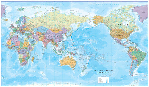
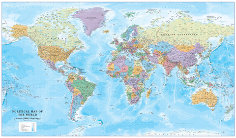
Available on Paper, Laminated, or Premium Canvas with Optional Hang Rails
Projection: Gall-Peters | Size: 1350 mm (W) x 900 mm (H)
🧭 See the World as It Really Is
Which is bigger: Greenland or China?
If you’re going by a traditional Mercator projection, they look about the same size. But in reality, China is nearly four times larger. That’s the cartographic illusion the Gall-Peters Projection corrects.
The Gall-Peters Equal Area Map presents the world as it truly is—accurately scaled by land area, without exaggerating the size of countries near the poles or shrinking those near the equator. It’s an essential visual tool for classrooms, offices, or homes where a deeper, fairer understanding of global geography matters.
🗺️ What Is the Gall-Peters Projection?
Originally proposed by James Gall in 1855 and popularised by Arno Peters in the 1970s, the Gall-Peters projection is an equal-area map, meaning all countries and continents are shown in correct proportion to their actual surface area.
Unlike the Mercator projection—which inflates the size of Europe, North America, and Russia—the Gall-Peters projection restores geopolitical balance and visual accuracy:
-
Africa and South America appear with their rightful prominence
-
Greenland is scaled down to its true size
-
Equatorial countries are no longer visually diminished
This map uses a rectangular grid, with vertical north-south lines and parallel east-west lines, allowing for precise directional relationships and geographic orientation.
📚 A Tool for Education and Awareness
The Gall-Peters projection has long been the map of choice in British schools and is endorsed by UNESCO. In 2017, Boston Public Schools in the United States adopted this projection to offer students a more accurate perspective of the world, sparking international conversation about map bias and educational equity.
It’s more than just a map—it’s a statement about how we view and understand the global community.
🖼️ Available Finishes
| Finish Type | Description |
|---|---|
| 160gsm Paper | Perfect for framing under glass or mounting on display boards. Smooth finish and sharp detail. |
| Laminated | Fully encapsulated in 80-micron gloss laminate (front and back), making it durable, waterproof, and wipeable. Ideal for classrooms or frequent use. |
| 395gsm Matte Canvas | Printed with pigment-based, fade-resistant inks on high-grade HP Professional Matte Canvas. Stunning clarity and long-lasting quality. A gallery-worthy piece. |
| Canvas with Hang Rails | Add wooden battens top and bottom (lacquered in natural timber) and a hanging cord. Easy to mount—just one hook required. |
📦 Please allow up to 10 working days for delivery of maps with hang rails, as they are hand-assembled by our framer.
✅ Key Features
-
Equal-area projection for true-to-scale global representation
-
Country and continent sizes reflect actual land mass
-
Accurate directional relationships and geographic positions
-
Popular in classrooms, supported by educational institutions worldwide
-
Excellent for social studies, geography, and international relations
📐 Product Specifications
| Feature | Detail |
|---|---|
| Map Title | Gall-Peters Equal Area World Map |
| Projection | Gall-Peters Equal-Area Projection |
| Size | 1350 mm (W) x 900 mm (H) |
| Print Options | Paper, Laminated, Canvas |
| Hang Rail Option | Yes (canvas only) |
| Made In | Australia |
| Delivery Time | 10 working days for hang rail option |
🛒 Add a New Perspective to Your Wall
Perfect for educators, students, globally minded households, or anyone who appreciates accurate cartography, the Gall-Peters World Map is both informative and impactful.
📌 Hang it in your classroom, office, or living room—and change the way you see the world.
Order yours today and explore Earth from a more honest and inclusive point of view.


