- Australia ▾
- Topographic
▾
- Australia AUSTopo 250k (2025)
- Australia 50k Geoscience maps
- Australia 100k Geoscience maps
- Australia 250k Geoscience maps
- Australia 1:1m Geoscience maps
- New Zealand 50k maps
- New Zealand 250k maps
- New South Wales 25k maps
- New South Wales 50k maps
- New South Wales 100k maps
- Queensland 10k maps
- Queensland 25k maps
- Queensland 50k maps
- Queensland 100k maps
- Western Australia 25k maps
- Western Australia 50k maps
- Western Australia 100k maps
- Compasses
- Software
- GPS Systems
- International ▾
- Wall Maps
▾
- World
- Australia & New Zealand
- Countries, Continents & Regions
- Historical
- Vintage National Geographic
- Australian Capital Territory
- New South Wales
- Northern Territory
- Queensland
- South Australia
- Tasmania
- Victoria
- Western Australia
- Celestial
- Children's
- Mining & Resources
- Wine Maps
- Healthcare
- Postcode Maps
- Electoral Maps
- Nautical ▾
- Flags
▾
- Australian Flag Sets & Banners
- Flag Bunting
- Handwavers
- Australian National Flags
- Aboriginal Flags
- Torres Strait Islander Flags
- International Flags
- Flagpoles & Accessories
- Australian Capital Territory Flags
- New South Wales Flags
- Northern Territory Flags
- Queensland Flags
- South Australia Flags
- Tasmania Flags
- Victoria Flags
- Western Australia Flags
- Gifts ▾
- Globes ▾
Dear valued customer. Please note that our checkout is not supported by old browsers. Please use a recent browser to access all checkout capabilities


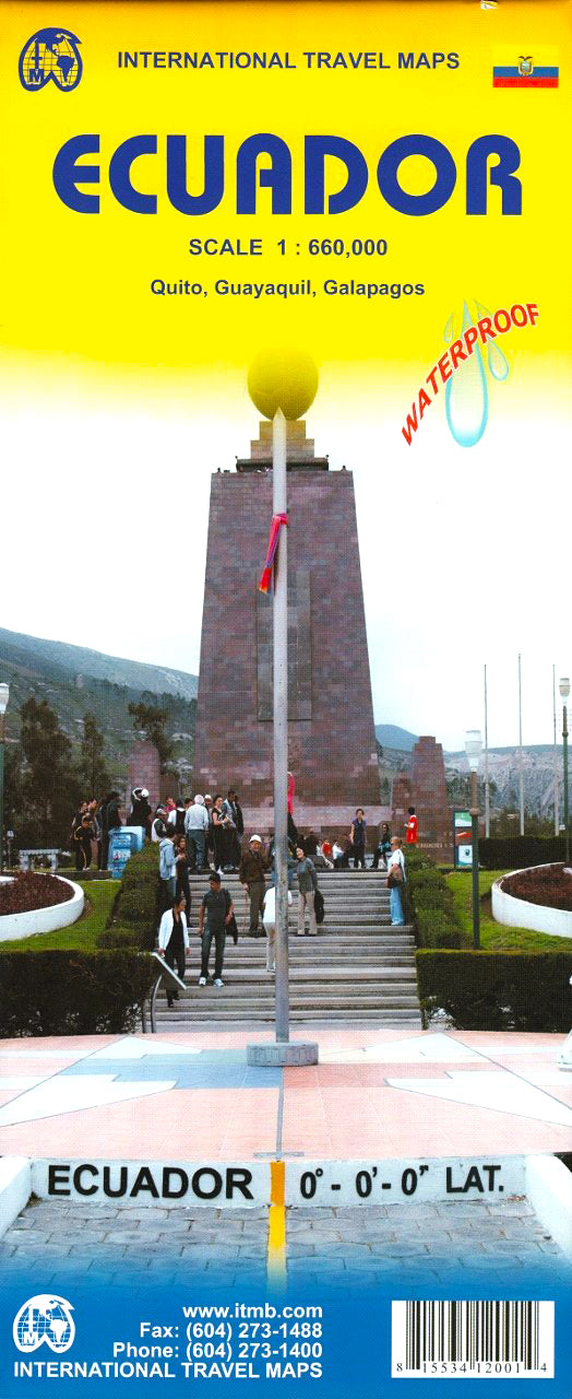
Ecuador ITMB Map
$24.95
Afterpay is only available for orders between $50.00 and $1000.00 More info
🇪🇨 Ecuador Travel Map – ITMB
Double-Sided | Waterproof Synthetic Paper | Includes Galápagos & City Insets
Scale: 1:660,000 (Main Map)
Flat Size: 690 mm x 1000 mm (27" x 39")
Publisher: ITMB (International Travel Maps)
Edition: Latest Available
Explore the rich landscapes and diverse ecosystems of Ecuador with this updated, double-sided travel map by ITMB. Printed on waterproof synthetic paper for durability in humid and tropical conditions, this map combines regional detail with focused city insets, making it the perfect tool for planning, navigating, or discovering Ecuador’s dramatic natural and cultural highlights.
From the Amazon Basin to the Andes, from the Pacific coast to the Galápagos Islands, this map brings one of South America's most compact and biodiverse countries into clear and practical focus.
🗺️ Double-Sided Coverage
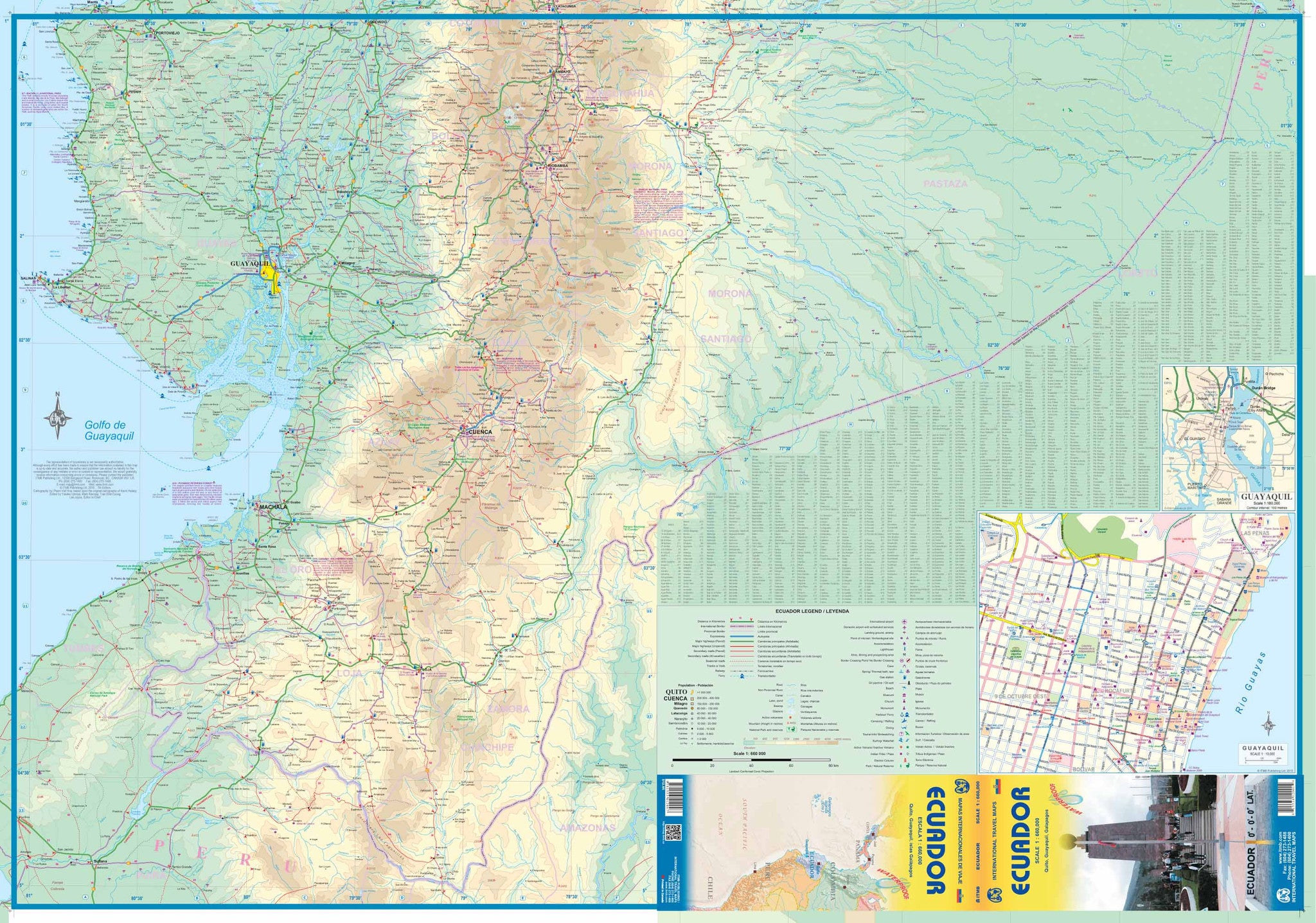
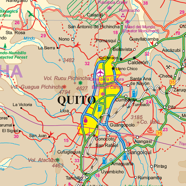
🏞️ Side 1: Mainland Ecuador (Scale: 1:660,000)
-
Covers the entire country, including:
-
Road networks simplified and updated for easier navigation
-
National parks, reserves, and volcanoes clearly marked
-
Major cities, regional airports, and travel routes noted
-
Small capsule comments added to highlight key destinations
-
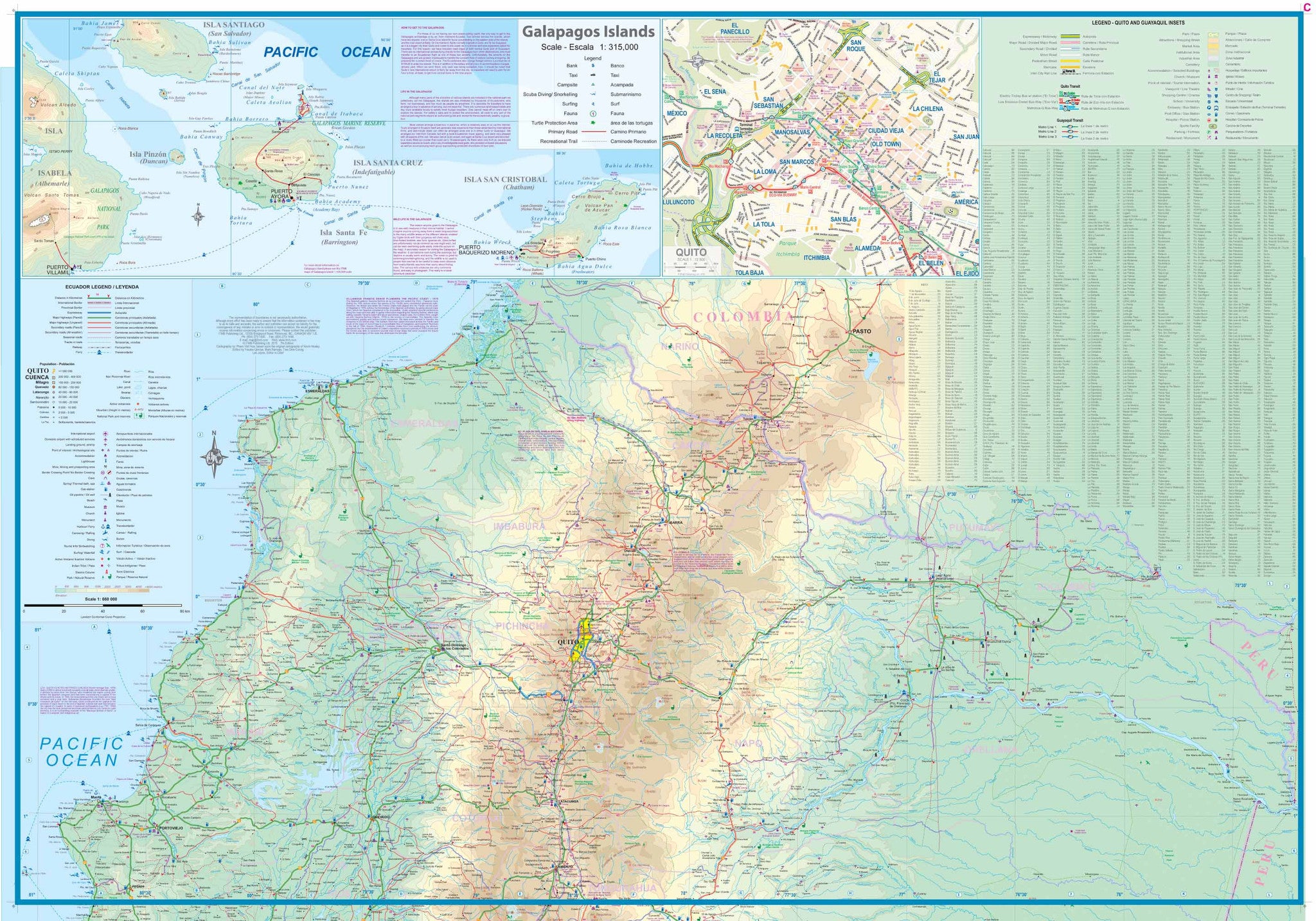
🏝️ Side 2: Galápagos Islands & City Insets
-
🐢 Galápagos Islands – Scale: 1:315,000
-
Shows island names, protected areas, ports, and landing sites
-
-
🏙️ Guayaquil City Centre – Scale: 1:10,000
-
Hotels, main roads, and points of interest mapped clearly
-
-
🏛️ Quito (split inset) – Now presented in two sections for enhanced clarity:
-
Historic Centre and modern cityscape separately labelled
-
🌟 Key Features
-
💧 Printed on waterproof synthetic paper – perfect for Ecuador’s tropical, coastal, and highland climates
-
🧭 Updated cartography – simplified road classifications and revised annotations
-
🗺️ Tourist and cultural highlights marked, including:
-
National parks, archaeological sites, cities, and beaches
-
Airports, ferry routes, and road distances between cities
-
-
📍 Improved city mapping – Quito and Guayaquil detailed for urban navigation
🧾 Map Specifications
| Feature | Details |
|---|---|
| Publisher | ITMB (International Travel Maps) |
| Map Type | Double-sided travel map |
| Material | Waterproof synthetic paper |
| Main Scale | 1:660,000 (Mainland Ecuador) |
| Insets | Galápagos (1:315,000), Guayaquil (1:10,000), Quito (split inset) |
| Size (Flat) | 690 mm x 1000 mm (27" x 39") |
| Language | English |
| Edition | Most recent available |
🛡️ Optional Lamination Available
For added durability and versatility, we offer this map with professional lamination:
-
💧 Waterproof and tear-resistant – built for outdoor use and tropical climates
-
✏️ Write-on/wipe-off surface – ideal for whiteboard markers and map dots
-
🔒 Laminated with high-quality 80-micron gloss
-
📦 Flattened before lamination – note: original fold lines may remain faintly visible
Ideal for classrooms, fieldwork, trip planning, or as a reusable travel companion.
🧳 Who Is This Map For?
Perfect for:
-
🧭 Backpackers and independent travellers exploring Ecuador overland
-
🏞️ Nature lovers and eco-tourists heading to the Andes, Amazon, or Galápagos
-
🐢 Cruise and wildlife tour planners working in the Galápagos region
-
🗺️ Educators and students studying Ecuador’s geography or biodiversity
-
✈️ Travel agencies and guides seeking reliable, printed references for clients
🇪🇨 Why Choose This Map?
Ecuador offers an incredible range of landscapes—high-altitude volcanoes, cloud forests, pristine coastlines, and world-renowned islands—all within reach of the savvy traveller. With this map in hand, you can plan your route, mark your highlights, and better understand the geography of one of South America’s most accessible adventure destinations.
Frequently Asked Questions
Where can I buy the Ecuador ITMB Map?
The Ecuador ITMB Map is available to buy online from Mapworld, Australia's largest map and geographic product retailer, with fast shipping Australia-wide.
Is the Ecuador ITMB Map in stock at Mapworld?
Mapworld maintains extensive stock across its map range and aims for fast dispatch. Orders placed before 2pm AEST on business days are typically dispatched the same day, with standard and express Australia-wide delivery options available.
What is Mapworld's returns policy?
Mapworld accepts returns on undamaged items in original condition. Contact Mapworld within 90 days of purchase to arrange a return or exchange.
Does Mapworld ship the Ecuador ITMB Map across Australia?
Yes, Mapworld ships Australia-wide. Standard shipping is a flat $7 rate, with free standard shipping on orders over $75. Express options are available at checkout. Most orders placed before 2pm AEST on weekdays are dispatched same day.
Related Items


© 2026 Mapworld. Website designed by Genie Media
X