- Australia ▾
- Topographic
▾
- Australia AUSTopo 250k (2024)
- Australia 50k Geoscience maps
- Australia 100k Geoscience maps
- Australia 250k Geoscience maps
- Australia 1.1m Geoscience maps
- New Zealand 50k maps
- New Zealand 250k maps
- New South Wales 25k maps
- New South Wales 50k maps
- New South Wales 100k maps
- Queensland 10k maps
- Queensland 25k maps
- Queensland 50k maps
- Queensland 100k maps
- Compasses
- Software
- GPS Systems
- Orienteering
- International ▾
- Wall Maps
▾
- World
- Australia & New Zealand
- Countries, Continents & Regions
- Historical
- Vintage National Geographic
- Australian Capital Territory
- New South Wales
- Northern Territory
- Queensland
- South Australia
- Tasmania
- Victoria
- Western Australia
- Celestial
- Children's
- Mining & Resources
- Wine Maps
- Healthcare
- Postcode Maps
- Electoral Maps
- Nautical ▾
- Flags
▾
- Australian Flag Sets & Banners
- Flag Bunting
- Handwavers
- Australian National Flags
- Aboriginal Flags
- Torres Strait Islander Flags
- International Flags
- Flagpoles & Accessories
- Australian Capital Territory Flags
- New South Wales Flags
- Northern Territory Flags
- Queensland Flags
- South Australia Flags
- Tasmania Flags
- Victoria Flags
- Western Australia Flags
- Gifts ▾
- Globes ▾
Dear valued customer. Please note that our checkout is not supported by old browsers. Please use a recent browser to access all checkout capabilities
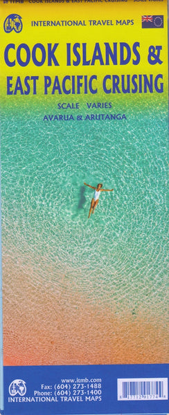
Cook Islands & East Pacific Cruising ITMB Map
$24.95
Afterpay is only available for orders between $50.00 and $1000.00 More info
Edition: Latest | Scale varies by region | Size: 685 mm × 990 mm | Double-Sided | ISBN: 9781553418136
🌴 Navigate the Idyllic South Pacific: From Island Paradise to Open-Ocean Adventure
This unique double-sided map by International Travel Maps (ITMB) blends two essential navigational tools into one thoughtfully designed product — ideal for cruise enthusiasts, island hoppers, tour operators, and anyone captivated by the South Pacific’s allure.
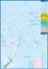
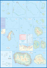
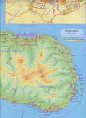
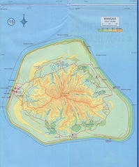
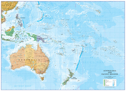
Side 1 focuses on the enchanting Cook Islands, offering highly detailed inset maps of key islands like Rarotonga, Aitutaki, Mangaia, and more. Side 2 broadens the perspective with a sweeping East Pacific Cruising Map, showcasing the major cruise routes across the tropical archipelagos — from Hawaii to Tahiti, Fiji to the Solomons, and down to New Zealand.
🔍 Side 1: The Cook Islands – In Detail
✅ Inset Island Maps
-
Includes Rarotonga, Aitutaki, Mangaia, Atiu, Mauke, Palmerston, Manihiki, and Penrhyn
-
Capital city Avarua and town Arutanga shown in detail
✅ Tourism-Oriented Design
-
Resorts, airstrips, harbours, and key travel infrastructure marked
-
Ideal for trip planning or showcasing destinations for tourism operators
✅ Clear Numbering & Legend
-
Fifteen distinct regions marked and labeled for easy reference
-
Colour-coded features and blue water routes for navigation
🌊 Side 2: East Pacific Cruising Map – Your Open-Ocean Companion
✅ Covers Vast Oceanic Geography
-
From the Marshall Islands and Solomons in the west
-
To Hawaii, French Polynesia (Tahiti) and Easter Island in the east
-
Includes Kiribati, Tuvalu, Samoa, Tonga, Fiji, New Caledonia, and more
✅ Cruise Routes Mapped
-
Shows key ocean cruising lanes across the Pacific basin
-
Perfect for following your ship’s route or planning multi-island adventures
✅ Elegant Oceanic Layout
-
Though island details are small, the beauty lies in the comprehensive overview
-
A lovely and decorative reference for cruise planners and enthusiasts alike
📐 Map Specifications
| Feature | Detail |
|---|---|
| Map Title | Cook Islands & East Pacific Cruising |
| Publisher | ITMB – International Travel Maps |
| Format | Folded, double-sided |
| Scale | Varies – Cook Islands (detailed), Pacific (broad) |
| Unfolded Size | 685 mm × 990 mm |
| Material | Paper (laminated option available) |
| ISBN | 9781553418136 |
🧭 Ideal For:
-
🛳️ Cruise Passengers & Agents – Follow your voyage and understand your route
-
🏝️ Island Explorers – Rarotonga, Aitutaki, and more in detail
-
🧳 Tour Operators – Showcase travel packages and resort locations
-
📚 Educators & Enthusiasts – A beautiful way to teach or display Pacific geography
-
🎁 Travel Gifts – Perfect for globetrotters and those who dream of South Pacific travel
💧 Laminated Version Available
We offer this map with optional high-gloss 80-micron lamination, allowing you to:
✔️ Mark locations with whiteboard marker
✔️ Apply map dots or labels
✔️ Protect against moisture, tears, and general wear
Note: Laminated maps are made to order — folded map is flattened and encapsulated, so original crease lines may be faintly visible.
📦 Shipping & Delivery
-
Ships from Australia
-
Standard and express shipping options available
Capture the spirit of the South Pacific – from tranquil lagoons to open-sea adventure – with this beautifully detailed and practical travel map.


