- Australia ▾
- Topographic
▾
- Australia AUSTopo 250k (2024)
- Australia 50k Geoscience maps
- Australia 100k Geoscience maps
- Australia 250k Geoscience maps
- Australia 1.1m Geoscience maps
- New Zealand 50k maps
- New Zealand 250k maps
- New South Wales 25k maps
- New South Wales 50k maps
- New South Wales 100k maps
- Queensland 10k maps
- Queensland 25k maps
- Queensland 50k maps
- Queensland 100k maps
- Compasses
- Software
- GPS Systems
- Orienteering
- International ▾
- Wall Maps
▾
- World
- Australia & New Zealand
- Countries, Continents & Regions
- Historical
- Vintage National Geographic
- Australian Capital Territory
- New South Wales
- Northern Territory
- Queensland
- South Australia
- Tasmania
- Victoria
- Western Australia
- Celestial
- Children's
- Mining & Resources
- Wine Maps
- Healthcare
- Postcode Maps
- Electoral Maps
- Nautical ▾
- Flags
▾
- Australian Flag Sets & Banners
- Flag Bunting
- Handwavers
- Australian National Flags
- Aboriginal Flags
- Torres Strait Islander Flags
- International Flags
- Flagpoles & Accessories
- Australian Capital Territory Flags
- New South Wales Flags
- Northern Territory Flags
- Queensland Flags
- South Australia Flags
- Tasmania Flags
- Victoria Flags
- Western Australia Flags
- Gifts ▾
- Globes ▾
Dear valued customer. Please note that our checkout is not supported by old browsers. Please use a recent browser to access all checkout capabilities


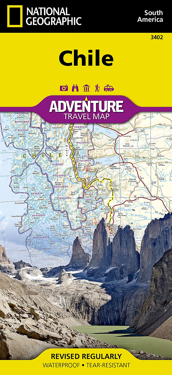
Chile National Geographic Folded Map
Sold Out
Afterpay is only available for orders between $50.00 and $1000.00 More info
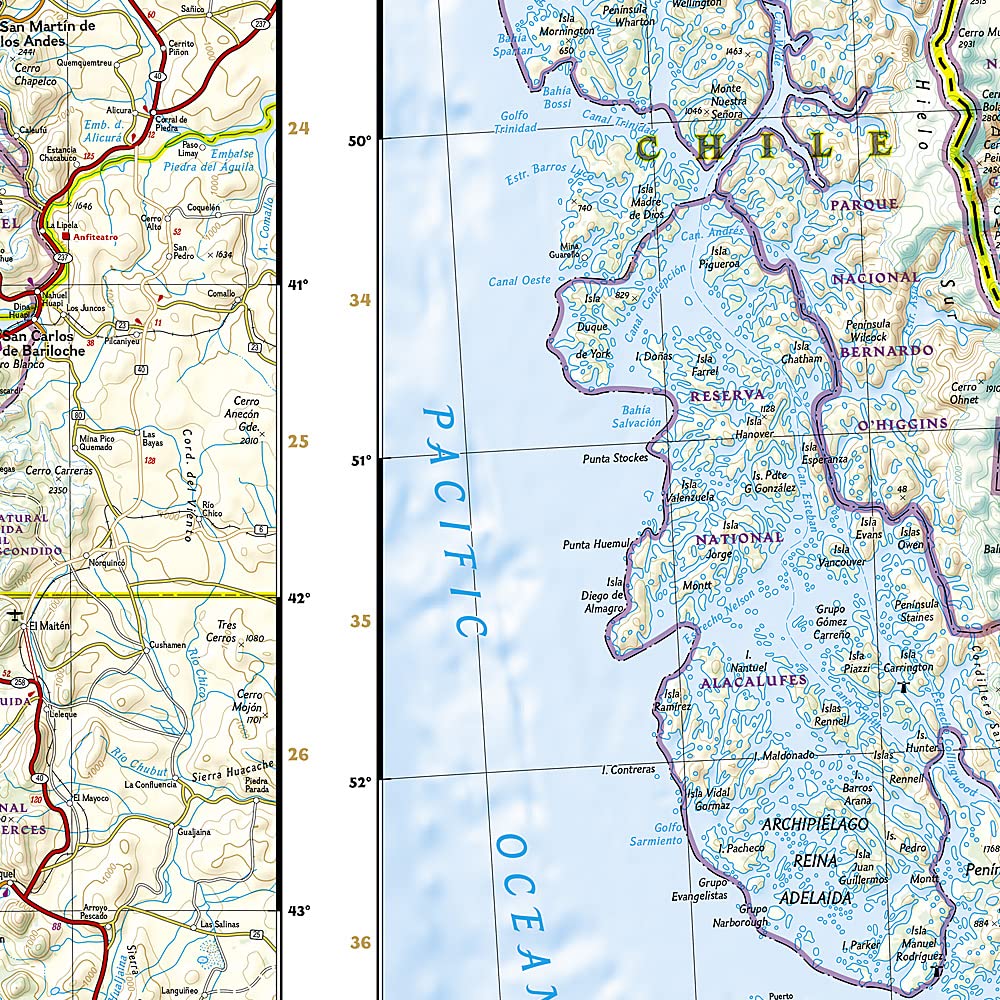
🇨🇱 Chile National Geographic Adventure Travel Map
Waterproof • Tear-Resistant • Detailed Road & Adventure Map
Scale: 1:1,950,000 | Size: 965 mm x 660 mm (folded: 235 mm x 108 mm)
🧭 Your Ultimate Companion for Exploring Chile
From the lunar landscapes of the Atacama Desert to the windswept fjords of Patagonia, Chile is a land of dramatic contrasts and unforgettable journeys. Whether you're planning a road trip, trekking expedition, or cultural deep dive, this National Geographic Adventure Map provides the perfect blend of practical detail and geographic insight.
Crafted for durability and legibility, the map is printed on synthetic waterproof, tear-resistant paper, making it tough enough to handle any terrain or weather you may encounter on your travels.
🗺️ Coverage & Map Features
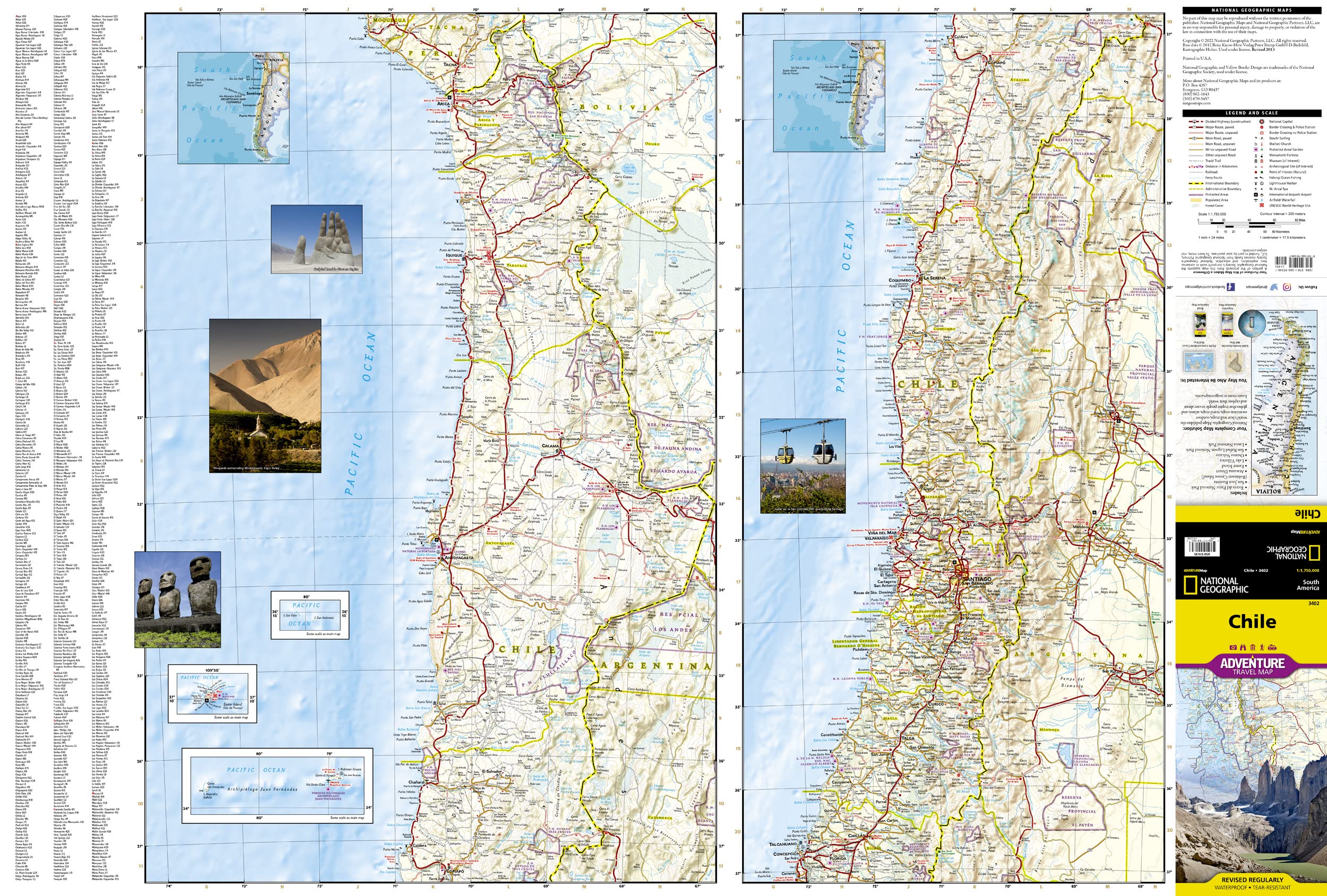
This double-sided map offers complete coverage of Chile from Peru to Cape Horn, highlighting key travel destinations, road networks, and natural landmarks:
Side One: Northern Chile
-
From Arica and the Peruvian border south to Concepción
-
Includes:
-
Santiago, La Serena, Antofagasta, Calama, Chanaral
-
The Atacama Desert and Andean altiplano
-
-
Inset Maps:
-
🏝️ Easter Island (Rapa Nui)
-
🏝️ Juan Fernández Archipelago
-
🏝️ San Félix & San Ambrosio Islands
-
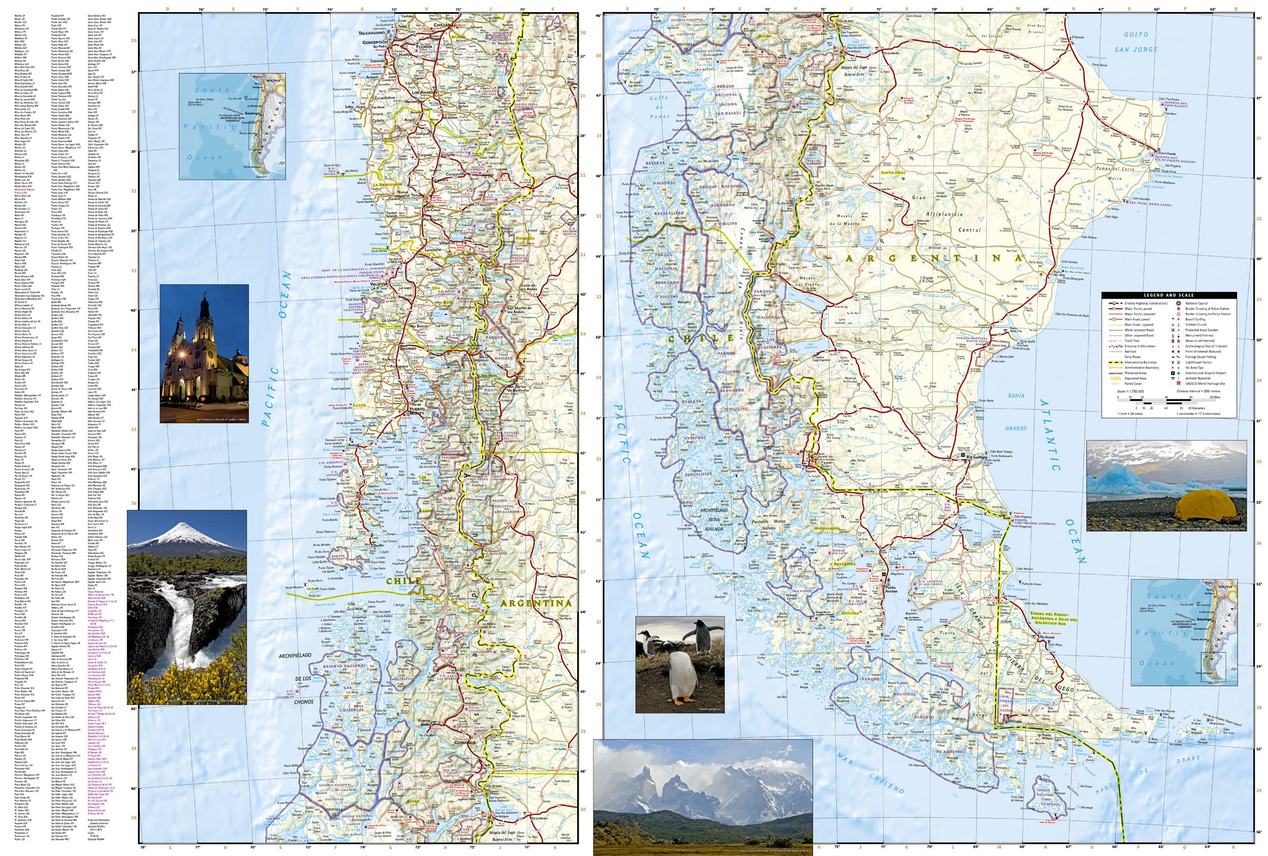
Side Two: Southern Chile
-
Overlapping north section, extends all the way to Cape Horn
-
Covers:
-
Puerto Montt, Coyhaique, Punta Arenas, and Tierra del Fuego
-
Iconic destinations like Torres del Paine, Carretera Austral, and numerous national parks
-
📌 Map Highlights
-
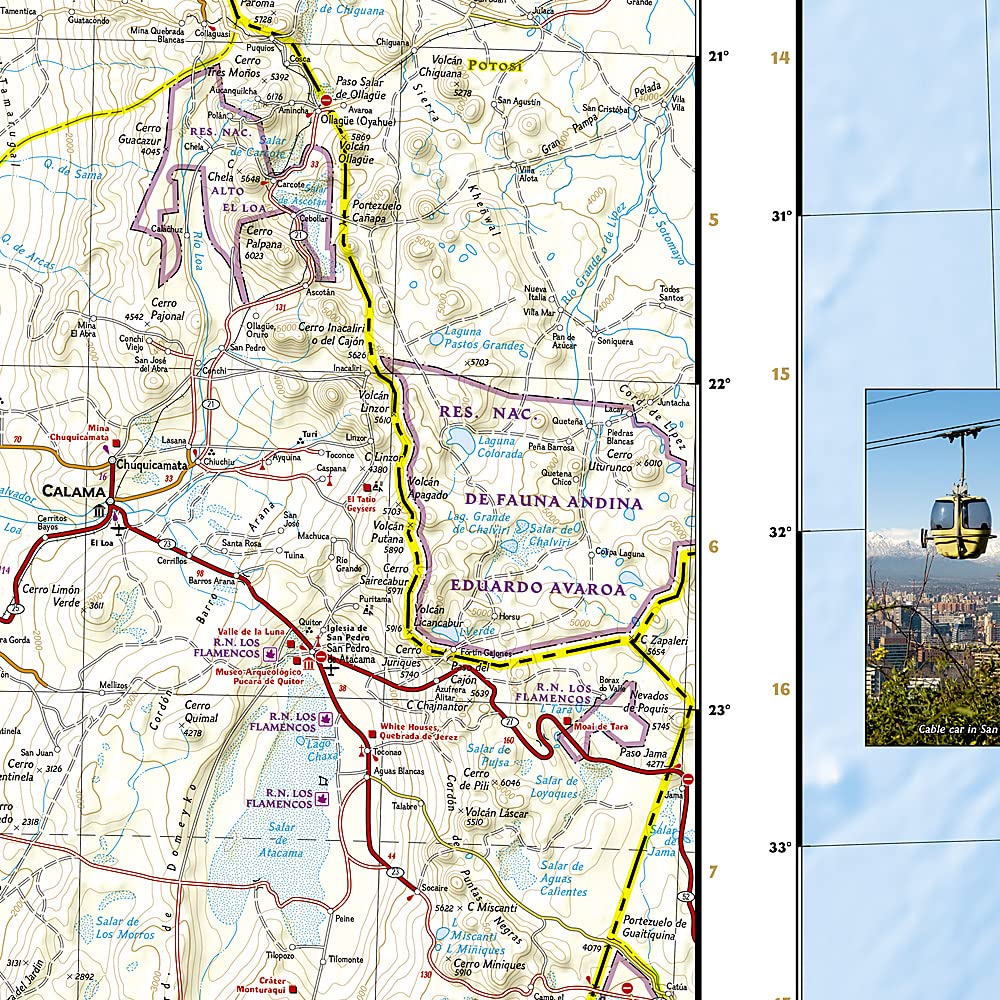
🛣️ Clearly marked highways and secondary roads with distances
-
🚶 Tracks and trails for trekking, biking, and remote exploration
-
📍 Hundreds of points of interest: parks, reserves, archaeological sites, UNESCO locations
-
🏙️ Cities and towns with a full index for easy navigation
-
🌄 National parks, glaciers, lakes, and volcanoes clearly displayed
-
🧭 Includes latitude/longitude grids, scale bars, and a compass rose for GPS navigation
💡 Why Choose This Map?
-
✅ Adventure-Ready: Durable and packable—built for outdoor use
-
✅ Comprehensive: Covers remote regions most maps omit
-
✅ Authoritative: Trusted National Geographic cartography
-
✅ Perfect for All Travellers: Road trippers, hikers, cyclists, and expedition planners
📐 Specifications
| Feature | Detail |
|---|---|
| Scale | 1:1,950,000 |
| Sheet Size (Unfolded) | 965 mm x 660 mm (38” x 26”) |
| Folded Size | 235 mm x 108 mm (9.25” x 4.25”) |
| Format | Folded, double-sided map |
| Material | Waterproof & tear-resistant synthetic paper |
| Publisher | National Geographic Maps |
🧳 The Perfect Map for Every Chilean Adventure
Whether you're:
-
Driving the Pan-American Highway
-
Trekking the Torres del Paine Circuit
-
Stargazing in the Atacama
-
Or navigating the islands of Patagonia
This is the essential tool for seeing Chile beyond the guidebooks.
📦 Ships folded. Lightweight, packable, and ideal for on-the-go adventurers.


