- Australia ▾
- Topographic
▾
- Australia AUSTopo 250k (2025)
- Australia 50k Geoscience maps
- Australia 100k Geoscience maps
- Australia 250k Geoscience maps
- Australia 1:1m Geoscience maps
- New Zealand 50k maps
- New Zealand 250k maps
- New South Wales 25k maps
- New South Wales 50k maps
- New South Wales 100k maps
- Queensland 10k maps
- Queensland 25k maps
- Queensland 50k maps
- Queensland 100k maps
- Western Australia 25k maps
- Western Australia 50k maps
- Western Australia 100k maps
- Compasses
- Software
- GPS Systems
- International ▾
- Wall Maps
▾
- World
- Australia & New Zealand
- Countries, Continents & Regions
- Historical
- Vintage National Geographic
- Australian Capital Territory
- New South Wales
- Northern Territory
- Queensland
- South Australia
- Tasmania
- Victoria
- Western Australia
- Celestial
- Children's
- Mining & Resources
- Wine Maps
- Healthcare
- Postcode Maps
- Electoral Maps
- Nautical ▾
- Flags
▾
- Australian Flag Sets & Banners
- Flag Bunting
- Handwavers
- Australian National Flags
- Aboriginal Flags
- Torres Strait Islander Flags
- International Flags
- Flagpoles & Accessories
- Australian Capital Territory Flags
- New South Wales Flags
- Northern Territory Flags
- Queensland Flags
- South Australia Flags
- Tasmania Flags
- Victoria Flags
- Western Australia Flags
- Gifts ▾
- Globes ▾
Dear valued customer. Please note that our checkout is not supported by old browsers. Please use a recent browser to access all checkout capabilities


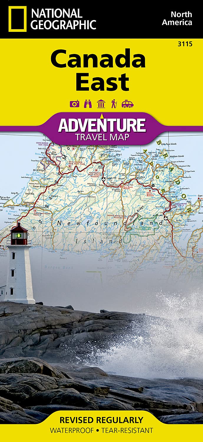
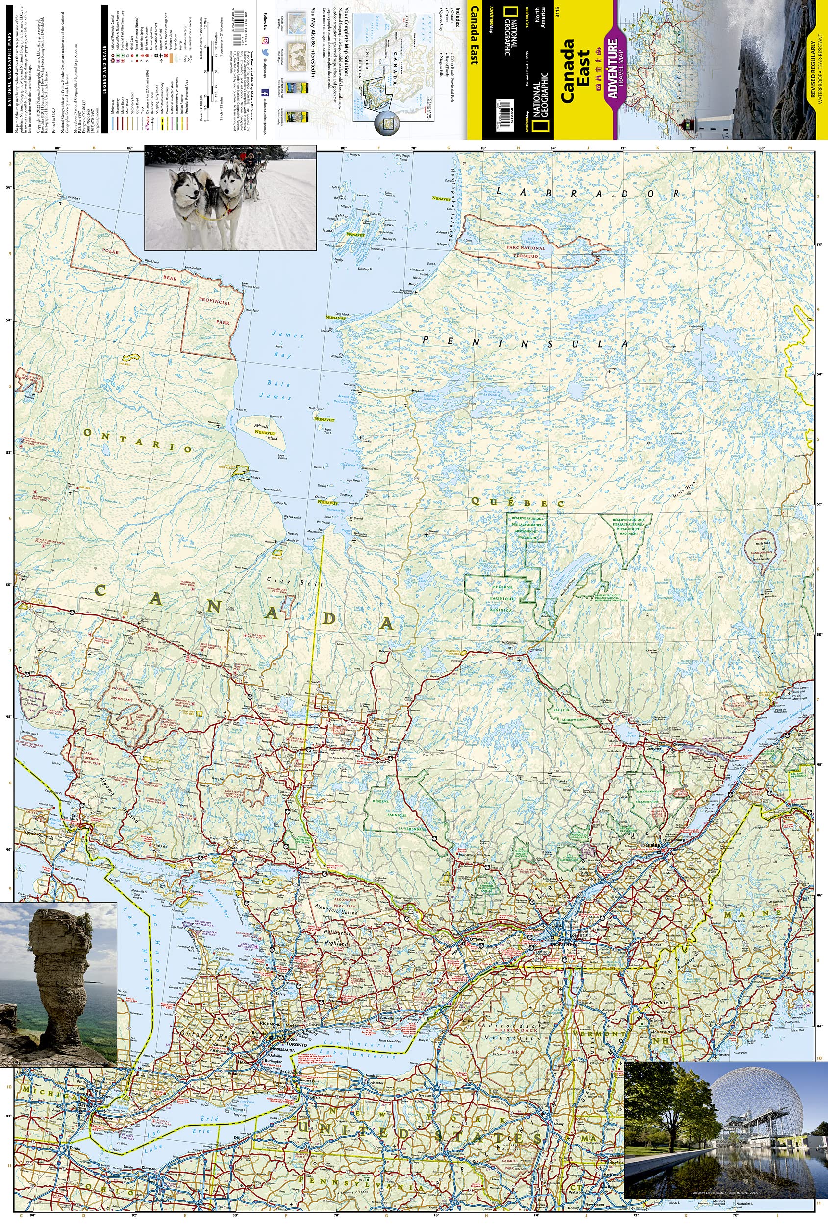
Canada East National Geographic Folded Map
$27.95
Afterpay is only available for orders between $50.00 and $1000.00 More info
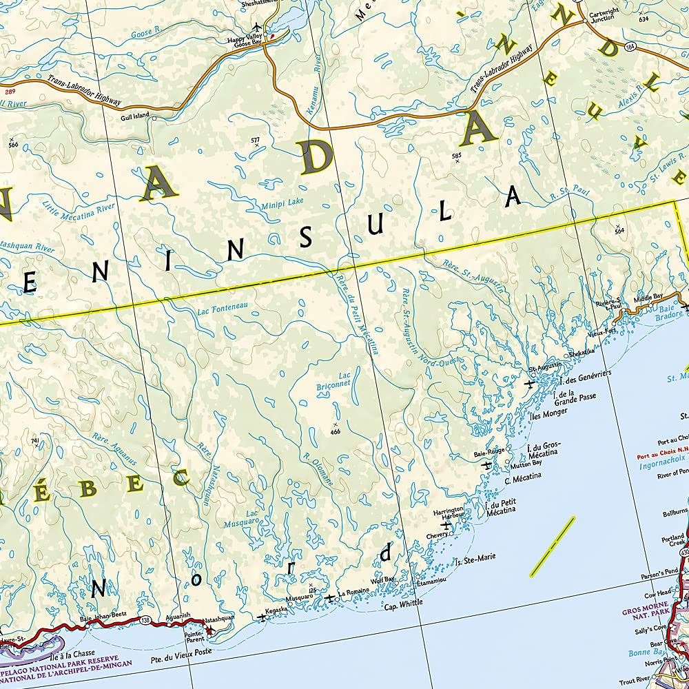
🇨🇦 Canada East Adventure Map – National Geographic
Explore Eastern Canada with Confidence, Detail, and Durability
Map Format: Folded | Printed on: Waterproof, tear-resistant synthetic paper
Map Scale: 1:1,200,000 (approx.)
Unfolded Size: 660 mm x 965 mm (26 in x 38 in)
Folded Size: 108 mm x 235 mm (4.25 in x 9.25 in)
Publisher: National Geographic Maps
Series: Adventure Map Collection
Edition: Updated regularly
🧭 Overview
From the historic cities of Québec and Halifax to the windswept shores of Newfoundland, National Geographic’s Canada East Adventure Map is the perfect planning and navigation tool for travellers exploring the heart of Eastern Canada.
Designed with adventure travellers, road trippers, paddlers, and explorers in mind, this rugged map goes far beyond tourist brochures and city centre guides. It’s a richly detailed, waterproof topographic reference that invites you to venture off the beaten path with confidence.
✅ Key Features
-
🌧 Waterproof & Tear-Resistant
Printed on tough synthetic paper, this map won’t rip, tear or turn soggy in the rain—built for the rigours of real travel. -
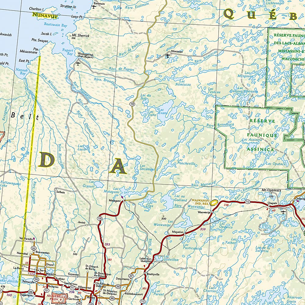
🗺 Highly Detailed Topography
With shaded relief and terrain markings, the map reveals the landscape’s natural contours—from highlands to coastlines. -
🚐 Complete Road Network
Includes major highways, minor roads, ferry routes, and cross-border connections into the northeastern United States. -
📍 Hundreds of Points of Interest
Includes National & Provincial Parks, historic sites, campgrounds, waterfalls, UNESCO World Heritage Sites, nature reserves, and scenic lookouts. -
🛣 Index of Cities, Towns & Natural Features
Easy to reference for trip planning and navigation. -
🔄 Double-Sided for Maximum Coverage
Unfolds to a generous size without sacrificing portability. -
🎯 Adventure-Ready Design
Includes lesser-known trails, rural routes, and protected natural spaces that don't appear on standard road maps.
🧭 Coverage Area
-
Provinces: Ontario (East), Québec, New Brunswick, Nova Scotia, Prince Edward Island, Eastern Newfoundland & Labrador
-
Key Features: St. Lawrence River, Bay of Fundy, Gulf of St. Lawrence, Great Lakes
-
Border Areas: Northern Maine, Vermont, and New York State (USA)
-
Cities Featured: Montréal, Québec City, Ottawa, Fredericton, Saint John, Halifax, St. John’s, Charlottetown
💡 Why Choose This Map?
| Feature | Benefit |
|---|---|
| 🧱 Durable, waterproof paper | Built for real-world conditions—rain, wind, and wear |
| 🌍 Created by National Geographic | Trusted accuracy and cartographic excellence |
| 🧭 Adventure-ready detail | Ideal for scenic drives, backroad exploration, and national park visits |
| 📚 Folded and portable | Travel-ready size fits backpacks, glove boxes, and map cases |
| 💖 Supports exploration | A portion of proceeds supports National Geographic’s conservation and education missions |
👤 Perfect For:
-
🚗 Road trippers planning coastal drives or cross-country adventures
-
🏕 Campers and RV travellers exploring national parks and scenic byways
-
🧭 Paddlers and hikers navigating wilderness areas and remote lakes
-
📚 Teachers and geography enthusiasts seeking a high-quality reference
-
🌍 International travellers who want a rugged, reliable map in their pocket
📦 Additional Details
-
Unfolded Map Size: 660 mm (W) x 965 mm (H) — 26 in x 38 in
-
Folded Size: 108 mm (W) x 235 mm (H) — 4.25 in x 9.25 in
-
Printed On: Waterproof synthetic material
-
Publisher: National Geographic Maps
-
Map Series: Adventure Map – Canada
✨ Adventure Starts Here
Whether you're kayaking the Ottawa River, driving the Gaspé Peninsula, or discovering the Cabot Trail, this map ensures you don’t miss a thing—from major attractions to hidden gems.
📌 Plan smarter. Travel further. Get lost in the right direction—with National Geographic.
Frequently Asked Questions
What area does the Canada East National Geographic Folded Map cover?
The Canada East National Geographic Folded Map provides road coverage of the region named in the product title. The map covers major cities, highways, towns, and regional roads, with inset city maps for key urban centres where applicable.
Is the Canada East National Geographic Folded Map up to date?
Yes, this is the current edition. Mapworld stocks the most current editions from all major publishers, updated to reflect new roads and infrastructure.
What size is this map when unfolded?
Folded maps from Mapworld's range are compact and portable. Most standard folded road or travel maps open to between A1 (594 × 841mm) and A0 (841 × 1189mm) when fully unfolded, and fold down to approximately A4 or smaller for easy storage in a glove box, bag, or backpack.
Is the Canada East National Geographic Folded Map in stock at Mapworld?
Mapworld maintains extensive stock across its map range and aims for fast dispatch. Orders placed before 2pm AEST on business days are typically dispatched the same day, with standard and express Australia-wide delivery options available.
Does Mapworld ship the Canada East National Geographic Folded Map across Australia?
Yes, Mapworld ships Australia-wide. Standard shipping is a flat $7 rate, with free standard shipping on orders over $75. Express options are available at checkout. Most orders placed before 2pm AEST on weekdays are dispatched same day.
Related Items


© 2026 Mapworld. Website designed by Genie Media
X