- Australia ▾
- Topographic
▾
- Australia AUSTopo 250k (2024)
- Australia 50k Geoscience maps
- Australia 100k Geoscience maps
- Australia 250k Geoscience maps
- Australia 1.1m Geoscience maps
- New Zealand 50k maps
- New Zealand 250k maps
- New South Wales 25k maps
- New South Wales 50k maps
- New South Wales 100k maps
- Queensland 10k maps
- Queensland 25k maps
- Queensland 50k maps
- Queensland 100k maps
- Compasses
- Software
- GPS Systems
- Orienteering
- International ▾
- Wall Maps
▾
- World
- Australia & New Zealand
- Countries, Continents & Regions
- Historical
- Vintage National Geographic
- Australian Capital Territory
- New South Wales
- Northern Territory
- Queensland
- South Australia
- Tasmania
- Victoria
- Western Australia
- Celestial
- Children's
- Mining & Resources
- Wine Maps
- Healthcare
- Postcode Maps
- Electoral Maps
- Nautical ▾
- Flags
▾
- Australian Flag Sets & Banners
- Flag Bunting
- Handwavers
- Australian National Flags
- Aboriginal Flags
- Torres Strait Islander Flags
- International Flags
- Flagpoles & Accessories
- Australian Capital Territory Flags
- New South Wales Flags
- Northern Territory Flags
- Queensland Flags
- South Australia Flags
- Tasmania Flags
- Victoria Flags
- Western Australia Flags
- Gifts ▾
- Globes ▾
Dear valued customer. Please note that our checkout is not supported by old browsers. Please use a recent browser to access all checkout capabilities
Maryborough, Hervey Bay & Bundaberg UBD 486/480 Map
Sold Out
Afterpay is only available for orders between $50.00 and $1000.00 More info
Scale: 1:500,000 | Size: 700mm (W) x 1000mm (H)
Includes Town Maps, Street Index & Optional Lamination
Perfect for Travel Planning, Local Navigation & Wall Display
🏖️ Explore the Fraser Coast & Wide Bay-Burnett in Detail
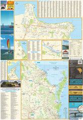
From coastal escapes to historic inland towns, the Maryborough, Hervey Bay & Bundaberg Touring Map by UBD Gregory’s provides a clear and reliable overview of one of Queensland’s most popular regional destinations.
This regional-scale map is ideal for travellers, locals, caravaners, and tourism businesses wanting to plan routes, locate towns, and explore lesser-known destinations across the Fraser Coast and surrounding inland regions. Whether you're visiting the turtle nesting beaches of Mon Repos, heading inland to Gayndah, or planning a holiday in Hervey Bay, this map is a handy, detailed guide.
🗺️ What’s Included
-
📌 Regional map of the entire Maryborough–Hervey Bay–Bundaberg area at 1:500,000 scale
-
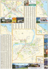
🏙️ Town map of Bundaberg with street index for detailed urban navigation
-
🧭 Additional town maps for:
-
Bargara
-
Burnett Heads
-
Childers
-
Gayndah
-
Moore Park Beach
-
Rainbow Beach
-
Tin Can Bay
-
Great for exploring beachside villages, hinterland towns, and tourism hotspots across the Fraser Coast and Burnett regions.
✍️ Optional Lamination – Reusable & Rugged
We offer a laminated version of this map for added functionality and durability:
-
✅ Write-on/wipe-off surface – Plan trips, mark locations or make notes using whiteboard markers
-
✅ Use with Map Dots – Perfect for identifying client locations, tourist attractions, or campgrounds
-
✅ Tear-resistant & stain-resistant – Built to withstand folding, handling, and use on the road
-
✅ Ideal for offices, caravans, tourism desks, or home planning walls
🛠️ Please note: Laminated versions are made by professionally flattening a folded map and encapsulating it in 80-micron gloss laminate. Slight fold lines may remain visible, but these do not affect the function or appearance of the map.
Who Is This Map For?
🚐 Caravanners & Holidaymakers – Plan scenic routes, stopovers, and coastal drives with ease
🏡 Local Residents & Property Planners – A clear overview of regional layout for land and home planning
🏢 Business Owners & Logistics Teams – Map your service area, client base, or delivery range
📚 Educators & Tourism Providers – Great for classroom use, visitor centres, and tour planning
📌 Map Collectors & Geography Enthusiasts – Add a reliable Queensland reference to your collection
📏 Product Specifications
| Feature | Details |
|---|---|
| Map Title | Maryborough, Hervey Bay & Bundaberg Touring Map – UBD 486/480 |
| Publisher | UBD Gregory’s |
| Scale | 1:500,000 |
| Map Size | 700mm (width) x 1000mm (height) |
| Town Maps Included | Bundaberg (with street index), plus 7 regional towns |
| Laminated Option | Yes – Write-on/wipe-off, waterproof, 80-micron gloss laminate |
| Printed In | Australia 🇦🇺 |
🛒 Add to Cart Now
Planning a coastal escape or managing regional operations? The Maryborough, Hervey Bay & Bundaberg Touring Map by UBD Gregory’s provides the clarity, scale, and detail you need — all in one expertly designed map.
Choose your preferred format (laminated or standard), and add to your cart today to start navigating Queensland’s Fraser Coast with confidence.


