- Australia ▾
- Topographic
▾
- Australia AUSTopo 250k (2024)
- Australia 50k Geoscience maps
- Australia 100k Geoscience maps
- Australia 250k Geoscience maps
- Australia 1.1m Geoscience maps
- New Zealand 50k maps
- New Zealand 250k maps
- New South Wales 25k maps
- New South Wales 50k maps
- New South Wales 100k maps
- Queensland 10k maps
- Queensland 25k maps
- Queensland 50k maps
- Queensland 100k maps
- Compasses
- Software
- GPS Systems
- Orienteering
- International ▾
- Wall Maps
▾
- World
- Australia & New Zealand
- Countries, Continents & Regions
- Historical
- Vintage National Geographic
- Australian Capital Territory
- New South Wales
- Northern Territory
- Queensland
- South Australia
- Tasmania
- Victoria
- Western Australia
- Celestial
- Children's
- Mining & Resources
- Wine Maps
- Healthcare
- Postcode Maps
- Electoral Maps
- Nautical ▾
- Flags
▾
- Australian Flag Sets & Banners
- Flag Bunting
- Handwavers
- Australian National Flags
- Aboriginal Flags
- Torres Strait Islander Flags
- International Flags
- Flagpoles & Accessories
- Australian Capital Territory Flags
- New South Wales Flags
- Northern Territory Flags
- Queensland Flags
- South Australia Flags
- Tasmania Flags
- Victoria Flags
- Western Australia Flags
- Gifts ▾
- Globes ▾
Dear valued customer. Please note that our checkout is not supported by old browsers. Please use a recent browser to access all checkout capabilities


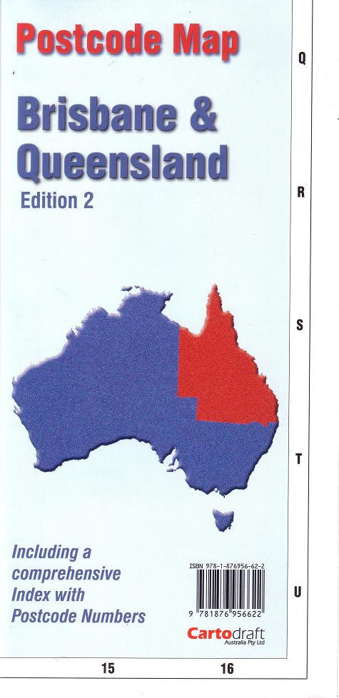
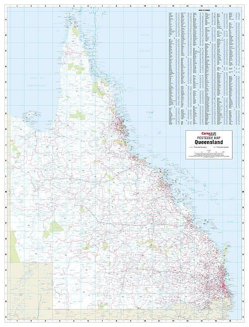
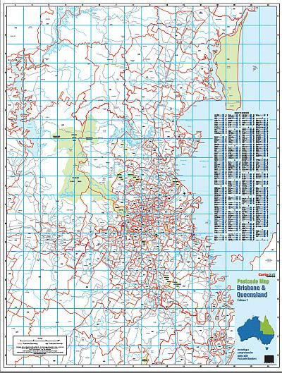
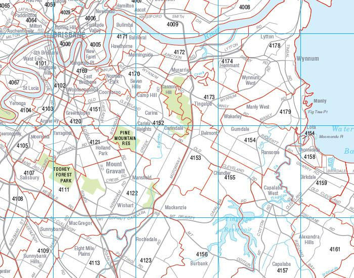
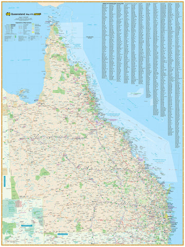
Brisbane & Queensland Folded Postcode Map
$29.95
Afterpay is only available for orders between $50.00 and $1000.00 More info
Double-Sided | Statewide Coverage | Comprehensive Postcode Boundaries
Size: 788 mm x 1036 mm (unfolded)
Whether you're managing deliveries, coordinating service areas, planning sales territories, or simply need a reliable postal reference, the Brisbane & Queensland Postcode Map by Cartodraft is your essential tool for understanding postcode zones across the entire state.
This double-sided, full-colour map is the only map available that displays postcode boundaries and numbers at the state level for Queensland, making it an invaluable resource for both regional and metro-based operations.
📍 Key Features
| Feature | Description |
|---|---|
| 📬 Postcode Boundaries | Clear and accurate postcode boundary lines throughout Queensland |
| 🔢 Postcode Numbers | Every postcode zone labelled with its official code |
| 📖 Comprehensive Index | Easy-to-read alphabetical listing of town names and their postcodes |
| 📌 Dual Coverage | Includes Brisbane metropolitan area and entire state of Queensland |
| 🗺️ Double-Sided Format | One side focuses on Brisbane; the other on regional Queensland |
| 🎯 Ideal for Business Use | Perfect for planning delivery zones, service coverage, and logistics |
🗺️ Coverage Includes:
-
✅ Brisbane City & Suburbs
-
✅ Gold Coast & Sunshine Coast regions
-
✅ Far North Queensland including Cairns, Townsville, and Cape York
-
✅ Western Queensland towns and rural postcode zones
-
✅ Outback, coastal, and remote postcode boundaries
From inner-city suburbs to remote stations, every corner of Queensland is represented with postcode clarity and precision.
📐 Product Specifications
| Specification | Detail |
|---|---|
| Title | Brisbane & Queensland Postcode Map |
| Publisher | Cartodraft |
| Format | Folded, double-sided map |
| Size | 788 mm (W) x 1036 mm (H) (unfolded) |
| Full colour | |
| Index | Town names and postcodes included |
💼 Who Is This Map For?
This map is particularly suited for:
-
🏢 Businesses managing logistics or delivery services
-
🧾 Sales teams planning territory or regional coverage
-
🏪 Retail and e-commerce operations needing postcode lookup for shipping
-
🗂️ Government, schools, and healthcare planners
-
🚚 Transport and courier companies
-
📦 Warehouse and distribution centre managers
💼 Why Use a Printed Postcode Map?
While online tools are useful, a printed postcode map offers:
-
📍 Instant big-picture clarity with no scrolling or zooming
-
🖊️ Space for annotation with markers or stickers during planning sessions
-
❌ No reliance on internet connection or digital devices
-
✅ Trusted accuracy with clearly defined postcode boundaries across the state
🛒 Add to Cart Now
When it comes to postcode clarity across Brisbane and Queensland, nothing beats Cartodraft’s double-sided postcode map. Trusted by businesses, planners, and logistics teams across Australia, this folded map is your go-to resource for smart, efficient regional planning.