- Australia ▾
- Topographic
▾
- Australia AUSTopo 250k (2024)
- Australia 50k Geoscience maps
- Australia 100k Geoscience maps
- Australia 250k Geoscience maps
- Australia 1.1m Geoscience maps
- New Zealand 50k maps
- New Zealand 250k maps
- New South Wales 25k maps
- New South Wales 50k maps
- New South Wales 100k maps
- Queensland 10k maps
- Queensland 25k maps
- Queensland 50k maps
- Queensland 100k maps
- Compasses
- Software
- GPS Systems
- Orienteering
- International ▾
- Wall Maps
▾
- World
- Australia & New Zealand
- Countries, Continents & Regions
- Historical
- Vintage National Geographic
- Australian Capital Territory
- New South Wales
- Northern Territory
- Queensland
- South Australia
- Tasmania
- Victoria
- Western Australia
- Celestial
- Children's
- Mining & Resources
- Wine Maps
- Healthcare
- Postcode Maps
- Electoral Maps
- Nautical ▾
- Flags
▾
- Australian Flag Sets & Banners
- Flag Bunting
- Handwavers
- Australian National Flags
- Aboriginal Flags
- Torres Strait Islander Flags
- International Flags
- Flagpoles & Accessories
- Australian Capital Territory Flags
- New South Wales Flags
- Northern Territory Flags
- Queensland Flags
- South Australia Flags
- Tasmania Flags
- Victoria Flags
- Western Australia Flags
- Gifts ▾
- Globes ▾
Dear valued customer. Please note that our checkout is not supported by old browsers. Please use a recent browser to access all checkout capabilities


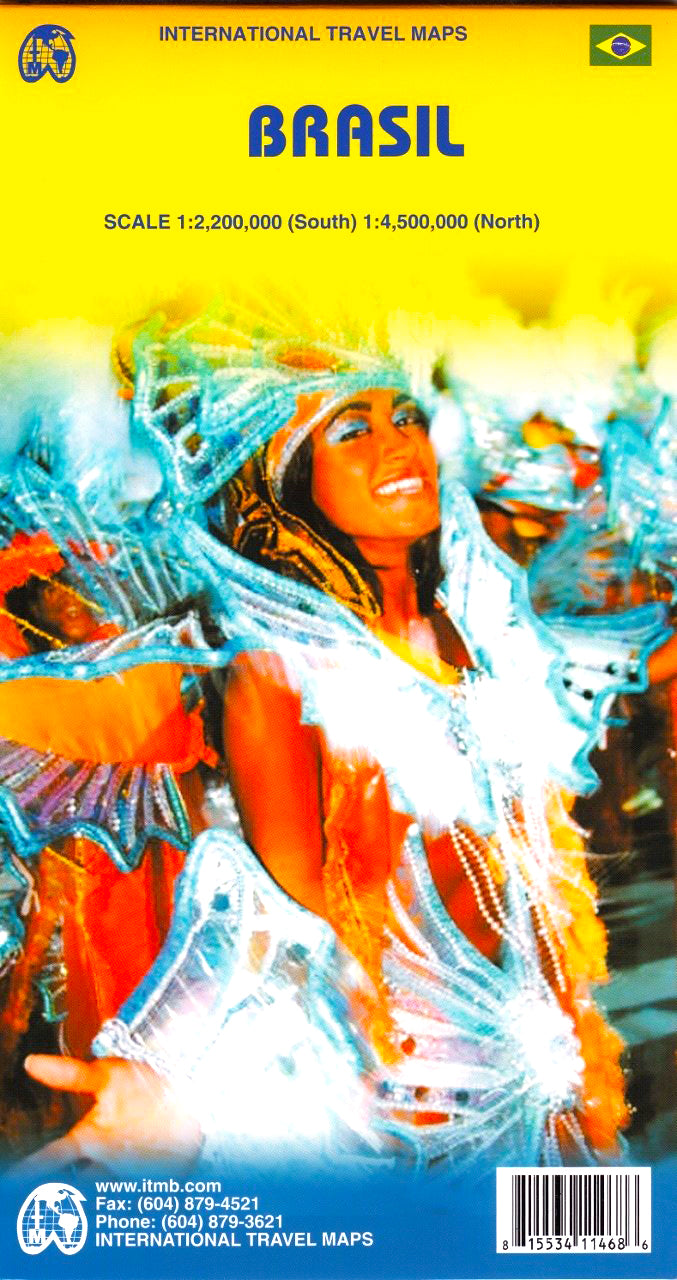
Brazil ITMB Map
$24.95
Afterpay is only available for orders between $50.00 and $1000.00 More info
🇧🇷 Double-Sided • Paper or Laminated • Updated Road Networks • Scale: 1:2,200,000 / 1:4,500,000
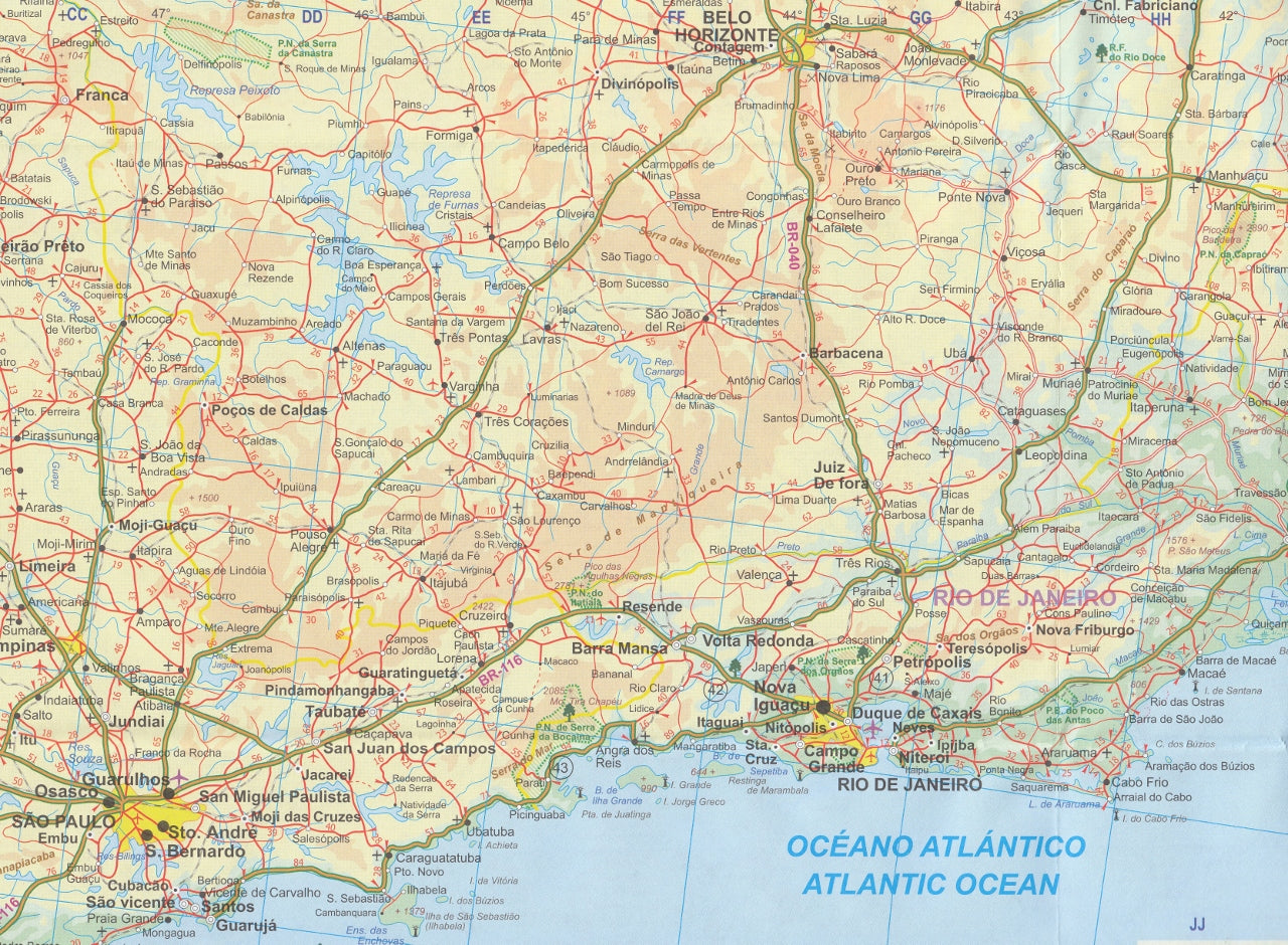
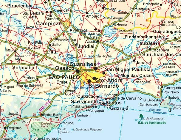
Discover the immense scale and diversity of Brazil with this comprehensive, double-sided map by ITMB – now available in its 4th edition. Covering one of the world's largest countries, this detailed travel map is an essential resource for travellers, educators, and anyone interested in South America’s most dynamic nation.
🗺️ Map Highlights
| Edition | 4th Edition (2008) |
|---|---|
| Format | Double-sided, printed on paper |
| Optional | Laminated for durability and reusability |
| Scale | 1:2,200,000 (South) / 1:4,500,000 (North) |
| Size | 690 mm × 1000 mm |
-
✅ Covers the entire country of Brazil in two detailed sections:
-
Southern Brazil at a larger, more detailed scale of 1:2,200,000
-
Northern Brazil at 1:4,500,000 for broader overview
-
-
🛣️ Shows updated highway and road networks, including recent improvements in the Amazon and interior regions
-
🗺️ Includes cities, towns, rivers, borders, terrain, and transport routes
-
🌐 Ideal for planning overland travel, educational use, or logistical reference
🧭 Optional Lamination Upgrade
Want a more durable version? We offer an optional laminated version, which allows you to:
-
Draw and erase using whiteboard markers
-
Apply removable map dots to mark places of interest
-
Protect your map from tears, stains, and moisture
📌 Laminated maps are created by flattening the folded paper map and sealing it in 80-micron gloss laminate. Some faint fold lines may remain visible.
🇧🇷 Why Choose This Map
Brazil is the fifth largest country in the world and the beating heart of South America—home to iconic cities like Rio de Janeiro, São Paulo, and Brasília, as well as the Amazon Rainforest, the Pantanal, and a long Atlantic coastline. This map captures it all in clear, travel-ready detail.
Whether you're:
-
Planning a trip to Iguaçu Falls
-
Exploring the interior road routes from Manaus to Cuiabá
-
Teaching about Latin American geography
-
Or just dreaming of Carnival…
This map is a practical and visually rich tool for understanding Brazil's vast and varied landscape.
📦 Delivery & Format Options
-
Standard format: Folded paper map
-
Optional upgrade: Laminated and shipped in a rigid tube
Take Brazil with you – on the road, in the classroom, or on your wall.


