- Australia ▾
- Topographic
▾
- Australia AUSTopo 250k (2025)
- Australia 50k Geoscience maps
- Australia 100k Geoscience maps
- Australia 250k Geoscience maps
- Australia 1:1m Geoscience maps
- New Zealand 50k maps
- New Zealand 250k maps
- New South Wales 25k maps
- New South Wales 50k maps
- New South Wales 100k maps
- Queensland 10k maps
- Queensland 25k maps
- Queensland 50k maps
- Queensland 100k maps
- Western Australia 25k maps
- Western Australia 50k maps
- Western Australia 100k maps
- Compasses
- Software
- GPS Systems
- International ▾
- Wall Maps
▾
- World
- Australia & New Zealand
- Countries, Continents & Regions
- Historical
- Vintage National Geographic
- Australian Capital Territory
- New South Wales
- Northern Territory
- Queensland
- South Australia
- Tasmania
- Victoria
- Western Australia
- Celestial
- Children's
- Mining & Resources
- Wine Maps
- Healthcare
- Postcode Maps
- Electoral Maps
- Nautical ▾
- Flags
▾
- Australian Flag Sets & Banners
- Flag Bunting
- Handwavers
- Australian National Flags
- Aboriginal Flags
- Torres Strait Islander Flags
- International Flags
- Flagpoles & Accessories
- Australian Capital Territory Flags
- New South Wales Flags
- Northern Territory Flags
- Queensland Flags
- South Australia Flags
- Tasmania Flags
- Victoria Flags
- Western Australia Flags
- Gifts ▾
- Globes ▾
Dear valued customer. Please note that our checkout is not supported by old browsers. Please use a recent browser to access all checkout capabilities


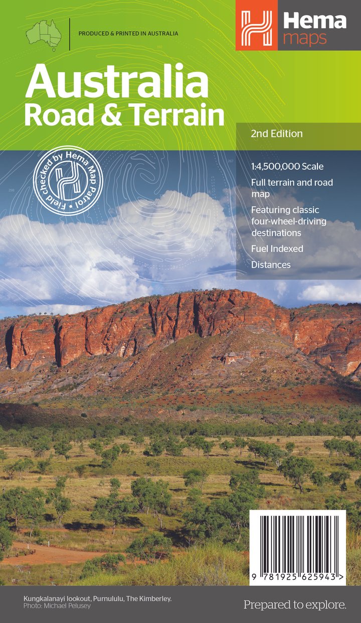
Australia Road & Terrain Map Hema
$15.95
Afterpay is only available for orders between $50.00 and $1000.00 More info
A richly detailed and visually stunning representation of Australia’s road networks and natural landscape — ideal for travellers, educators, planners, and map lovers alike
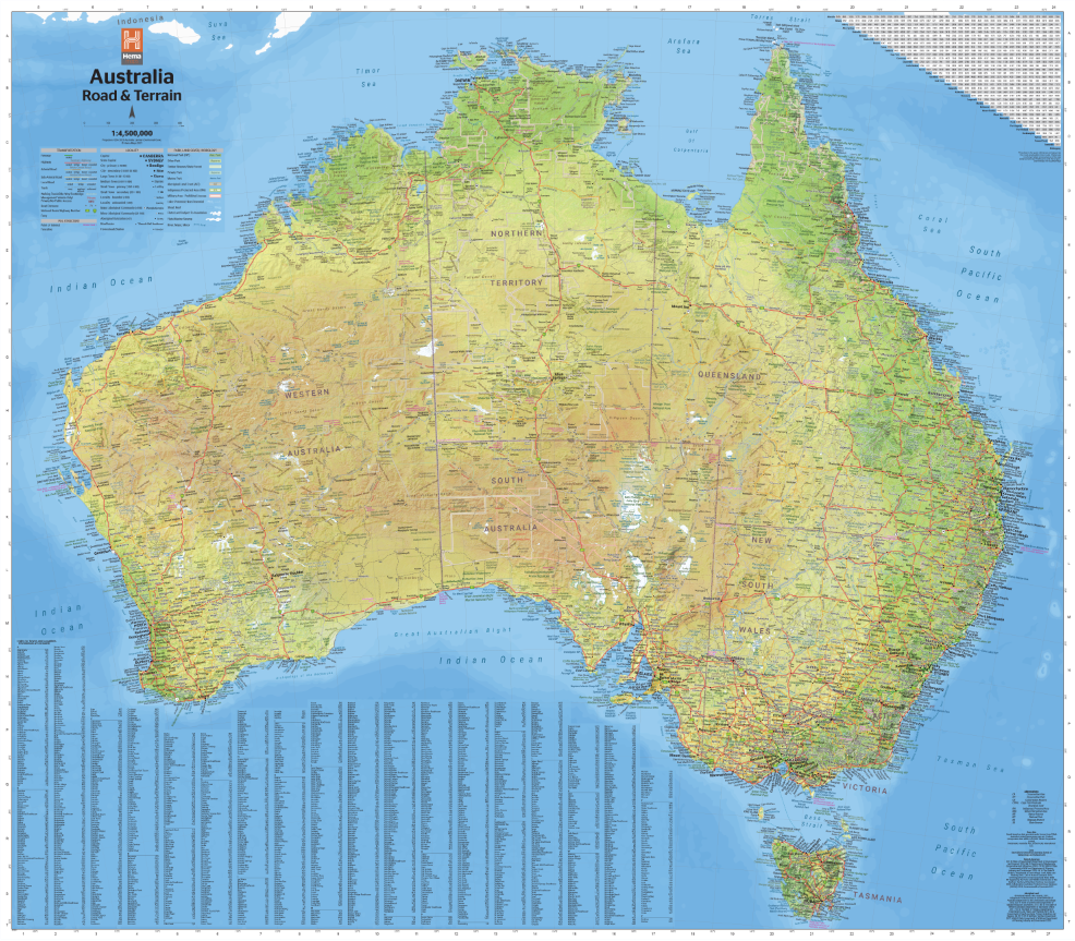
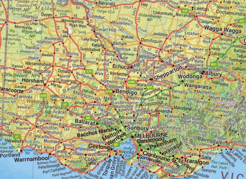
The Australia Road & Terrain Map by Hema Maps is more than just a road map — it’s a beautifully crafted reference and display piece that blends functional cartography with visual impact. Featuring a detailed network of roads and highways overlaid with contour shading, landform relief, and climate zone colours, this map paints a comprehensive picture of the Australian continent, perfect for planning epic journeys or understanding the geographic fabric of the nation.
Updated to its 2nd edition, this map incorporates the latest mapping data and combines Hema’s renowned touring expertise with high-resolution terrain rendering and critical travel information.
🗺️ Key Features
🚗 Detailed Road Network
-
Shows major highways, secondary roads, and regional connectors
-
Highlights sealed and unsealed roads, important for outback travel planning
-
Includes outback fuel stops, roadhouses, and 4WD tracks
-
Ideal for grey nomads, caravanners, and off-road enthusiasts
🏞️ Terrain Shading & Elevation
-
Uses hillshade relief based on a digital terrain model to depict mountains, ridges, valleys, and deserts
-
Visually conveys Australia's dramatic landscapes — from the red sands of the Simpson Desert to the peaks of the Snowy Mountains
-
Physical geography meets road infrastructure for a holistic view of the land
🌦️ Climate Zones
-
Colour-coded areas indicate climatic regions based on rainfall and temperature
-
Offers insight into arid, tropical, subtropical, temperate, and alpine zones
-
Perfect for understanding seasonal travel conditions or teaching geography
🌿 National Parks & Indigenous Lands
-
Clearly marks protected areas, including:
-
National parks
-
Marine parks
-
Aboriginal and Torres Strait Islander lands
-
-
Encourages respectful, informed travel and awareness of cultural heritage
📏 Additional Functional Layers
-
Distance grid for estimating travel between key locations
-
Town and locality index for quick reference
-
Major geographic landmarks, bodies of water, and state boundaries clearly labelled
-
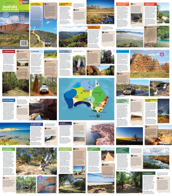
Reverse side includes touring region summaries, including:
-
Historical background
-
Geological features
-
Ecological zones
-
Iconic outback routes and 4WD highlights
-
📐 Specifications
-
Edition: 2nd Edition
-
Published: September 2021
-
Scale: 1:4,500,000
-
Flat Size: 1000 mm (W) x 875 mm (H)
-
Folded Size: 146 mm x 250 mm x 3 mm
-
Weight: Approx. 90 grams
-
Publisher: Hema Maps – Australia’s trusted name in exploration cartography
-
Printed in: Australia
📦 Available Formats
-
Folded Map – Ideal for use in the car, caravan, or camper. Compact and portable.
-
Flat Laminated Wall Map – Durable and wipe-clean; great for classrooms, offices, and planning spaces.
-
Canvas and Mega-Sized Prints – Optional in standard, supermap and mega map sizes.
🧭 Who It’s For
-
Travellers & Road Trippers – Plan and visualise routes across state lines or into remote areas with clarity and confidence
-
Educators & Students – A valuable classroom resource for teaching geography, climate zones, and landforms
-
Tourism Operators & Event Planners – Ideal for planning multi-region travel and interpreting road networks at a national level
-
Geography Enthusiasts – A collector’s item for anyone who appreciates a beautifully made map
-
Home and Office Decorators – Makes a striking and informative wall feature in any interior
See Australia from every angle.
From remote bush tracks to alpine passes, tropical coasts to red-dirt highways — the Hema Road & Terrain Map is your essential overview of the world’s sixth-largest country.
Informative. Decorative. Inspiring.
Plan with precision. Display with pride. Travel with confidence.
Frequently Asked Questions
Where can I buy the Australia Road & Terrain Map Hema?
The Australia Road & Terrain Map Hema is available to buy online from Mapworld, Australia's largest map and geographic product retailer, with fast shipping Australia-wide.
Is the Australia Road & Terrain Map Hema in stock at Mapworld?
Mapworld maintains extensive stock across its map range and aims for fast dispatch. Orders placed before 2pm AEST on business days are typically dispatched the same day, with standard and express Australia-wide delivery options available.
What is Mapworld's returns policy?
Mapworld accepts returns on undamaged items in original condition. Contact Mapworld within 90 days of purchase to arrange a return or exchange.
Does Mapworld ship the Australia Road & Terrain Map Hema across Australia?
Yes, Mapworld ships Australia-wide. Standard shipping is a flat $7 rate, with free standard shipping on orders over $75. Express options are available at checkout. Most orders placed before 2pm AEST on weekdays are dispatched same day.
Related Items


© 2026 Mapworld. Website designed by Genie Media
X