- Australia ▾
- Topographic
▾
- Australia AUSTopo 250k (2024)
- Australia 50k Geoscience maps
- Australia 100k Geoscience maps
- Australia 250k Geoscience maps
- Australia 1.1m Geoscience maps
- New Zealand 50k maps
- New Zealand 250k maps
- New South Wales 25k maps
- New South Wales 50k maps
- New South Wales 100k maps
- Queensland 10k maps
- Queensland 25k maps
- Queensland 50k maps
- Queensland 100k maps
- Compasses
- Software
- GPS Systems
- Orienteering
- International ▾
- Wall Maps
▾
- World
- Australia & New Zealand
- Countries, Continents & Regions
- Historical
- Vintage National Geographic
- Australian Capital Territory
- New South Wales
- Northern Territory
- Queensland
- South Australia
- Tasmania
- Victoria
- Western Australia
- Celestial
- Children's
- Mining & Resources
- Wine Maps
- Healthcare
- Postcode Maps
- Electoral Maps
- Nautical ▾
- Flags
▾
- Australian Flag Sets & Banners
- Flag Bunting
- Handwavers
- Australian National Flags
- Aboriginal Flags
- Torres Strait Islander Flags
- International Flags
- Flagpoles & Accessories
- Australian Capital Territory Flags
- New South Wales Flags
- Northern Territory Flags
- Queensland Flags
- South Australia Flags
- Tasmania Flags
- Victoria Flags
- Western Australia Flags
- Gifts ▾
- Globes ▾
Dear valued customer. Please note that our checkout is not supported by old browsers. Please use a recent browser to access all checkout capabilities


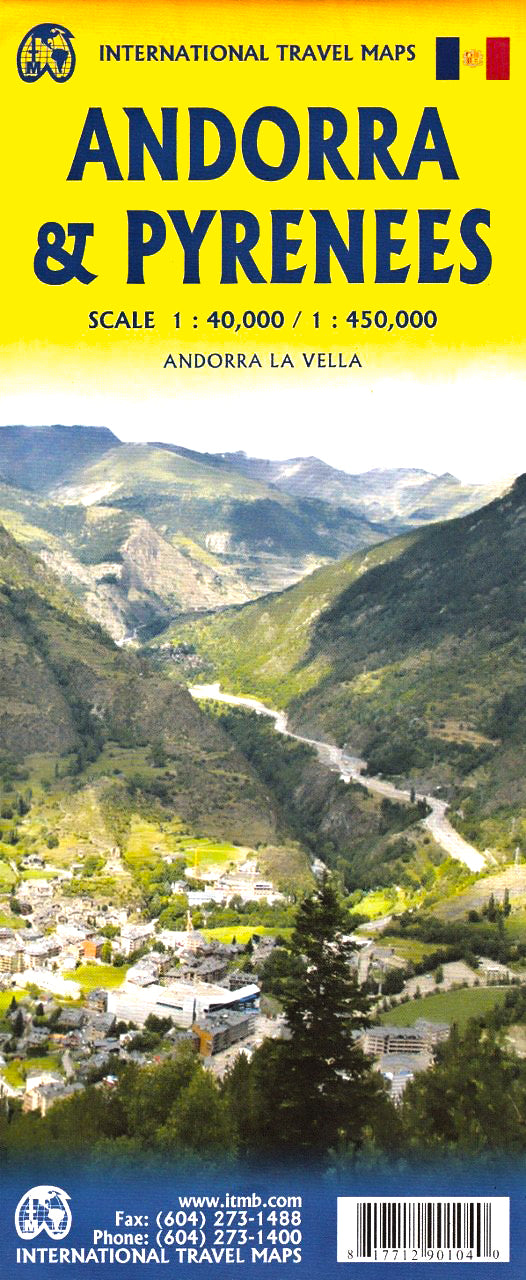
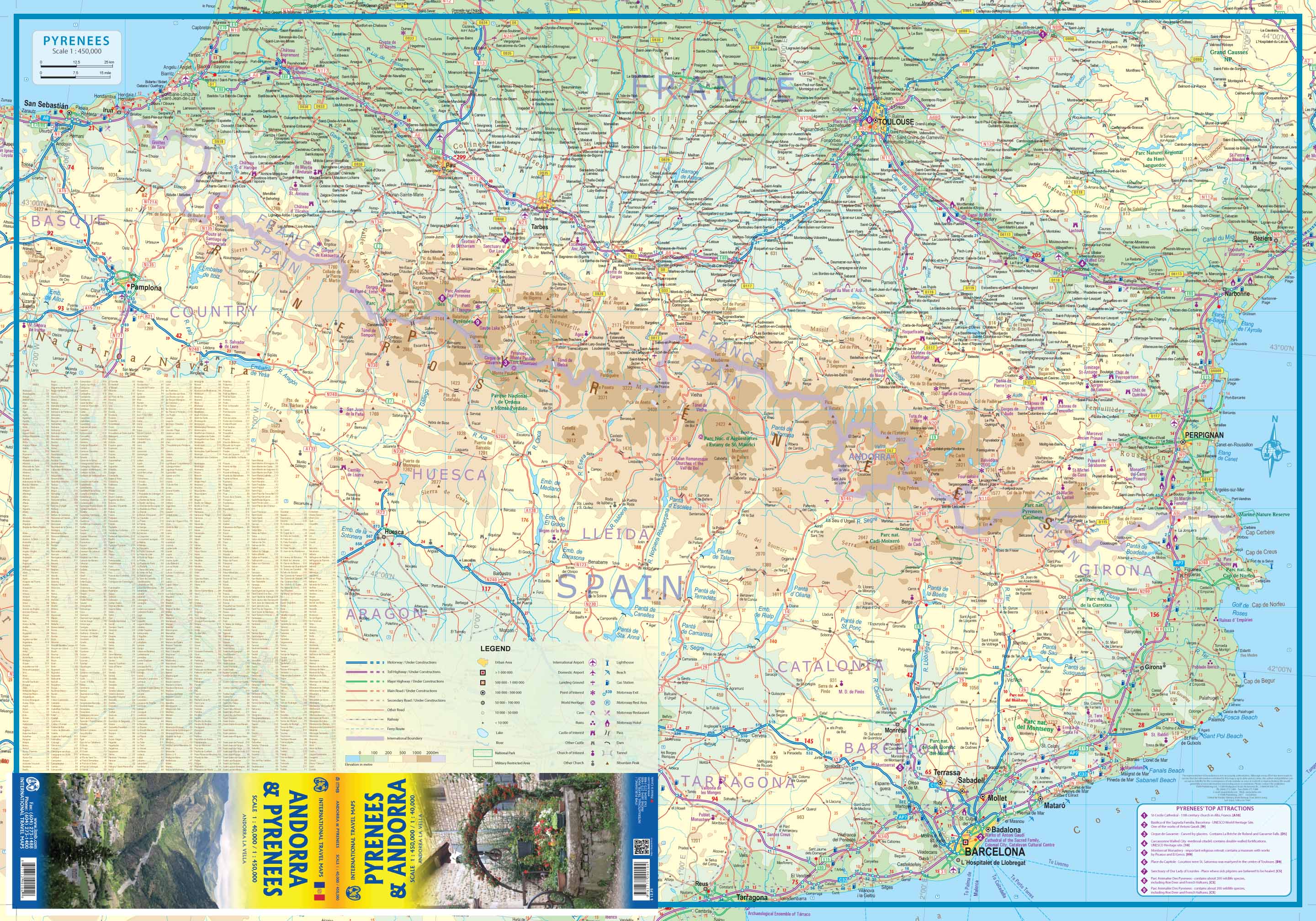
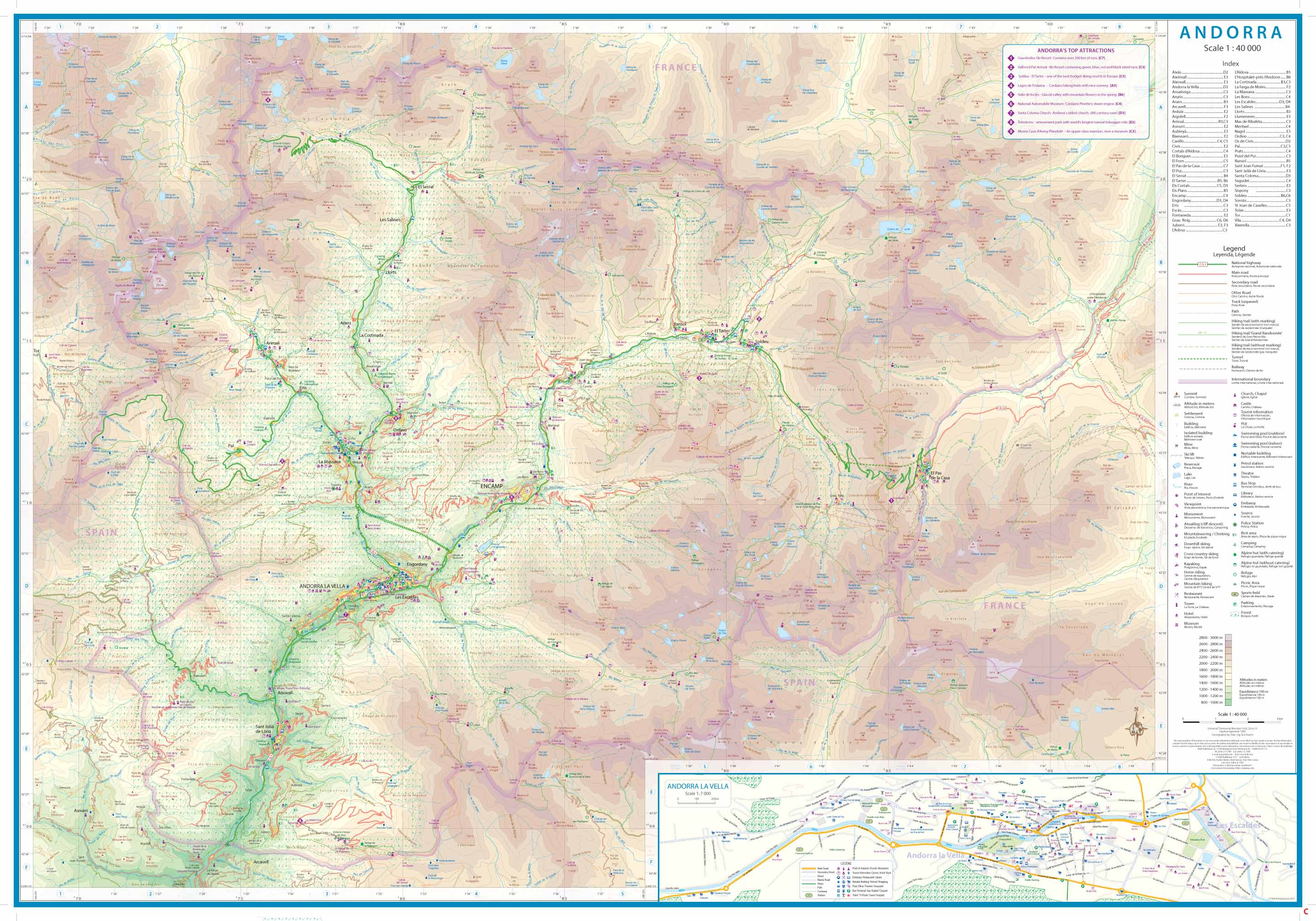
Andorra & The Pyrenees ITMB Map
$24.95
Afterpay is only available for orders between $50.00 and $1000.00 More info
🏔️ Andorra & The Pyrenees Travel Reference Map – ITMB
Scale: 1:40,000 (Andorra) / 1:450,000 (Pyrenees)
Map Dimensions: 690 mm x 990 mm
Edition: 1st/2nd Edition (2017)
Double-sided | Folded | Laminated option available
Discover the Peaks, Valleys, and Culture of the Pyrenees
Explore one of Europe's most scenic and historically rich mountain regions with the Andorra & The Pyrenees Map by ITMB. This beautifully designed, double-sided travel map covers both the expansive Pyrenees mountain chain—stretching from the Atlantic to the Mediterranean—and the compact yet fascinating Principality of Andorra.
Whether you're a road tripper, history lover, hiker, or ski enthusiast, this map offers detailed cartography for planning and adventure.
🗺️ Two Maps in One
This unique folded map is double-sided and dual-covered, allowing it to function as either a map of the Pyrenees or a detailed map of Andorra. Perfect for planning both macro-level itineraries and close-up regional excursions.
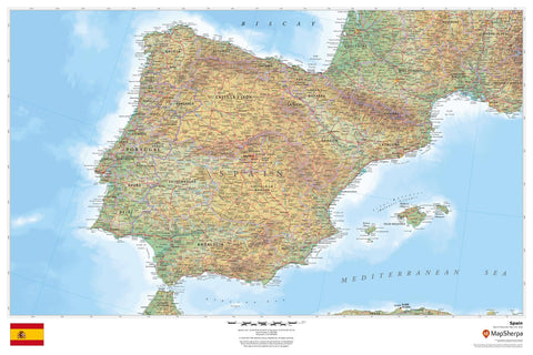
🔹 Side One – The Pyrenees (1:450,000)
Covers the full breadth of the Pyrenees mountain range from Pamplona in Spain to Beziers in France:
-
Atlantic to Mediterranean coastline
-
Major cities: Toulouse, Barcelona, Carcassonne, Huesca, Girona, and Pamplona
-
Regional highlights: Basque Country, Catalonia, Occitanie, and Andorra’s surrounding access routes
-
Includes major highways, national parks, mountain passes, towns, and points of interest
🔹 Side Two – Andorra (1:40,000)
A highly detailed, close-up map of the Principality of Andorra, including:
-
Full road network and terrain shading
-
Hiking and ski areas
-
Borders, mountain ranges, and river valleys
-
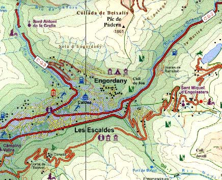
Inset map of Andorra La Vella, the nation’s capital
-
Duty-free shopping zones, cultural landmarks, and ski resorts
🧭 Practical Features
✅ Durable Lamination (Optional)
Encapsulated in high-quality 80-micron gloss laminate—ideal for marking routes with whiteboard pens or applying map dots without damaging the surface.
✅ Tear-Resistant & Reusable
Perfect for tour operators, classrooms, or seasoned travellers who return to the region year after year.
✅ Clear Cartography
Designed by ITMB with precise contouring, terrain shading, road hierarchies, national parks, and political boundaries clearly marked.
🇦🇩 Why Visit Andorra?
Nestled high in the heart of the Pyrenees, Andorra is a hidden gem of Europe. Known for its world-class ski slopes, duty-free shopping, and centuries-old independence, it offers a rich tapestry of history, alpine beauty, and unique cultural identity. This map is the only up-to-date printed reference to cover Andorra in this level of detail.
📏 Product Specifications
| Feature | Detail |
|---|---|
| Coverage | Andorra & Full Pyrenees Range |
| Scale | 1:40,000 (Andorra), 1:450,000 (Pyrenees) |
| Size | 690 mm (W) x 990 mm (H) |
| Edition | 1st/2nd Edition, 2017 |
| Publisher | ITMB – International Travel Maps |
| Format | Folded, Double-sided |
| Laminated Option | Yes (Encapsulated in 80-micron gloss film) |
🛒 Ideal For
-
Road trippers and campers exploring Spain and France
-
Hikers, climbers, and winter sports travellers
-
Cultural and historical travellers
-
Anyone visiting or researching Andorra
-
Geography teachers and schools
Add this dual-purpose travel map to your cart today and uncover the beauty of two iconic destinations in one convenient, durable format.
✈️ Order laminated for added protection and longevity. Please allow 7–10 working days for delivery of laminated versions due to custom encapsulation.