- Australia ▾
- Topographic
▾
- Australia AUSTopo 250k (2025)
- Australia 50k Geoscience maps
- Australia 100k Geoscience maps
- Australia 250k Geoscience maps
- Australia 1:1m Geoscience maps
- New Zealand 50k maps
- New Zealand 250k maps
- New South Wales 25k maps
- New South Wales 50k maps
- New South Wales 100k maps
- Queensland 10k maps
- Queensland 25k maps
- Queensland 50k maps
- Queensland 100k maps
- Western Australia 25k maps
- Western Australia 50k maps
- Western Australia 100k maps
- Compasses
- Software
- GPS Systems
- International ▾
- Wall Maps
▾
- World
- Australia & New Zealand
- Countries, Continents & Regions
- Historical
- Vintage National Geographic
- Australian Capital Territory
- New South Wales
- Northern Territory
- Queensland
- South Australia
- Tasmania
- Victoria
- Western Australia
- Celestial
- Children's
- Mining & Resources
- Wine Maps
- Healthcare
- Postcode Maps
- Electoral Maps
- Nautical ▾
- Flags
▾
- Australian Flag Sets & Banners
- Flag Bunting
- Handwavers
- Australian National Flags
- Aboriginal Flags
- Torres Strait Islander Flags
- International Flags
- Flagpoles & Accessories
- Australian Capital Territory Flags
- New South Wales Flags
- Northern Territory Flags
- Queensland Flags
- South Australia Flags
- Tasmania Flags
- Victoria Flags
- Western Australia Flags
- Gifts ▾
- Globes ▾
Dear valued customer. Please note that our checkout is not supported by old browsers. Please use a recent browser to access all checkout capabilities




4565-1 Cabbage Tree Creek 1:50k Topographic Map
$19.95
Afterpay is only available for orders between $50.00 and $1000.00 More info
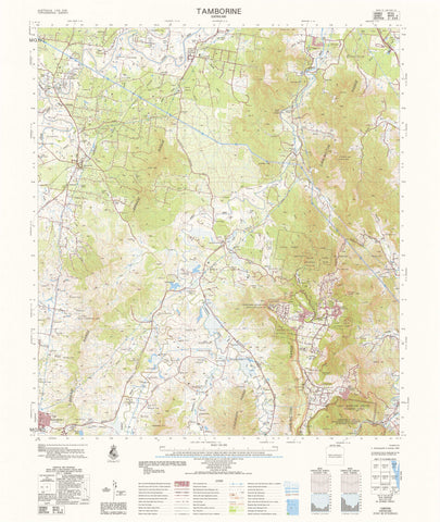
4565-1 Cabbage Tree Creek — 1:50,000 Topographic Map
The 4565-1 Cabbage Tree Creek 1:50,000 topographic sheet provides precise, high-clarity mapping across a diverse inland region featuring rugged hills, dissected slopes, narrow creek valleys, undulating plains, dense vegetation pockets and pastoral landscapes. Produced under Australia’s national 1:50k mapping program, this sheet delivers the dependable geographic detail required by emergency responders, environmental consultants, surveyors, engineers, land managers and experienced field navigators.
Contours, hydrology, vegetation, cultural features and access routes follow Australia’s standardised topographic symbology, ensuring clear, consistent interpretation for planning, analysis and field navigation.
🗺️ Map Content & Features
At 1:50,000 scale — 1 cm = 500 m, the Cabbage Tree Creek sheet includes:
-
Contours & Elevation: rugged hills, steep slopes, undulating plains, shallow basins and spot heights
-
Hydrology: Cabbage Tree Creek system, tributaries, narrow channels, ephemeral drainage lines and seasonal flow paths
-
Transport & Access: unsealed regional roads, pastoral tracks, steep 4WD routes, station access roads and remote trails
-
Cultural & Built Features: homesteads, tanks, yards, windmills, outstations and named locality features
-
Vegetation & Land Cover: dense scrub, woodland, open grassland, steep rocky surfaces and stony terrain
-
Administrative & Grid Framework: boundaries, coordinate grids and national mapping standards
-
Optimised for rugged topography: ideal for environmental studies, operational planning and technical navigation
🧭 Who Uses This Map?
The Cabbage Tree Creek 1:50k sheet is relied upon by:
-
Emergency services & SES — rugged terrain access analysis, search planning, hazard identification
-
Environmental consultants & scientists — ecological surveys, hydrological mapping, vegetation studies
-
Surveyors & civil engineers — terrain modelling, route feasibility, infrastructure assessment
-
Pastoral operators & land managers — muster planning, asset review, property management
-
Recreational users — 4WD enthusiasts, hikers, remote explorers, navigation trainees
-
Researchers & educators — geomorphology, upland landscape studies, environmental science
💧 Field-Ready Print Options
✅ Waterproof & Tear-proof Tyvek®
-
Printed on genuine DuPont™ Tyvek®
-
Fully waterproof, tear-resistant and UV-stable
-
Foldable like paper — ideal for rugged, steep and remote operating environments
✅ Laminated Edition
-
Encapsulated in 2 × 80-micron gloss laminate
-
Write-on / wipe-clean for whiteboard markers
-
Compatible with Mapworld map dots
-
Extremely durable — resists moisture, dust, heat and repeated use
📄 Standard Paper Edition
-
Crisp, high-resolution print
-
Ideal for office planning, documentation and map archives
📐 Map Details
| Field | Details |
|---|---|
| Title | 4565-1 Cabbage Tree Creek |
| Series | Australia 1:50,000 Topographic Series |
| Scale | 1:50,000 (1 cm = 500 m) |
| Coverage | Cabbage Tree Creek region — hills, valleys, plains & ephemeral drainage |
| Coordinates | Geographical & UTM |
| Datum | AGD66; later editions WGS84; AHD elevations |
| Projection | Universal Transverse Mercator (UTM) |
| Currency | Maps published 1968–2006 |
| Sheet Size | 600 mm (width) × 710 mm (height) |
| Material Options | Paper • Laminated • Tyvek® |
| Printed In | Australia |
🛒 Ordering & Options
-
Folded paper edition — compact, economical and convenient
-
Waterproof Tyvek® edition — ideal for rugged, steep or heavily vegetated terrain
-
Laminated edition — write-on/wipe-clean, perfect for operational planning and fieldwork
🎯 Summary
The 4565-1 Cabbage Tree Creek — 1:50,000 Topographic Map provides essential mid-scale mapping across a rugged and varied inland environment shaped by steep hills, dissected terrain and the Cabbage Tree Creek system. With detailed contours, hydrology, vegetation mapping and durable print formats, this sheet is indispensable for emergency responders, surveyors, environmental professionals, land managers and adventurous travellers.
Work clearly.
Plan confidently.
Navigate precisely.
Frequently Asked Questions
What area does the 4565-1 Cabbage Tree Creek 1:50k Topographic Map cover?
This topographic map covers the area named in the product title. It shows elevation contours, terrain features, waterways, roads, tracks, and key landmarks at 1:50,000 scale.
What scale is this topographic map?
This map is at 1:50,000 scale. Australian topographic maps are commonly produced at 1:25,000, 1:50,000, and 1:100,000 scales — the scale determines the level of detail and the area shown.
Is this map suitable for bushwalking and hiking?
Yes, topographic maps are the standard navigation tool for bushwalking, hiking, and off-track travel. They show contour lines, walking tracks, water sources, and terrain hazards.
Is this the most current edition available?
Mapworld stocks the most current editions available. Australian topographic maps are produced by Geoscience Australia or state mapping agencies and updated periodically.
Does Mapworld ship the 4565-1 Cabbage Tree Creek 1:50k Topographic Map across Australia?
Yes, Mapworld ships Australia-wide. Standard shipping is a flat $7 rate, with free standard shipping on orders over $75. Express options are available at checkout. Most orders placed before 2pm AEST on weekdays are dispatched same day.
Related Items


© 2026 Mapworld. Website designed by Genie Media


X