- Australia ▾
- Topographic
▾
- Australia AUSTopo 250k (2024)
- Australia 50k Geoscience maps
- Australia 100k Geoscience maps
- Australia 250k Geoscience maps
- Australia 1.1m Geoscience maps
- New Zealand 50k maps
- New Zealand 250k maps
- New South Wales 25k maps
- New South Wales 50k maps
- New South Wales 100k maps
- Queensland 10k maps
- Queensland 25k maps
- Queensland 50k maps
- Queensland 100k maps
- Compasses
- Software
- GPS Systems
- Orienteering
- International ▾
- Wall Maps
▾
- World
- Australia & New Zealand
- Countries, Continents & Regions
- Historical
- Vintage National Geographic
- Australian Capital Territory
- New South Wales
- Northern Territory
- Queensland
- South Australia
- Tasmania
- Victoria
- Western Australia
- Celestial
- Children's
- Mining & Resources
- Wine Maps
- Healthcare
- Postcode Maps
- Electoral Maps
- Nautical ▾
- Flags
▾
- Australian Flag Sets & Banners
- Flag Bunting
- Handwavers
- Australian National Flags
- Aboriginal Flags
- Torres Strait Islander Flags
- International Flags
- Flagpoles & Accessories
- Australian Capital Territory Flags
- New South Wales Flags
- Northern Territory Flags
- Queensland Flags
- South Australia Flags
- Tasmania Flags
- Victoria Flags
- Western Australia Flags
- Gifts ▾
- Globes ▾
Dear valued customer. Please note that our checkout is not supported by old browsers. Please use a recent browser to access all checkout capabilities


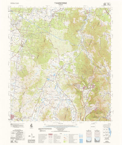
1929-1 Rosa 1:50k Topographic Map
$19.95
Afterpay is only available for orders between $50.00 and $1000.00 More info
1929-1 Rosa — 1:50,000 Topographic Map
The 1929-1 Rosa 1:50,000 topographic sheet provides clear, authoritative terrain detail across its mapped district, capturing landforms, access routes, hydrology, vegetation, infrastructure and cadastral information at a practical field scale. Produced as part of Australia’s national 1:50k mapping program, this sheet supports emergency response, resource management, engineering planning, land navigation, and environmental assessment.
Topographic maps at this scale depict contours, spot heights, waterways, roads, tracks, buildings, place names, administrative boundaries and vegetation — offering a reliable foundation for both professional and recreational use.
🗺️ Map Content & Features
At 1:50,000 scale — 1 cm = 500 m, the Rosa sheet includes:
-
Contours & Elevation: landform representation including ridges, slopes, plains and spot heights
-
Hydrology: rivers, creeks, drainage lines, waterholes and wetland features
-
Transport & Access: major and minor roads, 4WD tracks, trails, infrastructure routes
-
Cultural & Built Features: buildings, facilities, landmarks, named localities
-
Vegetation & Surface Cover: woodland, scrub, open areas and mapped vegetation boundaries
-
Administrative & Cadastral Detail: state boundaries, local administrative zones and related mapping
-
Professional Topographic Symbology: standardised mapping conventions suitable for technical fieldwork
Drawn from authoritative national geospatial datasets.
🧭 Who Uses This Map?
Ideal for users requiring dependable mid-scale terrain detail:
-
Emergency services & SES — response planning, search and rescue, hazard identification
-
Environmental managers — vegetation studies, catchment assessment, conservation planning
-
Surveyors & engineers — route design, terrain evaluation, site feasibility
-
Land managers & pastoral operators — property planning, track maintenance, resource monitoring
-
Recreational users — walkers, 4WD explorers, hunters, navigation training
-
Researchers & educators — geomorphology, geography, land-use mapping
💧 Field-Ready Print Options
✅ Waterproof & Tear-proof Tyvek®
-
Printed on genuine DuPont™ Tyvek®
-
Fully waterproof, tear-resistant, UV-stable
-
Foldable like paper — ideal for fieldwork, remote travel, and rugged use
✅ Laminated Edition
-
Encapsulated in 2 × 80-micron gloss laminate
-
Write-on / wipe-clean surface for whiteboard markers
-
Compatible with Mapworld map dots
-
Highly durable and protected against moisture, dirt, and tearing
📄 Standard Paper Edition
-
Crisp, high-resolution print
-
Ideal for office use, training, planning, or archiving
📐 Map Details
| Field | Details |
|---|---|
| Title | 1929-1 Rosa |
| Series | Australia 1:50,000 Topographic Series |
| Scale | 1:50,000 (1 cm = 500 m) |
| Coverage | Partial national coverage, concentrated in northern Australia, major transport corridors & selected regions |
| Coordinates | Geographical & UTM |
| Datum | AGD66; later editions on WGS84; AHD used for elevations |
| Projection | Universal Transverse Mercator (UTM) |
| Currency | Maps published 1968–2006 |
| Sheet Size | 600 mm (width) × 710 mm (height) |
| Material Options | Paper • Laminated • Tyvek® |
| Printed In | Australia |
For full national coverage, see: Australia 1:50k Indexes.
🛒 Ordering & Options
-
Folded paper edition — easy storage, great for quick reference
-
Waterproof Tyvek® edition — the preferred choice for outdoors and field operations
-
Laminated edition — write-on/wipe-clean, perfect for planning and repeated use
🎯 Summary
The 1929-1 Rosa — 1:50,000 Topographic Map delivers dependable, mid-scale geographic detail trusted by emergency services, surveyors, environmental professionals, land managers and recreational navigators. With contours, hydrology, transport networks, vegetation mapping, and robust printing options — it is a versatile and essential reference for planning, analysis, and field navigation.
Work clearly.
Plan confidently.
Navigate precisely.