- Australia ▾
- Topographic
▾
- Australia AUSTopo 250k (2025)
- Australia 50k Geoscience maps
- Australia 100k Geoscience maps
- Australia 250k Geoscience maps
- Australia 1:1m Geoscience maps
- New Zealand 50k maps
- New Zealand 250k maps
- New South Wales 25k maps
- New South Wales 50k maps
- New South Wales 100k maps
- Queensland 10k maps
- Queensland 25k maps
- Queensland 50k maps
- Queensland 100k maps
- Western Australia 25k maps
- Western Australia 50k maps
- Western Australia 100k maps
- Compasses
- Software
- GPS Systems
- International ▾
- Wall Maps
▾
- World
- Australia & New Zealand
- Countries, Continents & Regions
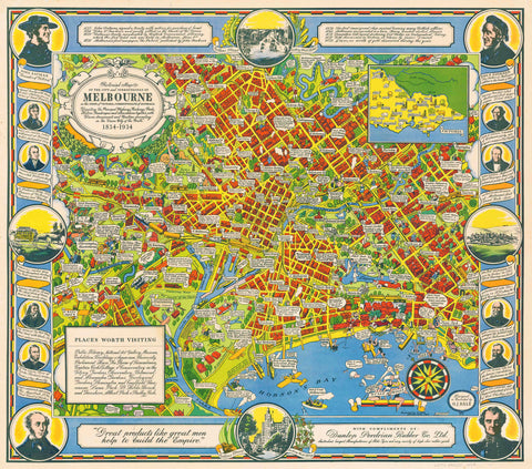
- Historical
- Vintage National Geographic
- Australian Capital Territory
- New South Wales
- Northern Territory
- Queensland
- South Australia
- Tasmania
- Victoria
- Western Australia
- Celestial
- Children's
- Mining & Resources
- Wine Maps
- Healthcare
- Postcode Maps
- Electoral Maps
- Nautical ▾
- Flags
▾
- Australian Flag Sets & Banners
- Flag Bunting
- Handwavers
- Australian National Flags
- Aboriginal Flags
- Torres Strait Islander Flags
- International Flags
- Flagpoles & Accessories
- Australian Capital Territory Flags
- New South Wales Flags
- Northern Territory Flags
- Queensland Flags
- South Australia Flags
- Tasmania Flags
- Victoria Flags
- Western Australia Flags
- Gifts ▾
- Globes ▾
Dear valued customer. Please note that our checkout is not supported by old browsers. Please use a recent browser to access all checkout capabilities


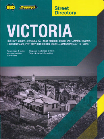
Victoria - Maps, Guides, Road Atlases, Digital Mapping & Street Directories
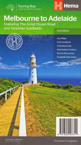
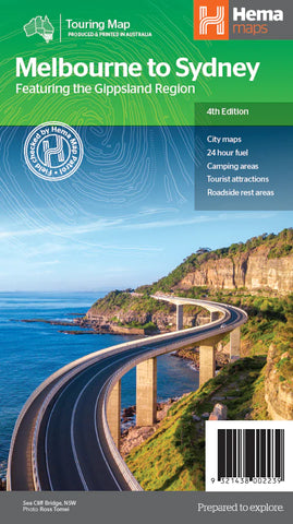
Victoria wall maps, road atlases, folded maps, and street directories provide a detailed and reliable way to navigate one of Australia’s most varied and vibrant states. From Melbourne’s complex suburban sprawl to the Great Ocean Road, the High Country, and the rural heartland, these maps cover every corner with clarity and precision.
Our collection includes large-format wall maps ideal for planning and display, robust road atlases for long-distance travel and touring, compact folded maps for easy reference on the go, and comprehensive street directories for navigating Melbourne and regional centres. Whether you're commuting, exploring, teaching, or managing logistics, Victoria maps are essential tools for understanding and moving through the state with confidence.


About Victoria Maps
Victoria is Australia's smallest mainland state by area but its most diverse for map demand. Within 230,000 square kilometres you have Melbourne — Australia's second-largest metropolis — alongside iconic touring routes (the Great Ocean Road, the Murray River drive), wine regions (Yarra Valley, Mornington Peninsula, Rutherglen), serious 4WD country in the Victorian High Country, the rugged Grampians, the wild coast of Wilsons Promontory and Gippsland, and the historic Goldfields towns of Ballarat and Bendigo. Each demands different cartography.
Mapworld stocks Victoria maps from every major Australian publisher — Hema, UBD-Gregory's, Spatial Vision (the Victorian topographic specialist), Rooftop Maps (4WD adventure), Meridian Maps and the Vicmap state series. Spatial Vision in particular produces the definitive Victorian topographic and adventure maps for bushwalking and 4WD touring.
Victoria Map Types Explained
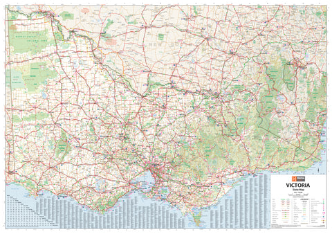
Touring & Wall Maps
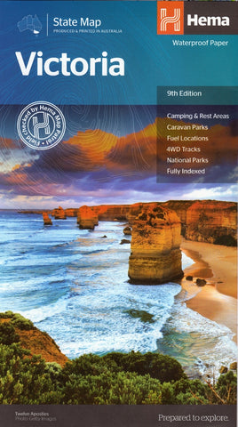
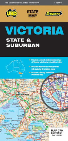
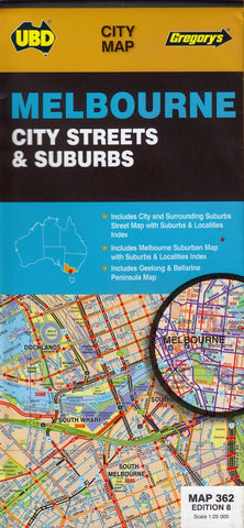
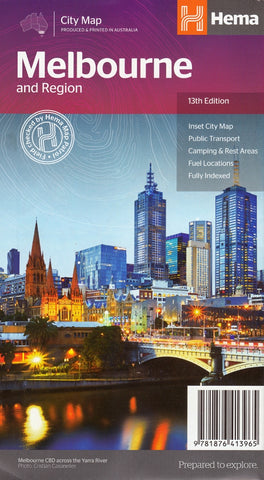
The Hema Victoria State Map is the standard touring reference — folded for glove-box use or laminated as a wall map for office and classroom display. The UBD 370 Victoria State and Suburban Map provides combined state-wide and Melbourne metro coverage in a single double-sided format. For Melbourne metro specifically, the UBD 362 Melbourne map is the standard street-level reference.
Victorian High Country & 4WD Maps
Victoria's High Country is one of Australia's premier 4WD destinations. Hema and Spatial Vision produce the most comprehensive coverage:
- Hema High Country Victoria Atlas & Guide — the comprehensive trip-planning resource
- Hema Victorian High Country in NE / NW / SE 1:100k regional sheets — detailed coverage of the alpine region
- Hema High Country Megamap (1673 × 1430mm laminated) and Supermap (1170 × 1000mm) wall map formats
- Boiling Billy 4WD Treks of the High Country — guidebook with 26 alpine 4WD adventures
Regional & Adventure Maps
Spatial Vision and Rooftop Maps produce the specialist Victorian regional and outdoor range:
- Wilsons Promontory topographic and adventure maps
- Mornington Peninsula 4WD Meridian map
- Mt Disappointment / Kinglake Ranges Rooftop activity map
- Jamieson / Licola Rooftop adventure map
- Kosciuszko alpine area (NSW border crossings) Spatial Vision topographic
- Blue Mountains South / North NSW topographic by Spatial Vision (popular crossover for VIC bushwalkers)
Topographic Maps
Victorian topographic sheets are published by Vicmap at 1:25k and 1:50k scales — the standard for bushwalking, orienteering, emergency services and fieldwork. Spatial Vision also produces commercial-quality topographic maps for the major bushwalking destinations. The Geoscience Australia 1:250k AUSTopo series provides broader topographic coverage.
Postcode, Electoral & LGA Maps
Victoria & Melbourne Postcode Laminated Wall Map covers state-wide postcode boundaries. Victoria Local Government Areas Wall Map shows every council, shire and city boundary across the state. Victoria Electoral Divisions and LGA Map (Melbourne area) combines federal electorate boundaries with LGA — ideal for political analysis, government affairs and journalism.
Marine & Nautical Charts
Victoria's coastline is covered by official AUS-numbered Australian Hydrographic Service charts. AUS 143 Port Phillip is the essential chart for Melbourne-based boating; AUS 151 Western Port Entrance covers the eastern bay; additional charts cover Bass Strait, Wilsons Promontory and the Gippsland Lakes.
Choosing the Right Victoria Map by Region
| Region | Recommended map |
|---|---|
| Melbourne metro / suburbs | UBD 362 Melbourne Suburban map (folded or laminated wall) |
| Mornington Peninsula / Phillip Island | Mornington Peninsula 4WD Meridian map + UBD 385 Geelong & Bellarine |
| Yarra Valley / Dandenongs | Hema Victoria State + Mt Disappointment Rooftop activity map |
| Great Ocean Road / Otways | Hema Victoria State + UBD 385 Geelong & Bellarine |
| Grampians National Park | UBD 382 Ballarat & Grampians Spa Country |
| Victorian High Country (4WD) | Hema High Country Atlas & Guide + the 1:100k regional sheets |
| Wilsons Promontory bushwalking | Wilsons Promontory topographic by Spatial Vision |
| Goldfields (Ballarat / Bendigo) | UBD 382 Ballarat & Grampians map |
| Real estate / sales / electoral planning | Victoria Postcode wall map + Victoria Electoral / LGA map |
| Port Phillip boating | AUS 143 Port Phillip nautical chart |
Why Buy Victoria Maps from Mapworld
- Largest specialist Victoria range — over 110 Victoria products in stock
- Spatial Vision & Rooftop Maps depth — comprehensive coverage of the Victorian topographic and adventure specialists
- Current editions only — we rotate stock with each new release
- Free shipping over $75 Australia-wide, flat $7 below that
- Custom mapping service — postcode overlays, sales territories, healthcare catchments, mining tenement maps
- Knowledgeable support — call 1300 795 697 for trip planning or product recommendations
Frequently Asked Questions
What is the best map for the Victorian High Country?
The Hema High Country Victoria Atlas & Guide is the comprehensive trip-planning resource. For in-vehicle navigation, pair it with the relevant 1:100k regional sheets (NE, NW or SE depending on your route). For wall-mounted planning at home, the High Country Megamap or Supermap.
Are these the latest editions of Victoria maps?
Yes. Mapworld stocks current editions only. Each product page lists the edition number and publication year. When publishers release new editions, we rotate stock to the new version.
Do you ship Victoria maps interstate?
Yes. Mapworld ships Australia-wide from our Perth warehouse. Free shipping on orders over $75, flat $7 below that. Most metro deliveries arrive in 2 to 5 business days. Express options available at checkout.
What is the difference between Spatial Vision and Vicmap topographic maps?
Vicmap is the official Victorian government topographic series at 1:25k and 1:50k — the authoritative reference for emergency services, surveying and detailed terrain navigation. Spatial Vision produces commercially-published topographic maps focused on the major bushwalking and adventure destinations, often with additional trail and interest-point overlays. Bushwalkers commonly use Spatial Vision; emergency services and surveyors typically need Vicmap sheets.
Can I get a custom Victoria postcode or sales-territory map?
Yes. Mapworld runs a custom mapping service for businesses needing branded or modified Victoria maps including postcode and electoral overlays, sales-territory colouring, healthcare service catchments, and fleet planning maps.
How quickly does Mapworld dispatch Victoria orders?
Orders placed before 2 pm AWST on weekdays dispatch same-day from our Perth warehouse. Australia-wide delivery typically takes 2 to 7 business days via Australia Post.
© 2026 Mapworld. Website designed by Genie Media
X