- Australia ▾
- Topographic
▾
- Australia AUSTopo 250k (2025)
- Australia 50k Geoscience maps
- Australia 100k Geoscience maps
- Australia 250k Geoscience maps
- Australia 1:1m Geoscience maps
- New Zealand 50k maps
- New Zealand 250k maps
- New South Wales 25k maps
- New South Wales 50k maps
- New South Wales 100k maps
- Queensland 10k maps
- Queensland 25k maps
- Queensland 50k maps
- Queensland 100k maps
- Western Australia 25k maps
- Western Australia 50k maps
- Western Australia 100k maps
- Compasses
- Software
- GPS Systems
- International ▾
- Wall Maps
▾
- World
- Australia & New Zealand
- Countries, Continents & Regions
- Historical
- Vintage National Geographic
- Australian Capital Territory
- New South Wales
- Northern Territory
- Queensland
- South Australia
- Tasmania
- Victoria
- Western Australia
- Celestial
- Children's
- Mining & Resources
- Wine Maps
- Healthcare
- Postcode Maps
- Electoral Maps
- Nautical ▾
- Flags
▾
- Australian Flag Sets & Banners
- Flag Bunting
- Handwavers
- Australian National Flags
- Aboriginal Flags
- Torres Strait Islander Flags
- International Flags
- Flagpoles & Accessories
- Australian Capital Territory Flags
- New South Wales Flags
- Northern Territory Flags
- Queensland Flags
- South Australia Flags
- Tasmania Flags
- Victoria Flags
- Western Australia Flags
- Gifts ▾
- Globes ▾
Dear valued customer. Please note that our checkout is not supported by old browsers. Please use a recent browser to access all checkout capabilities


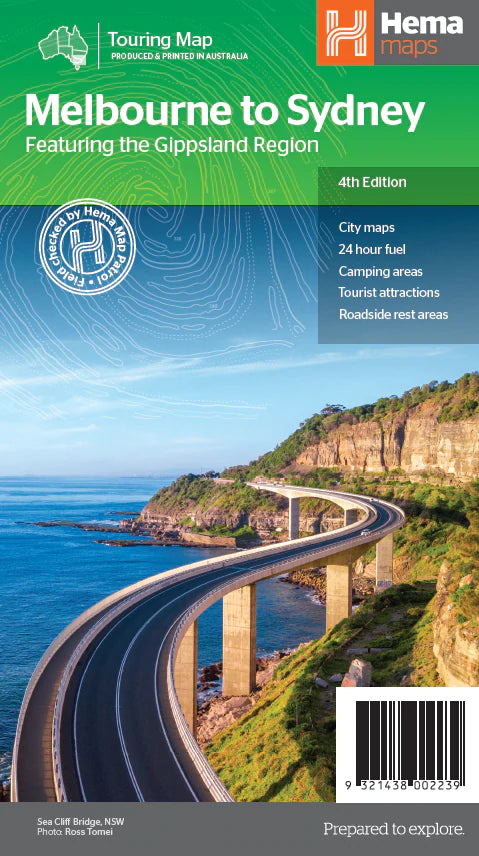
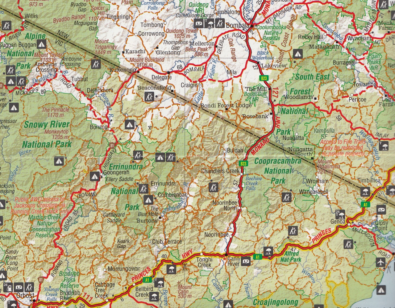
Melbourne to Sydney Hema Map
$14.95 $15.95
Afterpay is only available for orders between $50.00 and $1000.00 More info
Follow the Princes or Hume Highway | Full-Colour Touring Map | National Parks, City Insets & Scenic Routes
Embark on one of Australia’s most iconic overland journeys with the Hema Melbourne to Sydney City to City Map—an expertly crafted navigation guide designed to enhance every kilometre of your adventure between the nation’s two largest cities. Whether you're chasing ocean views along the Princes Highway or taking the fast inland route via the Hume Highway, this comprehensive map brings clarity, detail, and inspiration to every leg of your trip.
This is not just a road map—it's a curated travel companion, ideal for holidaymakers, grey nomads, caravanners, road-trippers, and families planning a drive that’s as memorable as the destination itself.
🧭 Your Journey, Your Way
Explore two distinctly different travel experiences on one beautifully designed map:
-
🛣 The Hume Highway – The direct inland route for faster travel through regional Victoria and New South Wales
-
🌊 The Princes Highway – A scenic meander along the coast, passing through charming seaside towns and national parks
Whichever route you choose, or if you decide to combine both into a looping itinerary, this map ensures you don’t miss a thing.
🗺️ Key Features
-
Detailed Highway Coverage
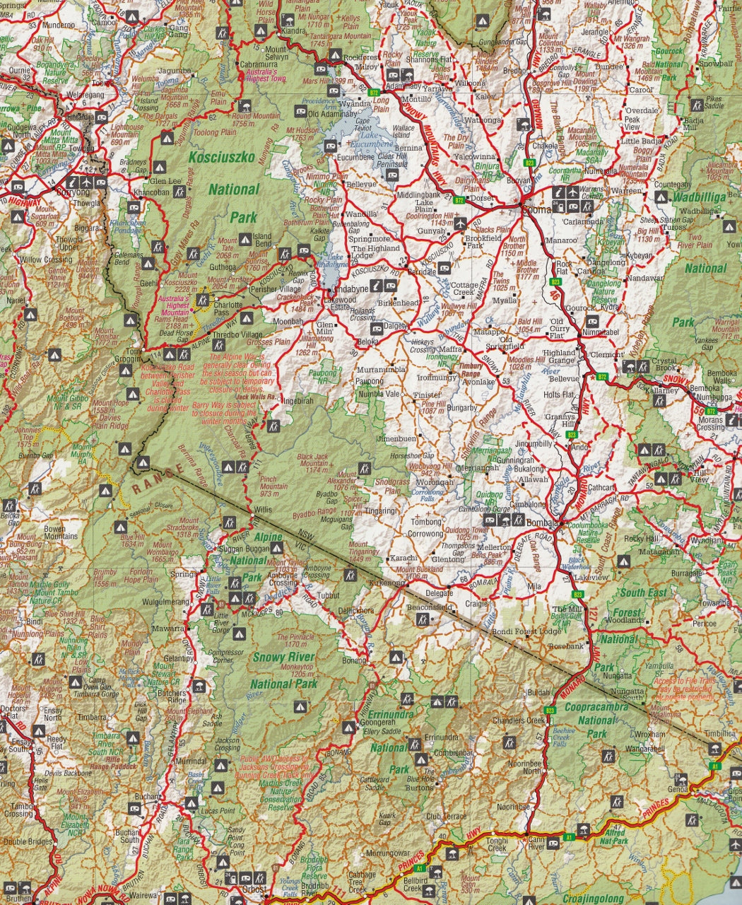
Both the Hume and Princes Highways are shown in detail, with all major and minor connecting roads included to help you explore further afield. -
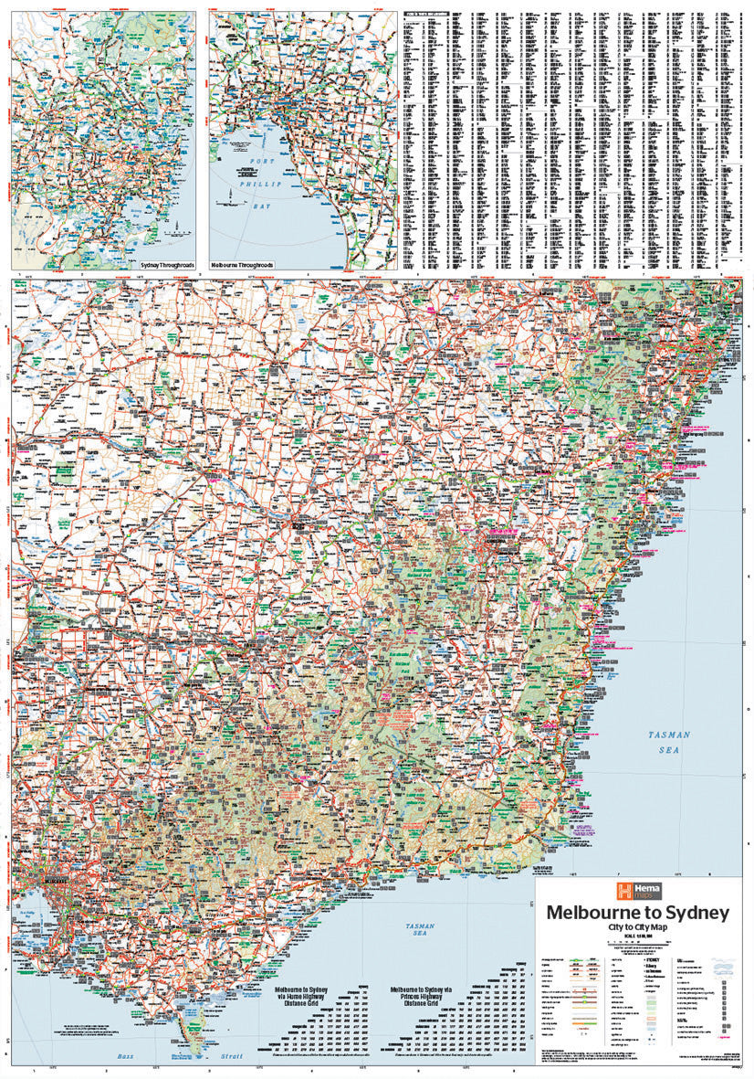
Inset Maps of Major Cities
Navigate the complexities of Australia’s biggest urban centres with detailed insets of:-
Greater Sydney
-
Greater Melbourne
-
These enlarged maps help you transition smoothly from highway to city driving without confusion.
-
Points of Interest
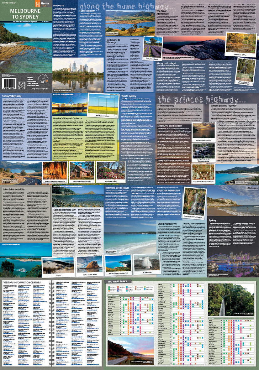
Highlights tourist attractions, cultural landmarks, and natural wonders along the way, making it easy to plan rewarding detours and photo stops. -
National & State Parks
Easily identify protected areas and reserves, from Coastal National Parks to High Country Forests, perfect for bushwalking, picnicking or camping. -
24-Hour Fuel Locations
Plan fuel stops strategically—especially helpful when travelling through remote areas where stations may be few and far between. -
Camping & Rest Areas
Symbols clearly mark rest stops, caravan parks, free campsites, and designated campgrounds, ideal for those touring in RVs or campervans. -
Photographic Highlights
Beautiful imagery and descriptive travel text offer inspiration and insight into key locations and hidden gems along your route. -
Distance Grid
Save time and reduce guesswork with a handy distance chart, making trip planning more efficient and accurate.
📐 Map Specifications
| Specification | Detail |
|---|---|
| Scale | 1:900,000 |
| Unfolded Size | 700 mm (W) × 1000 mm (H) |
| Format | Folded touring map (flat-rolled optional) |
| Publisher | Hema Maps – Australia’s most trusted cartographer |
| Edition | Latest available version |
| Material | High-quality paper stock (laminated version available upon request) |
🧳 Who Is This Map For?
-
Self-Drive Travellers – Plan every stop with confidence
-
Campers & Caravaners – Spot campsites and RV-friendly areas with ease
-
Grey Nomads & Retirees – Take the scenic route at your own pace
-
Nature Lovers & Photographers – Discover coastal lookouts and inland vistas
-
Family Holiday Planners – Find family-friendly stops, wildlife parks, and playgrounds
-
Geography Teachers & Students – A fantastic educational resource for understanding regional connections
📦 Packaging & Delivery
-
Ships folded (standard) – Compact, lightweight, and glovebox-friendly
-
Flat-rolled option available – Ideal for pinning or display
-
Laminated upgrade available – Protects your map on extended road trips or outdoor use
-
Typically ships within 1 business day
🛒 Complement Your Journey
Pair this map with:
-
Hema New South Wales and Victoria State Maps – For even greater detail off the main route
-
Camps Australia Wide Guide – For comprehensive campsite listings
-
Hema Road & 4WD Atlas – A complete driving and off-road companion
🧭 The Ultimate Travel Tool for One of Australia's Great Drives
From surf beaches and fishing villages to rolling farmlands and rugged ranges, the journey between Melbourne and Sydney offers an incredible cross-section of Australian life and landscape. With the Hema Melbourne to Sydney City to City Map, you’ll have everything you need at your fingertips to make your road trip safe, enjoyable, and unforgettable.
Add it to your cart today, and take the road less travelled—or the quickest route—with confidence and clarity.
Frequently Asked Questions
Where can I buy the Melbourne to Sydney Hema Map?
The Melbourne to Sydney Hema Map is available to buy online from Mapworld, Australia's largest map and geographic product retailer, with fast shipping Australia-wide.
Is the Melbourne to Sydney Hema Map in stock at Mapworld?
Mapworld maintains extensive stock across its map range and aims for fast dispatch. Orders placed before 2pm AEST on business days are typically dispatched the same day, with standard and express Australia-wide delivery options available.
What is Mapworld's returns policy?
Mapworld accepts returns on undamaged items in original condition. Contact Mapworld within 90 days of purchase to arrange a return or exchange.
Does Mapworld ship the Melbourne to Sydney Hema Map across Australia?
Yes, Mapworld ships Australia-wide. Standard shipping is a flat $7 rate, with free standard shipping on orders over $75. Express options are available at checkout. Most orders placed before 2pm AEST on weekdays are dispatched same day.
Related Items


© 2026 Mapworld. Website designed by Genie Media
X