- Australia ▾
- Topographic
▾
- Australia AUSTopo 250k (2025)
- Australia 50k Geoscience maps
- Australia 100k Geoscience maps
- Australia 250k Geoscience maps
- Australia 1:1m Geoscience maps
- New Zealand 50k maps
- New Zealand 250k maps
- New South Wales 25k maps
- New South Wales 50k maps
- New South Wales 100k maps
- Queensland 10k maps
- Queensland 25k maps
- Queensland 50k maps
- Queensland 100k maps
- Compasses
- Software
- GPS Systems
- Orienteering
- International ▾
- Wall Maps
▾
- World
- Australia & New Zealand
- Countries, Continents & Regions
- Historical
- Vintage National Geographic
- Australian Capital Territory
- New South Wales
- Northern Territory
- Queensland
- South Australia
- Tasmania
- Victoria
- Western Australia
- Celestial
- Children's
- Mining & Resources
- Wine Maps
- Healthcare
- Postcode Maps
- Electoral Maps
- Nautical ▾
- Flags
▾
- Australian Flag Sets & Banners
- Flag Bunting
- Handwavers
- Australian National Flags
- Aboriginal Flags
- Torres Strait Islander Flags
- International Flags
- Flagpoles & Accessories
- Australian Capital Territory Flags
- New South Wales Flags
- Northern Territory Flags
- Queensland Flags
- South Australia Flags
- Tasmania Flags
- Victoria Flags
- Western Australia Flags
- Gifts ▾
- Globes ▾
Dear valued customer. Please note that our checkout is not supported by old browsers. Please use a recent browser to access all checkout capabilities


Topographic Maps Australia
Mapworld stocks Australia's largest range of topographic maps — every state, every scale, every major Australian publisher. Whether you're heading bushwalking in the Blue Mountains, navigating outback Western Australia, planning emergency response, or working in mining, surveying or land management, we carry the topographic series you need, in stock and ready to ship.
What is a topographic map?
A topographic map shows the natural and built features of a landscape — contours and elevation, watercourses, roads and tracks, vegetation, buildings, fence lines and place names — at a known scale. Every line means something specific, drawn from official survey data. More frequently asked questions below.


Australian topographic maps are produced and maintained by:
- Geoscience Australia for the national 1:50k, 1:100k, 1:250k and 1:1 million series, plus the new AUSTopo 1:250k 2025 edition.
- State agencies for finer scales — NSW Spatial Services for the NSW 1:25k, 1:50k and 1:100k series, the Department of Resources Queensland for QLD 1:10k, 1:25k, 1:50k, 1:100k and 1:250k, and Landgate WA for Western Australian coverage.
- Land Information New Zealand (LINZ) for the New Zealand 1:50k and 1:250k series.
Mapworld carries every current edition direct from the relevant authority.
Choosing the right scale
The scale of a topographic map controls how much detail you see and how much area each sheet covers. The smaller the second number, the more detail.
- 1:10,000 — 1cm = 100m. Detailed urban and bushland mapping. Available in Queensland.
- 1:25,000 — 1cm = 250m. The bushwalker's standard. Trails, fence lines, individual buildings.
- 1:50,000 — 1cm = 500m. Multi-day hikes, 4WD touring through national parks.
- 1:100,000 — 1cm = 1km. Regional planning, longer 4WD trips, fire services.
- 1:250,000 — 1cm = 2.5km. State-level overview, long-distance touring.
- 1:1 million — 1cm = 10km. National and continental planning.
For most bushwalking, choose 1:25k. For 4WD touring, 1:50k or 1:100k depending on remoteness. For mining or land management, 1:100k–1:250k for area planning, 1:25k–1:50k for site detail.
Paper, waterproof or laminated
Most topographic sheets are available in three formats:
- Paper (folded standard, flat on request) — lightweight, foldable, the standard for backpacks and gloveboxes.
- Waterproof (DuPont Tyvek) — for field use in rain, river crossings or mud. Foldable like paper, virtually indestructible.
- Laminated (rolled in tubes) — heavy use, repeated reference, wall display. Take a whiteboard marker for trail planning.
All editions are printed on acid-free, non-fade pigment ink and ship folded as standard. Flat versions available on request.
Browse by region and scale
Australia (Geoscience Australia national series)
- AUSTopo 1:250,000 (2025 edition) — the latest national series, replaces the older Geoscience 250k for many use cases
- Australia 1:50,000 Geoscience
- Australia 1:100,000 Geoscience — the most popular national series
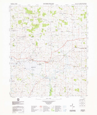
- Australia 1:250,000 Geoscience
- Australia 1:1 million Geoscience
New South Wales (NSW Spatial Services)
Queensland (Department of Resources)
- Queensland 1:10,000 — finest detail available
- Queensland 1:25,000
- Queensland 1:50,000
- Queensland 1:100,000
- Queensland 1:250,000
Western Australia (Landgate)
Tasmania
New Zealand (LINZ)
Field equipment
Free shipping on orders over $75, $7 standard postage Australia-wide, and same-day dispatch from Perth before 2pm AWST. If you can't find your sheet, type the map number (e.g. 9135-1N) into the search bar at the top of the page.
Frequently asked questions
Which scale should I choose for bushwalking?
For most bushwalking, the 1:25,000 series is the standard — it shows individual buildings, fence lines, trail intersections and 10-metre contours. For shorter walks on well-marked trails, 1:50,000 is often enough. For multi-day or off-track adventures, 1:25k is non-negotiable.
Are these the latest (current) editions?
Yes. We source direct from Geoscience Australia, NSW Spatial Services, the Department of Resources Queensland, Landgate WA and Land Information New Zealand. Every sheet shipped is the current edition at time of order. The new AUSTopo 1:250,000 series (2025) replaces the older Geoscience 250k series for many use cases.
What's the difference between paper, waterproof and laminated?
Paper is the standard format — folded, lightweight, perfect for a backpack or glovebox. Waterproof maps are printed on DuPont Tyvek — they handle rain, mud and river crossings without dissolving. Laminated maps are rolled in tubes, ideal for wall display, planning rooms or repeated reference; you can write on them with a whiteboard marker.
Can I use these maps with a GPS?
Yes. Every Australian topographic sheet is built on a known coordinate system (typically MGA94 / GDA94). Sheet edges, grid references and named points are accurate to the surveying tolerances of the issuing authority. We also stock GPS units, mapping software and digital chart subscriptions if you'd like a digital companion.
How do I find a specific topographic sheet?
Type the sheet name or sheet number (e.g. 9135-1N for Aberbaldie, NSW) into the search bar at the top of the page. You can also browse by region and scale in the grid above, then narrow within each collection.
How quickly do you ship?
Orders placed before 2pm AWST ship same-day from our Perth warehouse. Free shipping on orders over $75 Australia-wide; $7 standard postage on smaller orders. Express options at checkout.
Touring and 4WD alternatives
Topographic maps are built for bushwalking and detailed terrain navigation. If your trip is on roads or 4WD tracks rather than foot, the touring scale is more practical. Our Hema Maps Australia hub carries the full range of Hema 4WD touring maps, atlases, and laminated wall maps — the standard reference for Australian road trips, caravan tours, and outback expeditions.
© 2026 Mapworld. Website designed by Genie Media
X