- Australia ▾
- Topographic
▾
- Australia AUSTopo 250k (2025)
- Australia 50k Geoscience maps
- Australia 100k Geoscience maps
- Australia 250k Geoscience maps
- Australia 1:1m Geoscience maps
- New Zealand 50k maps
- New Zealand 250k maps
- New South Wales 25k maps
- New South Wales 50k maps
- New South Wales 100k maps
- Queensland 10k maps
- Queensland 25k maps
- Queensland 50k maps
- Queensland 100k maps
- Compasses
- Software
- GPS Systems
- Orienteering
- International ▾
- Wall Maps
▾
- World
- Australia & New Zealand
- Countries, Continents & Regions
- Historical
- Vintage National Geographic
- Australian Capital Territory
- New South Wales
- Northern Territory
- Queensland
- South Australia
- Tasmania
- Victoria
- Western Australia
- Celestial
- Children's
- Mining & Resources
- Wine Maps
- Healthcare
- Postcode Maps
- Electoral Maps
- Nautical ▾
- Flags
▾
- Australian Flag Sets & Banners
- Flag Bunting
- Handwavers
- Australian National Flags
- Aboriginal Flags
- Torres Strait Islander Flags
- International Flags
- Flagpoles & Accessories
- Australian Capital Territory Flags
- New South Wales Flags
- Northern Territory Flags
- Queensland Flags
- South Australia Flags
- Tasmania Flags
- Victoria Flags
- Western Australia Flags
- Gifts ▾
- Globes ▾
Dear valued customer. Please note that our checkout is not supported by old browsers. Please use a recent browser to access all checkout capabilities


Jenolan 8930-3N Topographic Map 1:25k
$19.95
Afterpay is only available for orders between $50.00 and $1000.00 More info
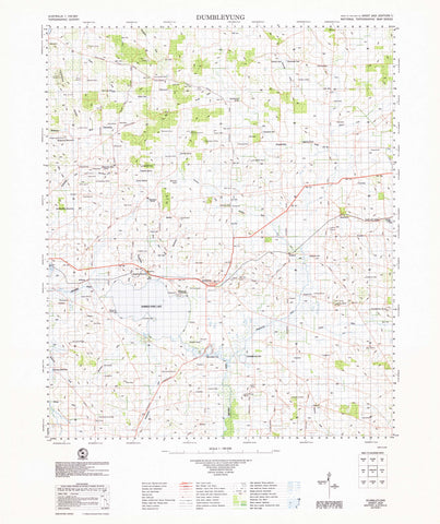
Explore, plan, or respond with precision using the Jenolan Topographic Map by LPI (Land and Property Information). This highly detailed, 1:25,000 scale topographic map provides a comprehensive overview of the Jenolan region, renowned for its natural beauty, complex terrain, and iconic limestone cave systems.
Whether you’re heading into the bush for a hike, coordinating emergency response, or conducting environmental surveys, this map is an indispensable tool designed for accuracy, clarity, and resilience in the field.
🧭 What Does This Map Show?
Designed using authoritative LPI data, this topographic map includes:
-
🔺 Contour lines – Detailed elevation profiles for landscape navigation
-
🌊 Waterways & Streams – Rivers, creeks, and drainage features
-
🛣️ Roads, Fire Trails & Tracks – From sealed access roads to remote bush trails
-
🏠 Buildings & Structures – Including huts, ranger stations, and other features
-
🧱 Place Names – Towns, localities, ridgelines, lookouts, and heritage features
-
🌿 Vegetation & Land Cover – Forests, clearings, scrub, and other natural features
-
🗺️ Points of Interest – Visitor attractions, walking tracks, campgrounds, caves
-
📍 Administrative Boundaries – National park zones, reserves, and land management areas
This level of detail makes it especially useful for planning, navigation, development, and search-and-rescue operations.
🌧️ Built for the Outdoors: Waterproof & Laminated Options
Because maps like this are often used in unpredictable environments, we offer multiple finishes to ensure maximum durability and flexibility:
💧 Tyvek® Waterproof Map (Tearproof & Foldable)
-
Printed on DuPont™ Tyvek®, made of pure polyethylene fibres
-
100% waterproof and tear-resistant
-
Strong like plastic, folds like paper
-
Ideal for fieldwork, wet conditions, and rugged terrain
-
Reusable and designed to last
🖊️ Laminated Map (Encapsulated Gloss)
-
Printed on base paper, then fully encapsulated in two layers of 80-micron gloss laminate
-
💡 Write on it with whiteboard markers – Plan routes, mark coordinates, or leave notes
-
🧼 Wipe clean and reuse
-
Resistant to tears, dirt, mud, and moisture
-
Compatible with removable map dots—great for temporary site marking
-
Ships rolled in a protective mailing tube
📐 Map Specifications:
| Feature | Description |
|---|---|
| Scale | 1:25,000 |
| Size | 1150 mm (width) × 600 mm (height) |
| Format | Folded paper, laminated, or Tyvek® waterproof |
| Publisher | New South Wales Spatial Services |
| Index Access | Full coverage listed via NSW Topo Index (linked) |
| Applications | Recreational, professional, environmental & emergency use |
🎯 Who Uses the Jenolan Topographic Map?
-
🥾 Bushwalkers & Hikers – For navigating the terrain of Jenolan and surrounding trails
-
🚨 Emergency Services – For field coordination, logistics, and incident response
-
🌏 Environmental Managers – Land assessment, resource planning, and conservation work
-
🛠️ Engineers & Developers – Site access planning, surveys, and terrain analysis
-
📚 Educators & Field Schools – For teaching map reading, orienteering, and geography
-
📍 Tourists & Explorers – Visiting the famed Jenolan Caves or scenic wilderness trails
🏞️ About the Jenolan Region
The Jenolan region in New South Wales is best known for the Jenolan Caves, one of the oldest cave systems in the world. The surrounding landscape includes steep escarpments, limestone ridges, forested gullies, and remote valleys—making topographic navigation essential. This map is ideal for exploring lesser-known tracks or planning wilderness routes in Blue Mountains wilderness areas and Great Dividing Range foothills.
📦 Delivery & Handling
-
Ships rolled (laminated) or folded (standard paper and Tyvek® versions)
-
Protective packaging ensures safe delivery anywhere in Australia
-
Typically ships within 1 business day
📌 Navigate With Confidence
When safety, precision, and reliability matter most, the Jenolan Topographic Map by LPI delivers. Whether you’re trekking to a cave entrance, assessing vegetation corridors, or marking fire trails, this map gives you the clarity and durability required in the real world.
Add it to your cart today, and get ready to explore, plan, or respond with confidence—rain, shine, or scrub.
Frequently Asked Questions
What area does the Jenolan 8930-3N Topographic Map 1:25k cover?
This topographic map covers the area named in the product title. It shows elevation contours, terrain features, waterways, roads, tracks, and key landmarks at 1:25,000 scale.
What scale is this topographic map?
This map is at 1:25,000 scale. Australian topographic maps are commonly produced at 1:25,000, 1:50,000, and 1:100,000 scales — the scale determines the level of detail and the area shown.
Is this map suitable for bushwalking and hiking?
Yes, topographic maps are the standard navigation tool for bushwalking, hiking, and off-track travel. They show contour lines, walking tracks, water sources, and terrain hazards.
Is this the most current edition available?
Mapworld stocks the most current editions available. Australian topographic maps are produced by Geoscience Australia or state mapping agencies and updated periodically.
Does Mapworld ship the Jenolan 8930-3N Topographic Map 1:25k across Australia?
Yes, Mapworld ships Australia-wide. Standard shipping is a flat $7 rate, with free standard shipping on orders over $75. Express options are available at checkout. Most orders placed before 2pm AEST on weekdays are dispatched same day.
Related Items


© 2026 Mapworld. Website designed by Genie Media
X