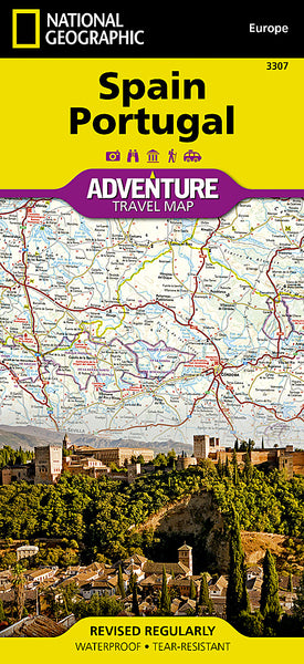
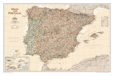
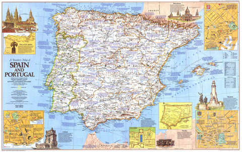
Folded Travel Map | Waterproof & Tear-Resistant | Synthetic Material
Scale: 1:1,000,000 | Size: 648 mm x 959 mm
🇪🇸🇵🇹 Discover the Spirit of the Iberian Peninsula
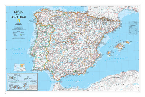
Embark on an unforgettable journey across two of Europe’s most culturally rich and geographically diverse nations with the Spain & Portugal Adventure Map by National Geographic. Designed with the needs of adventure travellers in mind, this rugged, highly detailed folded map blends practical navigation tools with curated travel insight—making it the perfect companion for road trippers, hikers, history buffs, and cultural explorers.
From sun-drenched coastlines and island escapes to medieval cities and World Heritage sites, this map is your gateway to authentic experiences in Spain and Portugal.
🌍 Two-Sided Regional Coverage
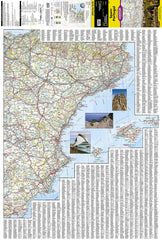
🗺 Side A – Eastern Spain
-
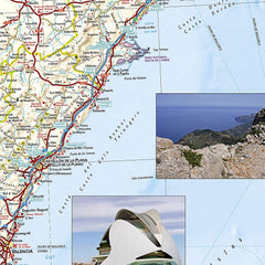
Covers the eastern half of Spain from the French and Andorran borders in the north, down along the Mediterranean coast to Almería
-
Includes Catalonia, Valencia, Aragon, Murcia, and parts of Castilla-La Mancha
-
Major cities: Barcelona, Zaragoza, Valencia, Alicante, Tarragona, and more
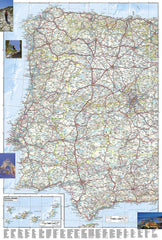
🗺 Side B – Portugal & Western Spain
-
Includes all of Portugal, Galicia, Extremadura, Andalusia, Castile and León, and Madrid
-
Includes inset of the Canary Islands
-
Major cities: Lisbon, Porto, Seville, Madrid, Toledo, Salamanca, and more
🧭 Map Features
✅ Highly Detailed Road Network
-
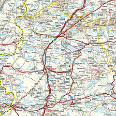
Clear designations for motorways, expressways, secondary roads, and tracks
-
Includes road distances, ferry routes, border crossings, and regional airports
-
Ideal for planning both major road trips and off-the-beaten-track journeys
✅ User-Friendly Indexing
-
Thousands of towns and cities indexed for easy location lookup
-
Coastal areas, rivers, mountains, and key geographic features clearly labeled
✅ Rich Cultural & Historical Highlights
✅ Rugged Construction for Global Travel
-
Printed on durable, waterproof, tear-resistant synthetic paper
-
Designed to handle folding, weather, and long-term use
-
Lightweight and compact—perfect for your glovebox, backpack, or daypack
📌 Specifications at a Glance
Feature |
Description |
Map Type |
Folded adventure travel map |
Brand |
National Geographic Maps |
Scale |
1:1,000,000 |
Size |
648 mm x 959 mm (25.5" x 37.75") |
Material |
Waterproof, tear-resistant synthetic paper |
Coverage |
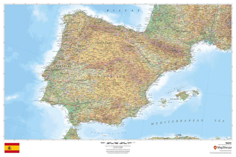
All of Portugal + Eastern and Western Spain + Canary Islands |
Language |
English (legend and place names) |
Printed In |
United States |
👥 Who Is This Map For?
-
🚗 Road trippers driving across Spain, Portugal, or the Algarve coast
-
🧭 Backpackers and adventure travellers exploring mountain ranges, historic towns, or cultural routes
-
📸 Tourists and vacationers planning visits to famous cities, island escapes, or scenic wine regions
-
📚 Students and educators studying European history, geography, or colonial influence
-
🗺️ Map collectors and National Geographic fans who appreciate premium, functional cartography
🌐 A Journey Through Empires Past
Spain and Portugal once stood at the helm of the Age of Exploration, shaping global history with their voyages, discoveries, and rich cultural legacies. This map brings that heritage to life—connecting today’s traveller with a vivid landscape of castles, cathedrals, coastal cities, and centuries-old traditions.
🛒 Add the Spain & Portugal Adventure Map to Your Cart Today
Experience Iberia through the expert lens of National Geographic—detailed, durable, and designed for discovery.