The definitive Queensland reference map for home, office, classroom, or logistics – combining detailed state-wide cartography with a metropolitan focus on Brisbane
Whether you’re plotting a cross-state road trip, managing a regional delivery network, or simply looking to gain a better spatial understanding of Queensland and its capital city, the UBD Queensland State & Brisbane Suburban Wall Map is a practical and reliable resource. This double-sided laminated map, updated for 2023, combines wide-scale state mapping with an easy-to-read urban breakdown of Brisbane’s sprawling suburbs, all printed in high-resolution and laminated for durability and long-term use.
With postcodes, route markers, town indexes, and green space clearly delineated, this is a visual planning tool as much as it is a map — equally at home in a business environment, council chamber, classroom, or living room.
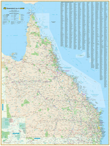
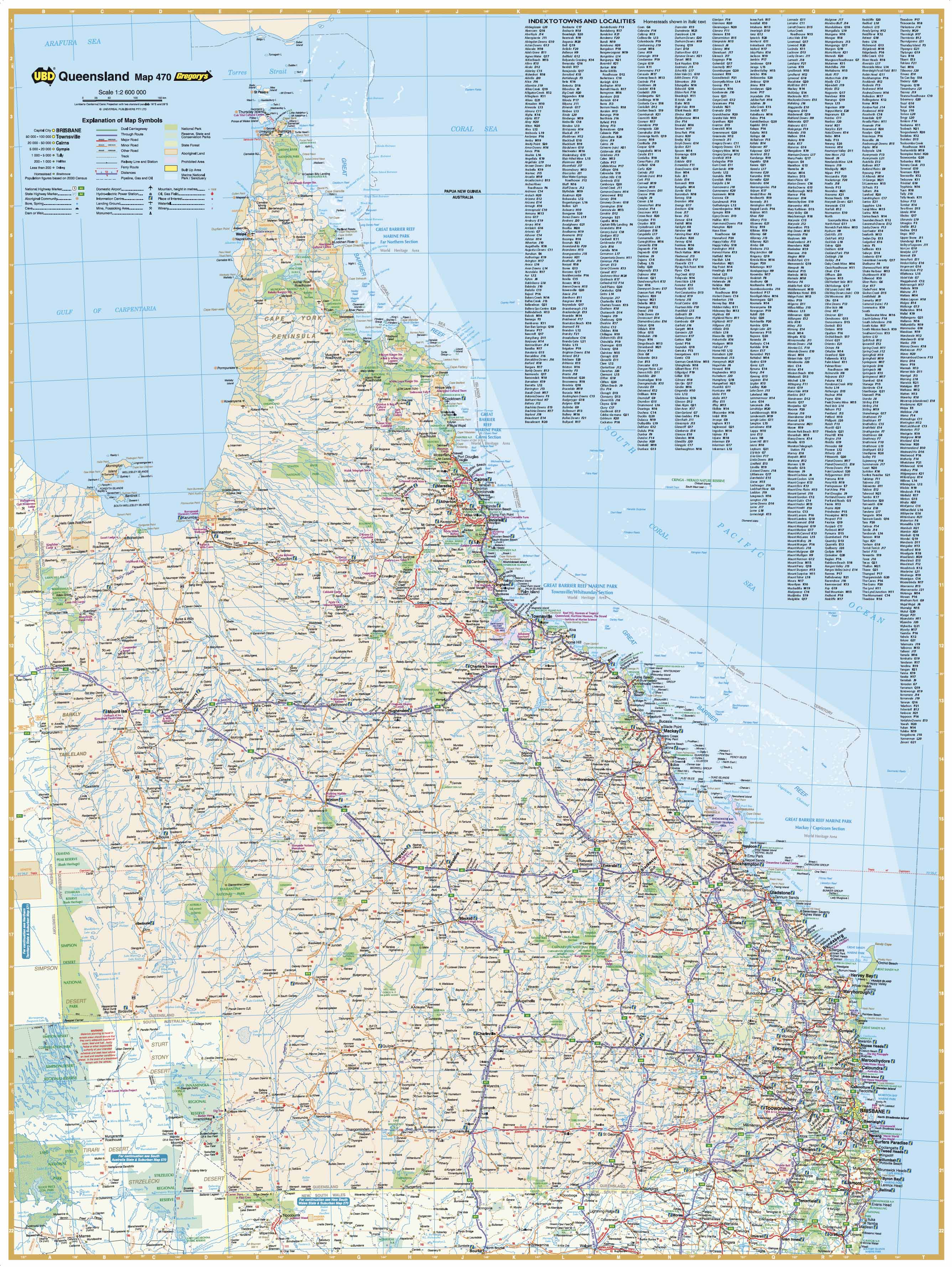
🗺️ Side A – Queensland State Map
Scale: 1:2,600,000
Offering a broad, well-organised overview of the entire state, this side of the map is ideal for understanding Queensland's regional layout, planning long-distance travel, or managing operations across the state.
-
Covers all of Queensland, from Torres Strait and Cape York in the north to the Gold Coast in the south, and inland through Longreach, Mount Isa, and Birdsville
-
Highlights:
-
Major and minor highways
-
National and state routes, including route numbers
-
Regional towns and cities, each clearly labelled and indexed
-
Natural features such as rivers, lakes, mountain ranges, deserts, and national parks
-
Road surfaces and dual carriageways indicated where relevant
-
-
Fully indexed — easily locate any town or region
-
Useful for:
-
Tourism planning, especially for outback and coastal routes
-
Freight and logistics businesses operating across vast regional areas
-
Educational geography studies focused on Australian states and regions
-
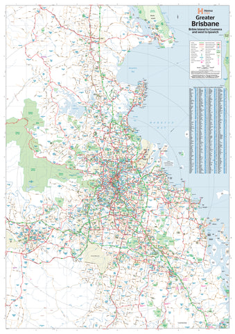
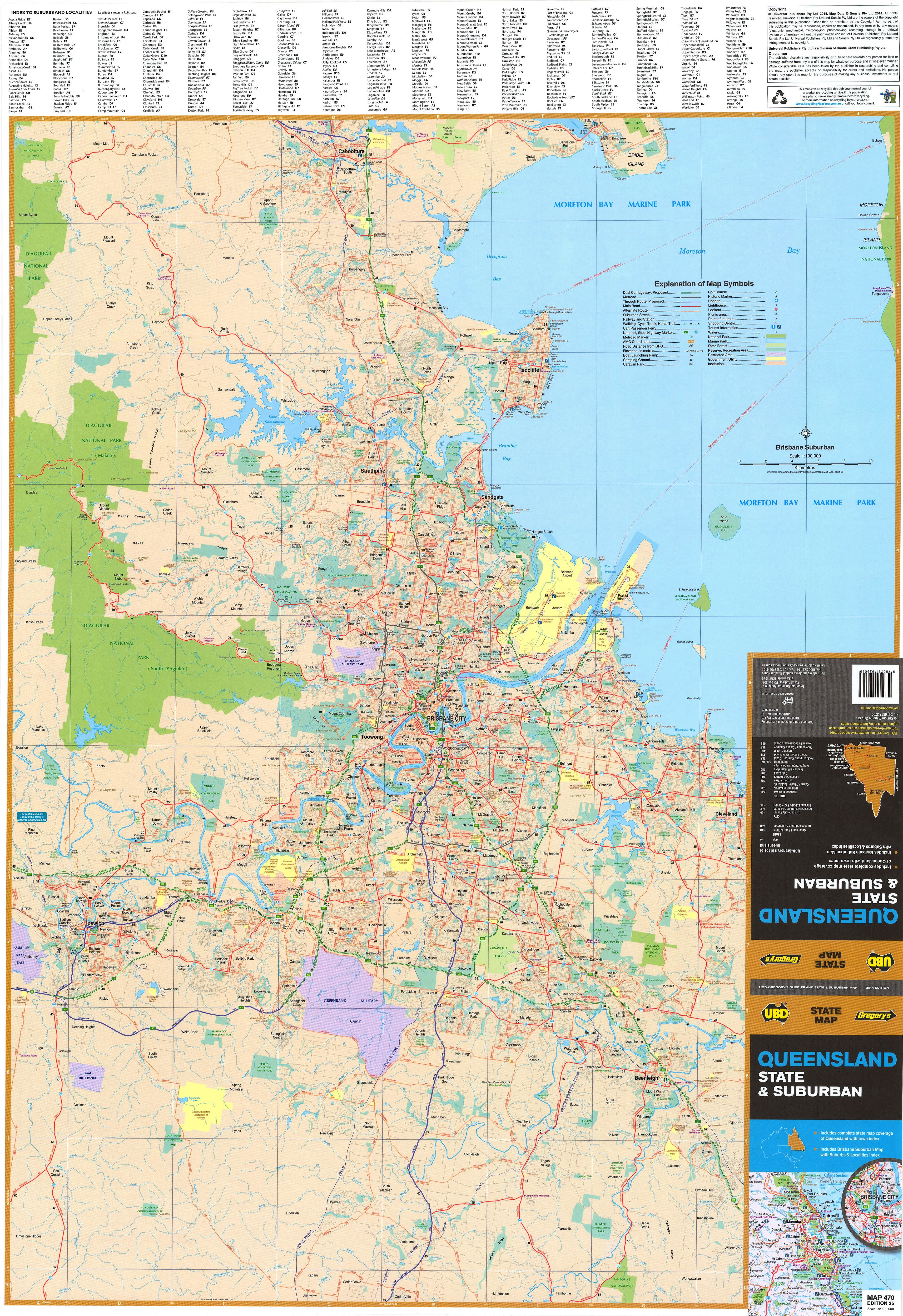
🏙️ Side B – Brisbane Suburban Map
Scale: 1:100,000
This side offers a detailed suburban breakdown of Greater Brisbane, one of Australia's fastest-growing urban regions. Designed to highlight connectivity, infrastructure, and suburb boundaries, it’s particularly useful for urban professionals, property managers, and field service providers.
-
Covers a 75 km radius around Brisbane’s CBD:
-
From Caboolture in the north to Coomera in the south
-
Includes Ipswich, Logan, Redcliffe, Moreton Bay, and parts of the Scenic Rim
-
-
Clearly shows:
-
Main roads and motorways, such as the M1, M3, M5, Gateway Motorway, and Bruce Highway
-
Rail lines, bridges, and key transport corridors
-
Suburb boundaries, with postcodes clearly marked
-
Industrial areas, parks, airport precincts, and coastal areas
-
-
Suburb names are fully indexed, allowing quick reference or postcode lookup
-
Ideal for:
-
Courier and delivery services mapping territories
-
Real estate and property development
-
New residents or businesses needing a clearer grasp of Brisbane’s layout
-
Teachers illustrating urban expansion, infrastructure, and city planning
-
🖨️ Print & Lamination Quality
-
Printed on 120gsm FSC-certified matte-coated paper for durability and eco-responsibility
-
Uses Hewlett-Packard archival-grade pigment inks, ensuring vibrant, fade-resistant colour
-
Fully encapsulated between two 80-micron gloss laminate sheets, providing:
-
Waterproof and tear-resistant protection
-
A surface suitable for whiteboard markers — write, wipe, and re-use
-
Compatibility with Map Dots, stickers, and pins
-
Enhanced resilience for long-term use in high-traffic areas
-
📐 Specifications
-
Published: 2023
-
Scales:
-
Queensland State Map: 1:2,600,000
-
Brisbane Suburban Map: 1:100,000
-
-
Map Size: 1000 mm (W) x 700 mm (H)
-
Format: Double-sided, fully laminated
-
Orientation: Landscape
-
Printed in: Australia
🪵 Optional Timber Hanging System
For a polished display, the map can be fitted with wooden hang rails:
-
Timber rails attached top and bottom
-
Includes a hanging cord on the upper rail
-
Natural lacquered finish complements both corporate and home interiors
-
Allow up to 10 working days for delivery of hang-railed maps, as these are made to order
🛒 Purchase Options
-
Flat Laminated Map – $95.00
-
Supplied flat and ready to frame, pin, or mount
-
Recommended for offices, schools, and professional spaces
-
-
Laminated Folded Map – $49.95
-
Laminated version of a previously folded map
-
May contain minor crease lines but remains fully durable and functional
-
A cost-effective solution for home use, workshops, or mobile reference
-
🎯 Ideal For:
-
Freight and logistics teams planning routes across urban and rural Queensland
-
Council planning departments, government offices, and community organisations
-
Sales teams, technicians, or franchise operators dividing service territories
-
Classrooms and educational spaces needing a large, clear geography reference
-
Travellers and grey nomads planning long-term routes or regional explorations
-
Real estate professionals, builders, and surveyors requiring suburb-level detail
✅ Why This Map Stands Out
-
Published by UBD Gregory’s, one of Australia's most trusted names in mapping
-
Combines broad regional detail with fine suburban breakdowns in one product
-
Fully laminated for durability — ideal for active use
-
Proudly printed in Australia, supporting local craftsmanship and quality control
From the rugged Outback to Brisbane’s bustling streets — one map covers it all.
The UBD Queensland State & Brisbane Suburban Wall Map is a practical, informative, and professional resource designed to support your planning, teaching, navigating, and exploring needs.
Built to last. Made to inform. Ready to display.
Queensland made easy — with UBD Gregory’s.