- Australia ▾
- Topographic
▾
- Australia AUSTopo 250k (2025)
- Australia 50k Geoscience maps
- Australia 100k Geoscience maps
- Australia 250k Geoscience maps
- Australia 1:1m Geoscience maps
- New Zealand 50k maps
- New Zealand 250k maps
- New South Wales 25k maps
- New South Wales 50k maps
- New South Wales 100k maps
- Queensland 10k maps
- Queensland 25k maps
- Queensland 50k maps
- Queensland 100k maps
- Compasses
- Software
- GPS Systems
- Orienteering
- International ▾
- Wall Maps
▾
- World
- Australia & New Zealand
- Countries, Continents & Regions
- Historical
- Vintage National Geographic
- Australian Capital Territory
- New South Wales
- Northern Territory
- Queensland
- South Australia
- Tasmania
- Victoria
- Western Australia
- Celestial
- Children's
- Mining & Resources
- Wine Maps
- Healthcare
- Postcode Maps
- Electoral Maps
- Nautical ▾
- Flags
▾
- Australian Flag Sets & Banners
- Flag Bunting
- Handwavers
- Australian National Flags
- Aboriginal Flags
- Torres Strait Islander Flags
- International Flags
- Flagpoles & Accessories
- Australian Capital Territory Flags
- New South Wales Flags
- Northern Territory Flags
- Queensland Flags
- South Australia Flags
- Tasmania Flags
- Victoria Flags
- Western Australia Flags
- Gifts ▾
- Globes ▾
Dear valued customer. Please note that our checkout is not supported by old browsers. Please use a recent browser to access all checkout capabilities


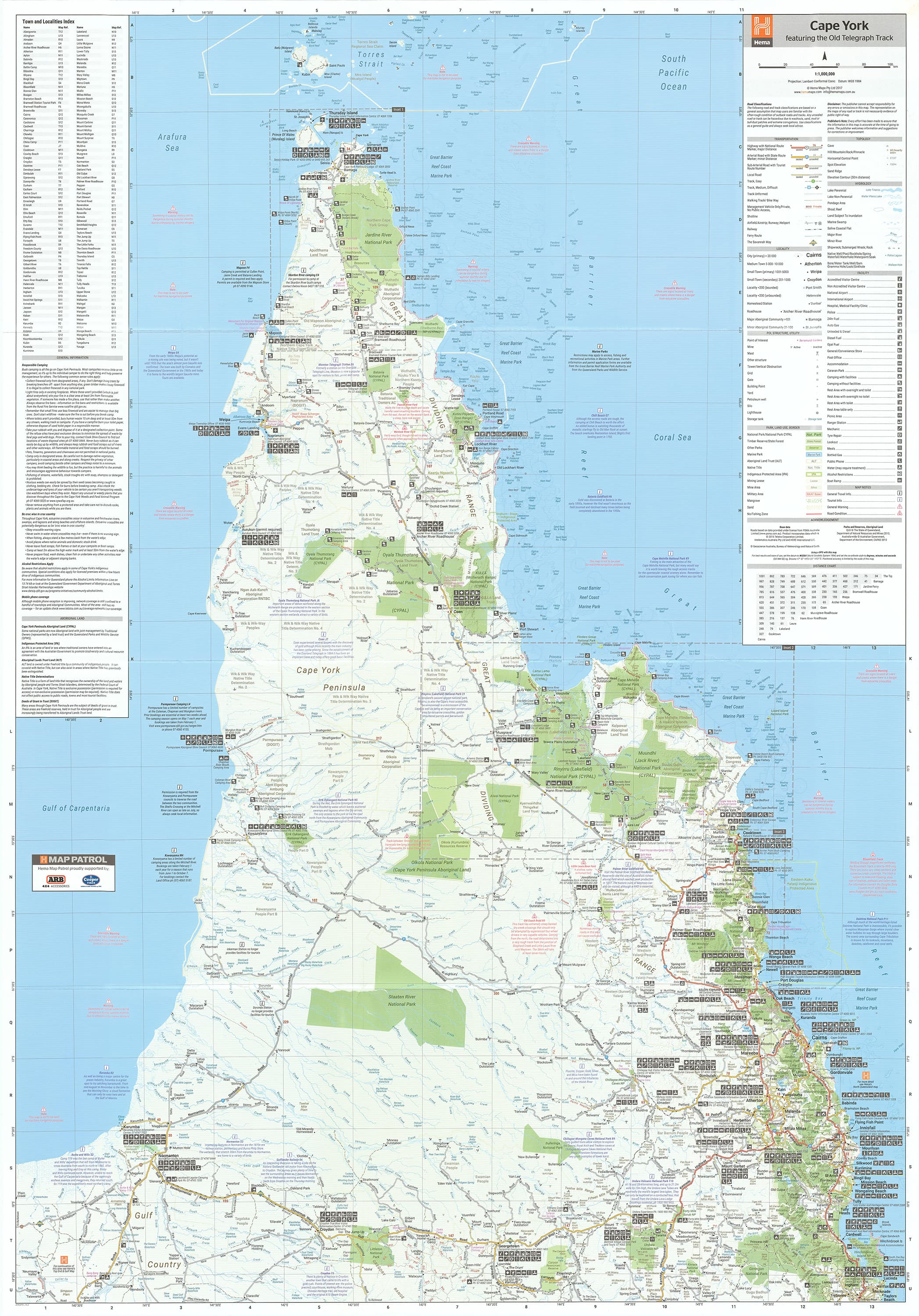
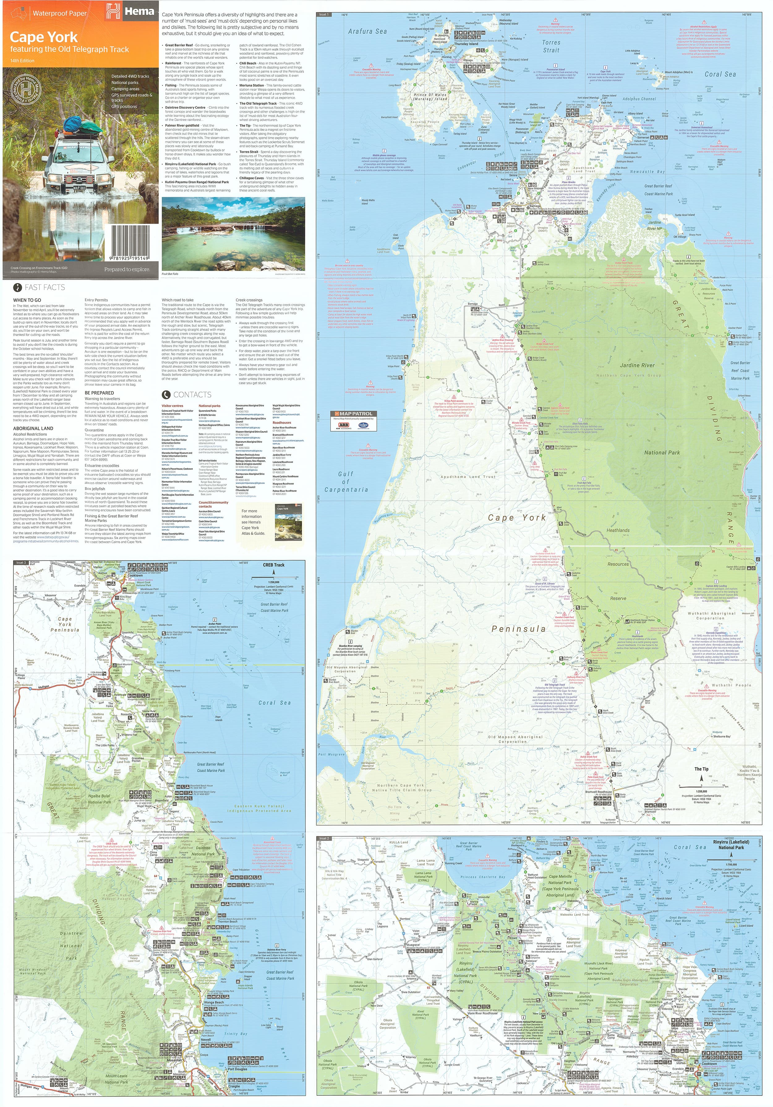
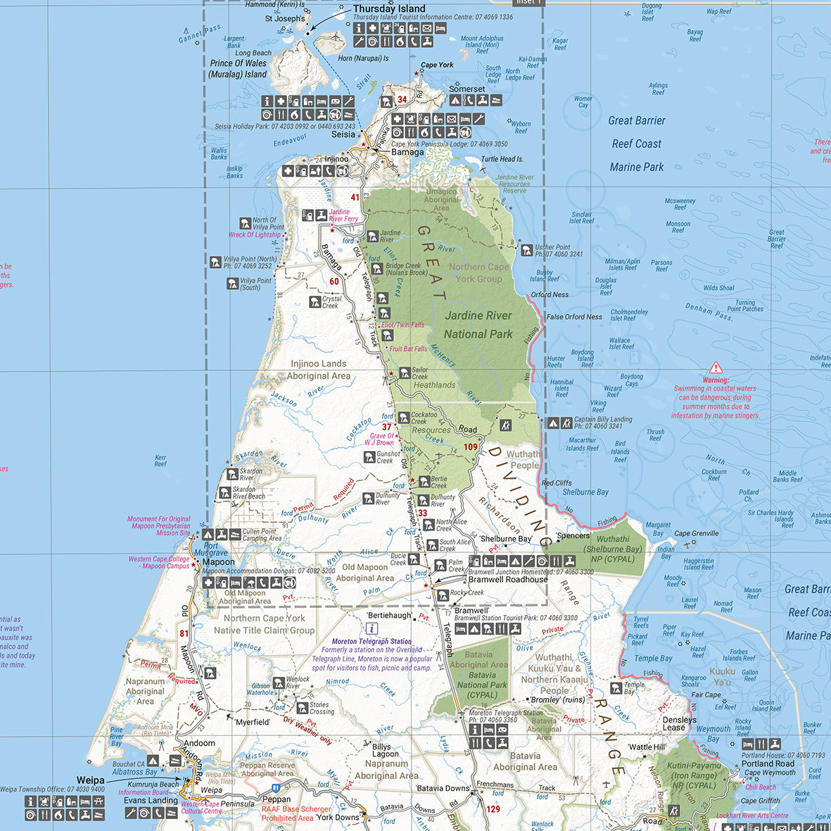
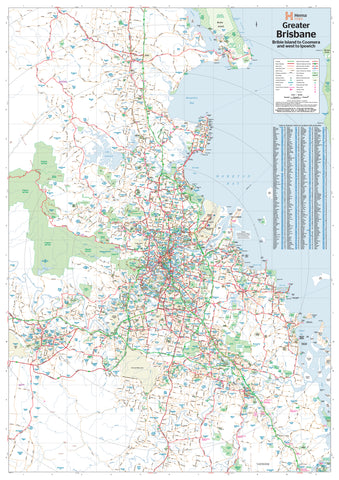
Cape York Hema 700 x 1000mm Laminated Wall Map
$49.95
Afterpay is only available for orders between $50.00 and $1000.00 More info
Size: 1000 mm (W) x 700 mm (H) | Scale: 1:1,000,000 | Waterproof & Durable
The Ultimate 4WD Map for Cape York
This Cape York Laminated Wall Map by Hema Maps is a must-have for anyone planning to tackle one of Australia’s most iconic off-road journeys—The Old Telegraph Track. This detailed, full-colour wall map covers the entire Cape York Peninsula, a region rich in rugged adventure, pristine wilderness, and remote cultural heritage.
With its 1:1,000,000 scale, this map strikes the perfect balance between regional overview and on-ground navigation—ideal for trip planning, classroom reference, business walls or garage display.
Key Map Features
| Feature | Description |
|---|---|
| 🛰️ GPS Markers | Grid references and GPS coordinates for key points |
| 🧭 Old Telegraph Track | Dedicated inset map detailing this legendary 4WD route |
| ⛺ Camping Areas | Designated campsites and bush camping zones clearly marked |
| 🌳 National Parks | Fully outlined, with names and boundaries shown |
| 💻 Digital Cartography | Updated with the latest geographic and road data from Hema |
Map Specifications
| Specification | Detail |
|---|---|
| Brand | Hema Maps |
| Format | Laminated Wall Map |
| Opened Size | 1000 mm (W) x 700 mm (H) |
| Scale | 1:1,000,000 |
| Pigment-based inks on 120 gsm FSC matte-coated paper | |
| Lamination | Fully encapsulated with 80-micron gloss laminate |
Why Choose This Map?
-
Authoritative detail from Hema’s GPS-surveyed mapping database
-
Perfect for Cape York expedition planning—from Cairns to the Tip
-
Campsites, 4WD tracks, and access roads all marked clearly
-
Laminated for reusability – write with whiteboard marker or use map dots to highlight key stops
-
Tear-resistant and waterproof, ideal for outdoor and vehicle use
Ideal For:
-
4WD trip planning
-
Educational displays
-
Travel agencies or adventure tour offices
-
Garage walls, adventure planning rooms or classrooms
📦 Note: This map has been professionally flattened from its original folded form before lamination. As a result, some subtle crease lines may remain visible—but its functionality and presentation are not affected.
Made in Australia 🇦🇺
Published by Hema Maps
Map Edition: Latest Available
🛒 Ready to hit the Old Tele Track or planning a Cape adventure? Let this Hema map be your trusted guide from start to finish.
Frequently Asked Questions
What are the dimensions of the Cape York Hema 700 x 1000mm Laminated Wall Map?
Mapworld wall maps range from standard 700×1000mm to large-format 1000×1430mm Supermaps. The exact dimensions for this map are shown in the product title. Where multiple sizes are available, select your preferred size when adding to cart.
Is this wall map available laminated?
Many Mapworld wall maps are available in paper, laminated, or framed finishes. Check the product options when adding to cart. Laminated maps are wipe-clean and more durable.
Is this the latest edition?
Mapworld stocks the most current editions available from all publishers. Edition year is shown in the product title where applicable. Mapworld updates its catalogue as new editions are released.
Can I write on or pin this wall map?
Laminated wall maps can be written on with whiteboard markers and wiped clean. Paper maps can be pinned on a corkboard. Choose a laminated option for a writeable surface.
Does Mapworld ship the Cape York Hema 700 x 1000mm Laminated Wall Map across Australia?
Yes, Mapworld ships Australia-wide. Standard shipping is a flat $7 rate, with free standard shipping on orders over $75. Express options are available at checkout. Most orders placed before 2pm AEST on weekdays are dispatched same day.
Related Items

© 2026 Mapworld. Website designed by Genie Media
X