- Australia ▾
- Topographic
▾
- Australia AUSTopo 250k (2025)
- Australia 50k Geoscience maps
- Australia 100k Geoscience maps
- Australia 250k Geoscience maps
- Australia 1:1m Geoscience maps
- New Zealand 50k maps
- New Zealand 250k maps
- New South Wales 25k maps
- New South Wales 50k maps
- New South Wales 100k maps
- Queensland 10k maps
- Queensland 25k maps
- Queensland 50k maps
- Queensland 100k maps
- Compasses
- Software
- GPS Systems
- Orienteering
- International ▾
- Wall Maps
▾
- World
- Australia & New Zealand
- Countries, Continents & Regions
- Historical
- Vintage National Geographic
- Australian Capital Territory
- New South Wales
- Northern Territory
- Queensland
- South Australia
- Tasmania
- Victoria
- Western Australia
- Celestial
- Children's
- Mining & Resources
- Wine Maps
- Healthcare
- Postcode Maps
- Electoral Maps
- Nautical ▾
- Flags
▾
- Australian Flag Sets & Banners
- Flag Bunting
- Handwavers
- Australian National Flags
- Aboriginal Flags
- Torres Strait Islander Flags
- International Flags
- Flagpoles & Accessories
- Australian Capital Territory Flags
- New South Wales Flags
- Northern Territory Flags
- Queensland Flags
- South Australia Flags
- Tasmania Flags
- Victoria Flags
- Western Australia Flags
- Gifts ▾
- Globes ▾
Dear valued customer. Please note that our checkout is not supported by old browsers. Please use a recent browser to access all checkout capabilities
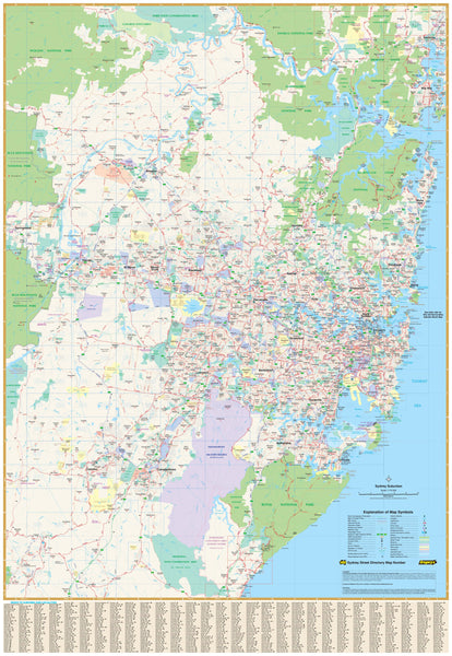
Sydney UBD 262 Map 1020 x 1480mm Laminated Wall Map
$365.00
or make 4 interest-free payments of
$91.25 AUD
fortnightly with
![]() More info
More info
Size: 1020 mm (W) x 1480 mm (H)
A Comprehensive View of Greater Sydney
The Sydney UBD 262 Map by UBD Gregory’s is a large-format, laminated wall map that offers exceptional detail and clarity—perfect for business use, logistics planning, education, or home offices. Covering a 75km radius from central Sydney, this map stretches from Gosford in the north to Clifton in the south, and as far west as Springwood, providing a full overview of the Greater Sydney metropolitan area.
🧭 Features at a Glance
-
Arterial roads and key transport routes clearly marked
-
Suburban areas, national parks, and industrial zones all identified
-
Every suburb name displayed, complete with postcode labels
-
Fully indexed suburb listing for quick referencing
-
Printed in full colour for easy readability and planning
-
Ideal for sales teams, operations coordinators, delivery managers, educators, and city planners
Durable, Writable, and Made for Everyday Use
Encapsulated in premium 80-micron gloss laminate, this map features a smooth, wipeable surface that allows you to:
-
Draw with whiteboard markers and wipe clean
-
Apply Mark-It Dots or stickers to pinpoint client locations, delivery zones, or sales territories
-
Resist everyday wear and tear—perfect for high-use environments
📏 Specifications
| Feature | Detail |
|---|---|
| Map Title | Sydney UBD 262 Map |
| Coverage Radius | 75km from Central Sydney |
| Includes | Suburb names, postcodes, parks, roads |
| Format | Flat, laminated wall map |
| Material | 80-micron gloss-laminated 120gsm paper |
| Size | 1020 mm (W) x 1480 mm (H) |
| Best Use | Office planning, education, logistics |
Whether you're managing operations across Sydney or simply want a comprehensive wall reference for the city and its surrounds, this high-quality map provides both form and function—combining professional presentation with practical utility.


