- Australia ▾
- Topographic
▾
- Australia AUSTopo 250k (2024)
- Australia 50k Geoscience maps
- Australia 100k Geoscience maps
- Australia 250k Geoscience maps
- Australia 1.1m Geoscience maps
- New Zealand 50k maps
- New Zealand 250k maps
- New South Wales 25k maps
- New South Wales 50k maps
- New South Wales 100k maps
- Queensland 10k maps
- Queensland 25k maps
- Queensland 50k maps
- Queensland 100k maps
- Compasses
- Software
- GPS Systems
- Orienteering
- International ▾
- Wall Maps
▾
- World
- Australia & New Zealand
- Countries, Continents & Regions
- Historical
- Vintage National Geographic
- Australian Capital Territory
- New South Wales
- Northern Territory
- Queensland
- South Australia
- Tasmania
- Victoria
- Western Australia
- Celestial
- Children's
- Mining & Resources
- Wine Maps
- Healthcare
- Postcode Maps
- Electoral Maps
- Nautical ▾
- Flags
▾
- Australian Flag Sets & Banners
- Flag Bunting
- Handwavers
- Australian National Flags
- Aboriginal Flags
- Torres Strait Islander Flags
- International Flags
- Flagpoles & Accessories
- Australian Capital Territory Flags
- New South Wales Flags
- Northern Territory Flags
- Queensland Flags
- South Australia Flags
- Tasmania Flags
- Victoria Flags
- Western Australia Flags
- Gifts ▾
- Globes ▾
Dear valued customer. Please note that our checkout is not supported by old browsers. Please use a recent browser to access all checkout capabilities
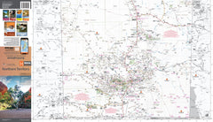
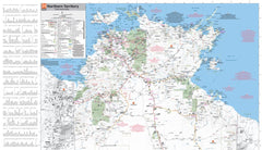
Northern Territory Hema Handy Map 13th Edition
$11.95
Afterpay is only available for orders between $50.00 and $1000.00 More info
ISBN: 9781925625684
Open Size: 500 mm x 750 mm
Folded Format: Compact touring map
🧭 Your Ultimate Touring Companion for the Northern Territory
The Hema Northern Territory Handy Map (13th Edition) is a compact yet information-rich touring map designed to support road trippers, campers, 4WD adventurers, and caravanners as they journey through Australia’s untamed Top End and Red Centre.
Whether you’re taking the Stuart Highway from Darwin to Alice Springs, venturing into Arnhem Land, or exploring the national parks around Kakadu and Uluru, this easy-to-carry map offers practical, up-to-date navigation support, curated by Australia’s most trusted cartographers.
🌟 Key Map Features
✔️ Camping Areas – Free and paid campsites, bush camping, and national park camping zones are clearly marked for convenience.
✔️ Caravan Parks – Ideal for grey nomads and family travellers, with locations pinpointed across all key towns.
✔️ Rest Areas – Well-spaced roadside rest stops for long-distance driving, with stopover symbols included.
✔️ 24-Hour Fuel Locations – Essential for timing long-range travel legs across remote desert highways.
✔️ Outback Fuel Stops – Covers roadhouses and isolated stations where fuel may be the only supply for hundreds of kilometres.
✔️ Points of Interest – Waterfalls, lookout points, gorges, cultural sites, and geological landmarks highlighted for tourism value.
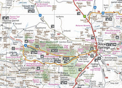
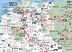
✔️ National Parks – Including Kakadu, Litchfield, Nitmiluk (Katherine Gorge), West MacDonnell Ranges, and Uluru-Kata Tjuta.
✔️ Distance Grid – Quickly estimate travel times between major centres.
✔️ Town Index & Localities – Fully indexed with postcode and map grid references for fast lookup.
📍 Area Coverage
Covers the entire Northern Territory, from the lush coastal wetlands of the Top End to the stark desert landscapes of the central and southern regions. Major highlights include:
-
Darwin & Palmerston
-
Kakadu & Arnhem Land Access Routes
-
Katherine & Nitmiluk National Park
-
Tennant Creek & Barkly Tablelands
-
Alice Springs & MacDonnell Ranges
-
Uluru-Kata Tjuta National Park & Yulara
-
Outback highways including the Stuart, Barkly, Victoria, Carpentaria, and Sandover Highways
📐 Map Specifications
| Feature | Details |
|---|---|
| Edition | 13th |
| Publication Year | 2021 (latest available) |
| Scale | Touring scale (approx. 1:2.5M) |
| Publisher | Hema Maps |
| Map Type | Folded, single-sided |
| Open Dimensions | 500 mm (H) x 750 mm (W) |
| Folded Dimensions | ~125 mm x 250 mm |
| Weight | Approx. 80 grams |
| Material | High-grade map stock paper |
| Printed In | Australia |
🏕️ Perfect For
-
🛻 4WD Adventurers exploring unsealed tracks and rugged off-road areas
-
🚐 Caravanners needing precise locations for fuel and overnight stops
-
🏕️ Campers searching for remote and national park campsites
-
📚 Teachers & educators looking for an accessible NT geography reference
-
🚗 Self-drive tourists planning efficient, scenic road trips
-
🌏 Eco-tourists and photographers tracking natural wonders and Indigenous sites
🎯 Why Choose the Hema Handy Map Series?
Hema’s Handy Map Series is a trusted travel aid for those who prefer lightweight, compact, and accurate navigation. Each map is:
-
🛰️ Field-checked by Hema’s Map Patrol using GPS mapping data
-
🧭 Designed for maximum readability with essential wayfinding details
-
💧 Weather-resistant and folds neatly into glove compartments or backpacks
-
🇦🇺 Australian-made and printed using fade-resistant pigment inks
-
✅ Regularly updated to reflect the latest route, infrastructure, and camping developments
🌄 Explore Australia's Last Frontier with Confidence
From tropical wetlands to rust-red escarpments, sandstone gorges to sacred sites, the Northern Territory is a land of contrasts—and this map ensures you experience it fully and safely.
Whether you're planning the long haul from Darwin to Uluru, checking fuel stops before crossing the Barkly, or identifying campsites near Litchfield's waterfalls, the Hema Northern Territory Handy Map is a compact powerhouse of practical knowledge.
Explore with clarity. Travel with confidence.


