- Australia ▾
- Topographic
▾
- Australia AUSTopo 250k (2025)
- Australia 50k Geoscience maps
- Australia 100k Geoscience maps
- Australia 250k Geoscience maps
- Australia 1:1m Geoscience maps
- New Zealand 50k maps
- New Zealand 250k maps
- New South Wales 25k maps
- New South Wales 50k maps
- New South Wales 100k maps
- Queensland 10k maps
- Queensland 25k maps
- Queensland 50k maps
- Queensland 100k maps
- Western Australia 25k maps
- Western Australia 50k maps
- Western Australia 100k maps
- Compasses
- Software
- GPS Systems
- International ▾
- Wall Maps
▾
- World
- Australia & New Zealand
- Countries, Continents & Regions
- Historical
- Vintage National Geographic
- Australian Capital Territory
- New South Wales
- Northern Territory
- Queensland
- South Australia
- Tasmania
- Victoria
- Western Australia
- Celestial
- Children's
- Mining & Resources
- Wine Maps
- Healthcare
- Postcode Maps
- Electoral Maps
- Nautical ▾
- Flags
▾
- Australian Flag Sets & Banners
- Flag Bunting
- Handwavers
- Australian National Flags
- Aboriginal Flags
- Torres Strait Islander Flags
- International Flags
- Flagpoles & Accessories
- Australian Capital Territory Flags
- New South Wales Flags
- Northern Territory Flags
- Queensland Flags
- South Australia Flags
- Tasmania Flags
- Victoria Flags
- Western Australia Flags
- Gifts ▾
- Globes ▾
Dear valued customer. Please note that our checkout is not supported by old browsers. Please use a recent browser to access all checkout capabilities


Southeast USA Hallwag Map
$25.95
Afterpay is only available for orders between $50.00 and $1000.00 More info
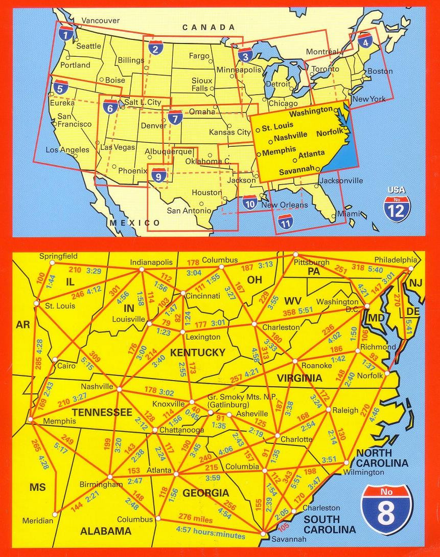
🇺🇸 Southeast USA Hallwag Touring Map – Kentucky, Virginia, Tennessee, Georgia & Alabama
Scale 1:1,000,000 | Includes Lift-Out City & National Park Guide
Discover the Spirit of the American South
From the misty Appalachian Highlands to the soulful rhythms of Memphis, from Bluegrass Country to Savannah’s oak-lined squares, the Southeast USA Hallwag Touring Map is your gateway to a region rich in history, music, cuisine, and natural beauty.
Crafted with Hallwag’s renowned cartographic precision, this full-colour, single-sided touring map is far more than a navigational aid—it’s your trusted companion for road trips, vacation planning, RV adventures, educational use, and heritage tourism.
🗺 Detailed Map Coverage
Primary States Included:
-
Kentucky – From Louisville’s world-famous bourbon scene to Lexington’s rolling horse country.
-
Virginia – The Shenandoah Valley, historic Williamsburg, Richmond, and the Blue Ridge Parkway.
-
Tennessee – Home of country music, the blues, the Great Smoky Mountains, and Civil Rights history.
-
Georgia – Atlanta’s vibrant urban hub, Savannah’s Southern charm, and the Atlantic coast.
-
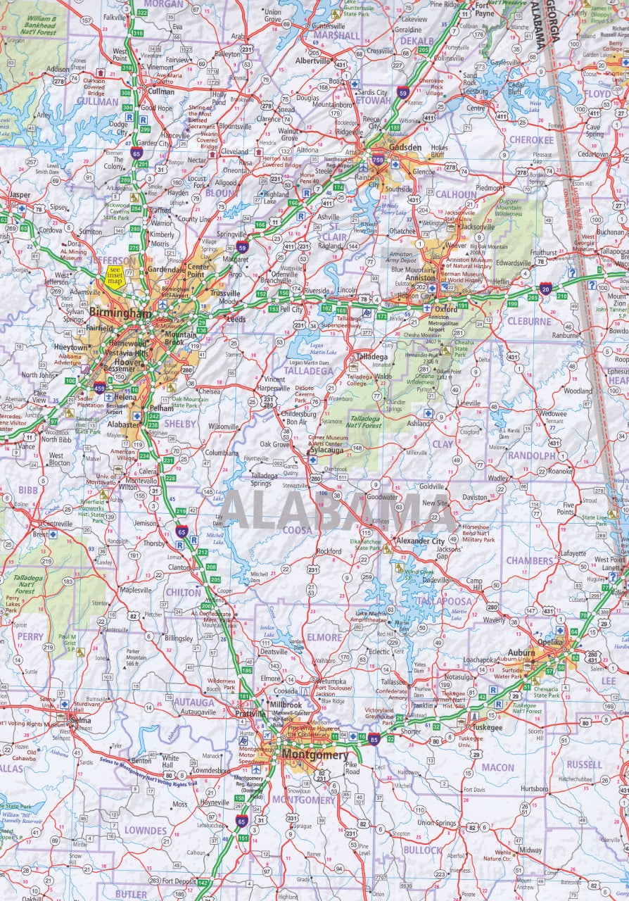
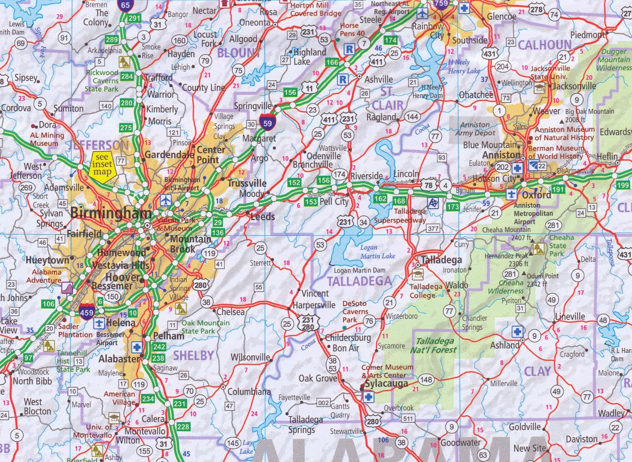
Alabama – From Birmingham’s industrial heritage to Mobile’s Gulf Coast beauty.
Inset Map:
-
Atlanta, Georgia – A street-level city map highlighting major districts, attractions, and transport hubs.
📖 Bonus Lift-Out Travel Guide
An exclusive feature of this Hallwag map is its removable travel guide, packed with:
-
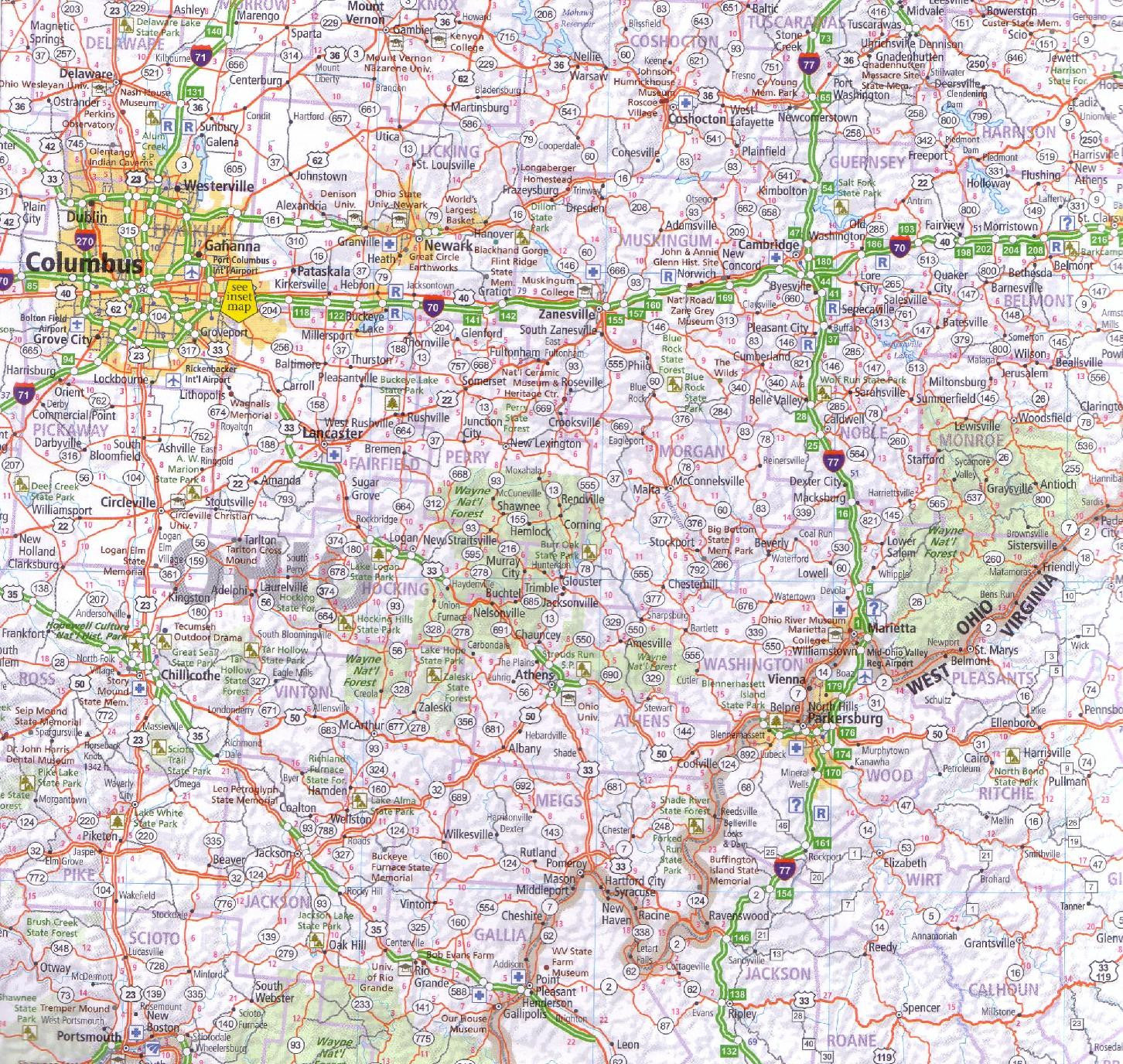
16 Detailed City Maps – Navigate key urban areas including Indianapolis, Cincinnati, Columbus, Louisville, Memphis, Nashville, Birmingham, Charlotte, Raleigh/Durham, Richmond, Hampton Roads, Wilmington, Baltimore, Philadelphia, and Washington D.C.
-
National Park Overviews – Detailed visitor maps for Shenandoah National Park (Virginia) and Great Smoky Mountains National Park (Tennessee/North Carolina).
-
Travel Resources – State tourism and transportation contacts, hotel and airline information, rental car services, and orientation notes for major cities.
📌 Helpful Travel Tools in the Lift-Out Guide
| Tool / Feature | Description |
|---|---|
| Distance Calculator | Quickly estimate driving times and distances between key cities. |
| Metric Conversions | Temperature, distance, fuel, and weight conversion charts. |
| Traffic Signs Guide | Understand US road sign conventions for confident navigation. |
| Transport & Tourism Info | State departments, public transport links, and visitor info. |
| Accommodation & Airlines | Reference for booking lodging and flights. |
| Rental Car Contacts | National car hire services for self-drive travellers. |
⭐ Key Features of the Map
-
Scale: 1:1,000,000 – Ideal for regional planning and scenic route navigation.
-
Road Network Clarity – Interstates, highways, backroads, and scenic byways.
-
Points of Interest – Icons for historic sites, landmarks, and attractions.
-
Rail & Ferry Routes – Where applicable, for multi-modal journey planning.
-
Topographic Shading – Highlights mountains, valleys, and terrain variations.
-
Weather-Resistant Paper – Designed to withstand travel handling.
-
Fully Indexed – Complete city and town listing for quick location reference.
🎯 Who This Map Is Perfect For
-
🚗 Road Trip Enthusiasts – Planning legendary Southern drives.
-
🥾 National Park Visitors – Hiking, camping, and nature exploration.
-
📚 Educators & Classrooms – Large-scale, easy-to-read reference material.
-
🚐 RV & Camper Travellers – For those who prefer reliable paper navigation.
-
🏛 History & Culture Seekers – Civil War battlefields, blues heritage, and Civil Rights landmarks.
📐 Product Specifications
| Feature | Detail |
|---|---|
| Publisher | Hallwag Kümmerly+Frey, Switzerland |
| Edition | Current |
| Format | Folded, single-sided |
| Bonus Content | Lift-out travel guide with city maps and travel resources |
| Unfolded Size | Approx. 1000 mm × 1250 mm |
| Folded Size | Compact, travel-friendly dimensions |
| Scale | 1:1,000,000 |
| Print Quality | Full-colour, weather-resistant paper |
✨ Your Southern Journey Awaits
Whether you’re sipping bourbon in Kentucky, driving the Blue Ridge Parkway, exploring Savannah’s historic district, or dancing in Nashville, the Southeast USA Hallwag Touring Map ensures you’ll always have the region’s best routes and attractions at your fingertips.
Frequently Asked Questions
Where can I buy the Southeast USA Hallwag Map?
The Southeast USA Hallwag Map is available to buy online from Mapworld, Australia's largest map and geographic product retailer, with fast shipping Australia-wide.
Is the Southeast USA Hallwag Map in stock at Mapworld?
Mapworld maintains extensive stock across its map range and aims for fast dispatch. Orders placed before 2pm AEST on business days are typically dispatched the same day, with standard and express Australia-wide delivery options available.
What is Mapworld's returns policy?
Mapworld accepts returns on undamaged items in original condition. Contact Mapworld within 90 days of purchase to arrange a return or exchange.
Does Mapworld ship the Southeast USA Hallwag Map across Australia?
Yes, Mapworld ships Australia-wide. Standard shipping is a flat $7 rate, with free standard shipping on orders over $75. Express options are available at checkout. Most orders placed before 2pm AEST on weekdays are dispatched same day.
Related Items


© 2026 Mapworld. Website designed by Genie Media
X