- Australia ▾
- Topographic
▾
- Australia AUSTopo 250k (2025)
- Australia 50k Geoscience maps
- Australia 100k Geoscience maps
- Australia 250k Geoscience maps
- Australia 1:1m Geoscience maps
- New Zealand 50k maps
- New Zealand 250k maps
- New South Wales 25k maps
- New South Wales 50k maps
- New South Wales 100k maps
- Queensland 10k maps
- Queensland 25k maps
- Queensland 50k maps
- Queensland 100k maps
- Compasses
- Software
- GPS Systems
- Orienteering
- International ▾
- Wall Maps
▾
- World
- Australia & New Zealand
- Countries, Continents & Regions
- Historical
- Vintage National Geographic
- Australian Capital Territory
- New South Wales
- Northern Territory
- Queensland
- South Australia
- Tasmania
- Victoria
- Western Australia
- Celestial
- Children's
- Mining & Resources
- Wine Maps
- Healthcare
- Postcode Maps
- Electoral Maps
- Nautical ▾
- Flags
▾
- Australian Flag Sets & Banners
- Flag Bunting
- Handwavers
- Australian National Flags
- Aboriginal Flags
- Torres Strait Islander Flags
- International Flags
- Flagpoles & Accessories
- Australian Capital Territory Flags
- New South Wales Flags
- Northern Territory Flags
- Queensland Flags
- South Australia Flags
- Tasmania Flags
- Victoria Flags
- Western Australia Flags
- Gifts ▾
- Globes ▾
Dear valued customer. Please note that our checkout is not supported by old browsers. Please use a recent browser to access all checkout capabilities
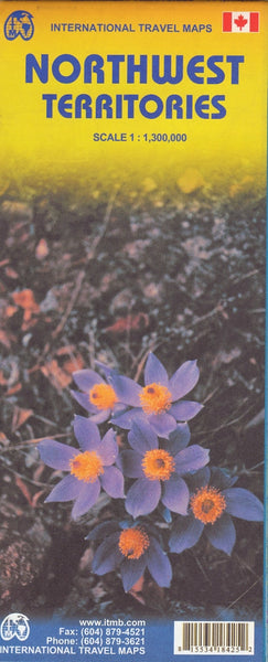
North West Territories ITMB Map
$24.95
Afterpay is only available for orders between $50.00 and $1000.00 More info
Explore Canada’s Rugged Northern Frontier
Scale: 1:1,300,000 | Size: 690 mm x 1000 mm
Format: Double-sided, folded paper map | Publisher: ITMB – International Travel Maps
🏔️ Discover the Land of Lakes, Tundra, and Arctic Mystique
Vast, untamed, and staggeringly beautiful — Canada’s Northwest Territories (NWT) is a place like no other. Stretching across a landscape carved by ancient glaciers and peppered with some of the largest freshwater lakes on Earth, this is where wild nature still holds sway.
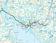
The Northwest Territories ITMB Map offers an up-to-date, highly detailed view of this awe-inspiring part of northern Canada. From the shores of Great Bear Lake and Great Slave Lake to the wind-swept tundra of the Arctic Archipelago, this double-sided map is your essential planning companion for exploring one of North America’s last great wildernesses.
🗺️ Map Coverage & Highlights
| Feature | Details |
|---|---|
| 🧭 Main Map Coverage | Entire Northwest Territories, plus parts of eastern Yukon and western Nunavut |
| 🏙️ Inset Map | Detailed map of Yellowknife, the capital |
| 🧊 Physical Features | Shows major rivers, lakes, mountain ranges, Arctic islands, and glacial terrain |
| 🛣️ Road & Access | Includes key roads, ice roads, ferry routes, airstrips, and seasonal access points |
| 🏕️ Points of Interest | National parks, historic sites, remote communities, campgrounds, and wilderness lodges |
| 📌 Index & Labels | Fully indexed with place names, parks, major landforms, and geographic coordinates |
🌌 Why Choose This Map?
-
✅ Up-to-date cartography by ITMB, renowned for mapping remote regions with precision
-
✅ Covers one of the most remote and untouched areas on Earth, ideal for serious explorers
-
✅ Yellowknife inset helps plan urban arrival and orientation before venturing further north
-
✅ Cultural relevance: Includes Indigenous communities and traditional travel routes
-
✅ Ideal for fly-in adventures, canoe expeditions, geology tours, and northern lights viewing
🧳 Who This Map Is For
-
❄️ Adventure travellers planning expeditions through the Canadian Arctic
-
🛶 Canoeists, hikers, and overlanders seeking trails and water routes in remote areas
-
🧭 Geographers and students studying Canadian topography and political geography
-
📚 Educators and classrooms needing large-format references of northern Canada
-
📍 Travel planners and tour operators working in remote logistics or tourism
📘 Product Summary
| Specification | Details |
|---|---|
| Publisher | ITMB (International Travel Maps) |
| Scale | 1:1,300,000 |
| Map Dimensions | 690 mm x 1000 mm |
| Format | Double-sided folded paper map |
| Inset | Includes Yellowknife city map |
| Edition | Most recent available |
| Printed in | Canada |
🌲 A Territory Like No Other
Once the vast governing domain of nearly all northern and western Canada, the Northwest Territories has since been redefined by political evolution — with the creation of Nunavut in 1999 and shifting boundaries in the Yukon. What remains is still epic in scale, untamed in character, and rich in natural and cultural heritage.
The ITMB map captures that scale and spirit — from the aurora-lit skies of Inuvik to the icy edges of Banks Island, from Tuktut Nogait National Park to the wild Canol Heritage Trail.
🧊 Let this map guide your journey through the Back of Beyond.
Adventure begins where the roads end — and the NWT is calling.


