- Australia ▾
- Topographic
▾
- Australia AUSTopo 250k (2025)
- Australia 50k Geoscience maps
- Australia 100k Geoscience maps
- Australia 250k Geoscience maps
- Australia 1:1m Geoscience maps
- New Zealand 50k maps
- New Zealand 250k maps
- New South Wales 25k maps
- New South Wales 50k maps
- New South Wales 100k maps
- Queensland 10k maps
- Queensland 25k maps
- Queensland 50k maps
- Queensland 100k maps
- Compasses
- Software
- GPS Systems
- Orienteering
- International ▾
- Wall Maps
▾
- World
- Australia & New Zealand
- Countries, Continents & Regions
- Historical
- Vintage National Geographic
- Australian Capital Territory
- New South Wales
- Northern Territory
- Queensland
- South Australia
- Tasmania
- Victoria
- Western Australia
- Celestial
- Children's
- Mining & Resources
- Wine Maps
- Healthcare
- Postcode Maps
- Electoral Maps
- Nautical ▾
- Flags
▾
- Australian Flag Sets & Banners
- Flag Bunting
- Handwavers
- Australian National Flags
- Aboriginal Flags
- Torres Strait Islander Flags
- International Flags
- Flagpoles & Accessories
- Australian Capital Territory Flags
- New South Wales Flags
- Northern Territory Flags
- Queensland Flags
- South Australia Flags
- Tasmania Flags
- Victoria Flags
- Western Australia Flags
- Gifts ▾
- Globes ▾
Dear valued customer. Please note that our checkout is not supported by old browsers. Please use a recent browser to access all checkout capabilities
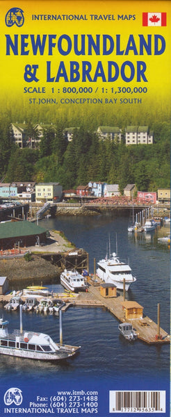
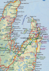
Newfoundland & Labrador ITMB Map
$24.95
Afterpay is only available for orders between $50.00 and $1000.00 More info
Double-Sided • Waterproof Option Available • Scale 1:800,000 / 1:1,300,000
Map Size: 685 mm x 990 mm | Folded Format | Publisher: ITMB (International Travel Maps)
Scale: 1:800,000 (Island of Newfoundland) / 1:1,300,000 (Labrador region)
ISBN: 978‑1771295833
🇨🇦 Discover One of Canada’s Most Storied Provinces
Explore the wild beauty and deep history of Newfoundland and Labrador with this double-sided, highly detailed travel map by ITMB. From the windswept shores of St. John's, the oldest city in North America north of the Caribbean, to the remote grandeur of Labrador’s untamed wilderness, this map is your essential guide to Canada’s eastern frontier.
Newfoundland & Labrador is not just a province — it’s a journey through time. The map also includes St. Pierre & Miquelon, the last remnant of France’s former North American empire.
🗺️ Map Highlights:
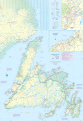
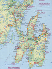
Side 1 – Island of Newfoundland
-
Detailed road network including Route 1 (Trans-Canada Highway)
-
Insets:
-
🏙️ St. John’s city map
-
🌊 Conception Bay
-
-
🛳️ Ferry terminals and seasonal routes from Nova Scotia
-
🧭 Points of interest including L'Anse aux Meadows – the first known European (Viking) settlement in North America (c.1000 AD)
-
🌐 Includes St. Pierre & Miquelon (French territory)
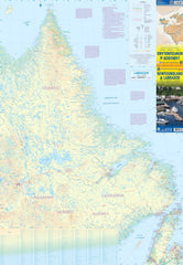
Side 2 – Labrador
-
Extensive northern road network including:
-
Route from Quebec to Labrador City
-
Route east to Happy Valley–Goose Bay
-
Southern highway to the Strait of Belle Isle ferry crossing
-
-
Remote community locations and access routes
🧳 Features & Benefits:
-
✔️ Double-sided format to cover both regions in full detail
-
🧾 Indexed with place names, parks, ferry crossings, and key infrastructure
-
🗺️ Includes historical and cultural highlights
-
🛣️ Roads, tracks, airports, parks, and geographic features clearly marked
🧼 Optional Lamination:
We offer this map in a fully laminated version for maximum durability:
-
✅ Write on it with a whiteboard marker
-
✅ Apply and remove map dots
-
✅ Protects against rips, spills, and stains
-
✅ Long-lasting — perfect for planning or wall display
🛠 To laminate, we first flatten the folded map, then encapsulate it in high-grade 80-micron laminate. Please note: original fold lines will still be slightly visible through the lamination.
📐 Specifications:
| Feature | Details |
|---|---|
| Publisher | International Travel Maps (ITMB) |
| Map Type | Double-sided, folded |
| Laminated Option | Yes – 80-micron encapsulation |
| Scale | 1:800,000 (Newfoundland) / 1:1,300,000 (Labrador) |
| Map Size | 685 mm x 990 mm |
| Inset Maps | St. John’s, Conception Bay, St. Pierre & Miquelon |
| Region Coverage | All of Newfoundland and Labrador, plus French overseas territory |
🌎 Who It’s For:
-
🎒 Adventure travellers exploring the East Coast
-
📚 History buffs interested in Norse settlements
-
🚗 Road trippers navigating long distances and ferry crossings
-
🧭 Geography lovers and map collectors
-
🇨🇦 Canadians discovering their own back yard


