- Australia ▾
- Topographic
▾
- Australia AUSTopo 250k (2025)
- Australia 50k Geoscience maps
- Australia 100k Geoscience maps
- Australia 250k Geoscience maps
- Australia 1:1m Geoscience maps
- New Zealand 50k maps
- New Zealand 250k maps
- New South Wales 25k maps
- New South Wales 50k maps
- New South Wales 100k maps
- Queensland 10k maps
- Queensland 25k maps
- Queensland 50k maps
- Queensland 100k maps
- Compasses
- Software
- GPS Systems
- Orienteering
- International ▾
- Wall Maps
▾
- World
- Australia & New Zealand
- Countries, Continents & Regions
- Historical
- Vintage National Geographic
- Australian Capital Territory
- New South Wales
- Northern Territory
- Queensland
- South Australia
- Tasmania
- Victoria
- Western Australia
- Celestial
- Children's
- Mining & Resources
- Wine Maps
- Healthcare
- Postcode Maps
- Electoral Maps
- Nautical ▾
- Flags
▾
- Australian Flag Sets & Banners
- Flag Bunting
- Handwavers
- Australian National Flags
- Aboriginal Flags
- Torres Strait Islander Flags
- International Flags
- Flagpoles & Accessories
- Australian Capital Territory Flags
- New South Wales Flags
- Northern Territory Flags
- Queensland Flags
- South Australia Flags
- Tasmania Flags
- Victoria Flags
- Western Australia Flags
- Gifts ▾
- Globes ▾
Dear valued customer. Please note that our checkout is not supported by old browsers. Please use a recent browser to access all checkout capabilities


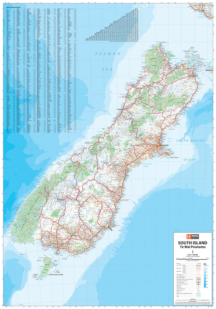
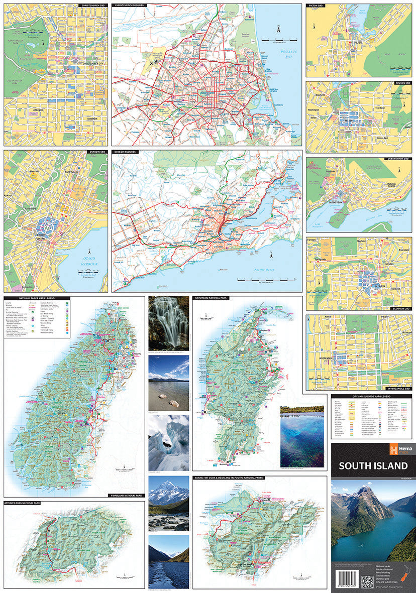
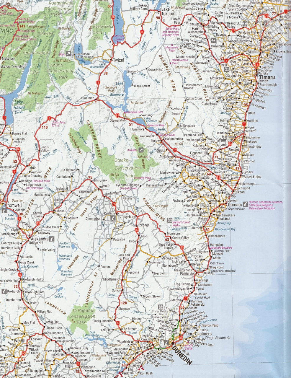
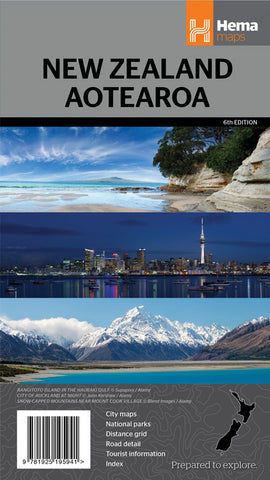
New Zealand South Island Hema Map (Te Waipounamu) 8th Edition
$15.95 $19.95
Afterpay is only available for orders between $50.00 and $1000.00 More info
A beautifully detailed, practical touring map for discovering the wild beauty, alpine peaks, and coastal charm of Aotearoa’s South Island.
Whether you’re driving the scenic coastal highways, venturing into the high country for a wilderness hike, or planning a wine trail adventure through Central Otago, the Hema South Island Map (8th Edition) is the ultimate companion for navigating New Zealand’s southern gem. With up-to-date cartography, inset city maps, national parks, and touring symbols, this map makes it easy to find your way while uncovering the natural, cultural, and scenic wonders of Te Waipounamu.
Crafted with Hema’s signature clarity and traveller-friendly layout, it’s a must-have for road trippers, campers, hikers, photographers, and lovers of the great outdoors.
🗺️ Map Specifications:
-
Scale: 1:1,000,000 (1 cm = 10 km)
Ideal for touring and regional route planning -
Unfolded Size: 1000 mm (W) x 700 mm (H)
-
Folded Size: 250 mm x 140 mm x 3 mm
-
Weight: Approx. 90 grams
-
Edition: 8th Edition
-
Publication Date: 19 December 2018
-
ISBN: 9781925625899
-
Printed on: Durable map-grade stock suitable for repeated folding and field use
🧭 Key Features:
🚗 Road and Touring Information:
-
Includes all state highways, regional routes, backroads, and ferry links
-
Clearly marked sealed and unsealed roads
-
Driving distances for major routes and regional towns
-
Touring route highlights including Alpine Pacific Touring Route, Southern Scenic Route, and The Great Coast Road
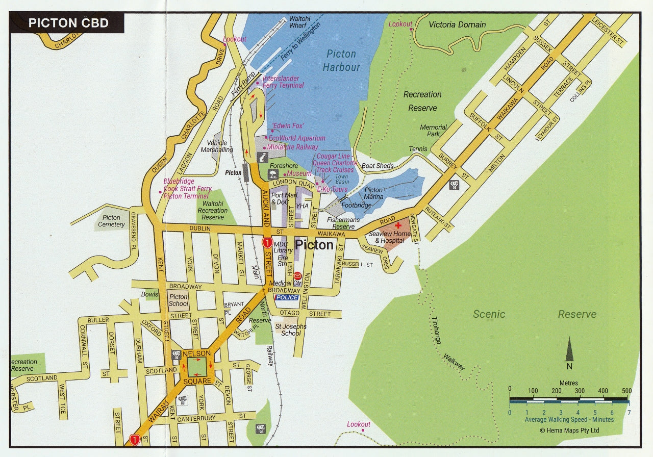
🗺️ Inset Maps:
-
City Maps: Christchurch, Queenstown, Dunedin, Nelson, Invercargill, Picton, and Blenheim
-
Suburban Insets: Christchurch and Dunedin expanded for urban navigation
-
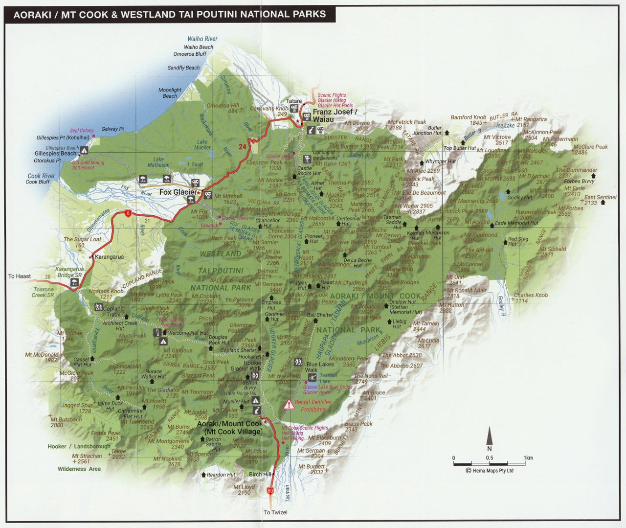
National Parks Insets:
-
Fiordland National Park – New Zealand’s largest and home to Milford and Doubtful Sounds
-
Arthur’s Pass – gateway to the Southern Alps
-
Kahurangi – a remote hiking paradise
-
Aoraki/Mount Cook – with detailed alpine geography and access points
-
🏞️ Outdoor & Nature Focused:
-
Clearly shows boundaries for national parks, reserves, and DOC land
-
Rivers, lakes, glaciers, and mountain ranges named and easy to locate
-
Hiking routes and popular walking tracks indicated
-
Campsites, DOC huts, scenic lookouts, hot springs, and boat ramps marked
🧳 Traveller Essentials:
-
Indexed list of towns, localities, and geographic features
-
Touring information by region: major attractions, natural highlights, historical towns
-
Distance matrix between key towns for travel planning
-
Great for motorhome travellers, self-drive holidays, or outdoor educators
-
Highlights heritage sites, Maori cultural areas, and tourist services
🛠️ Practical and Reliable:
-
Folds easily to glovebox size
-
Durable enough for use in the field or under glass for planning
-
Works well in tandem with GPS navigation or apps for real-time adjustment
-
Ideal for framing in hostels, rental offices, or educational settings
🌍 Why Choose This Map?:
-
Trusted by travellers and tourism operators alike
-
Produced by Hema Maps, renowned for accurate, field-verified cartography
-
Essential for anyone wanting to uncover the South Island’s remote corners, from the rugged West Coast to the peaceful Marlborough Sounds
-
Makes a great gift for travellers, students, or lovers of New Zealand
With this map in hand, you're equipped to embrace the freedom of the open road and the unforgettable adventure that is Te Waipounamu. From the jagged peaks of the Southern Alps to the windswept Catlins coastline, the Hema South Island Map is your guide to discovering it all — beautifully, accurately, and confidently.
Explore New Zealand’s South Island the way it’s meant to be explored — with clarity, purpose, and wonder.
Frequently Asked Questions
Where can I buy the New Zealand South Island Hema Map (Te Waipounamu) 8th Edition?
The New Zealand South Island Hema Map (Te Waipounamu) 8th Edition is available to buy online from Mapworld, Australia's largest map and geographic product retailer, with fast shipping Australia-wide.
Is the New Zealand South Island Hema Map (Te Waipounamu) 8th Edition in stock at Mapworld?
Mapworld maintains extensive stock across its map range and aims for fast dispatch. Orders placed before 2pm AEST on business days are typically dispatched the same day, with standard and express Australia-wide delivery options available.
What is Mapworld's returns policy?
Mapworld accepts returns on undamaged items in original condition. Contact Mapworld within 90 days of purchase to arrange a return or exchange.
Does Mapworld ship the New Zealand South Island Hema Map (Te Waipounamu) 8th Edition across Australia?
Yes, Mapworld ships Australia-wide. Standard shipping is a flat $7 rate, with free standard shipping on orders over $75. Express options are available at checkout. Most orders placed before 2pm AEST on weekdays are dispatched same day.
Related Items
© 2026 Mapworld. Website designed by Genie Media
X